BOU AVENUE
Battle Mountain
For the last leg of our hiking 'vacation' in British
Columbia, Dan Millar, Kelly Wood and I visited the Battle Mountain area
in Wells Gray Provincial Park. On 29 August 2002, we backpacked into
a primitive campsite hidden in a small grove of trees near Fight Lake.
The crux of the trip may well have been driving up the rough 4x4 road to
get to the Philip Lake trailhead, but doing so saved us about 500 metres
in elevation gain (the Battle Creek trailhead starts lower but avoids
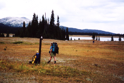
the rough 4x4 road). When we reached the expansive meadows surrounding
Fight Lake, we had some difficulty locating the campsite (signage is poor).
There are actually some marker sticks planted in the ground that lead you
to the campsite, but these are easy to miss if you aren't looking in the
right direction. What also confounded us was the fact that the public
shelter, marked as being next to the campsite in the free map handed out
at the info centre, is actually hidden in the trees about 1.5 km west of
the campsite. To complicate things further, there is a private chalet
, not marked on the map, which is visible on the far side of the meadows
about 2 km north of the campsite.
|
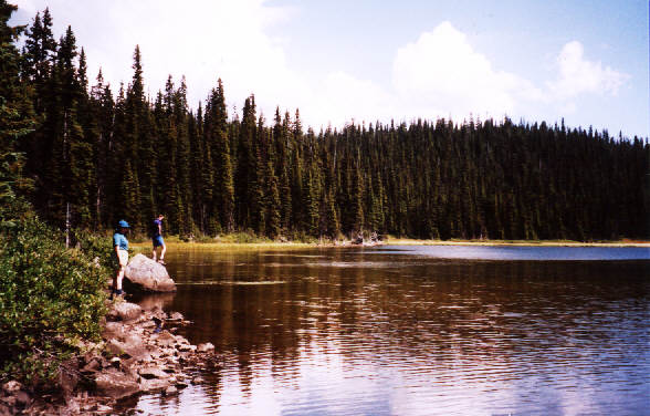
Kelly and Dan stop by Philip Lake
on the way to Fight Lake.
|
|
The Fight Lake campsite is just beyond
the trees at far left. Battle Mountain can also be seen.
|
After we pitched our tent, Kelly curled up
with a book while Dan and I decided to go check out the private chalet
thinking that it was the public shelter. About halfway there, storm
clouds began developing over the area, and rain began to fall. Suddenly,
we saw lightning flash behind us, and I began worrying about our worsening
predicament. The storm was intensifying, but with nothing close by
that even resembled shelter, all we could do was keep walking toward the
cabin. When we finally got there, we were dismayed to learn that
it was a private chalet and that it was locked. While Dan and I were
both cold and wet, we weren't quite desperate enough yet to break into
the chalet. We tried standing on the front porch for awhile, but
it wasn't really adequate enough to shield us from the storm. I circled
around the back and found a small alcove with a raised floor and an aluminum
roof. Propane tanks were stored here, but there was plenty of room
to squeeze in two inundated hikers. We found the alcove just in time
as the full force of the storm began to pound the entire area. The
rain was coming down in sheets, and hail would soon follow. Lightning
flashed all around us while the accompanying thunder underscored the ferocity
of the storm. Dan and I waited probably almost an hour before the
storm abated enough for us to safely wander back out into the meadows.
On our way back to the campsite, we found
the hidden public shelter. While it was no Holiday Inn, the shelter
was dry and well-stocked (with food, even). The shelter would have
provided a good place to cook meals (no tables at the campsite near the
lake), but the storm left a small muddy pond in front of the doorway making
access annoying if not difficult. Furthermore, numerous piles of
horse dung littered the ground surrounding the shelter; cooking and eating
there would have been unsavoury.
When Dan and I returned to the campsite,
we found Kelly sitting atop a pile of sleeping bags and Thermarests inside
the tent. Water had pooled on the floor of the tent, and she was
struggling to keep the sleeping bags dry on her little makeshift island.
Here was the second lowest point of our entire vacation in British Columbia:
I was using my already wet wool socks to soak up the puddles inside the
tent and wring them just outside the door. What was the lowest point?
Shivering in the alcove at the height of the storm and having to listen
to Dan kill time (and possibly the sanctity of music in general) by banging
on the propane tanks like he was in a steel drum band. Ouch!
By the time we got things back in order
inside the tent, we were in no mood for cooking. We basically skipped
dinner that night and went straight to sleep. Around midnight, I
had to get up to use the outhouse. Fog covered the entire area, and
the moon was casting an eerie glow. Most memorable for me though
was the deafening silence--no wind, no critters, nothing.
The fog lifted just as we awoke at sunrise.
Dan put up a clothesline to dry out our wet gear, and we quickly ate breakfast
before setting off to scramble up Battle Mountain. The summit of
Battle Mountain is visible from Fight Lake, but it is much farther away
than it looks. Furthermore, there is an intervening height of land,
known as 52 Ridge, that must be climbed over to reach the base of Battle
Mountain. 52 Ridge is actually a tuya, an ancient volcano that
erupted underneath a glacier. Interestingly, there are numerous
craters on 52 Ridge; we passed a few of them and mistook them as being
dry ponds. Once we were over the crest of 52 Ridge, we picked out
an easy route to the summit of Battle Mountain. From there, we had
a commanding 360° view of the surrounding landscape including the Cariboo
Mountains to the north, Stevens Lakes to the east, and the eye-catching
Trophy Mountains to the south.
|
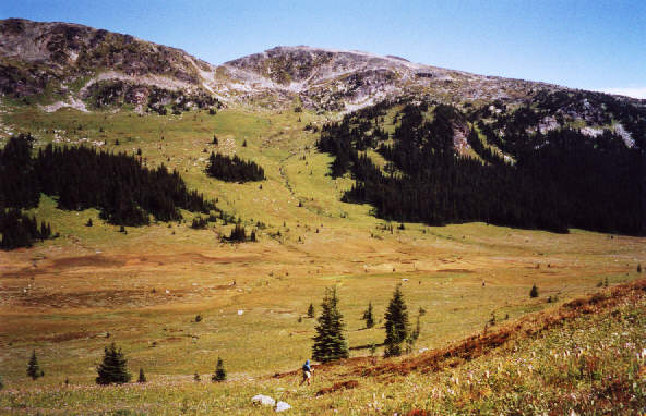
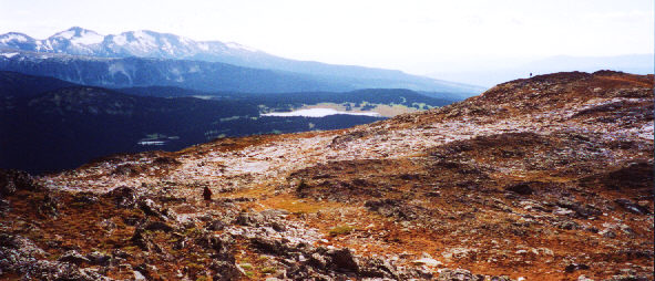
This is Battle Mountain as viewed
from 52 Ridge. We went straight up the open grassy slope before angling
right and continuing to the summit.
|
|
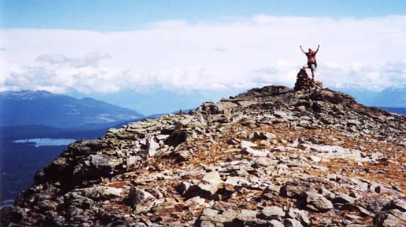
Sonny stands on the 2369-metre summit
of Battle Mountain.
|
|
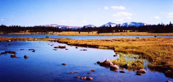
Fight Lake and the Trophy Mountains
are visible to the south.
|
|
Fight Lake
|
|
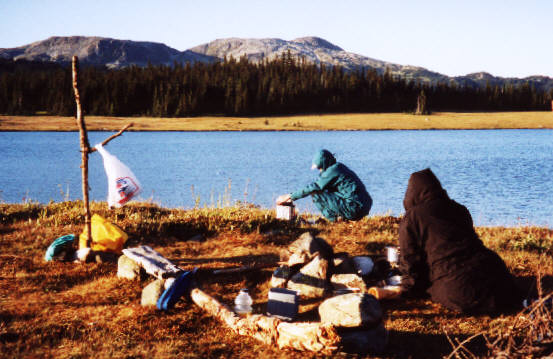
Everyone is hard at work cooking in
the 'kitchen'.
|
After enjoying a fine day on Battle Mountain,
we decided to cut our trip short and head home the following day.
Thus ended a tiring but rewarding week of hiking and exploring in British
Columbia.