 |
Mount Ball comes into view early in
the climb up the drainage. |
 |
Sonny hikes along the soft, mossy
ground of the upper valley. Copper Mountain is visible behind
him. |
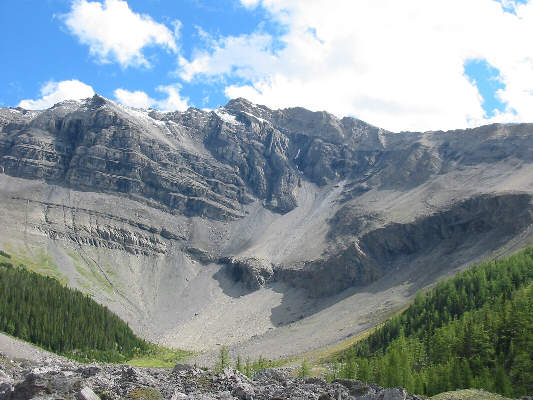 |
This is Mount Brett as seen from the
upper valley. The ascent route heads up through the larch trees
at lower right to eventually gain the skyline ridge at upper right. |
 |
Sonny hikes along the skyline ridge. |
 |
This is the view of the remainder of
the route from just past the first downclimb. The summit is
just left of centre. |
 |
Sonny stands on the 2983-metre summit
of Mount Brett. |
 |
The view north from the summit
includes Copper Mountain at left and Pilot Mountain at right.
Castle Mountain is visible in the distance, and even Mount Hector can
be seen sticking up on the horizon. |
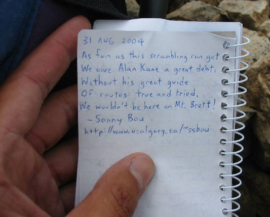 |
Sonny writes a tribute to Alan Kane in
the summit register. |
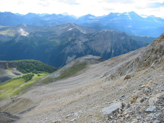 |
This is the rubble slope on the west
side of Mount Brett that Alan Kane recommends for a quicker descent.
The idea is to angle down to the saddle at centre and pick up a trail
that contours around the mountain to the right. |
 |
Sonny easily hikes toward the notch
(right of centre) where he originally gained the skyline ridge on the
ascent. |
 |
This is arguably the best part of the
whole trip: the return bike ride on the Redearth Creek fire road. |