
The sky was just beginning to lighten when I started up
the Carthew-Alderson Trail at 7:13 AM. I passed Summit Lake in
about an hour and continued along the trail to where it crests the south
ridge of Mount Carthew. I then followed this ridge up to the summit
of Mount Carthew (on top at 10:17 AM). The wind was a real force to be reckoned with on
this day, and several times on my way up Mount Carthew, I had to fight to
keep my balance against some strong gusts.
|
|
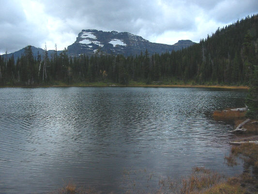
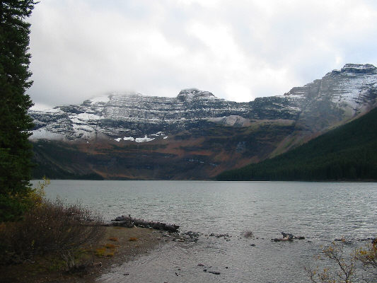
This is Summit Lake with Mount Custer in Glacier National Park (US) visible in the distance. |
|
|
This is the view of Mount Carthew from the "summit" of the Carthew-Alderson Trail. The summit of Mount Carthew is the bump on the far right. Note the trail marker. |
|
|
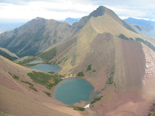
These are the three Carthew Lakes as seen from the upper slopes of Mount Carthew. Mount Alderson is the colourful peak on the right while further in the distance at left is Bertha Peak. |
|
|
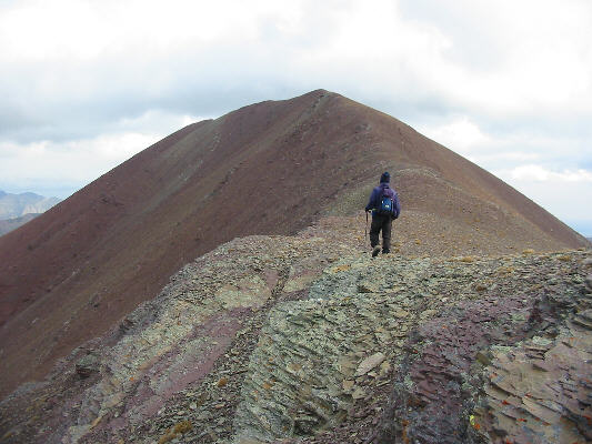
Sonny hikes up the easy summit ridge of Mount Carthew. |
|
|
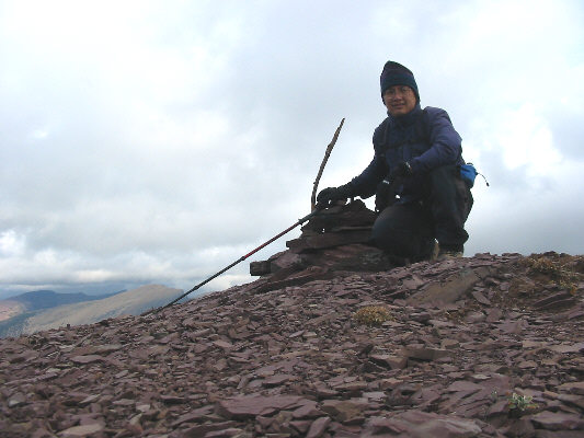
Sonny squats beside the cairn on the 2630-metre summit of Mount Carthew. |
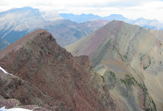 |
This is the view of Buchanan Peak (right) from the top of Mount Carthew. |
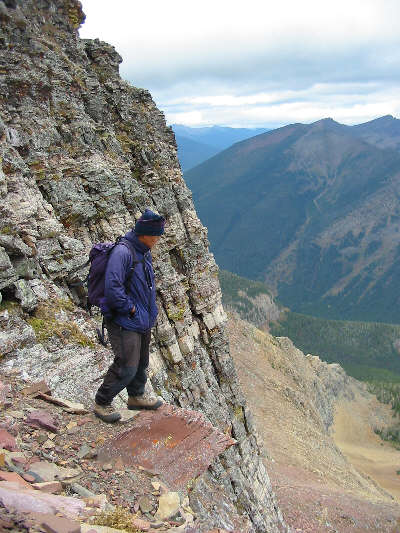 |
Sonny looks for a reasonable route down Mount Carthew's north face. It's odd that the crux of climbing Buchanan Peak is actually on another mountain! |
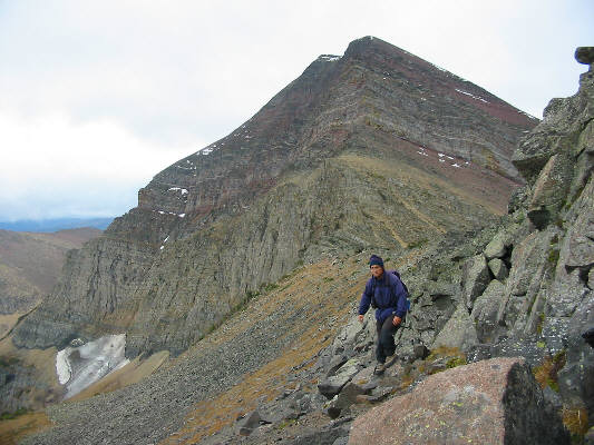 |
This is looking back at the north face of Mount Carthew from the lower slopes of Buchanan Peak. |
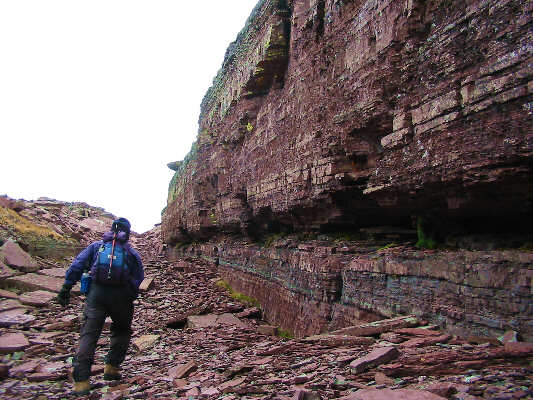 |
On the south side of Buchanan Peak is this rather interesting red gully with what looks like a brick wall on one side. |
 |
Sonny places his hand and foot on Buchanan Peak's summit cairn (elevation 2575 metres*). |
Defiantly, I kept climbing up the ridge, and conditions deteriorated rapidly soon after. The wind was relentless, snow began stinging the side of my face, and visibility was virtually nil. On two occasions, I thought I was close to the summit only to see the clouds clear briefly and reveal more of the ridge above me. The second one occurred as I reached the "second step" mentioned by Kane and nearly crushed my will to continue. Snow and wind made descending the ledges of this step a lot more serious, and I was starting to feel cold and tired. Still, the thought of having to return to bag Mount Alderson at some later date was so unsavoury that I pushed on with renewed vigour. Some time later, I realized that I must have been quite a pathetic sight to see. My fingers were so frozen that I had retracted them into the palms of my gloves to try and warm them up in my fists. As a result, my trekking pole was dangling freely from my left wrist so that I was basically dragging it along the ground. My toque was an icicle while my eyeglasses were so caked with snow that they were practically useless to see with (I kept them on to more or less protect my eyes from the windblown snow). With my head and shoulders hunched against the wind, I must have resembled a cross between Quasimodo and Beck Weathers!
At 2:48 PM, I finally came upon the two summit cairns on Mount Alderson. I quickly dug out a fresh pair of gloves from my pack and painstakingly set up my camera to take a photo of myself on the summit. The register canister was difficult to open, but just when I was about to give up, I managed to unscrew the cap. Shivering in the wind, I didn't bother coming up with a limerick and simply signed my name. Ironically, I spent more time on Mount Alderson's summit, with no views and poorer weather, than on both of the other two summits combined.
On my descent, I was thankful for the handful of small cairns marking the route through the snowy ledges of the second step. Later at the spot where I originally gained the west ridge on my ascent, I was in no mood to find the normal descent route and basically retraced my steps back down to the Carthew Lakes. This meant that I would have to gain even more elevation to hike back over the south ridge of Mount Carthew, but I knew that once I picked up the Carthew-Alderson Trail, there would be no more route-finding problems. A long plod had me back at the Cameron Lake trailhead by 6:00 PM.
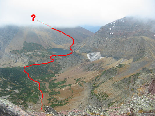 |
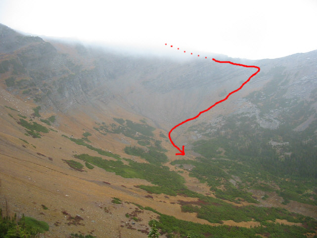
This photo, taken from near the top of Buchanan Peak, shows Sonny's route to Mount Alderson. Click here to see Sonny's route down into the basin. |
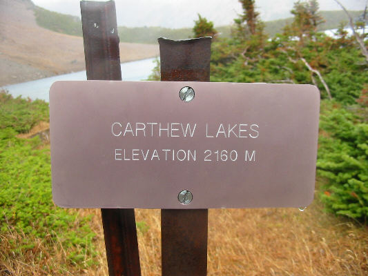 |
This sign is on the west side of the middle of the three Carthew Lakes. |
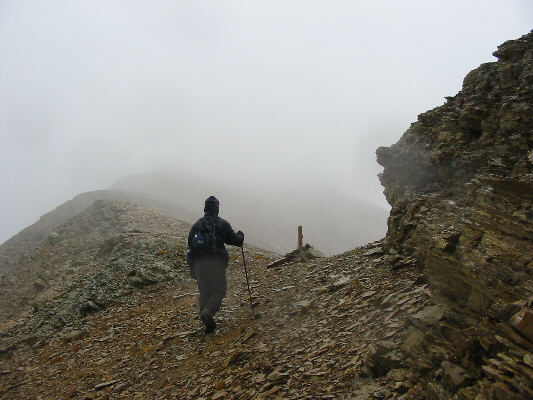 |
Coming up from Carthew Lakes, Sonny gains the west ridge of Mount Alderson just past the "first step" as described by Alan Kane. |
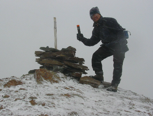 |
After a dreadfully long plod in blizzard conditions, Sonny finally reaches the 2692-metre summit of Mount Alderson. |
 |
What a difference seven hours can make! This is the "view" of Mount Carthew from the "summit" of the Carthew-Alderson Trail. Note the trail marker. |
 |
This is Cameron Lake as seen from the bridge near the trailhead. Shrouded in clouds on the left is Mount Custer while Forum Peak is visible at far right. |
Click here to see a photo of Mount Carthew, Buchanan Peak and Buchanan Ridge as seen from the northeast.
Click here to see Eric Praetzel's photo of the same three peaks from the summit of Mount Alderson.
Click
here
to see Eric Praetzel's photo of Buchanan Ridge and Buchanan Peak from the
summit of Mount Carthew.