BOU AVENUE
Mount Glasgow To Banded Peak Traverse
Lying between the Little Elbow and Elbow Rivers of Kananaskis Country,
the four peaks--Mount Glasgow, Mount Cornwall, Outlaw Peak (unofficial
name), and Banded Peak--that constitute the Mount Glasgow to Banded Peak
Traverse are not technically challenging for experienced scramblers.
Nevertheless, the overall length, cumulative height gain (over 2100
metres), and logistical problems of the Traverse are a good test of
endurance and will power.Vern Dewit and I got together early on the morning of 25 September 2004
to do the Mount Glasgow to Banded Peak Traverse.
The sky was just beginning to brighten when we set off up the Little
Elbow Trail on our mountain bikes at 7:00 AM. It took us about 35
minutes to reach the cairn marking the entrance to the drainage northwest
of Mount Glasgow. After stashing our bikes, we started hiking up
the drainage and soon encountered the narrow canyon mentioned in Alan
Kane's scrambles guide. Unfortunately, neither of us had brought
along Kane's route description (I absent-mindedly left my photocopy in my
car), and we made the mistake of heading up the slope to the right of the
canyon. This resulted in some needless bushwhacking, but we
eventually worked our way back to the creek bed and started making better
progress. As we climbed up to the west ridge of Mount
Glasgow, I became separated from Vern when I took a steeper and more direct
line to the ridge while he opted to contour around further west. My
route selection slowed me down considerably as I had to contend with some
very slippery treadmill scree. By the time I gained the west ridge,
Vern was already some 10 minutes ahead of me. Vern would be ahead
of me for most of the rest of the day. What concerned me
more was that I was already feeling weary even before bagging our first
of four peaks. That thought weighed heavily on my mind as I
joined Vern on Mount Glasgow's summit at 10:54 AM.
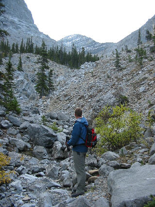 |
Vern looks up the rocky drainage
toward Mount Glasgow. |
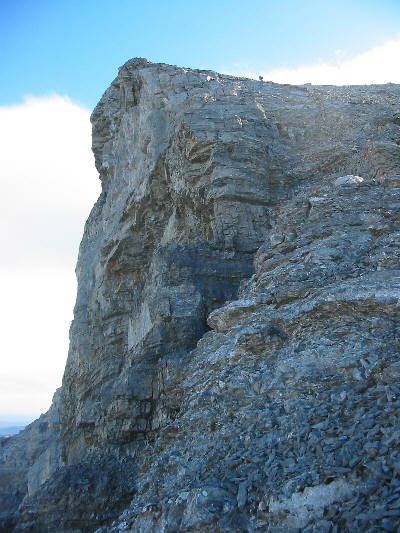 |
Vern climbs up the west ridge of Mount
Glasgow. |
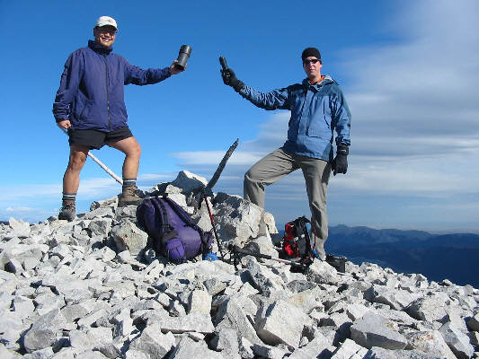 |
Sonny and Vern hold up a couple of
register canisters at the 2935-metre summit of Mount Glasgow. |
After a 15 minute break, Vern and I descended Mount Glasgow's south
ridge which provided some modest challenges along the way. After a
lengthy scree bash, we reached the summit of Mount Cornwall about 1.5
hours after leaving the top of Mount Glasgow. From the summit of
Mount Cornwall, we had our first chance to survey the valley immediately
to the west--our eventual exit route. It looked exceedingly long.
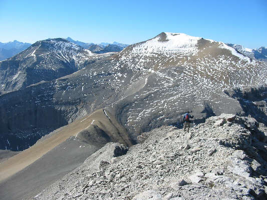 |
Vern descends Mount Glasgow's south
ridge on his way to Mount Cornwall (right). The unofficially
(and mistakenly) named Outlaw Peak is
visible at left. |
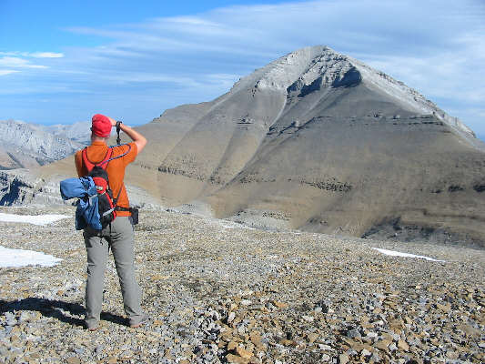 |
After losing about 300 metres of
elevation to reach the Glasgow/Cornwall col, Vern turns around to snap a photograph of Mount Glasgow. |
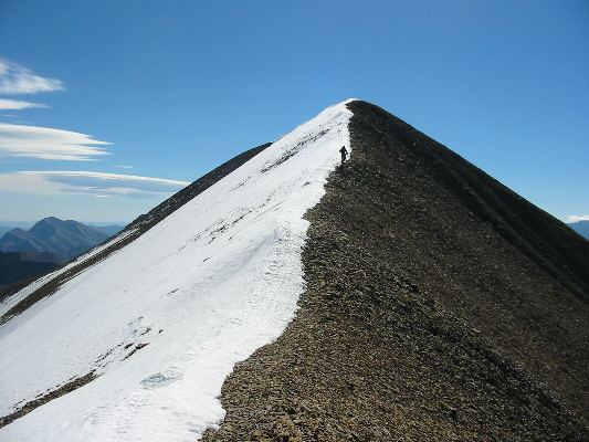 |
Vern hikes up the summit ridge
of Mount Cornwall. |
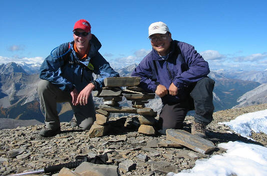 |
Vern and Sonny crouch beside an
inukshuk on the 2978-metre summit of Mount Cornwall. |
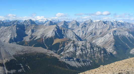 |
A veritable sea of peaks dominates the
view westward from Mount Cornwall's summit. The Opal Range is
most evident. |
Less than 10 minutes after reaching the summit of Mount Cornwall, Vern
and I were on our way to Outlaw Peak. For me, Outlaw Peak was the
most enjoyable ascent of the day possibly because it entails the least
height gain of the four peaks (about 200 metres from the Cornwall/Outlaw
col). The northwest ridge of Outlaw Peak also has a couple of cliff
bands (easy to circumvent but more fun to tackle head on) to break up the
monotony of all the scree. We were on top of Outlaw Peak about 55
minutes after leaving Mount Cornwall's summit. Although there was a
register in the summit cairn, I was too exhausted to think of something
that rhymes with "outlaw" for my usual limerick and simply signed my
name. Vern also signed the register, but I could hardly discern his
name from what he scrawled. Either he was tired too, or he has
really bad penmanship (perhaps from typing on a computer everyday)!
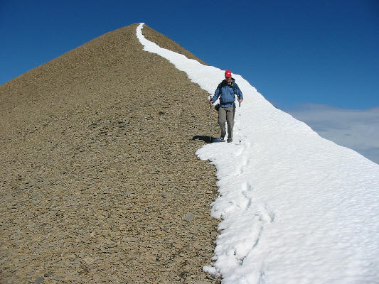 |
Vern works his way down from the top
of Mount Cornwall. The elevation loss to the Cornwall/Outlaw
col is about 210 metres. |
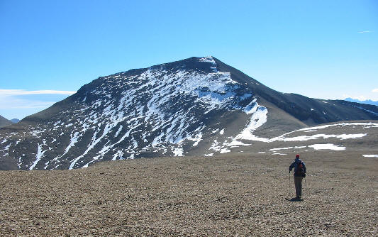 |
Vern walks across the Cornwall/Outlaw
col toward Outlaw Peak. |
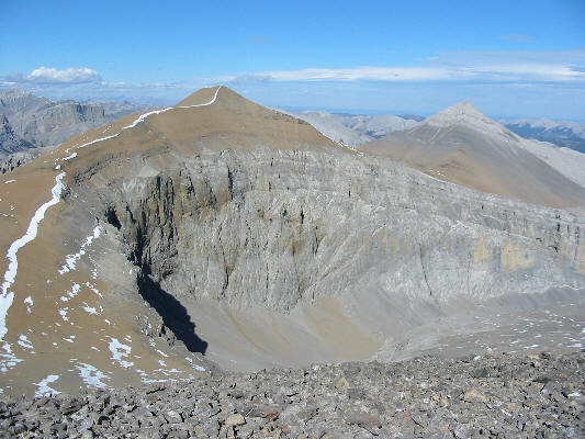 |
This is the view of Mount Cornwall and
Mount Glasgow from the top of Outlaw Peak. |
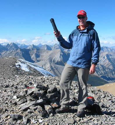 |
Vern holds up the register canister at
the 2970-metre summit of Outlaw Peak. |
After a pregnant 10-minute pause, Vern and I headed off to bag our
last summit of the day--Banded Peak. By this time, the whole game
of losing and regaining elevation was wearing pretty thin, but strangely
enough, I was getting used to it despite my fatigue. While
ascending the endless rubble slopes of Banded Peak, I felt more focused
than on the previous three peaks. Perhaps knowing that this would
be the last peak of the day gave me a psychological lift. About 1
hour and 10 minutes after leaving Outlaw Peak's summit, we were on top of
Banded Peak. Although we felt a deep sense of satisfaction, it was
sobering to realize that, in terms of distance, we were only halfway through our
trip.
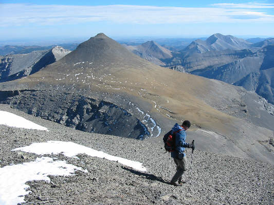 |
Vern descends Outlaw Peak's southeast
slope. The elevation loss to the Outlaw/Banded col is about 330
metres. |
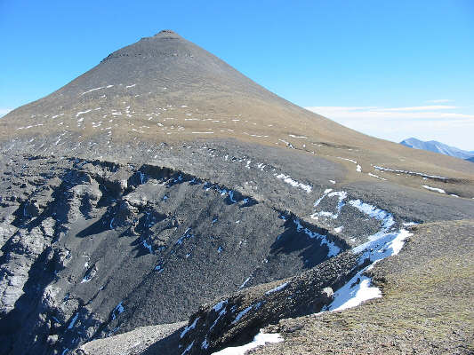 |
This is the view of Banded Peak from
the Outlaw/Banded col. |
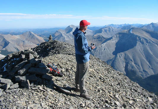 |
On the 2934-metre summit of Banded
Peak, Vern looks for more peaks to bag. |
On the Rocky
Mountain Books WebForum, a fellow by the name of Steve Parkins had
previously suggested an alternate descent from Banded Peak that would
essentially loop back to the Little Elbow Trail thereby taking full
advantage of a bike approach to Mount Glasgow. This alternate descent,
however, entails a pretty miserable side-hill bash up to a high col
southwest of Outlaw Peak, an exposed descent through a difficult cliff
band, some tricky route-finding to get down to the aforementioned valley
west of Mount Cornwall, and a rather long and mundane march along an
excessively undulating trail (hiker's and equestrian's access to Talus Lake).The ascent to the high col was the most miserable part of the whole day.
Although the height gain is modest (about 120 metres from the
Banded/Outlaw col), the footing is terrible the entire way up (1 hour 22
minutes from Banded Peak's summit). On the other side of the col,
we followed a beaten path down to a break in the cliffs where we had to
downclimb a short but exposed wall. Further down, we bypassed several
spectacular canyons before reaching the creek bed at valley
bottom. At one point, we spotted the hiker/equestrian trail
and followed it briefly into the trees until it started to climb steeply
uphill. Reluctant to gain any further height, we stuck to the creek
bed only to find that it was becoming increasingly tedious to follow
(lots of annoying drop-offs and big, awkward boulders). When we
spotted the trail again on a high bank a little later, we decided to
follow it with all its annoying ups and downs the rest of the way back to
the Little Elbow Trail. Another three kilometres of walking brought
us back to our bikes. At this point, the sun was long gone, and it
was getting pretty dark out. I had brought a bike headlight with
me, but I forgot that my headlight mount was on my other bike at home!
Doh! Vern had his LED headlamp which, though weaker and somewhat
limited in range, was still better than nothing. Fortunately, the
sky was clear, and the moon provided enough illumination to at least see
the road. Nasty boulders and even nastier horse droppings were a
little more difficult to make out though, and I nearly passed out on a
couple of the short uphill sections on the return ride. We made it
back to the trailhead at 8:34 PM (round-trip time of about 13.5 hours)
and celebrated by treating ourselves to dinner at the Subway in Bragg
Creek.
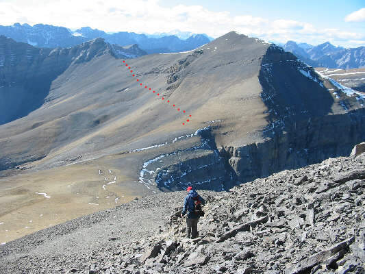 |
Vern heads back down to the
Banded/Outlaw col. He and Sonny would eventually angle up to the
high col southwest of Outlaw Peak (shown). |
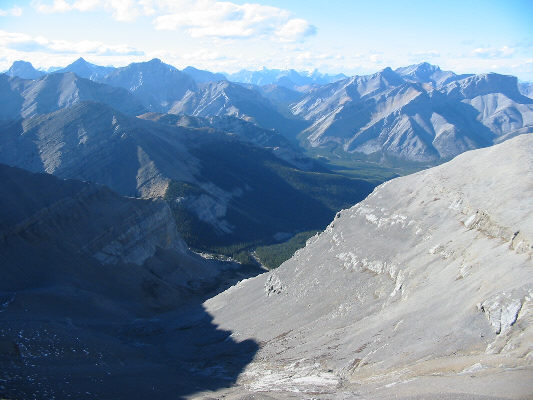 |
From the high col southwest of Outlaw Peak, this is the view of the valley west of Mount
Cornwall. Visible at upper right are Fisher Peak and Mount
Romulus. |
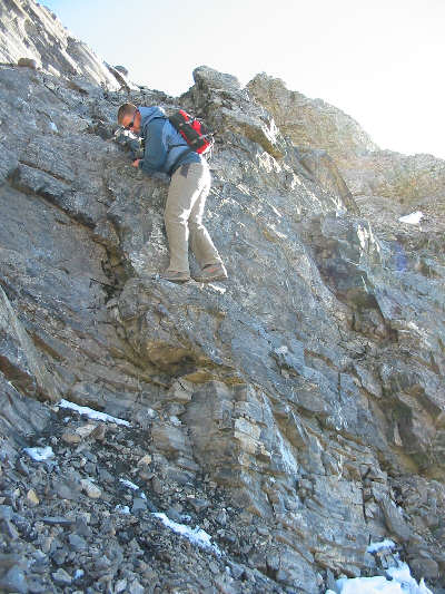 |
Vern downclimbs a tricky rock band
guarding the north side of Outlaw Peak's southwest ridge. |
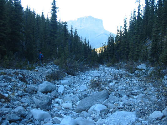 |
It's a long, tedious hike down the
valley to get back to the Little Elbow Trail. In the hazy
distance is Mount Romulus. |
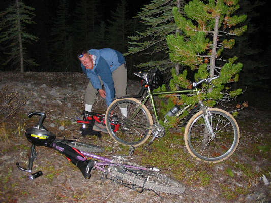 |
Vern gets ready to ride back to the
trailhead in the dark! |
Be sure to check out Vern's photos of our traverse of
Mount
Glasgow,
Mount Cornwall,
Outlaw
Peak, and
Banded
Peak!


