

In the wee hours of the morning of 28 August 2004, Frank Nelson, Peter Nelson, Andrew Nugara, Dave Stephens and I drove out in two vehicles to the Little Elbow Campground. After leaving the Nelson brothers at the trailhead parking lot (in the chilly darkness no less!), I followed Dave and Andrew in Dave's truck for about 14 kilometres on the Powderface Trail to the Canyon Creek trailhead. After leaving Dave's truck there, I drove the three of us back to rejoin the Nelson brothers. The entire car shuttle took only about half an hour, but knowing how far away Dave's truck was, I already had some apprehension about the long trek ahead of us.
Although the sun had not yet risen, the sky was beginning to lighten
by the time we set off. The pace was brisk, and in less than two
hours, we were already past the south
summit of Nihahi Ridge. For the next couple of hours, we headed
north along the undulating ridge. Although most of Nihahi Ridge is
not technically difficult, the constant losing and regaining of elevation
is wearisome, and by the time we reached the 2530-metre north (highest)
summit, I was pretty tired (it didn't help that I had played about two
hours of volleyball the night before and had gotten only about three
hours of sleep). Our snack break on the north summit was cut short
by a rain squall which forced us to get moving to stay warm and caused me
to reconsider the merits of continuing on to Compression Ridge.
Fortunately, the skies cleared by the time we bottomed out at the col
separating the two ridges, and I was again keen on completing the
traverse.
|
|
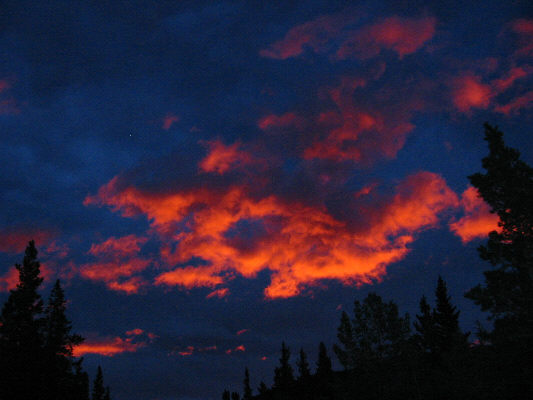
From the Little Elbow Campground, the pre-dawn sky looks remarkable. |
|
|
The group continues north beyond the south summit of Nihahi Ridge. On the horizon just left of centre is Mount Howard. |
|
|
Pete and Dave watch Frank scrambling up a rock step somewhere along Nihahi Ridge. |
|
|
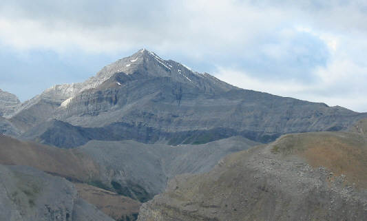
This is Fisher Peak as seen from Nihahi Ridge. |
|
|
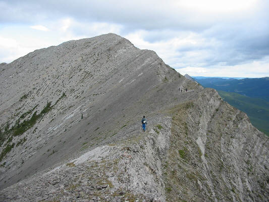
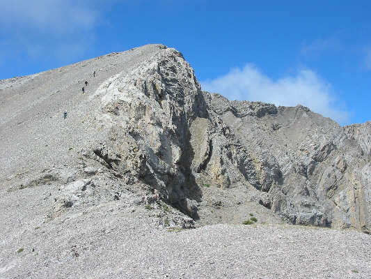
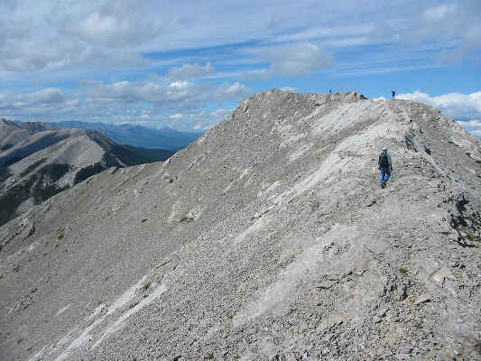
Nihahi Ridge is essentially a long series of bumps just like this one. |
|
|
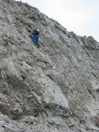
Frank climbs up a steep wall just before reaching the north summit of Nihahi Ridge. |
|
|
Compression Ridge is visible behind the rainbow in this view from just below the north summit of Nihahi Ridge. |
While Frank rode shotgun, Pete, Andrew and I piled into the back of
Dave's truck, and Dave drove us all back to Little Elbow Campground to
pick up my car. A subsequent stop at the Subway in Bragg
Creek capped off another fabulous group scramble trip.
 |
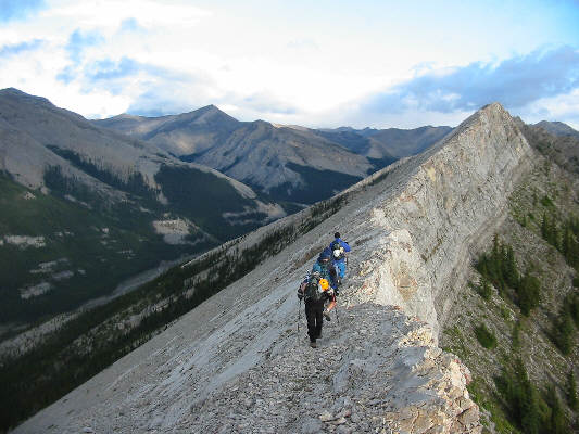
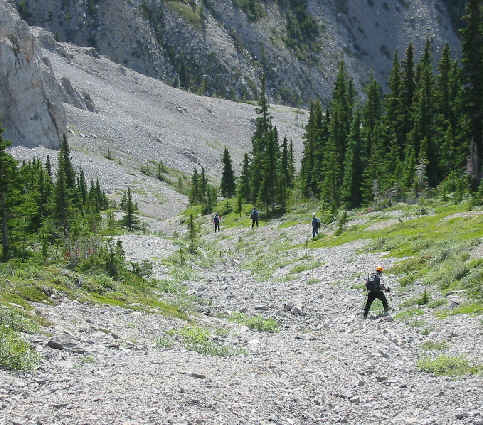
The group trudges up a rubble slope (visible at far left in the previous photo). The initial sections of Compression Ridge are similar in nature to Nihahi Ridge. |
 |
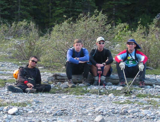
Despite over six hours of up and down scrambling, the group is still in good spirits. From L to R are Andrew, Frank, Pete and Dave. |
 |
Andrew scrambles up a slabby section. |
 |
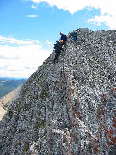
The group approaches the first serious obstacle of the day--a narrow rock fin blocking the ridge. The high point of Compression Ridge is visible straight ahead. |
 |
Andrew, Pete and Frank carefully work their way down past the rock fin. |
 |
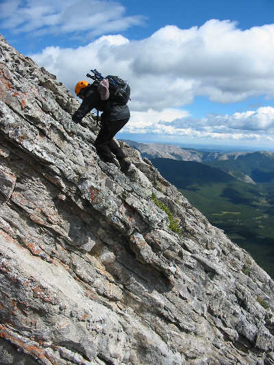
This steep wall looks intimidating but is actually fairly easy to surmount. |
 |
About 7.5 hours after leaving the Little Elbow Campground, Sonny, Andrew, Frank, Pete and Dave reach the 2530-metre high point of Compression Ridge. |
 |
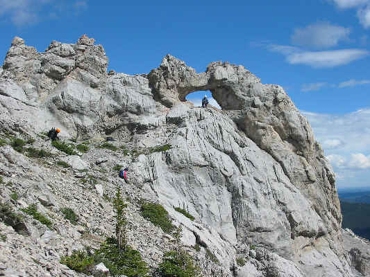
Pete stands above the first of two windows the group would encounter on Compression Ridge. |
 |
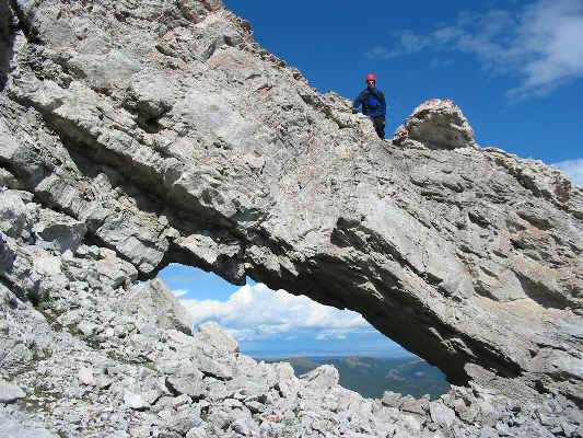
Frank is perched inside the second window. |
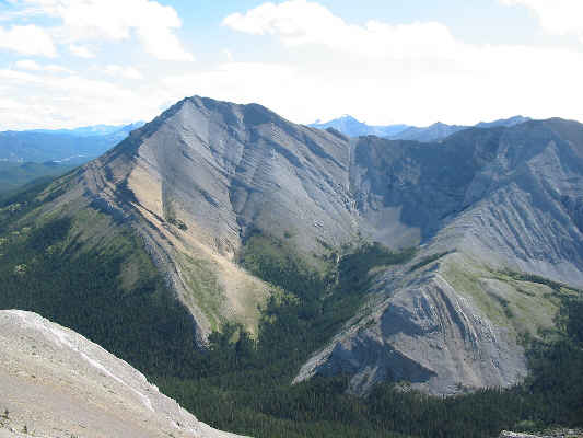 |
This is looking back at the north summit of Nihahi Ridge from across upper Prairie Creek basin. |
 |
This is the final bump at the north end of Compression Ridge. |
 |
The group descends a rubble-filled drainage which leads to a tributary of Canyon Creek. |
 |
Andrew, Pete, Frank and Dave wait patiently at the valley bottom of Canyon Creek for the slowpoke of the group (Sonny). |