

|
|
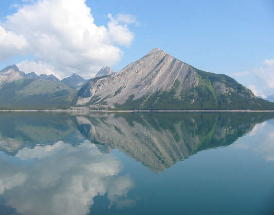
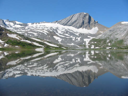
Mount Indefatigable is reflected in Upper Kananaskis Lake. |
|
|
This is the north end of Hidden Lake. The route up the headwall is shown. |
|
|
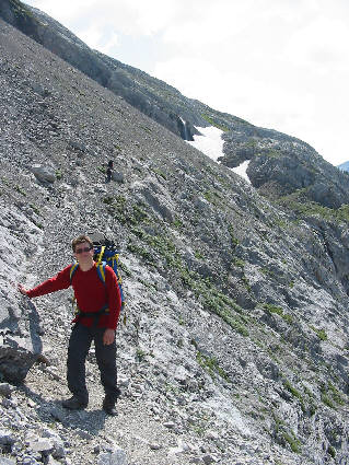
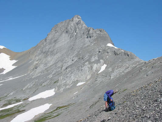
Chris pauses to mug for the camera during the ascent of the headwall. On this day, the crux of the route is crossing the snow patch up ahead. |
|
|
Everyone takes a break just before the crux. Hidden Lake, Upper Kananaskis Lake and Mount Indefatigable grab the most attention in the background. |
|
|
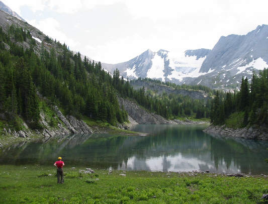
Eddie stops to admire picturesque Foch Pond with Mount Marlborough in the background. |
|
|
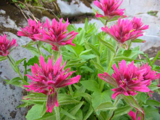
Some Indian paintbrushes adorn the trail to Aster Lake. |
|
|
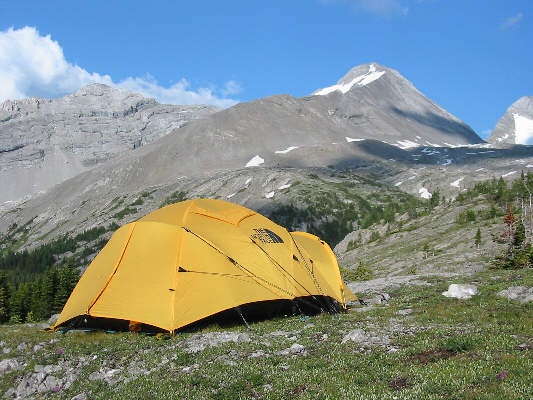
This is Chris and Eddie's tent with Mount Sarrail in the background. |
As if nocturnal porcupine attacks weren't exciting enough, Chris and Eddie, while packing up their tent the next morning (24 July 2004), spotted a young adult grizzly bear digging up the turf not far from their campsite. When I came by their tent to have a look for myself, the bear began wandering in our general direction. Suddenly, the bear must have caught wind of our presence because it promptly turned around, splashed across Aster Creek, and proceeded to climb up the hill north of the campground. Once it got sufficiently far enough from us, the bear resumed its diggings on the hill. Meanwhile, we calmly packed our gear and headed to Aster Lake to ford the outlet stream. We continued around the north shore of the lake and eventually climbed up the gully north of Warrior Mountain. Upon reaching the Continental Divide, we met a fellow by the name of Van Belliveau who had just traversed Mount Northover from south to north. He had arrived at Aster Lake campground late (we weren't even aware he was there) and also had a run-in with some porcupines (there was more than one?) during the night. Van actually recognized me from my website, so we had quite a long chat about scrambling and other related topics. He also gave us some useful route information about Northover Ridge before we parted ways.
After a lengthy but scenic plod on the British Columbia side of the Divide, we climbed up a steep snow slope to the col west of Mount Northover. While everyone else decided to stop here for lunch, I dropped my heavy pack, grabbed my camera, tripod and a bottle of water, and started climbing up the northwest face of Mount Northover (the descent route described by Alan Kane). After an initial grunt up shifting scree, I tackled a series of rock bands which progressively became steeper the higher I climbed. For me, the crux was an exposed traverse across a slippery ledge, but overall, the route was easier than I had expected. It took me less than 40 minutes to reach the summit from the col (about 250 metres height gain). After taking some photos and scribbling a very lame limerick in the summit register, I headed back down to the col in less than 20 minutes.
From the col, we hiked along the 'spine of the continent' for the next 2.5 kilometres. On this day, the views in every direction were spectacular--sensory overload at its most acute. After traversing the high point of Northover Ridge, we took an extended break at a broad saddle about one kilometre east of Defender Mountain. From there, we dropped down the Alberta side of the Divide into a long valley running north to Three Isle Lake. By the time we reached the Three Isle Lake campground (9.5 hours from Aster Lake), we were a pretty tired, hot and sweaty bunch, and some of us had no qualms about stripping buck naked and jumping in the lake despite the presence of numerous other people in the area.
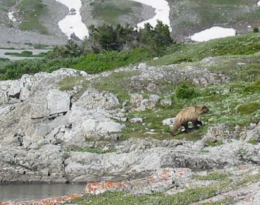 |
The grizzly bear begins to climb up the hill north of the campground in search of breakfast. |
 |
The ford of Aster Creek near the outlet of the lake is shallow but painfully chilly. The peak in the background is Mount Marlborough. |
 |
Warrior Mountain is reflected in Aster Lake. The route to Northover Ridge climbs up the grassy slope at right before turning up the gully to the right of Warrior Mountain. |
 |
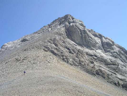
This is Mount Northover as seen from the southeast. |
 |
Kelly climbs up the grassy slope below Warrior Mountain. Aster Lake and Mount Sarrail are visible behind her. |
 |
The route to Northover Ridge traverses below the southwest face of Mount Northover before climbing to the col at far left. |
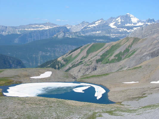 |
This is one of the two Northover Lakes. Mount King George dominates the western horizon. |
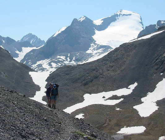 |
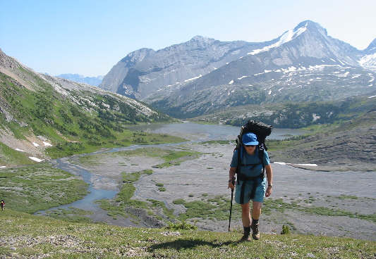
As Dan and Kelly hike north toward the col, Mount Joffre (3450 metres) begins to dominate the view southward. |
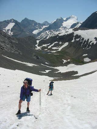 |
Dan and Kelly trudge up the steep snow slope below the col. |
 |
From the col, Sonny heads up the
northwest face of Mount Northover. Photo Courtesy of Edwina Podemski |
 |
This is the view of Mount Northover's summit from its north ridge. |
 |
Sonny crouches on the summit of Mount Northover (3003 metres). The Royal Group are on the horizon while snow-clad Northover Ridge can be seen in the foreground. |
 |
This is the current summit register of Mount Northover. It was placed on 9 August 1990. |
 |
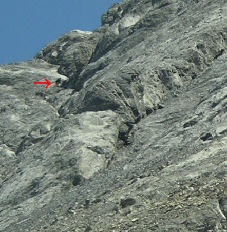
Sonny descends the northwest face of
Mount Northover. Click here
to see exactly where Sonny is. Photo Courtesy of Edwina Podemski |
 |
The northwest slopes of Warrior Mountain and Waka Nambe are unbelievably sublime. |
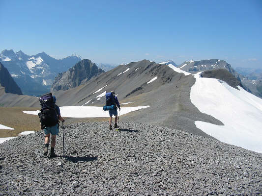 |
Kelly and Dan hike along an easy section of Northover Ridge. |
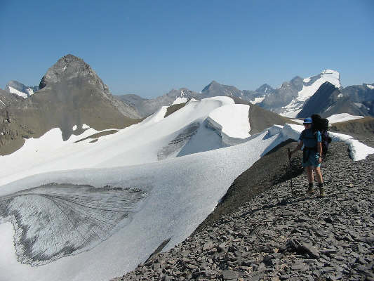 |
Kelly pauses to admire the view of Northover Glacier. Mount Northover (left) and Mount Joffre (right) dominate the skyline. |
 |
Chris begins hiking the more difficult section of Northover Ridge. Dan is barely discernable on the high point of the ridge. |
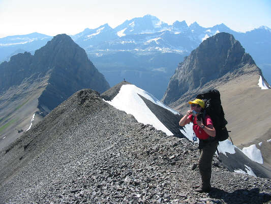 |
Eddie takes out her camera on the high point (about 2800 metres) of Northover Ridge. Mount King George is visible between Onslow Mountain (left) and Defender Mountain (right). The route eventually drops down to the saddle at lower right. |
 |
This is the high point of Northover Ridge as seen from the basin to the north. The route descends the scree slope at far right. |
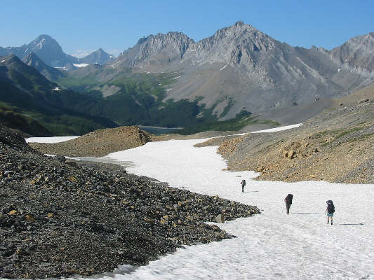 |
On the long descent to Three Isle Lake (barely visible), lingering snow patches like this one are much appreciated by those with sore, weary feet. Visible at upper left are Mount Sir Douglas and Mount Robertson. |
 |
Three Isle Lake |
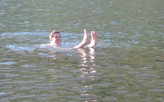 |
Chris takes a refreshing dip in Three Isle Lake. |
 |
Just before leaving the campground at Three Isle Lake, Kelly, Sonny, Chris, Eddie and Dan pose for a group photo with Mount Worthington in the background. |
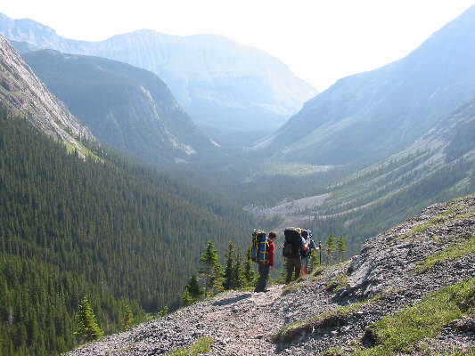 |
This is looking down the Three Isle Creek valley from the headwall guarding Three Isle Lake. Mount Indefatigable is visible straight ahead despite the morning haze. |