BOU AVENUE
Cougar Mountain
Because of some unforeseen circumstances at work, I decided at the last moment to take the day off on 23 June 2006 and go scrambling.  I was aware that some friends might be attempting Cougar Mountain in Kananaskis Country on this day.  That plus the close proximity of the trailhead to Calgary (I had to be back in town for an early evening commitment) made Cougar Mountain an attractive objective for me.  Starting from Little Elbow campground at 6:38 AM, I biked up Big Elbow Trail to the foot of Cougar Mountain's northeast ridge where I ditched my bike and began bushwhacking up to tree line.  Appropriately, when I passed a rain gauge near the last of the trees, the weather deteriorated, and rain began falling steadily.  Despite getting soaked, I pressed on in hopes that the rain would be short-lived.  I was right; the rain soon turned into wet snow!  I was beginning to wonder if I should have simply stayed in bed that morning.  Upon reaching the ridge crest though, I was encouraged to see clearer skies to the west.  I climbed higher up the ridge, and eventually the precipitation stopped and gave way to warm sunshine.  Amazingly, enough new snow had accumulated on the slopes below the false summit that I was able to step-kick much of the way up.  Going from the false summit to the true summit, I stuck mostly to the ridge crest and was pleasantly surprised by the abundance of enjoyable hands-on scrambling.  After spending a good forty minutes at the true summit, I returned to the false summit where I ran into a fellow named Kevin Papke going the other way.  Kevin asked me to take a photo of him with his camera, and then he asked if he could take a photo of me as well.  Apparently his wife was under the impression that he was scrambling with friends (the same mutual friends I thought would be scrambling this mountain), and Kevin hoped that a photo of me would help him maintain that guise.  Amused, I was more than happy to oblige him.  While Kevin continued on to the true summit, I headed down to tree line where I bushwhacked my way back to my bike.  The bike ride back out to the trailhead was a blast and took only half as long as the ride in.  I was back at my car by 4:20 PM.
Looks good to go! 
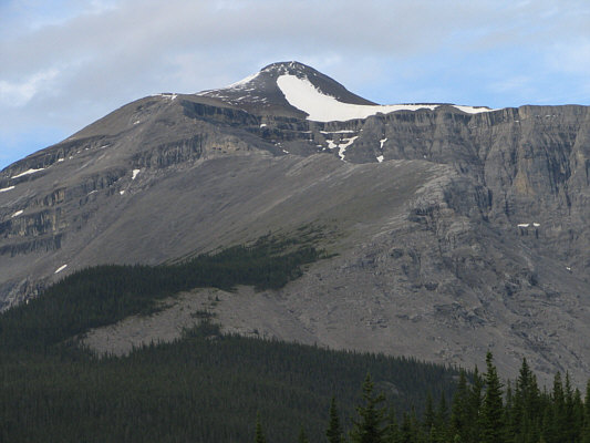
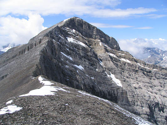
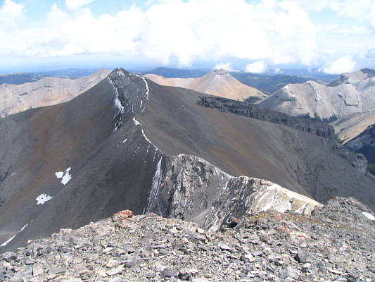
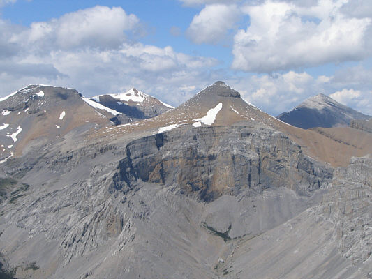
This is the false summit and the northeast ridge of Cougar Mountain as seen from Big Elbow Trail.
So who actually comes up here to check on this thing?? 
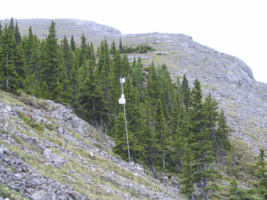
This is the rain gauge near the last of the trees.  Rain begins to fall.
The psychological low point of the day. 
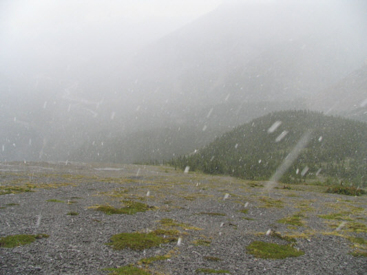
This is looking back down the open slopes above tree line.  Snow is falling.
The 6th Annual Banded Peak Challenge would be held the next day! 
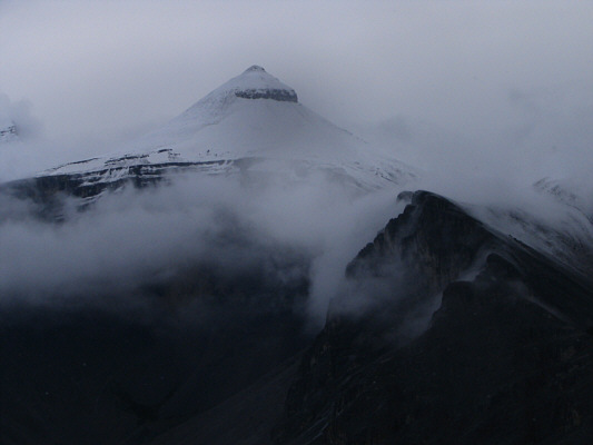
To the northwest, Banded Peak is blanketed by fresh snow.
At this point, I was feeling a little soggy! 
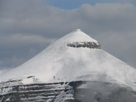
Sonny continues up the lower ridge.  The false summit is plastered with fresh snow.
Looks like a giant breast! 
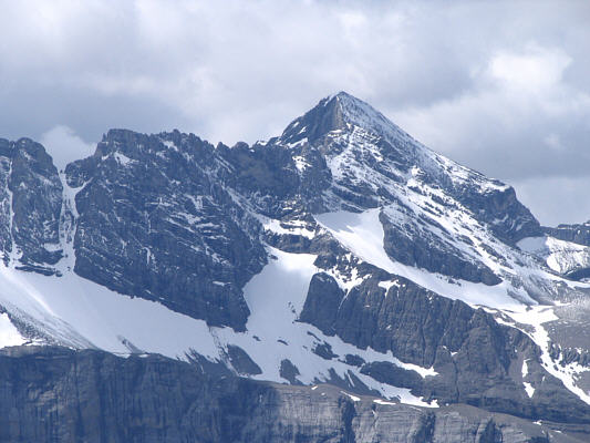
Here is a closer look at all the fresh snow on Banded Peak.
Here comes the sun! 
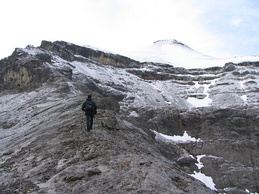
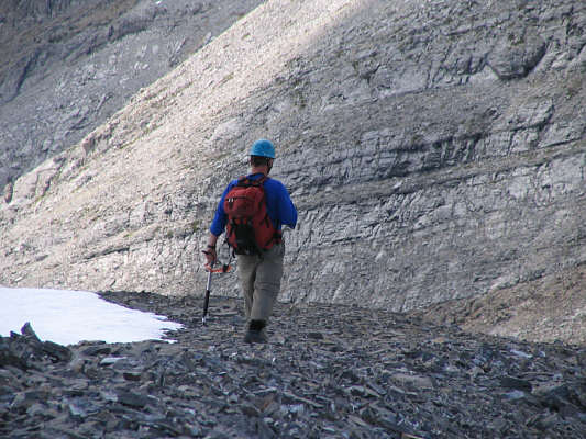
The big rock band is easily circumvented to the left.
An alternate quick descent route? 
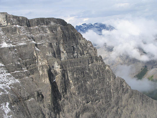
There are some impressive cliffs flanking the north ridge of Cougar Mountain.  Tombstone Mountain is barely visible beyond the mist.
It took me another hour and twenty minutes to reach the true summit from here. 
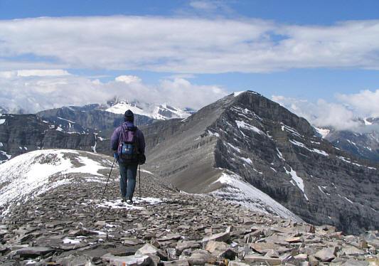
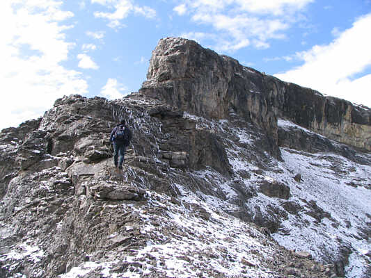
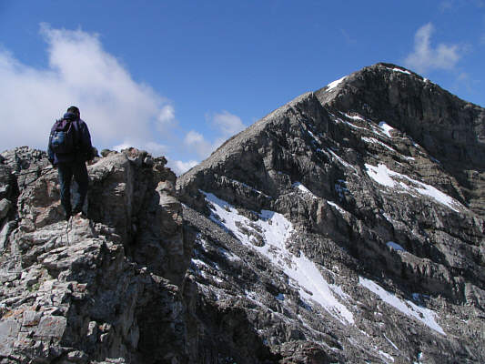
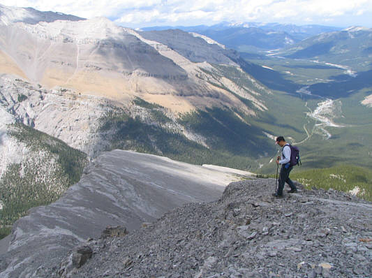
Sonny continues over the top of the false summit en route to the true summit in the distance.
Okay, so it's not much of a secret anymore... 
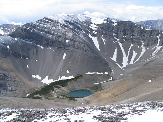
This is the secret tarn on the south side of Cougar Mountain.
Looks like an awesome place to camp...if you can hump a backpack all the way in there! 
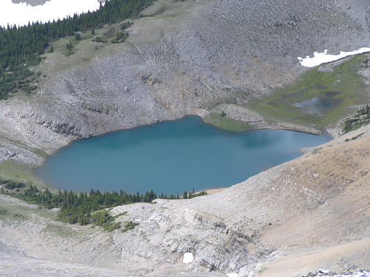
Here is a closer look at the tarn.
Some delightful scrambling ahead! This is the final ridge before the true summit.
It's a good thing that it's not snowing now! Sonny climbs up the final ridge.
Steeper than it looks here... 
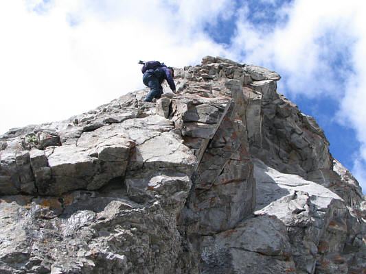
Sonny scrambles up a steep rock band.
Weather aside, this was a most enjoyable ascent. 
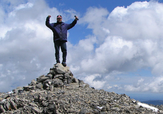
Sonny stands on the 2863-metre summit of Cougar Mountain.
Some people ascend Cougar Mountain from this side. This is looking west from the summit.  Elpoca Mountain is at left while Tombstone Mountain is at far right.
Looks much more impressive than from the other side. 
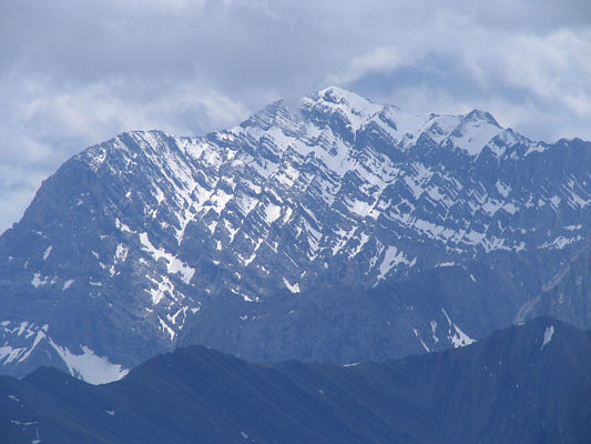
Here is a close-up view of Mount Rae to the southwest.
I'm still curious about where the hot spring is on this mountain. Mist Mountain is visible to the south.
It took me about 4.5 hours to get here from my bike.  It would take me less than 2.5 hours to get back to my bike. This is looking back (east) at the connecting ridge to the false summit.  To the right of the false summit is Mount Rose.
That snow sure disappeared quickly! 
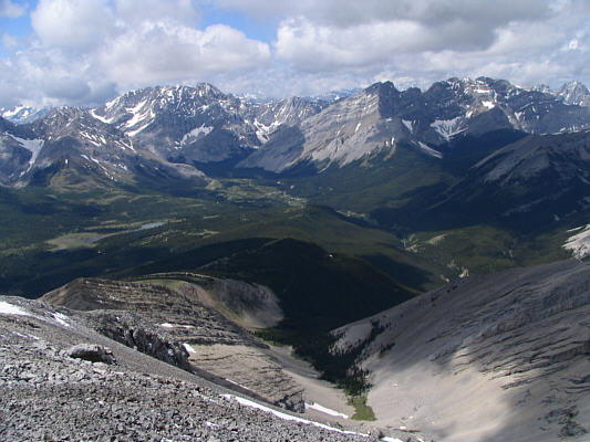
The view to the north is dominated by (L to R) Outlaw Peak, Mount Cornwall, Banded Peak and Mount Glasgow.
Kevin has a a nice camera--the Panasonic Lumix DMC-FZ3 with 12X optical zoom! This is Kevin Papke heading for the true summit.
Looking forward to that bike ride back to Little Elbow campground. Sonny descends the ridge below the false summit.
One hour and twenty minutes to ride in, forty minutes to ride out.  Sweet. It's time to rock and roll!