

Starting from camp beside
North Saskatchewan River, I hiked through light bush before crossing
David Thompson Highway and continuing along a good trail on the north
bank of Two O'Clock Creek. I left the trail only a few minutes from
the highway and began climbing steadily up the south ridge.
Route-finding was generally easy and I had no real difficulties getting
up to the first summit. A light hailstorm blew in while I was
signing the multiple registers, but the weather cleared up nicely by the
time I scrambled up the second summit. I retraced my steps for the
uneventful descent and was back in camp after a round-trip time of 7
hours.
|
|
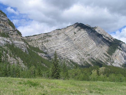
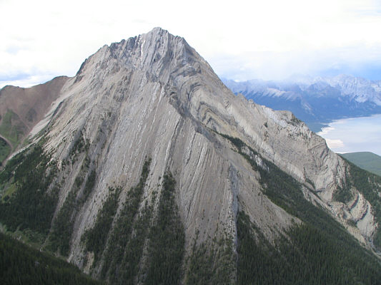
This is Mount Ernest Ross as seen from the highway. Only the first summit is visible here. |
|
|
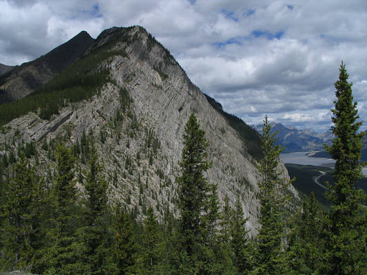
This is looking up from near a dip in the south ridge. The second summit is visible here. |
|
|
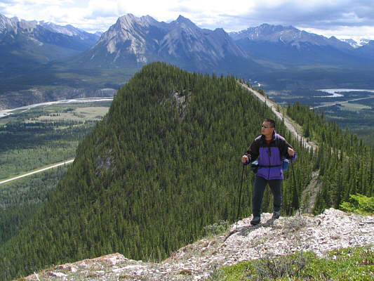
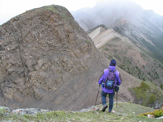
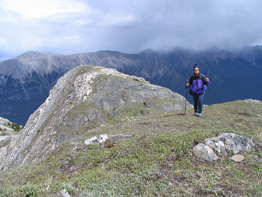
Sonny climbs out of the dip on the right after coming over the ridge behind him. Excoelis Mountain is visible in the distance at centre. |
|
|
In an effort to detour around Sonny, a sheep fearlessly descends a steep rock band. |
|
|
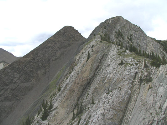
Here are the twin summits of Mount Ernest Ross as seen from a small plateau along the south ridge. |
|
|
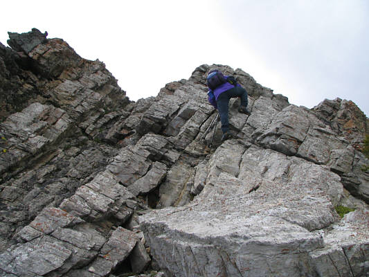
Sonny scrambles up the last rock band before the first summit. |
|
|
Sonny stands atop the 2454-metre summit of Mount Ernest Ross. |
|
|
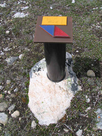
The summit register container is quite unique. |
|
|
Sonny heads for the second summit. |
|
|
This is the south face of Elliot Peak as seen from Mount Ernest Ross. |
|
|
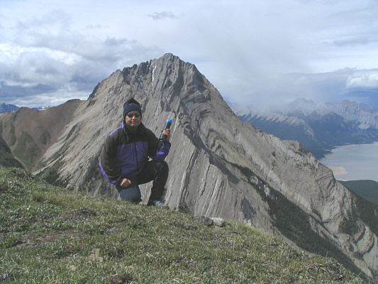
Sonny reaches the top of the second summit. The first summit is visible at left. |
|
|
Sonny shows off the register canister on the second summit with Elliot Peak behind him. |
|
|
Abraham Lake lies northeast of Mount Ernest Ross. |
|
|
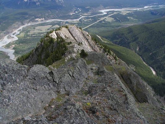
This is looking back down the south ridge from near the first summit. At right is the north fork of Two O'Clock Creek. |
|
|
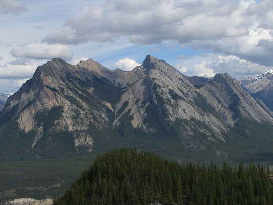
Excoelis Mountain is a rather complex peak with five distinct summits. |