BOU AVENUE
Mount Kerr, Kiwetinok Peak, Mount Pollinger And Mount
McArthur
In July of 2005, a group of us from the Rocky Mountain Books WebForum
visited Little Yoho Valley in Yoho National Park with high hopes of
scrambling up numerous peaks in this area. Bad weather and an
abundance of snow severely limited the number of peaks we were able to
actually climb. Another trip was planned in August of 2006, and
although this trip was a success for those involved, I backed out at the
last minute due in part to bad weather and also bad timing. On 8
September 2006, I finally returned with Kelly Wood to Little Yoho
Campground and resolved to climb Mount Kerr, Kiwetinok Peak, Mount
Pollinger and Mount McArthur.The next day, 9 September 2006, Kelly and
I left camp at 9:00 AM and hiked up toward Kiwetinok Pass.
Following our group's 2005 ascent of Mount Kerr, there was some debate
about whether or not we had actually reached the true summit (see
footnote here).
As a result, I was determined to re-ascend Mount Kerr and leave no doubts
this time. While Kelly continued hiking to the
pass, I veered off the trail above tree line and headed directly for the
pointy peak which I had passed up in 2005 and which is now generally
regarded as the true summit of Mount Kerr. Although this route is
essentially an easy slog, I strayed a couple of times to scramble up
steeper and more exposed terrain--a good warm-up for some tougher
scrambling later in the day. As I reached the top of the pointy
peak at 11:46 AM, a light drizzle began to fall, and this precipitation
would come and go over the next couple of hours. I was on the move
again by 12:03 PM, and because I was too lazy to re-ascend the lower
summit of Mount Kerr, I traversed the west-facing slopes.
Initially, this was quite easy, but as I came within sight of Kiwetinok
Pass, the terrain steepened considerably. I ended up down-climbing
some pretty difficult cliff bands which were quite exposed and very
loose. I breathed a huge sigh of relief when I cleared this section
and reached easier terrain. Kelly was
still waiting for me when I arrived at the pass at 1:04 PM.
 |
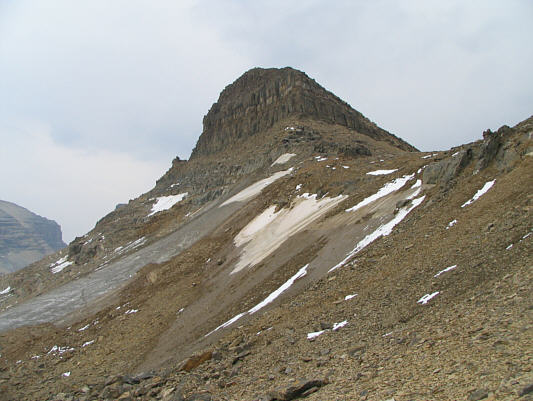
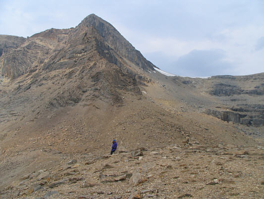
This is generally regarded as the
true summit of Mount Kerr. |
 |
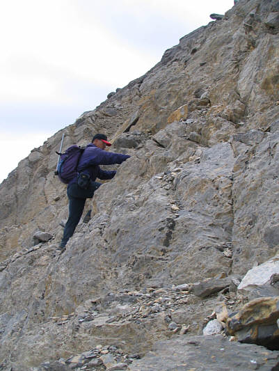
Sonny approaches some big cliffs on
his way up Mount Kerr. |
 |
A traverse to the right is necessary
to access the final summit block. |
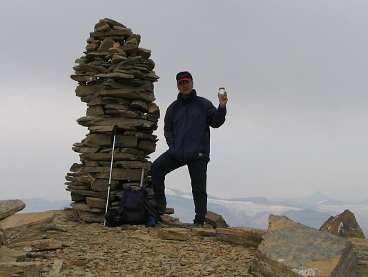 |
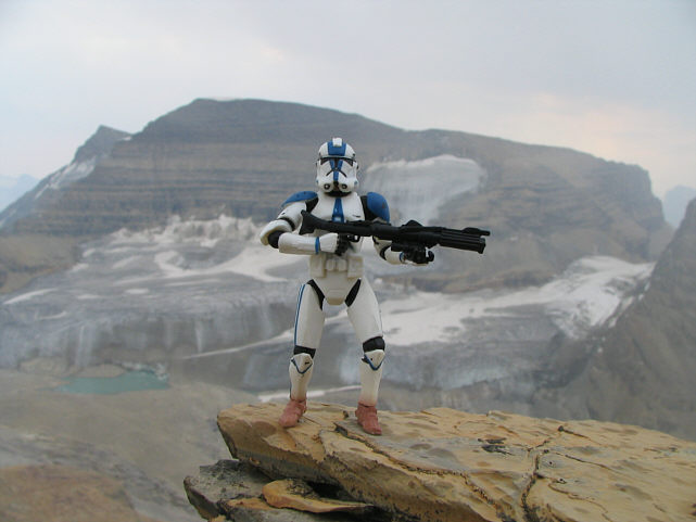
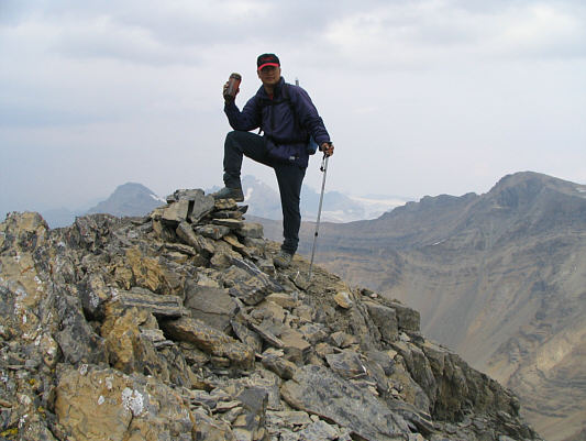
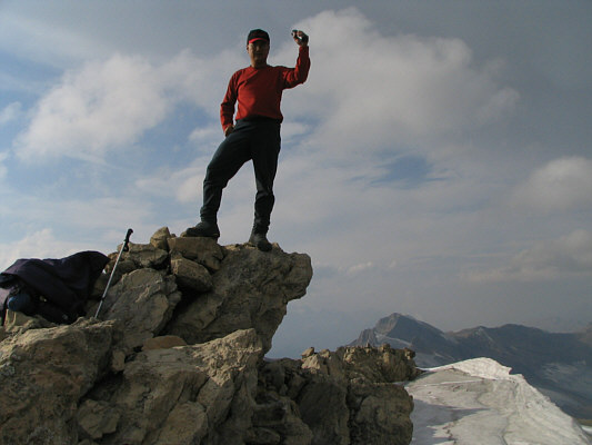
Sonny stands beside the gargantuan
cairn on the real 2863-metre summit of Mount Kerr. |
 |
The President dominates the view to
the east. |
 |
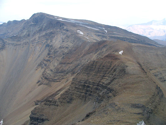
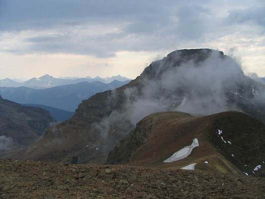
To the north are Kiwetinok Peak, Mount
Pollinger (indistinct) and Mount McArthur. The lower summit of
Mount Kerr is also visible in front of Kiwetinok Peak. |
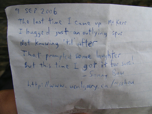 |
Sonny's register entry somewhat
reflects his feelings about the whole Mount Kerr summit controversy. |
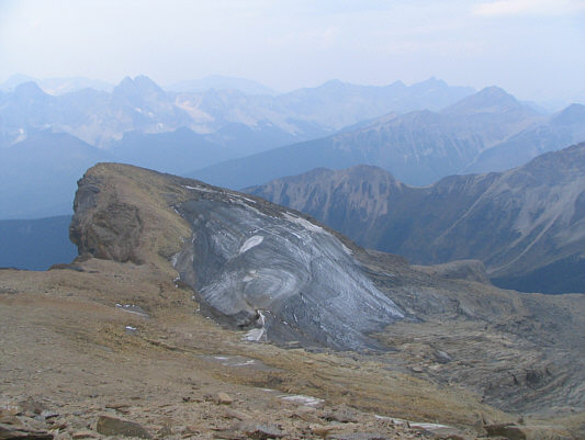 |
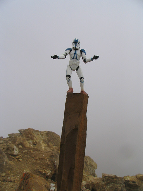
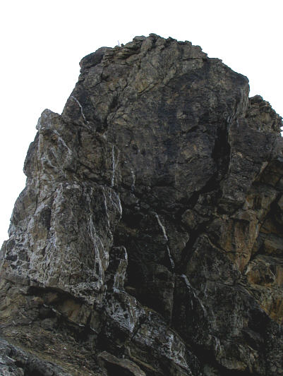
This is possibly another summit of
Mount Kerr! |
After a very short break, Kelly accompanied me briefly to the
base of Kiwetinok Peak before turning to head back to camp. I
continued up rubble toward the ice patch on the east face. Just
before the ice patch, I took a short cut up a steep crack that actually
had water flowing down the middle. I managed to stay dry by
ascending a narrow slab staircase on the left side of this crack. A
couple spots were very exposed, but the rock was solid on the staircase.
At the top of this crack, I regained the normal ascent route and simply
followed numerous cairns marking breaches in successive cliff bands.
Just when I thought that this ascent was taking far too long, I popped
out onto the summit ridge at 2:58 PM. The summit cairn was only a
few metres away. After signing the register, I made a point of
walking along the entire length of the summit ridge both north and south
of the cairn. After the Mount Kerr fiasco, I was not taking any
chances! I finally left the summit at 3:27 PM, and except for a
short stretch of ice near the bottom (I was too lazy to pull out my
crampons), I had a trouble-free descent and was off the east face by 3:56
PM. As I trudged along the connecting ridge to Mount Pollinger, a
steady rain began to fall.
 |
Kelly waits patiently for Sonny at
Kiwetinok Pass. Kiwetinok Peak is behind her. |
 |
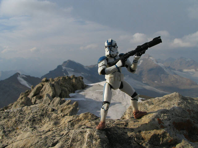
Sonny scrambles up typical terrain on
the east face of Kiwetinok Peak. |
 |
Sonny stands on the real
2902-metre summit of Kiwetinok Peak. |
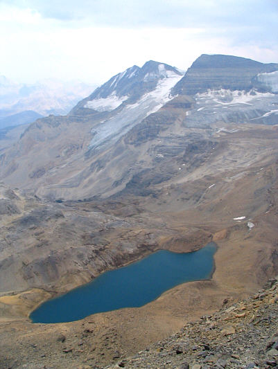 |
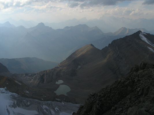
The Vice President and The President
form a magnificent backdrop to Kiwetinok Lake. |
 |
This is looking northeast toward Mount
Pollinger (right and indistinct, again) and Mount McArthur. |
 |
Here is a zoomed-in shot of Mount
Carnarvon to the south. |
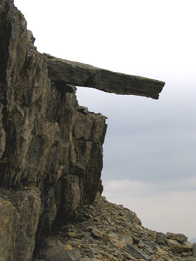 |
This slab of rock overhangs one of the
cliff bands on the east face of Kiwetinok Peak. |
 |
This is looking back up the east face
of Kiwetinok Peak from the connecting ridge to Mount Pollinger. |
As I approached the summit of Mount Pollinger, the weather got
steadily worse. A dark cloud enveloped The Vice President and The
President, and I could hear some thunder in the distance (Kelly told me
later that the campground really got hammered by the storm).
Although I was slowly getting wet from the rain, my fleece sweater kept
me warm, and I actually felt more refreshed than earlier in the day.
Clearing skies to the west meant that this storm would be short-lived,
and by the time I stepped on the summit of Mount Pollinger at 4:21 PM,
most of the rain had tapered off. While I was setting up my camera
for a summit photograph, a white mist blew in quite suddenly and
completely obscured all surrounding views. What lousy timing!
Strangely, as if on cue, the mist cleared as I was about to down-climb
the cliff beyond the summit. I paused to take some extra
photographs before resuming the short but entertaining down-climb.
By 4:46 PM, I had descended the crux and was on my way to Mount McArthur.
 |
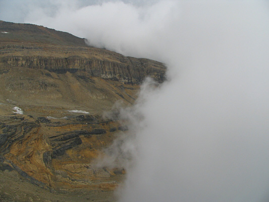
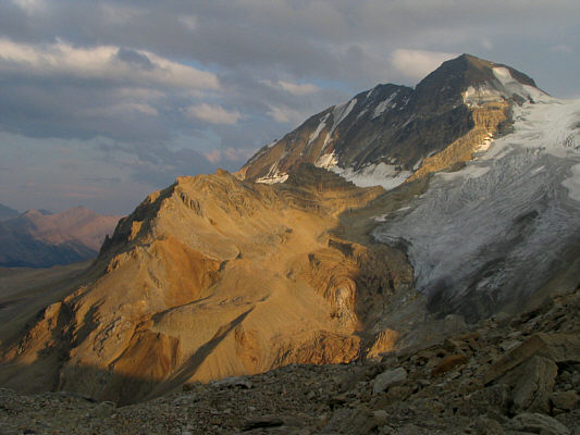
Even Mount Kerr looks ominous under a
dark cloud. |
 |
The white mist rapidly blows in. |
 |
Sonny is surrounded by mist on the
2816-metre summit of Mount Pollinger. |
 |
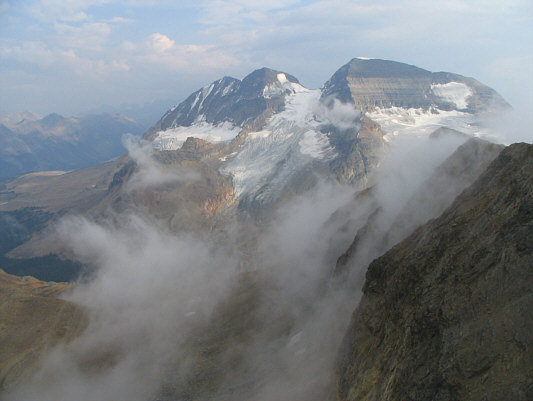
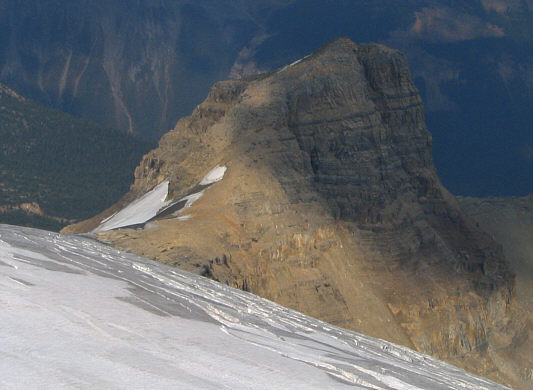
The mist finally clears to reveal
Mount McArthur. |
 |
Some lingering mist partially obscures
Kiwetinok Peak. |
 |
Here is a look back at the crux below
Mount Pollinger's summit. |
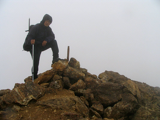
The remaining plod up Mount McArthur was easy, and I bagged my
fourth and final peak of the day at 5:50 PM. Although the skies
were relatively clear at the summit, I felt a slight spark when I handled
my small camera tripod, and at the same time, I could hear the metal
button on my wind jacket buzzing! Because the earlier thunderstorm
had moved off well to the northeast, I did not think that a lightning
strike was likely. In any event, the buzzing soon stopped, and I
completed my usual chores before wandering a bit further north along the
summit ridge to assure myself that I had indeed bagged Mount McArthur!
Leaving the top at 6:20 PM, I took Alan Kane's alternate descent route
and made it back to Little Yoho Campground by 8:00 PM without too much
fuss. Kelly and I celebrated my success by having teriyaki noodles
and blueberry cheesecake for dinner. The following day, 10
September 2006, we simply packed up and headed home.
 |
The Vice President and The President
reappear as the mist dissipates. |
 |
There are some interesting cliff bands
on the south side of Mount McArthur. Mount Daly and Mount Niles
are visible at upper right. |
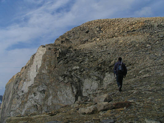 |
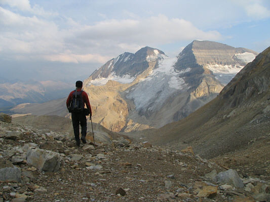
Sonny hikes up the easy south slopes
of Mount McArthur. |
 |
Sonny dares to be struck by lightning
on the 3015-metre summit of Mount McArthur. |
 |
Across Glacier des Poilus is Isolated
Peak. |
 |
Many of the peaks on the Wapta
Icefield can be seen to the northeast. Mount des Poilus (left)
and Mount Collie (centre) are the two most easily identified. |
 |
A host of peaks stretch into the
distant northwest. |
 |
This view to the south includes Mount
Marpole, Mount Carnarvon, Mount Kerr, Mount Pollinger and Kiwetinok
Peak. |
 |
This is looking back at the connecting
ridge between Mount Pollinger and Mount McArthur from the hanging
valley to the southeast. |
 |
Sonny hikes down the scenic hanging
valley. |
 |
The late day sun illuminates The Vice
President. |