 |
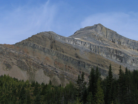
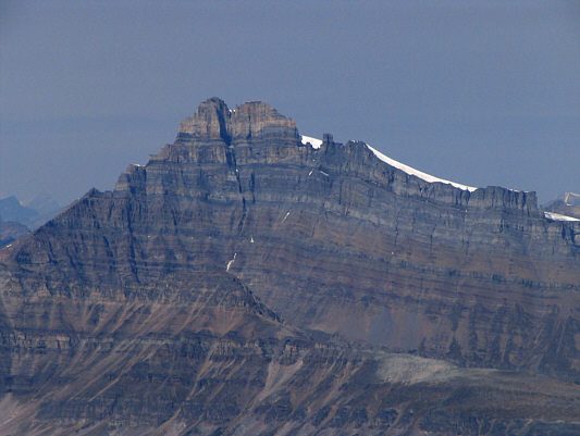
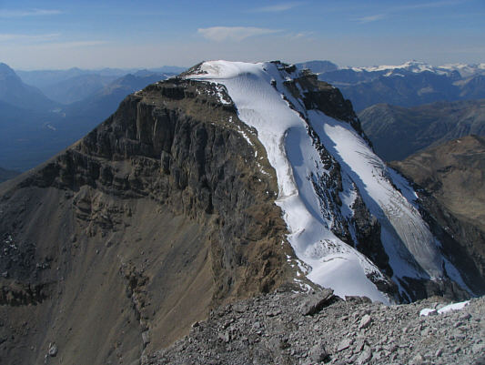
This is Mount Richardson as seen from
the trail to Hidden Lake. |
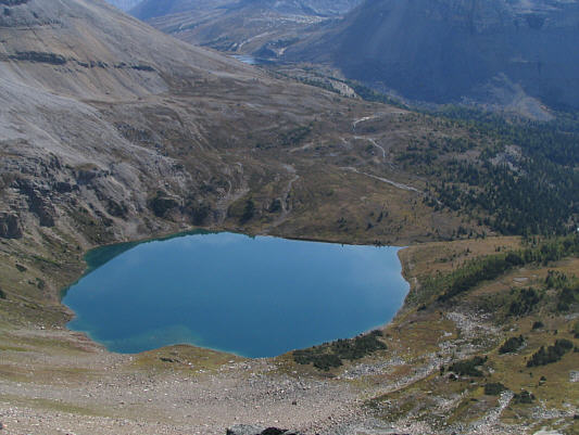 |
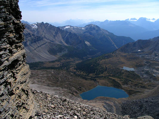
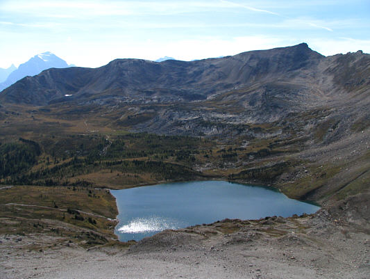
Hidden Lake appears tranquil from this
vantage point on Mount Richardson's south ridge. |
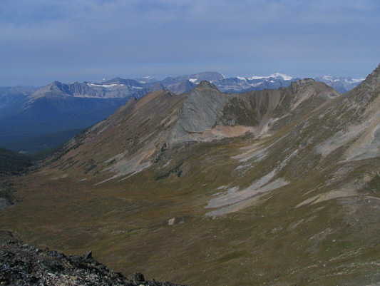 |
This is an unnamed valley southwest of
Mount Richardson. Mount Daly and Mount Balfour are a couple of
the more recognizable peaks on the horizon. |
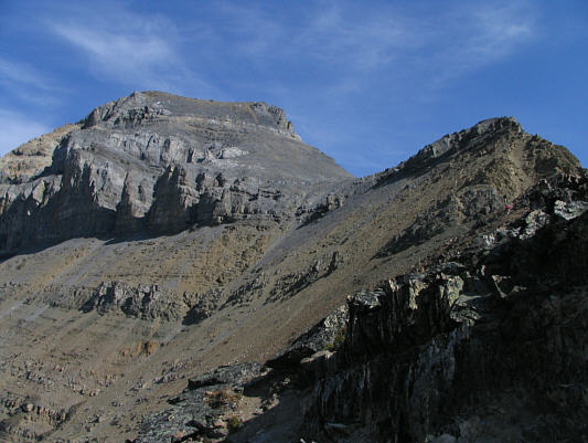 |
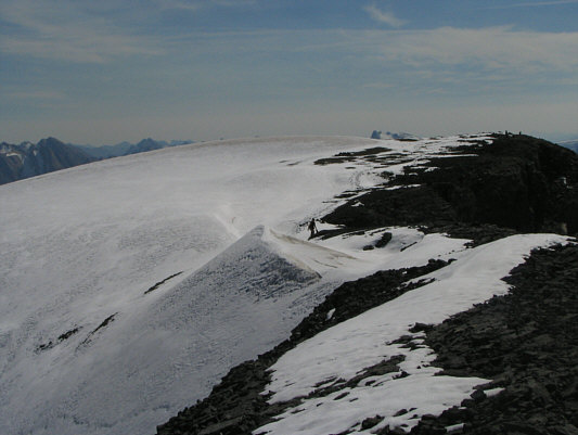
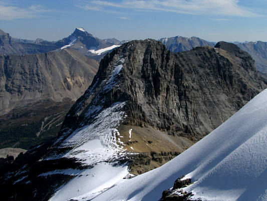
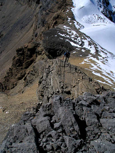
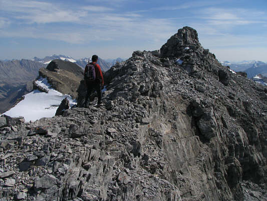
This is looking up at the remainder of
the route from the south ridge. |
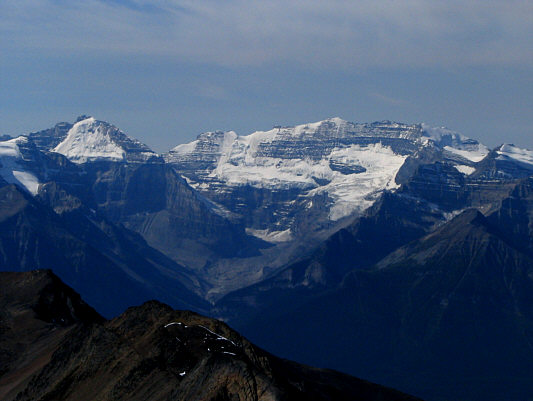 |
Mount Lefroy (left) and Mount Victoria
are prominently visible to the southwest. |
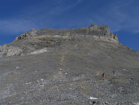 |
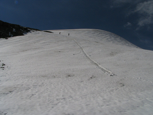
Linda and Robert hike up lots of
treadmill rubble just below the summit of Mount Richardson. |
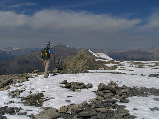 |
Although this broad area is likely the
true summit of Mount Richardson (3086 metres), Robert heads toward a
nub in the distance which seemingly looks higher. |
 |
Linda (barely visible at centre) makes
her way up to the nub. |
 |
Merlin Lake looks magical from the top
of Mount Richardson. |
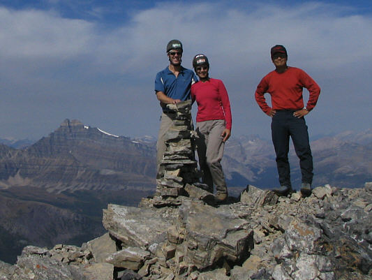 |
Robert, Linda and Sonny pose beside a
cairn on the nub. Mount Hector is visible at left. |
 |
This is looking across the intervening
col to Pika Peak. |
 |
Here is a close-up view of Mount
Hector. |
After an exhilarating glissade down Mount Richardson's east
ridge, Robert, Linda and I hiked across the col to the base of Pika
Peak's west ridge. Linda was not feeling well at this point and
decided to forego an ascent of Pika Peak. Robert and I continued up
the ridge, and we were both on our second summit of the day by 2:23 PM.
We parted company here, and Robert descended quickly to rejoin his wife
for a speedy descent back to Hidden Lake and out. I lingered on the
summit for a bit longer before making my way carefully back down to the
col. From there, I followed a beaten path traversing below Pika
Peak's south face. At one point, I turned around to snap a
photograph of Mount Richardson when I suddenly heard some rockfall
clattering high above me. I looked up and noticed that, among the
many rocks bouncing down the slope, there was one that was about the size
of a large television set. Although all the rocks bounced
harmlessly past me a few feet away, it was a little disconcerting to know
that I would have been directly in the path of the rocks had I not turned
around just at that precise moment to snap my photograph. I resumed
my descent without further incident and eventually made it back to the
campground by 4:13 PM. Kelly had actually gone to Hidden Lake to
wait for me there but did not realize that I had bypassed the lake on my
way down. She eventually found me back in camp, and together, we
packed up and headed for home. Although the hike back to my car was
mostly downhill and technically easy, the hot afternoon sun and bagging
five peaks over three days were taking their toll on me. The last
few kilometres along Temple Fire Road were especially painful on my poor
feet. Next time I come back, I will be bringing either my bicycle
or my skis!
 |
Linda and Robert descend Mount
Richardson's east ridge. |
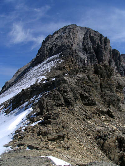 |
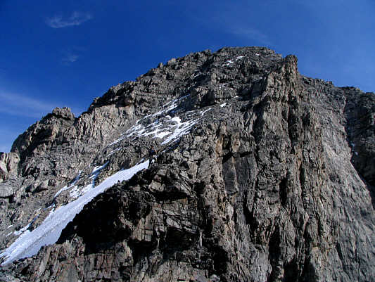
This is the west ridge of Pika Peak as
viewed from the col. |
 |
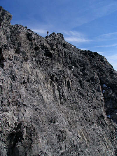
Robert climbs up the west ridge. |
 |
Robert (left of centre) continues
scrambling up the ridge. |
 |
Here is Merlin Lake as seen from the
upper slopes of Pika Peak. |
 |
Robert walks along the summit ridge. |
 |
Sonny approaches the summit. |
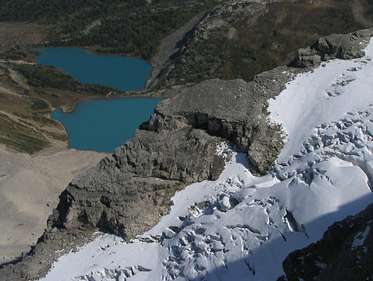 |
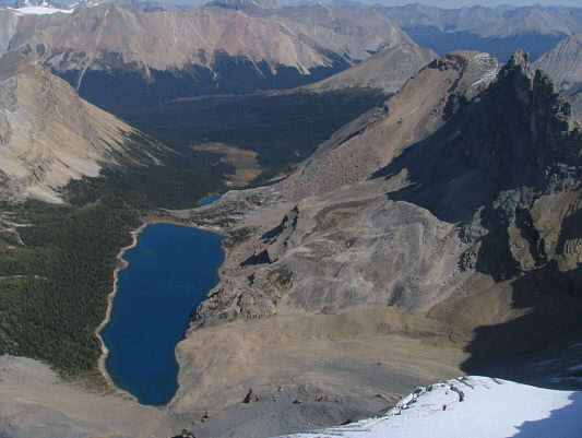
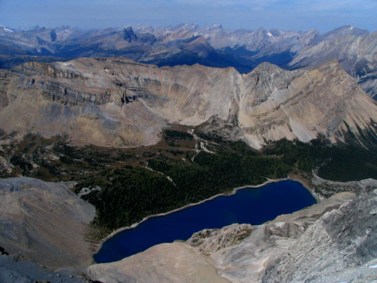
This is looking down on Myosotis Lake
(top) and Zigadenus Lake from the summit of Pika Peak. |
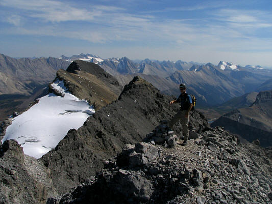 |
Robert stands beside a cairn near the
summit of Pika Peak. Ptarmigan Peak is at left just above the
glacier. |
 |
North of Pika Peak is the striking
Wall of Jericho. |
 |
Mount Richardson dominates the view to
the west. |
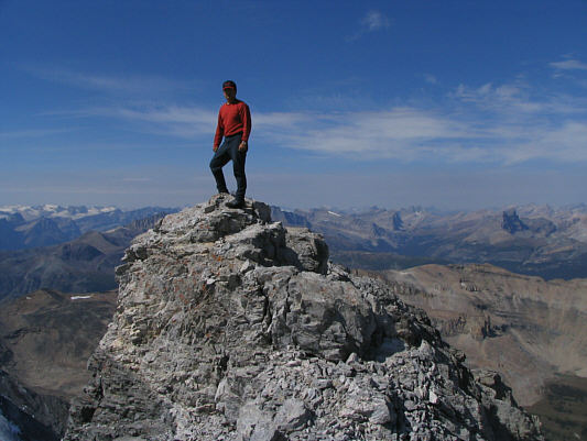 |
Sonny stands atop the 3033-metre
summit of Pika Peak. |
 |
This is looking down at Hidden Lake
from the base of Pika Peak's west ridge. Lipalian Mountain can
be seen at centre. |
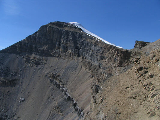 |
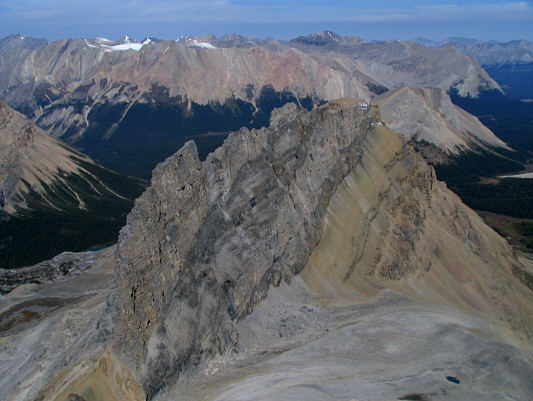
Here is Mount Richardson as viewed
from below Pika Peak's south face. |
 |
Mount Richardson's south ridge
provides a nice backdrop for Hidden Lake. Mount Temple can be
seen at far left. |