Be sure to
check out
Wietse's and
Raff's pictures.
|
|
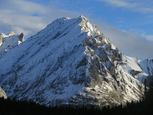
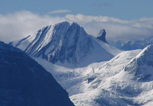
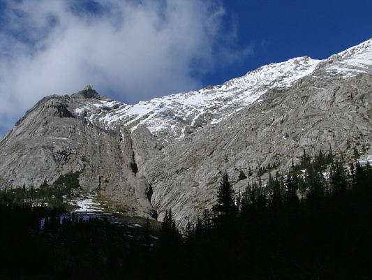
This is Tombstone South as seen from the approach trail. |
|
|
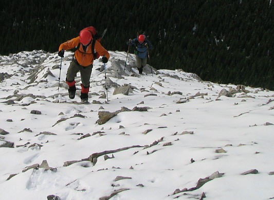
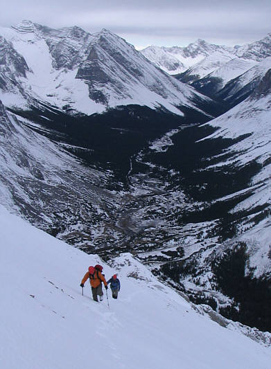
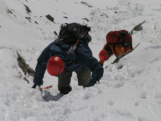
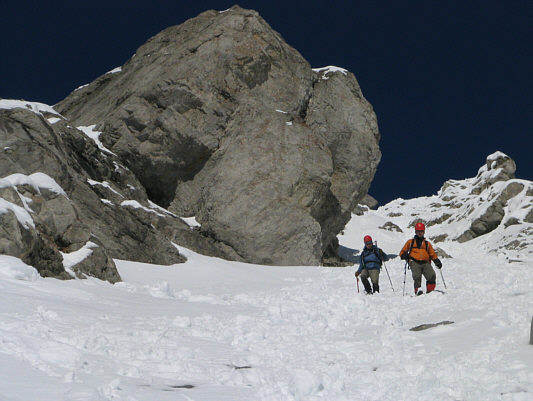
Raff and Wietse hike up snow-covered rubble. |
|
|
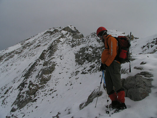
Raff looks up the south ridge. |
|
|
Raff carefully crosses a knife-edged section of the ridge. Behind him is Mount Rae and the Rae Glacier. |
|
|
Raff and Wietse follow Sonny's footsteps up the snow slope. Mount Tyrwhitt is visible at upper right. |
|
|
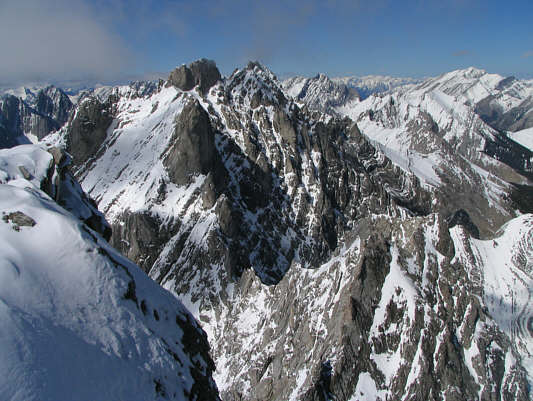
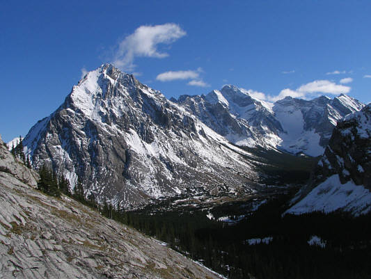
Elpoca Mountain looks impressive across the valley to the southwest. |
|
|
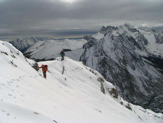
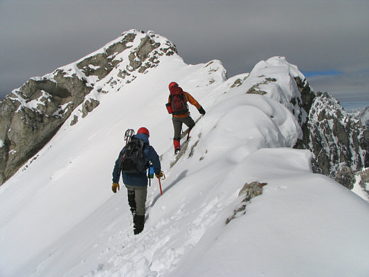
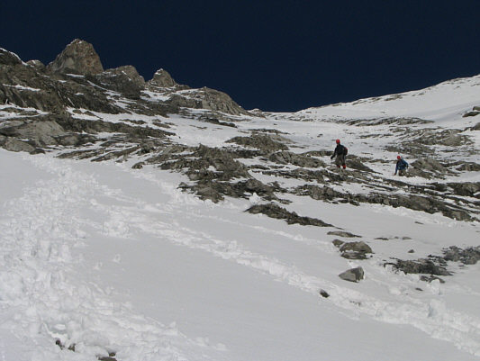
Raff and Wietse continue to follow Sonny's footsteps higher up the ridge. |
|
|
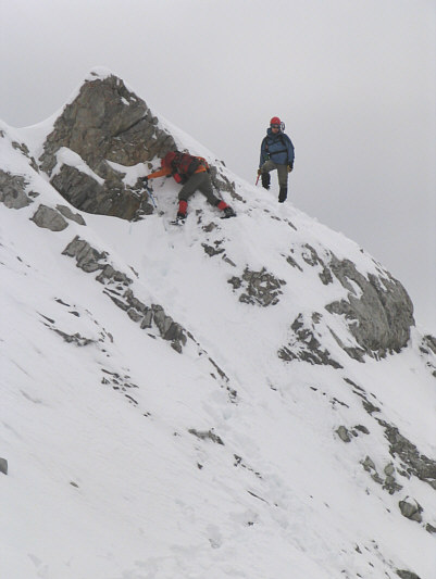
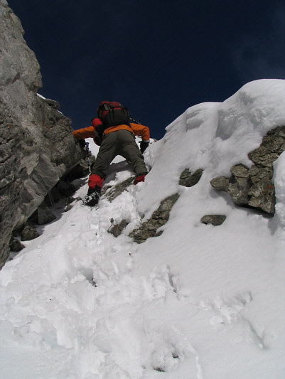
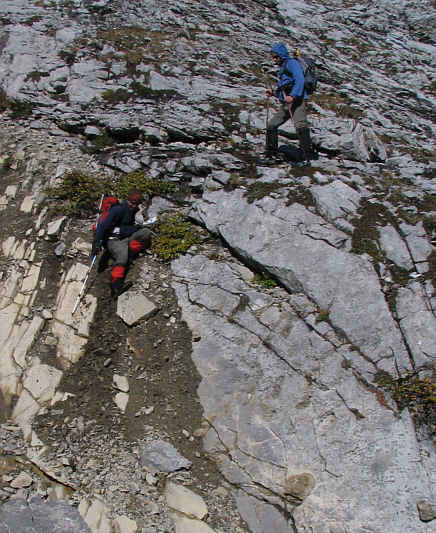
Wietse watches as Raff negotiates a tricky spot on the ridge. |
|
|
Here is a more complete view of the scene from the previous photograph. |
|
|
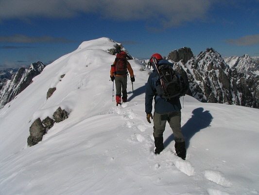
Wietse and Raff regain the ridge just past the false summit. The true summit is ahead. |
|
|
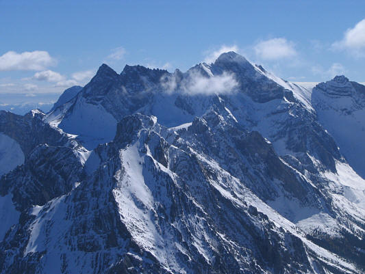
Clearing skies reveal Mount King George to the west. |
|
|
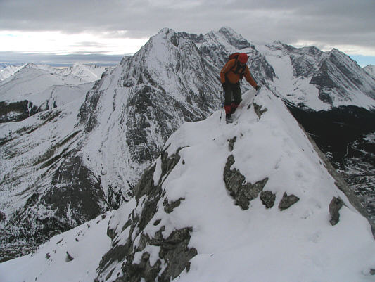
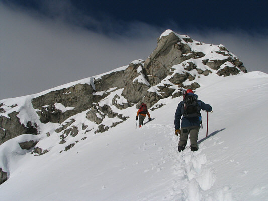
Raff and Wietse approach the final gendarme before the summit. |
|
|
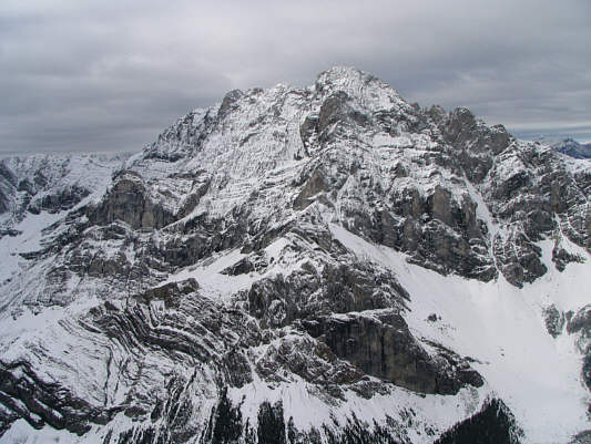
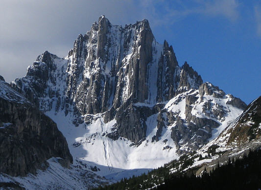
Here is a close-up view of Warrior Mountain and Waka Nambe. |
|
|
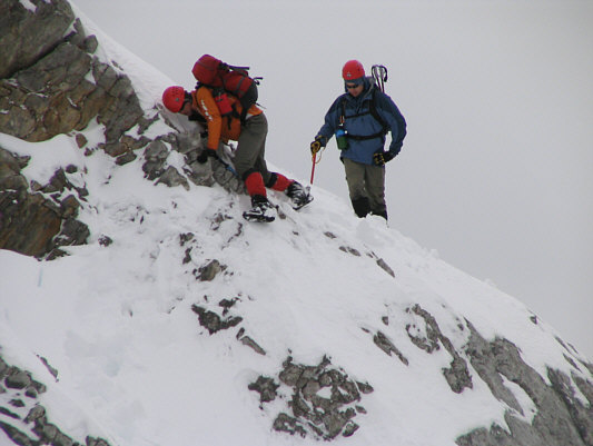
Raff climbs up a shallow chimney. |
|
|
Raff and Wietse take the last few steps before the summit. |
|
|
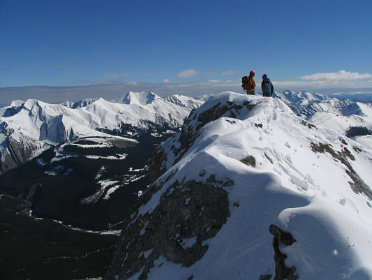
Wietse, Raff and Sonny stand on the summit of Tombstone South (over 2925 metres). |
|
|
This is looking back at the summit from just a little further north along the ridge. To the left are some of the peaks at the north end of the Highwood Range. |
|
|
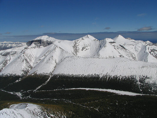
To the northeast are Mount Cornwall, "Outlaw Peak" and Banded Peak. |
|
|
Fisher Peak, Mount Romulus and Mount Remus can be seen to the north. |
|
|
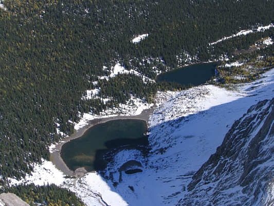
Tombstone Lakes are nearly 750 metres below the summit of Tombstone South. |
|
|
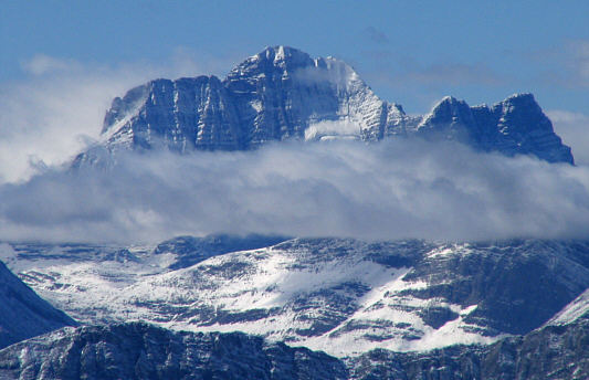
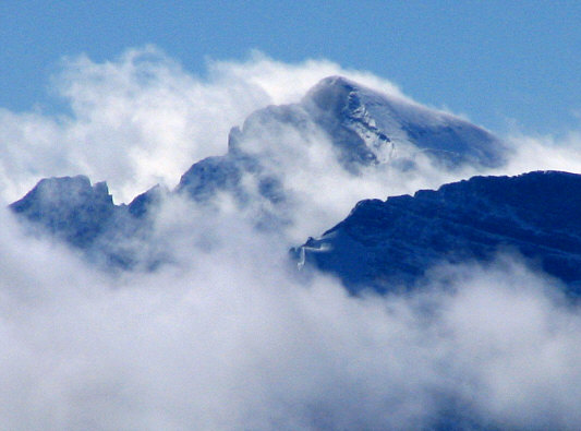
This is looking northwest at the real Tombstone Mountain (3035 metres). |
|
|
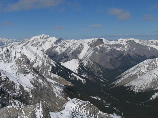
Mount Rae dominates the view to the south. |
|
|
This is a zoomed-in view of Mount Joffre to the southwest. |
|
|
Wietse and Raff descend a steep snow gully near the summit. |
|
|
The snow makes plunge-stepping easy. |
|
|
Raff and Wietse work their way down a mix of snow and rock slabs. |
|
|
Wietse watches Raff slide down a short but nasty dirt slope. |
|
|
Here is a view of Mount Rae (right of centre) from the lower slopes of Tombstone South. |
|
|
This is looking back up Kane's alternate descent route. The summit is visible at upper right. |
|
|
At the head of Piper Creek valley is this spectacular formation unofficially known as "Cats Ears". |