On 22 July 2006, I crawled out of bed at about 1:30 AM and was already wondering if three hours of sleep would sustain me for the long day ahead. After picking up Linda and Dan, I drove us out to the trailhead, and we were a little surprised that Dave was nowhere in sight. As we began gearing up, Dave's car suddenly pulled into the parking lot; he had been waiting for us at the wrong trailhead! We were finally on our way by 5:15 AM and ploughed through a gauntlet of annoying invisible spider webs all along the south shore of Upper Kananaskis Lake. Reaching the north end of Hidden Lake at 7:00 AM, I was not surprised but still disappointed to find that the lake was full. We took to the bushy and deadfall-choked trail winding and undulating around the east shore, and thankfully, the great company alleviated some of the misery. After reaching the south end of Hidden Lake and climbing up through the trees, we took a break at 9:00 AM at the base of the rubble slope below the headwall guarding Aster Lake. A large group of day hikers doing the Northover Ridge loop passed us here, and I watched with some dismay as they waltzed up the rubble slope with seemingly little effort. It took us an hour to climb up the headwall at which point the sun was beginning to take its toll on us. We reached Aster Lake campground by 11:25 AM, and after setting up camp, we all had a snack and promptly took a nice long nap in the shade.
Some time later, we all woke up and began organizing ourselves to scramble up Warrior Mountain and possibly Mount Cordonnier. We left camp at about 2:15 PM and hiked around the south shore of Aster Lake before heading across the river flats to the base of Warrior Mountain. The heat of the day was becoming unbearable as we scrambled up the lower slopes, and about halfway up the mountain, Linda and Dan decided to turn around. I was not feeling particularly energetic myself, but in my mind, I had already resolved on bagging both peaks. I pushed on with Dave up to the foot of the remnant glacier hugging the east side of Warrior Mountain. Clear patches of ice attested to the fact that this indeed was a glacier and not just a snowfield. Dave and I donned our crampons and began trudging up the glacier where we met a roped party of four and a dog on their way down. It only took us about twenty minutes to climb up the glacier, and after removing our crampons, Dave and I slogged our way up scree for another thirty minutes before reaching the top of Warrior Mountain at 5:30 PM. I was so exhausted that I actually caught myself falling asleep a couple of times while trying to sign the summit register! I did eventually doze off with dreams of climbing Mount Cordonnier...
Check out Dave's trip report and photos
here.
|
|
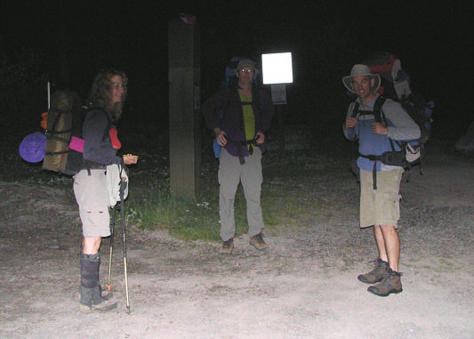
Linda, Dan and Dave get ready to set off from the parking lot in the dark. |
|
|
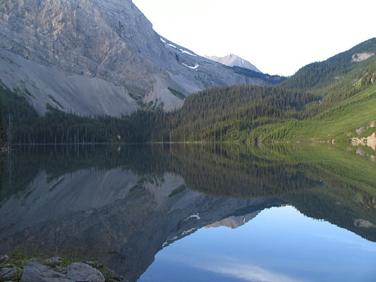
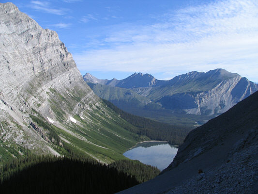
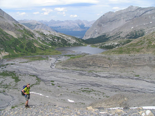
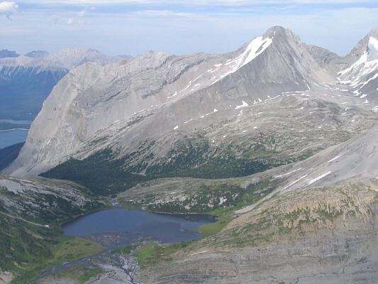
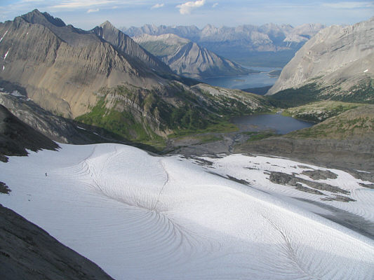
Hidden Lake is unfortunately full to the brim. The headwall guarding Aster Lake is visible beyond. |
|
|
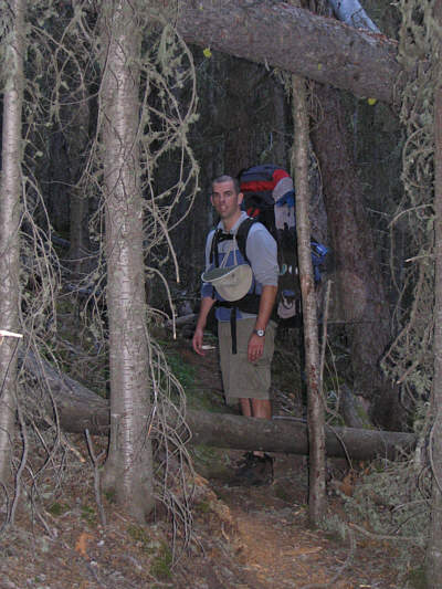
Dave looks back along one of the "tamer" sections of the trail around Hidden Lake. |
|
|
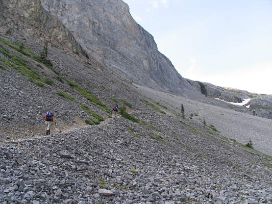
The group begins the steep climb up the headwall. |
|
|
This is looking down on Hidden Lake from further up the headwall. On the horizon are (L to R) Mount Warspite, Mount Invincible and Mount Indefatigable. |
|
|
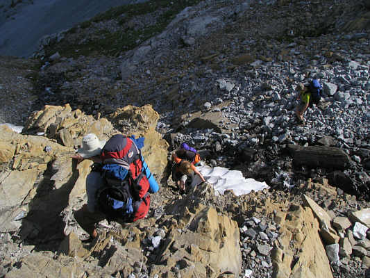
The group scrambles up a rock band near the top of the headwall. |
|
|
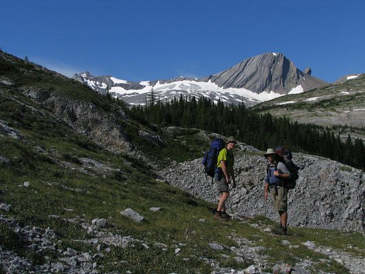
Dan and Dave pause at the top of the headwall. In the distance are Mount Cordonnier and Warrior Mountain. |
|
|
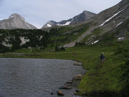
After setting up camp, the group hikes around the south end of Aster Lake. Mount Sarrail is visible at far left. |
|
|
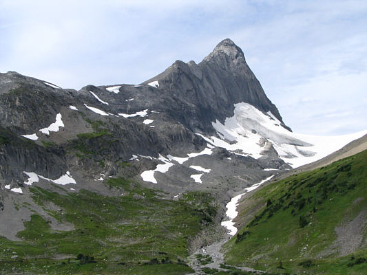
This is Mount Northover as seen from the river flats west of Aster Lake. |
|
|
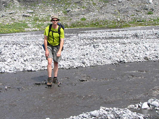
Dan looks a bit nonplussed as he fords one of the braided streams. |
|
|
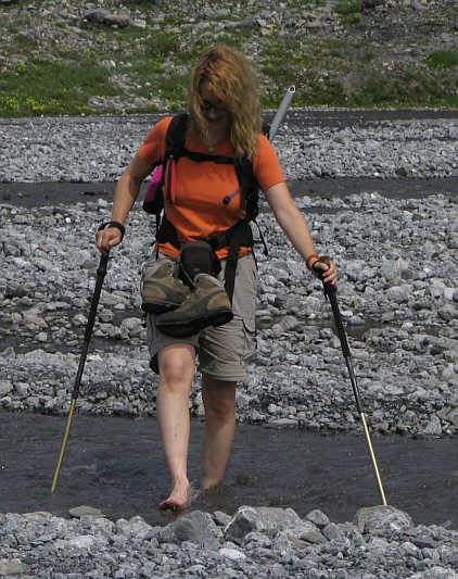
Linda decides to keep her boots dry while fording. |
|
|
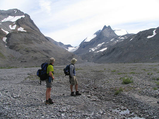
Dan and Dave gaze up at Mount Joffre while crossing the river flats. |
|
|
Dan climbs up the lower slopes of Warrior Mountain with Aster Lake in the background. |
|
|
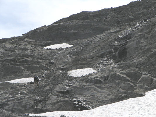
Dave climbs up typical terrain on Warrior Mountain's lower slopes. |
|
|
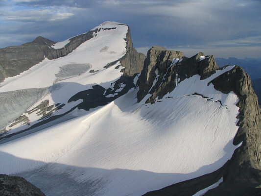
This is the remnant glacier hugging the east side of Warrior Mountain. Dave and Sonny would eventually ascend to the left of the exposed ice patch before angling right toward the low notch on the skyline. |
|
|
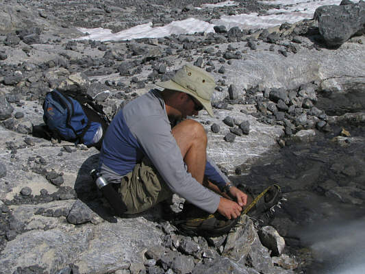
Dave dons his crampons. |
|
|
Dave sets foot on a glacier for the first time in his life. |
|
|
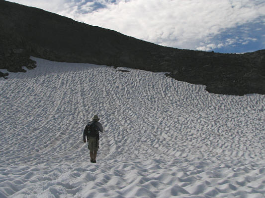
Dave approaches the top of the glacier. |
|
|
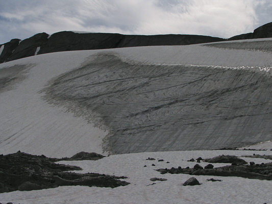
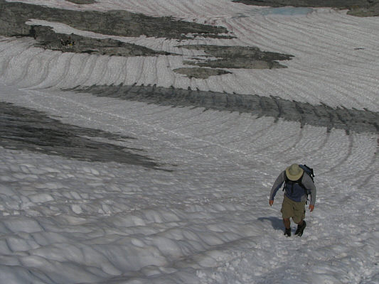
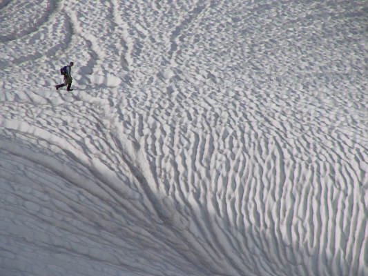
Near the top of the glacier is this interesting snow formation. |
|
|
Dave trudges up the final slope of Warrior Mountain. Mount Northover can be seen at far right. |
|
|
Dave stands beside the summit cairn of Warrior Mountain. |
|
|
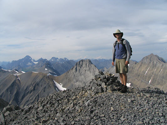
Sonny stands on the 2973-metre summit of Warrior Mountain. Behind him is Mount Joffre. |
|
|
This outlier to the west of Warrior Mountain is known as Waka Nambe. |
|
|
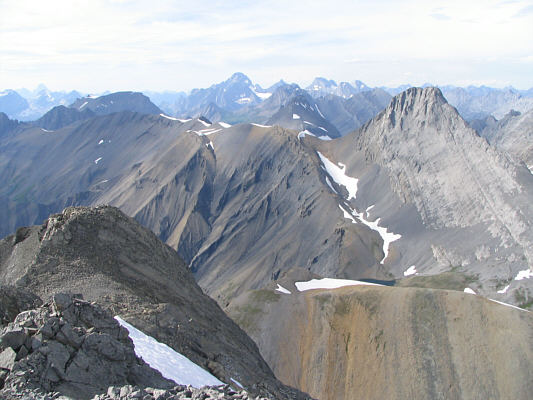
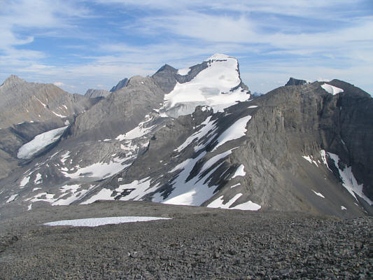
The view to the north includes Mount Northover (right), Mount Sir Douglas (distant middle) and Mount Assiniboine (very distant far left). |
|
|
To the east are Aster Lake and Mount Sarrail. |
|
|
Mount Joffre dominates the view to the south. At right is Mount Cordonnier. |
|
|
Here is another look at Mount Northover. |
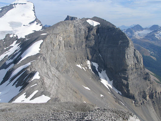 |
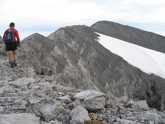
The connecting ridge to Mount Cordonnier is clear of snow on this day. |
 |
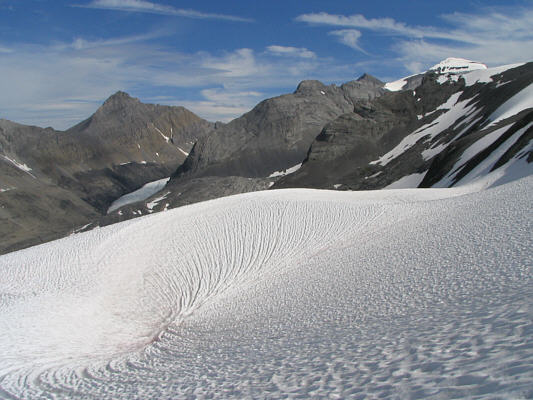
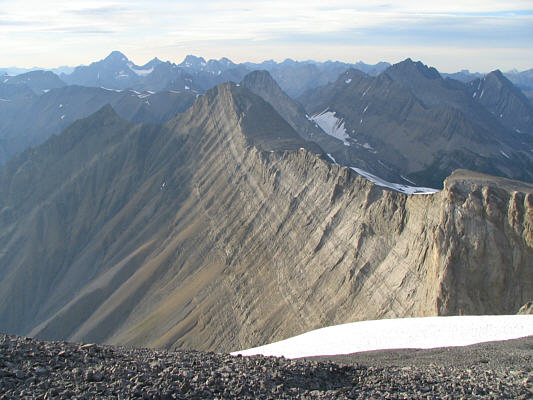
This is the view of the remnant glacier from along the connecting ridge between Warrior Mountain and Mount Cordonnier. |
 |
Here is a close-up of Dave crossing the glacier. |
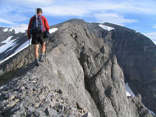 |
Parts of the connecting ridge are surprisingly narrow and exposed. |
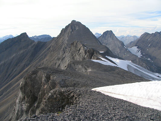 |
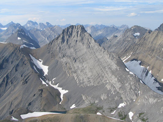
This is looking back at Warrior Mountain (centre) from further along the connecting ridge. |
 |
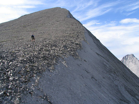
Sonny continues along the undulating ridge to the summit. |
 |
Sonny holds up the register canister on the 3021-metre summit of Mount Cordonnier. |
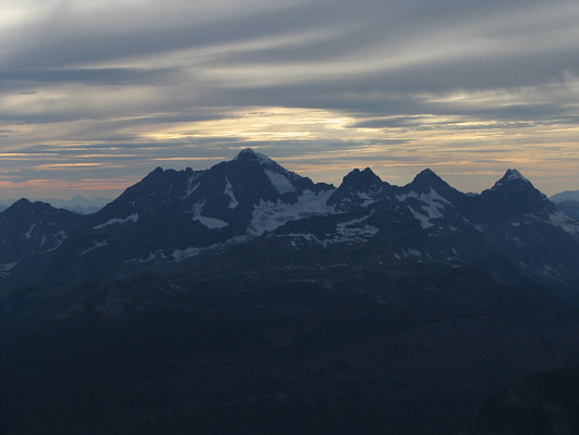 |
Mount King George and The Royal Group look rather ominous under the evening clouds. |
 |
This is the view north from Mount Cordonnier's summit. |
 |
Mount Joffre and Mount Mangin look great late in the day. |
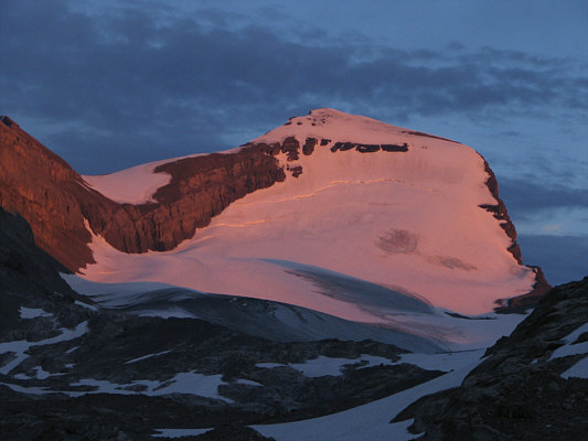 |
Alpenglow lights up Mount Joffre. |
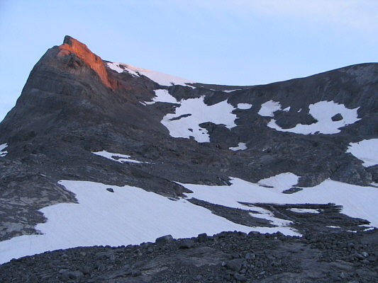 |
This is looking back up Kane's alternate descent route. |
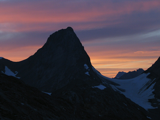 |
Mount Northover is silhouetted against a beautiful evening sky. |