


The next morning (1 July 2006), Kelly and I packed up our tent and drove to Jasper townsite for a quick breakfast before heading up the Jasper Tramway ($23.00 CAD per adult). From the upper tram terminal, it took Kelly (fighting a lingering bad cold) and me about 35 minutes to reach the top of The Whistlers. Leaving the crowds behind, we dropped down to the meadows to the west where we ran into a Francophone who was just returning from an aborted attempt on the summit of Indian Ridge. He claimed that the rocks just below the summit were "overhanging", and he felt that it was too dangerous to climb up. Unfazed, Kelly and I continued up the beaten trail until we reached a patch of snow just below the summit. Here, the trail peters out, and the terrain is looser and steeper. Although this was not a problem for me, Kelly had reached the limits of her comfort zone and elected to wait for me while I dashed up to tag the summit. Upon reaching the summit, I felt it would be a shame to pass up traversing the ridge on such a gorgeous day. I yelled down to Kelly that I was doing the traverse and would meet her back at the meadows we crossed earlier. It took me about 45 minutes to traverse to the high point at the northwest end of Indian Ridge. Beyond that high point, a few minor challenges only made the scrambling more enjoyable, and I had no serious difficulties descending the ridge and eventually rejoining Kelly. A final climb over The Whistlers had us back at the upper tram terminal after a very leisurely round-trip time of over 7 hours. Unfortunately, the upper tram terminal was a zoo as hordes of descending tourists crowded around a beleaguered ticket attendant. Kelly and I waited for almost an hour before we were able to get onto a car and descend to the lower tram terminal.
After enjoying a nice dinner in Jasper townsite, Kelly and I returned to Snaring River Overflow Campground where we found to our dismay that our "choice" site from the previous night was already taken. We pitched our tent in the middle of a big field with a single lowly bush and some wildflowers providing token privacy from all the big RV's parked around us. As I pulled out a lawn chair and Alan Kane's Scrambles In The Canadian Rockies and sat beside Kelly who was already reading some novel in front of the wildflowers, I thought to myself, "We should do this more often."
|
|
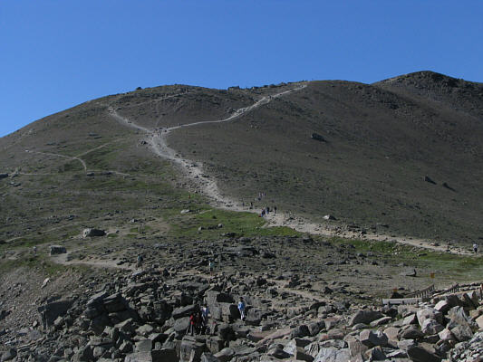
This is the easy trail leading to the top of The Whistlers. |
|
|
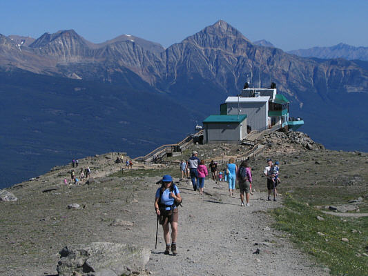
Kelly leaves the upper tram terminal. Pyramid Mountain is the eye-catching peak in the distance. |
|
|
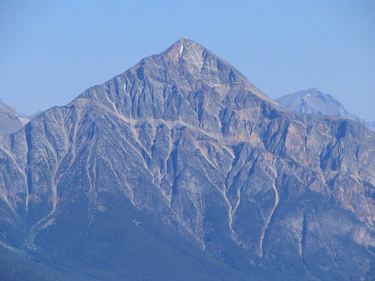
Here is a closer look at Pyramid Mountain. |
|
|
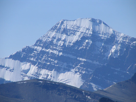
This is Mount Edith Cavell as seen from the trail to The Whistlers. |
|
|
Kelly approaches the top of The Whistlers. Behind and just to the right of her is Mount Tekarra. |
|
|
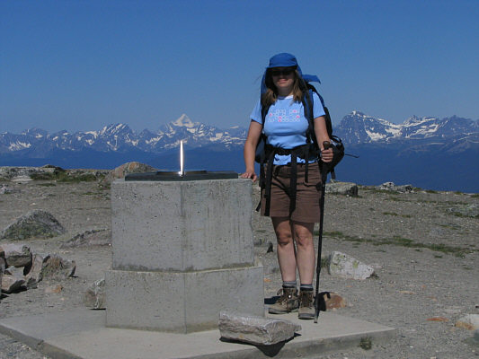
Kelly stands beside a movable pointer at the 2466-metre summit of The Whistlers. |
|
|
This is Indian Ridge as seen from The Whistlers. Barely visible to the left of Indian Ridge is Manx Peak. |
|
|
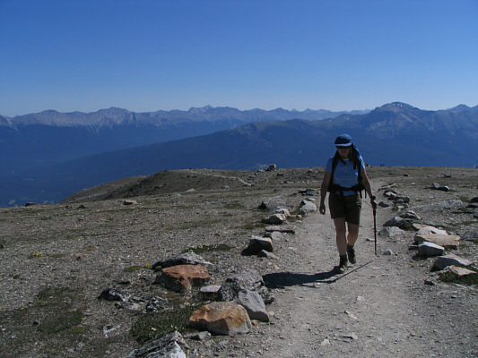
Kelly hikes up the beaten trail on the way up Indian Ridge. Behind her is The Whistlers. |
|
|
This small plateau is a good place for Kelly to catch her breath before resuming the climb. |
|
|
To the south is Marmot Mountain. Also visible in the distance at left is Mount Kerkeslin. |
|
|
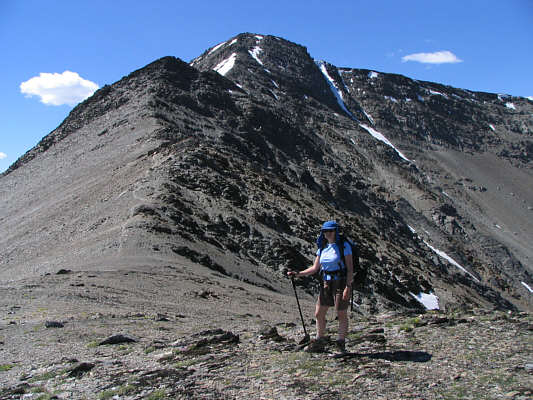
Kelly heads up increasingly broken and loose terrain. |
|
|
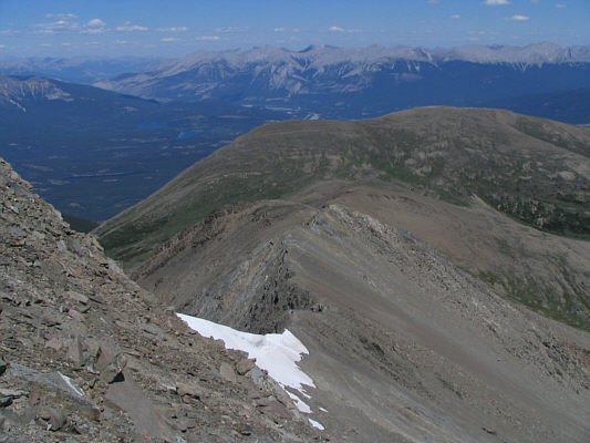
The trail peters out just before the big snow patch. Sonny would scramble up to the left of the snow patch. |
|
|
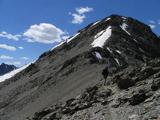
This is looking back down the ridge toward The Whistlers. |
|
|
Sonny takes the last few steps before the summit. The biggest peak on the horizon is Mount Edith Cavell. |
|
|
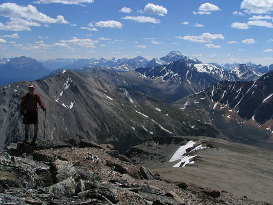
Sonny sits on the 2720-metre summit of Indian Ridge. |
|
|
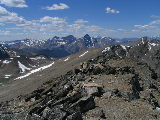
This is looking west from the summit of Indian Ridge. The pointy dark peak is Roche Noire. |
|
|
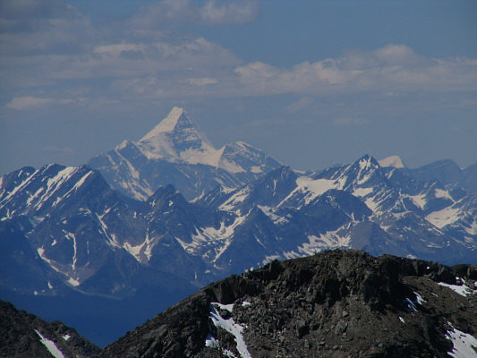
Mount Robson is hard to miss on a clear day like this. In the foreground is the high point at the northwest end of Indian Ridge. |
|
|
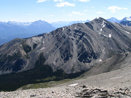
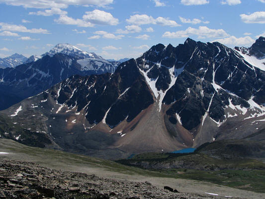
A small tarn at the foot of Terminal Mountain captures much attention in this view south from somewhere along Indian Ridge. |
|
|
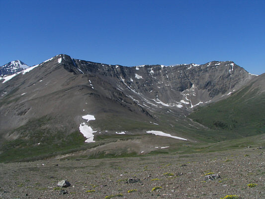
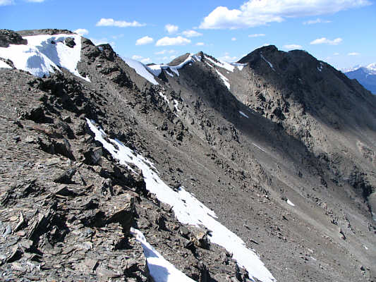
Clouds cast some shadows over the northwest end of Indian Ridge. |
|
|
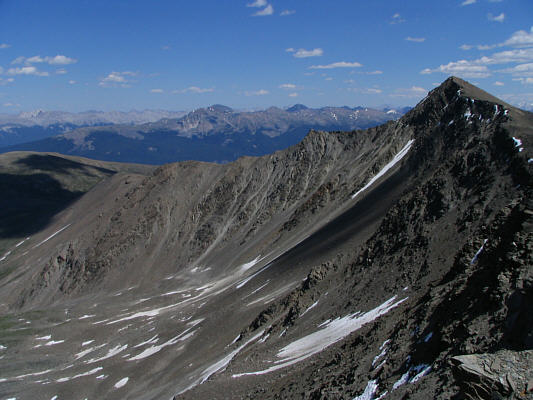
This is looking back at the summit of Indian Ridge (far right). |
|
|
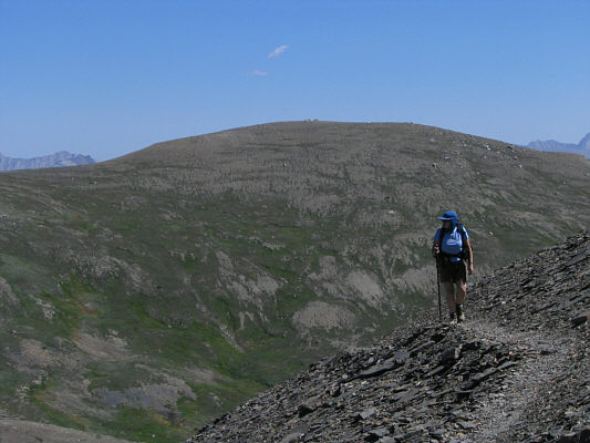
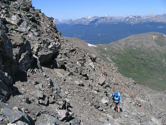
Sonny approaches the high point at the northwest end of Indian Ridge. |
|
|
Sonny continues past the high point. |
|
|
This is looking across a big notch in the ridge crest. |
|
|
After backtracking a bit and scrambling down some ledges, Sonny hikes along the west side of the ridge crest. |
|
|
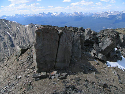
Some of the rocks near the notch resemble pieces of wood. |
|
|
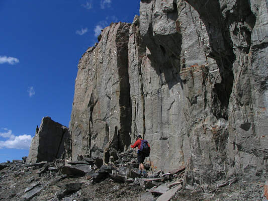
The northwest end of Indian Ridge looks a bit challenging. |
|
|
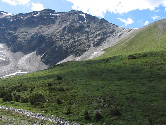
This is looking back up at the northwest end of Indian Ridge from the meadows below. |
|
|
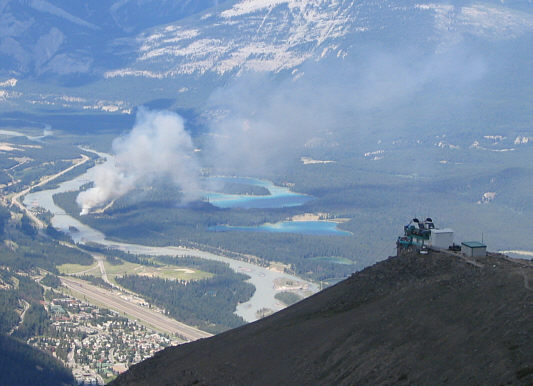
A fire breaks out not far from Jasper townsite. It would eventually be contained. |
|
|
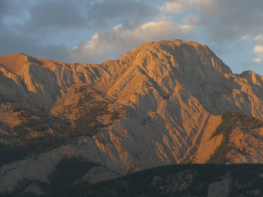
In this view from the overflow campground, the setting sun lights up Hawk Mountain. |