


That opportunity came on 14 October 2007. I drove out to Cranbrook the day before to stay with my wife and her friend at Elizabeth Lake Lodge (both of them were performing with the Symphony of the Kootenays that weekend). In the morning, I ate a quick breakfast, scraped frost off my car, and parted ways with my wife and her friend. After an uneventful drive along Mause Creek Road, which was better than average as far as back roads go, I quickly geared up at the signed trail head and began ascending through the forest. The Mount Fisher Trail basically follows the drainage emanating from the cirque on the south side of the mountain. The trail disappears in a few places where it crosses some talus slopes, but there are abundant cairns and flagging to mark the way. As I progressed further into the cirque, I began encountering more snow, but this snow was ideal for step-kicking and actually made travel easier especially when I began slogging up the steep gully leading to the south col. From the south col, it is still another 300 vertical metres to the summit, but the hardest part about this section for me was trying to keep my focus on the scrambling instead of ogling the spectacular views surrounding me. Nevertheless, I found the scrambling on the south ridge to be excellent with fairly decent rock and just enough challenges and exposure to keep things interesting. I could not have picked a better day to be on the summit of Mount Fisher--clear skies, hardly a breath of wind, and somewhat surprisingly, not another soul. After spending a glorious 35 minutes at the summit, I carefully retraced my steps back down to the south col where I took another break to soak in the views before continuing my descent. I made it back to my car after a round-trip time of less than 7.5 hours.
Although the scramble went without a hitch, I blew a tire on my car as
I was turning from Mause Creek Road onto the paved Wardner-Fort Steele
Road. I was forced to make a sharp turn across a Texas Gate because
another car was coming across at the same time. Something punctured
my rear passenger side tire, but by the time I realized it was flat, I
had already driven several hundred metres and effectively destroyed it.
After changing tires, I drove home without further incident.
Replacing the destroyed tire cost me $82 (after warranty), but after the
amazing day I had on Mount Fisher, it was worth every penny.
|
|
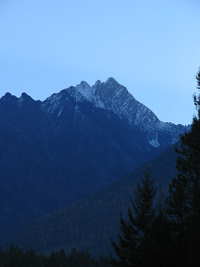
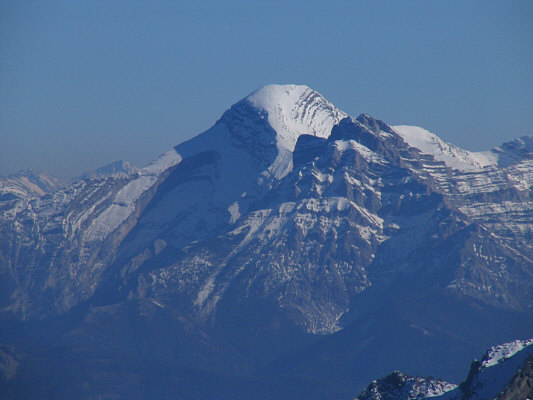
This is Mount Fisher as seen from Mause Creek Road early in the morning. |
|
|
Sonny scrambles through a boulder field to get into the cirque south of Mount Fisher. |
|
|
This is the first glimpse of Mount Fisher from the trail. |
|
|
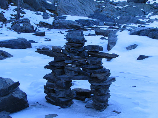
An inukshuk marks a bivouac site near the upper part of the cirque. |
|
|
This is the southwest face of Mount Fisher as seen from the upper part of the cirque. |
|
|
Sonny heads to the back of the cirque. The route goes up the slope ahead and to the left. |
|
|
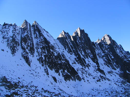
These unnamed pinnacles guard the south side of the cirque. |
|
|
One of the pinnacles is remarkably striking. |
|
|
This is looking up the gully leading to the south col. |
|
|
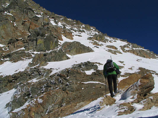
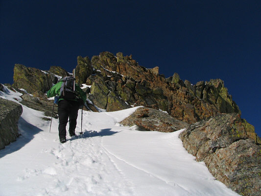
Sonny reaches the south col and begins ascending the south ridge. |
|
|
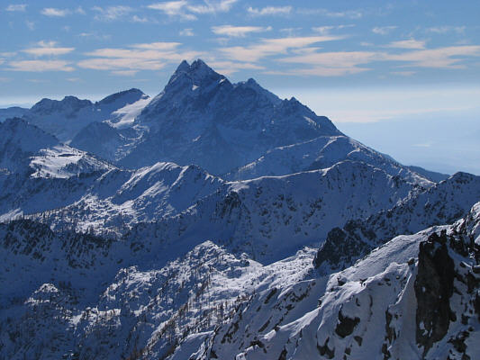
As seen from partway up the south ridge of Mount Fisher, the north end of The Steeples dominates the view to the south. |
|
|
Another "scrambler" literally inches up the snow slope (click on the photo for a close-up). |
|
|
Sonny climbs past some lichen-covered rocks. |
|
|
Sonny continues up the narrowing ridge. |
|
|
The last section before the summit is challenging especially with snowy conditions. |
|
|
Sonny stands on the 2843-metre summit of Mount Fisher. There is a unique sign and register box there. |
|
|
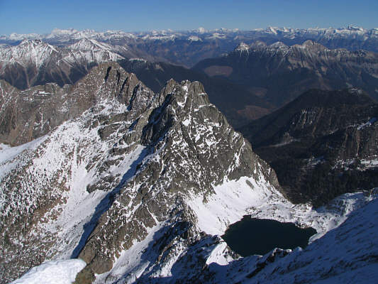
A surprisingly big tarn lies just northeast of Mount Fisher. |
|
|
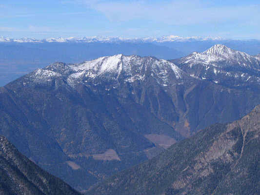
To the north are Lakit Mountain (2530 metres) at centre and Mount Bill Nye (2648 metres) at far right. |
|
|
Crowsnest Mountain (2785 metres) is visible about 75 kilometres to the east. |
|
|
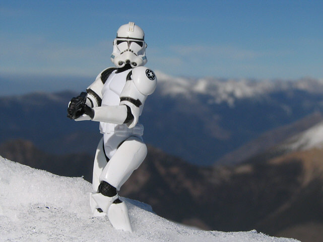
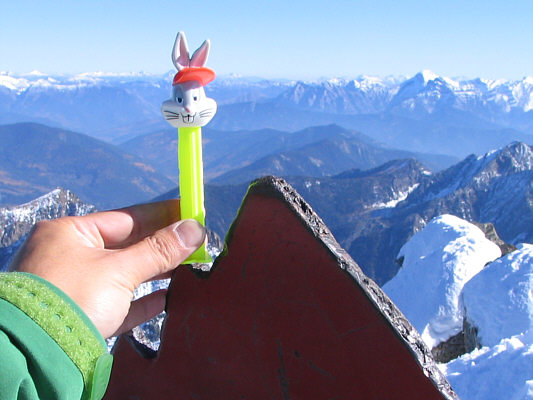
Even Bugs Bunny has climbed Mount Fisher! |
|
|
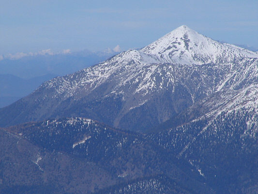
Further north is shapely Teepee Mountain (2797 metres). |
|
|
Sonny carefully descends the south ridge of Mount Fisher. |
|
|
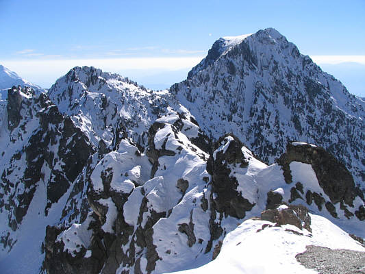
This is looking past the south col at an unnamed peak. |
|
|
Southeast of the col is Mount Patmore (2637 metres). |
|
|
Further southeast is Mount Bisaro (2841 metres). |
|
|
Sonny heads home. |
|
|
The sun passes behind the striking pinnacle seen earlier. |
|
|
Here are The Steeples in their full glory as seen from Mause Creek Road. |
|
|
This is Mount Fisher as seen from Mause Creek Road late in the afternoon. |