BOU AVENUE
Twin Peaks
On 3 November 2007, I joined Dinah Kruze and Bob Spirko for their second trip up Cabin Ridge near the headwaters of the Oldman River in southwest Alberta.  The north end of Cabin Ridge sports two distinct summits known collectively as Twin Peaks.  The previous week, Dinah and Bob had reached the south summit, but because they had some trouble navigating through the labyrinth of logging roads in the area, they did not have enough time to traverse to the slightly higher north summit.  This time, armed with better knowledge of the approach, they guided me efficiently up a logging road to the base of the south summit.  While I made a quick dash up to the south summit, Dinah and Bob made a beeline for the north summit.  I traversed the connecting ridge between the two summits and eventually caught up to Dinah and Bob near the north summit.  The cool wind limited our stay at the top, and we were soon on our way back to the base of the south summit.  For some variety, we hiked over a couple of scenic bumps before regaining the logging road and returning uneventfully to the trail head.  Our round-trip time was less than 7 hours.

Be sure to check out Bob's trip report here.
It's a chilly start to the day! 
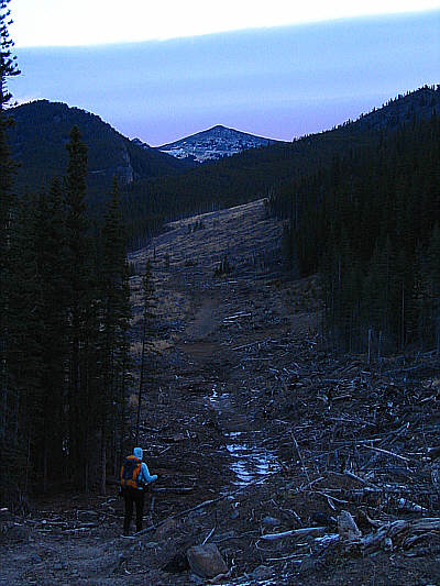
Dinah and Bob stretch their legs out before starting the trip.
Those clouds are moving pretty darn quick! Bob turns around to admire the colourful morning clouds.
The south summit is farther away than it looks. Dinah follows a logging road.  The south summit of Twin Peaks is visible in the distance.
This logging road seemingly never ends! Dinah and Bob continue to follow the logging road.
Nice to finally clear the trees! 
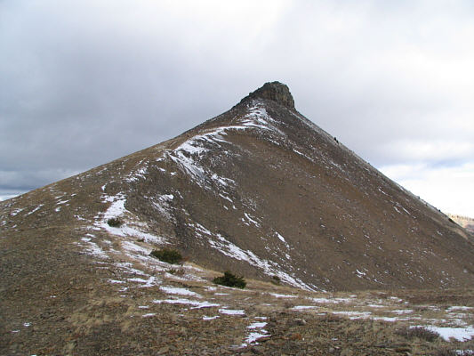
Dinah hikes toward the south summit of Twin Peaks.
Bob's GPS gives this summit an elevation of 2492 metres. 
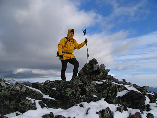
Sonny reaches the south summit of Twin Peaks.
Note the big flake on the left side of the summit block. 
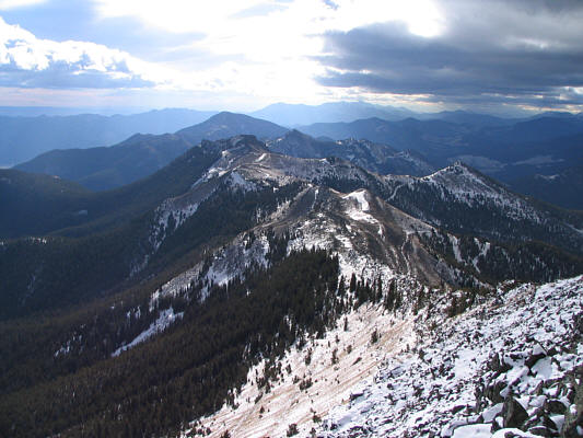
This is the north summit of Twin Peaks as seen from the south summit.
Looks like a fun ridge walk. 
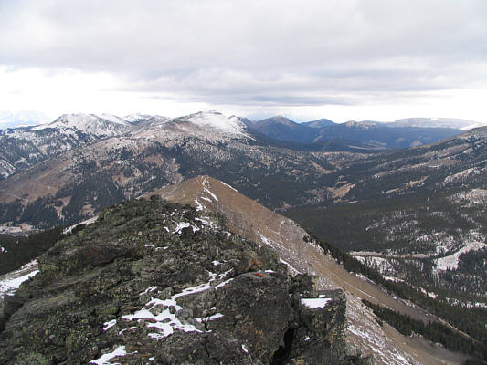
Cabin Ridge stretches into the distance to the south.
It's the highest active lookout in Canada! Sugarloaf Lookout is situated atop this ridge to the southwest.
It takes about 45 minutes to traverse between the two summits. Sonny begins dropping down the ridge as he heads for the north summit.
Can you spot Bob and Dinah? 
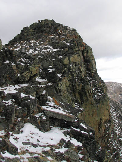
This is the north summit as seen from the low point on the connecting ridge.
The scrambling on the summit block is the highlight of the trip. 
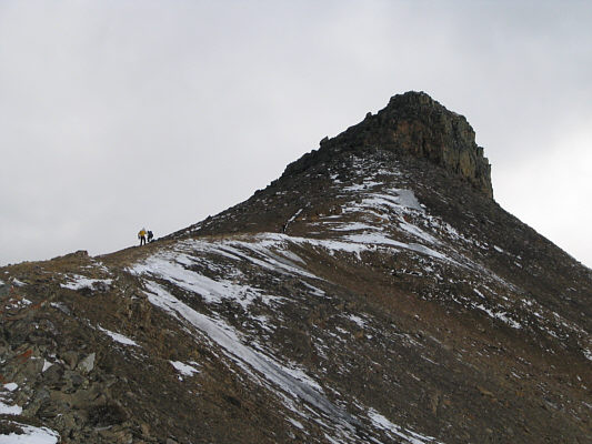
Bob and Dinah approach the summit block.
A most impressive east face. Dinah and Bob are very close to the summit.
This is also the highest point of Cabin Ridge. Sonny, Dinah and Bob gather on the 2513-metre north summit of Twin Peaks.
Lots of great ridge walking opportunities in this area. This is looking north from the north summit.  Plateau Mountain is visible at far right on the horizon.
Definitely worth exploring in the future. The twin peaks of Mount Gass are shrouded by clouds to the northwest.
That was an enjoyable outing. 
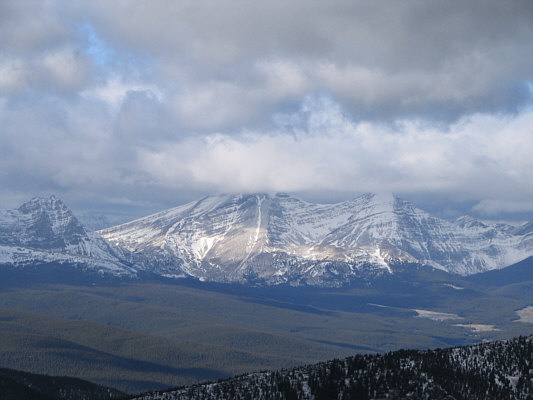
Mount Livingstone is visible to the northeast.
I'm glad I tagged the south summit first! 
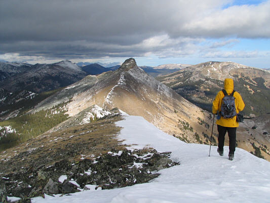
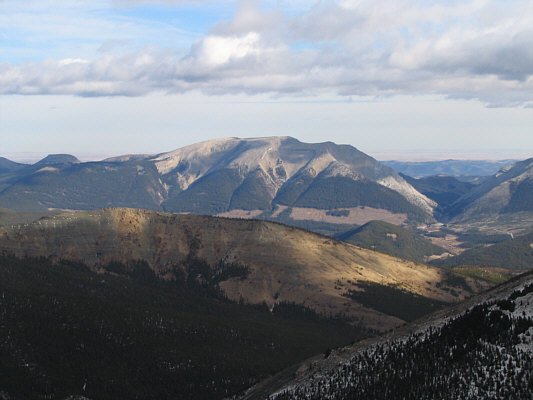
Bob descends the ridge.  The south summit of Twin Peaks dominates the view.
A highly recommended route! Bob and Dinah consider hiking over the two bumps in the near distance.
A good bouldering problem! Sonny climbs up some artificially stacked boulders near the trail head.
Photo Courtesy of Bob Spirko
Not a bad "onsight" if I may say so myself! As the wind blows against Sonny, he can feel the top boulders teetering.
Photo Courtesy of Bob Spirko