BOU AVENUE
Sofa Mountain
My plan on 3 October 2008 was to get up early and drive to Waterton National Park to scramble up Anderson Peak, Lost Mountain and Mount Bauerman.  When I arrived at the Red Rock Canyon parking lot, the weather did not look promising, and most of the surrounding mountain tops were obscured by clouds.  After some procrastinating, I finally hit the trail and proceeded up Blakiston Creek.  Andrew Nugara forwarded me an addendum to the route description in his More Scrambles in the Canadian Rockies, but when I reached his recommended access gully, I was startled to see a grizzly bear foraging right on the route!  I could have continued further up the trail and taken Nugara's original ascent route, but because I did not want to risk running into the same bear later on my hike out, I decided to retreat.  I was not overly enthusiastic about continuing anyway given the overcast weather.  Back at my car, I consulted Nugara's guidebook to find an alternate destination.  Mounts Glendowan and Dungarvan were both socked in, and I definitely wanted to save those peaks for better weather.  Bellevue Hill was feasible but a little too short.  I finally settled on Sofa Mountain at the east end of the park.  This turned out to be a good choice as the weather was markedly better over there.  Following Nugara's route description to the letter, I had a very enjoyable and trouble-free outing on Sofa Mountain (round-trip time of 7 hours 10 minutes).  I even made it back to my car before sunset for a change!
With the overcast weather, I was just looking for an excuse to bail... This is looking up Nugara's recommended access gully for Anderson Peak.  His route goes up the dirt slope on the right.
The bear knew I was there but appeared to be indifferent about my presence.  Sigh. 
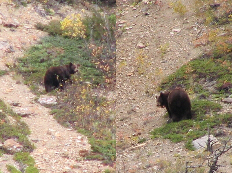
Here are a couple of zoomed-in shots of the grizzly bear foraging on Nugara's route.
Kinda reminds me of a steak! 
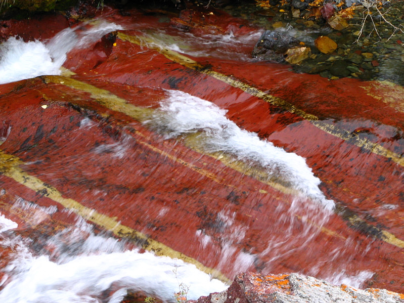
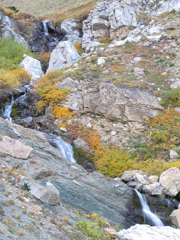
Blakiston Creek has some amazing colours in it.
You could spend all day photographing the creek! Here is another part of Blakiston Creek.
I definitely want to come back to this beautiful place. 
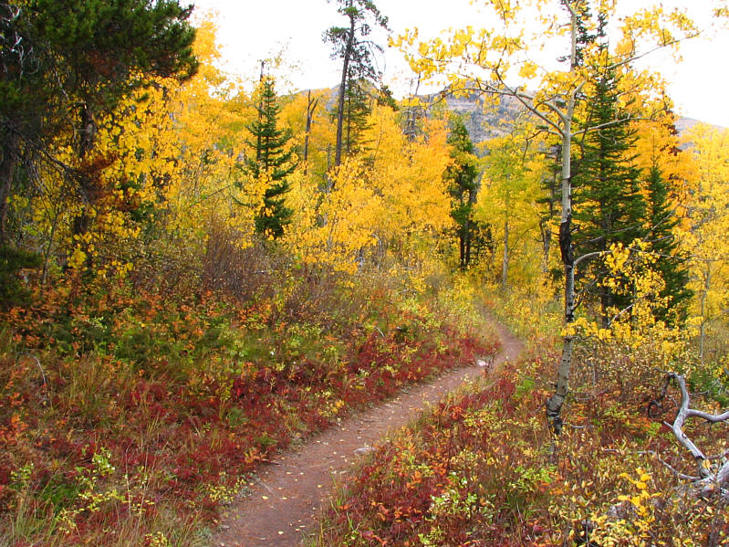
The Fall colours along the Blakiston Creek Trail also look amazing.
The rock band near the top looks impossible from this distance! This is the access ridge for Sofa Mountain.  The summit is not visible here.
One of the more striking peaks in Waterton. 
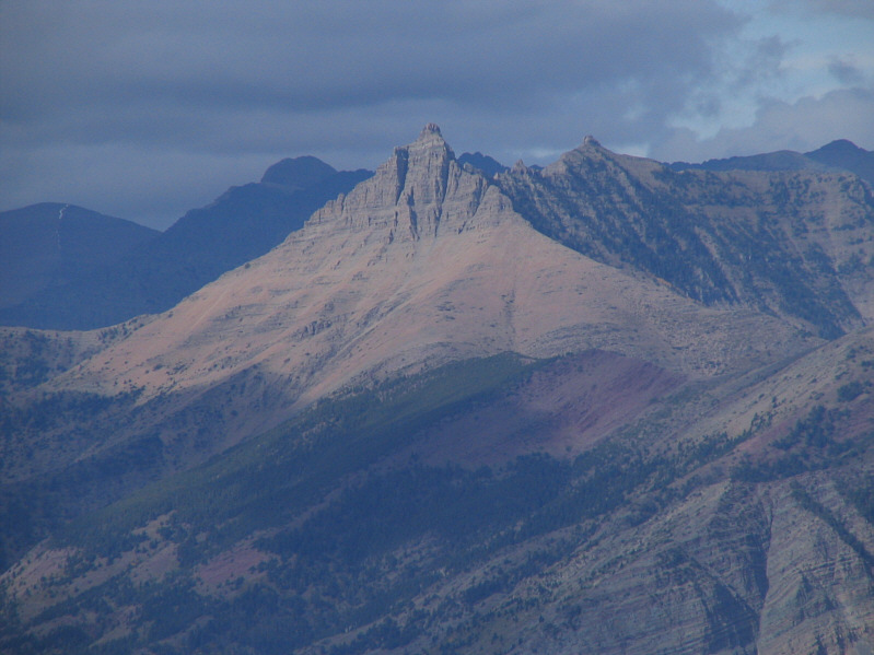
This is Mount Galwey as seen from the lower slopes of Sofa Mountain.
Just goes to show that not all the best views are from the summit. 
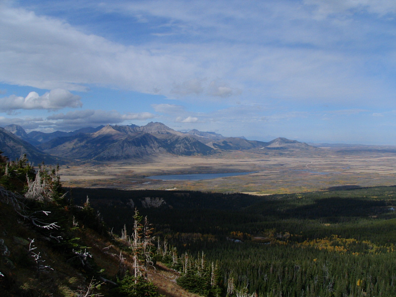
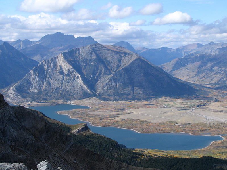
This is looking northwest toward Lower Waterton Lake.  The prominent peak just left of centre is Mount Dungarvan.
Doesn't look any easier! Here is a closer look at the start of the scrambling section on Sofa Mountain.
This is where the real fun begins! 
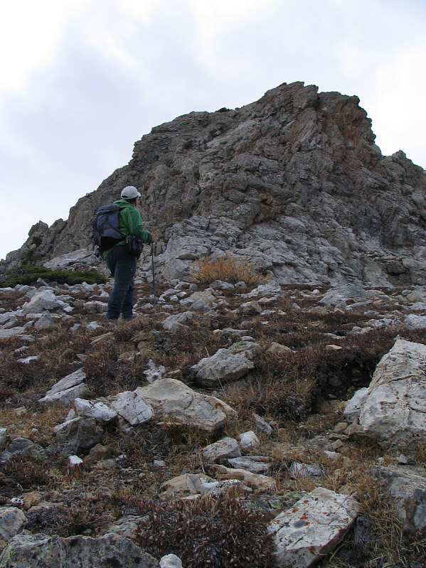
Sonny sizes up the first rock band before ascending it.
Some of the scrambling is perhaps on the high side of moderate in my opinion, but the rock is generally solid. This is looking up one of the many rock bands along the route.
Piece of cake! Sonny climbs up yet another rock band.
And towering behind Mount Crandell is Mount Blakiston. Mount Crandell and Middle Waterton Lake are visible to the west.
The summit is still about 2 km away. This is looking toward the summit from the high point of Sofa Mountain's northwest ridge.
The elevation of the northwest ridge's high point is about 2320 metres. 
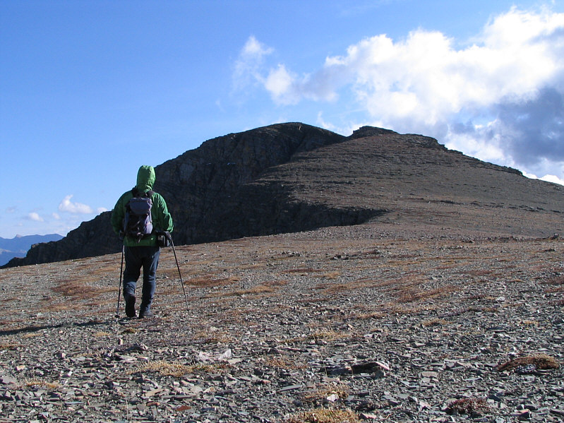
Sonny hikes along the easy northwest ridge.  Behind him is the high point of the ridge.
And the connecting bump on the left is even higher and overlooks Crypt Lake. A series of unnamed ridges stretch out to the west.  The bump that is just poking up behind the one in the foreground at right is the high point described by Nugara as an extension to Vimy Ridge.
The summit is about 15 minutes away from here. 
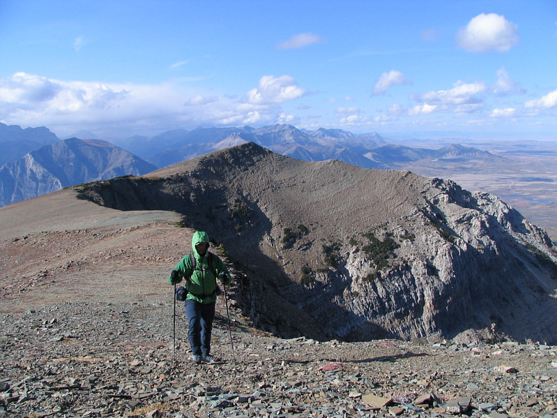
Sonny approaches the summit of Sofa Mountain.
4 hours 9 minutes from the car. Sonny plants his foot on the cairn at the 2522-metre summit of Sofa Mountain.
A must-do mountain for any peak bagger! 
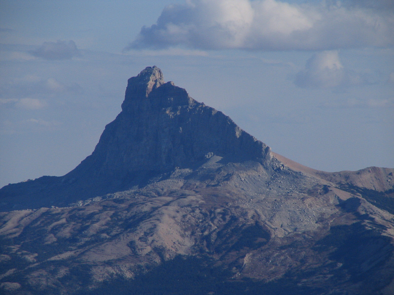
The best view from the summit on this day is of Chief Mountain to the southeast.
The last entry was recorded on 12 May 2007. The summit register is completely soaked.  Also in the canister are two pencils, a corroded pencil sharpener, and a spent rifle shell.
It started raining at the summit! 
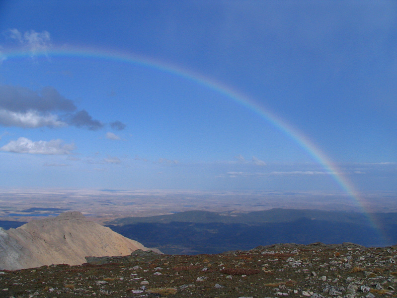
A rainbow develops in the sky to the east.
Now you know where the pot of gold is! Here is the other end of the rainbow.
It's fairly easy if you're good at route-finding. 
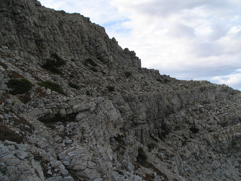
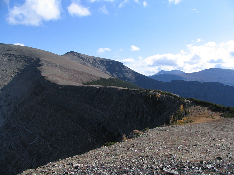
This is typical of the terrain on the access ridge that must be down-climbed.
A nice way to end the trip. A series of cascades are visible from the access trail.
Thank you Andrew Nugara for the great route description! This is Sofa Mountain as seen from the trail head.