BOU AVENUE
GR232803
On 18 July 2009, I made an ambitious attempt to scramble up Mount Hunter on the western boundary of British Columbia's Yoho National Park.  My plan was to utilize the good trail leading to the two lookout sites near the terminus of Mount Hunter's 11-kilometre long southeast ridge and then continue along the ridge toward the summit.  On paper at least, this seemed like a reasonably easy route, and as I started up the trail to the lookout sites, I had the utmost confidence in reaching the summit of Mount Hunter.  Two hours later, I arrived at the upper lookout site and was already feeling weary because of the soaring temperatures.  I took a lengthy break before bushwhacking up behind the lookout site and eventually breaking out of the trees onto the open ridge.  From the lookout site, it took me another 1.5 hours to reach the first true high point along the ridge.  My progress was frustratingly slow up to this point, and as I surveyed the rest of the undulating ridge, I was beginning to doubt my chances of reaching Mount Hunter's summit.  The next high point, GR232803, looked quite impregnable, but I felt it was worth a closer look before I gave up altogether.  Losing about 100 metres of elevation, I passed a park boundary marker before climbing up to the base of GR232803's summit block.  A direct assault without a rope was definitely out of the question, but I noticed a beaten path heading to climber's left and bypassing GR232803's summit block.  I followed the beaten path across several scree basins, any of which are feasible to scramble up to regain the ridge crest and the summit of GR232803.  When I eventually gained the northwest end of GR232803's summit ridge, I had my first clear view of Mount Hunter's summit block which was still about 3 kilometres away.  I had run out of time, but more depressingly, the remainder of the connecting ridge appeared to be increasingly complicated with numerous obstacles and alarming drop-offs.  Any thoughts of returning to complete the ascent via this route were quickly quashed.  Dejected, I scrambled back along the ridge to tag the summit of GR232803 before dropping down one of the aforementioned basins to regain the beaten path.  The long hike back to the trail head (over 10 hours round-trip) gave me plenty of time to mull over my unsuccessful attempt on Mount Hunter, and an early evening thunderstorm seemed to underscore my failure.
Hopefully, you won't have to jump a train here! The start of the trail to the two lookout sites is fraught with danger--crossing the very busy Trans Canada Highway and crossing the railroad tracks shown here.
I didn't bother visiting the lower lookout site. 
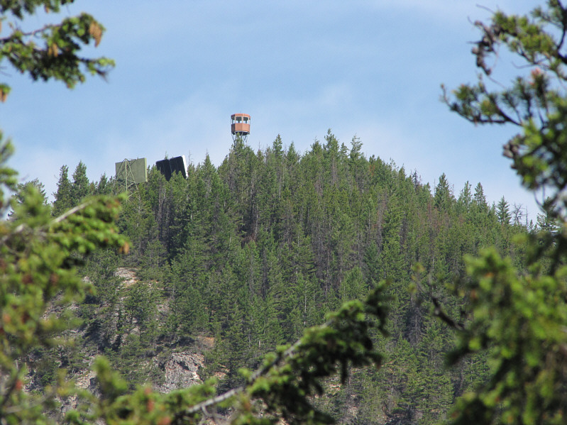
The cupola of the lower lookout site is visible through the trees.
The nearby biffy, however, is in pretty sad shape. 
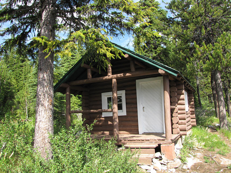
Near the upper lookout site is a surprisingly well-maintained cabin.
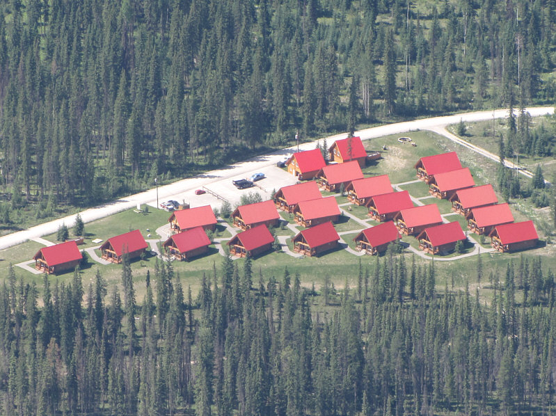
Mucho expensive! These are the Chancellor Peak Chalets as seen from the upper lookout site.
It was so warm that I stripped naked here to dry out my sweat-soaked clothes! 
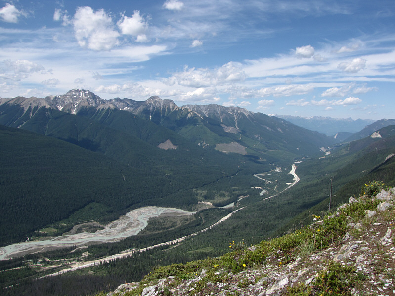
This is looking west from the upper lookout site.  The Kicking Horse River and Trans Canada Highway are visible in the valley while Kapristo Mountain is the prominent peak at left.
Its elevation is listed as 2722 metres on Peakfinder.com. 
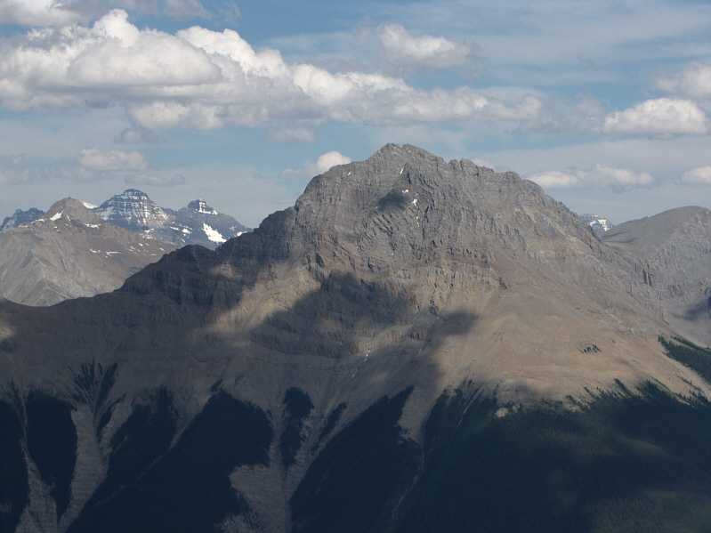
Here is a closer look at Kapristo Mountain.
Even getting to the first true high point is a bit complicated. 
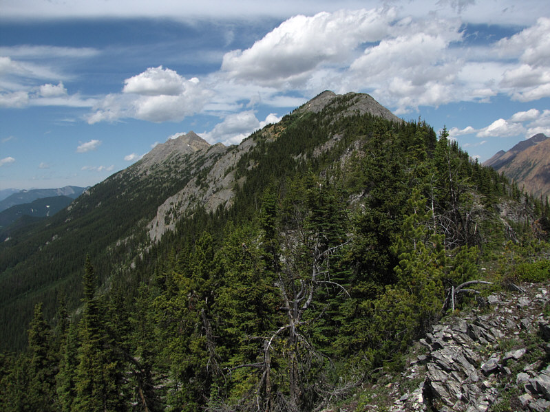
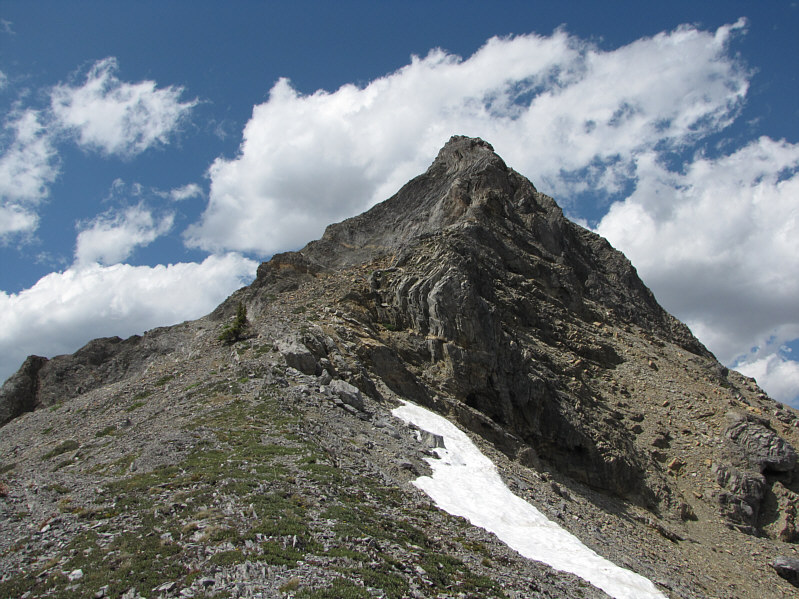
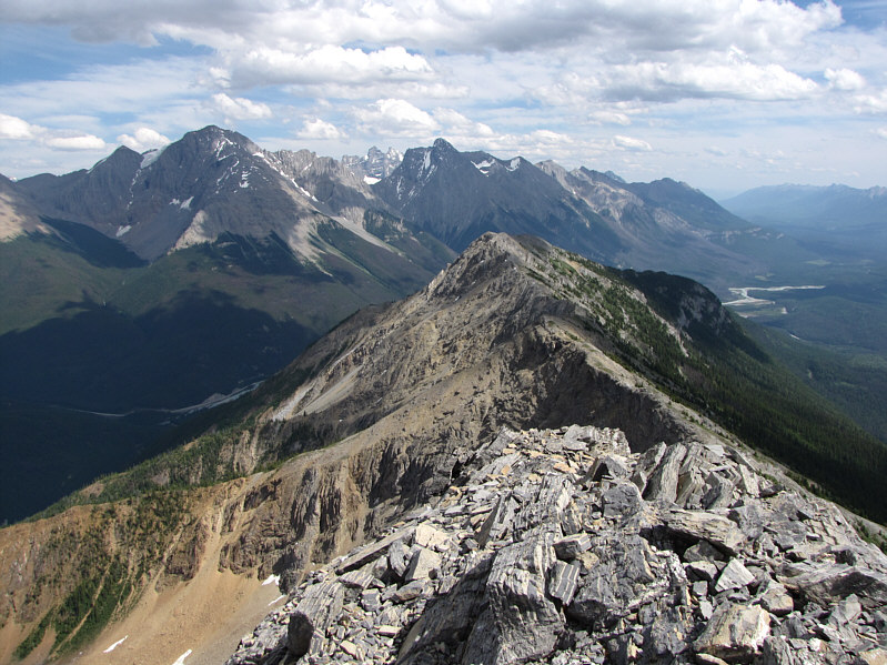
This is a section of Mount Hunter's southeast ridge.  Right of centre is the first true high point while GR232803 is visible in the distance at left.
Mount Hunter's summit is also visible here although I didn't realize it at the time. This is approaching the first true high point (cairn) with GR232803 visible further along the ridge.
No problems here; just a lot of annoying ups and downs. 
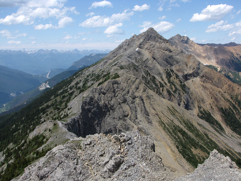
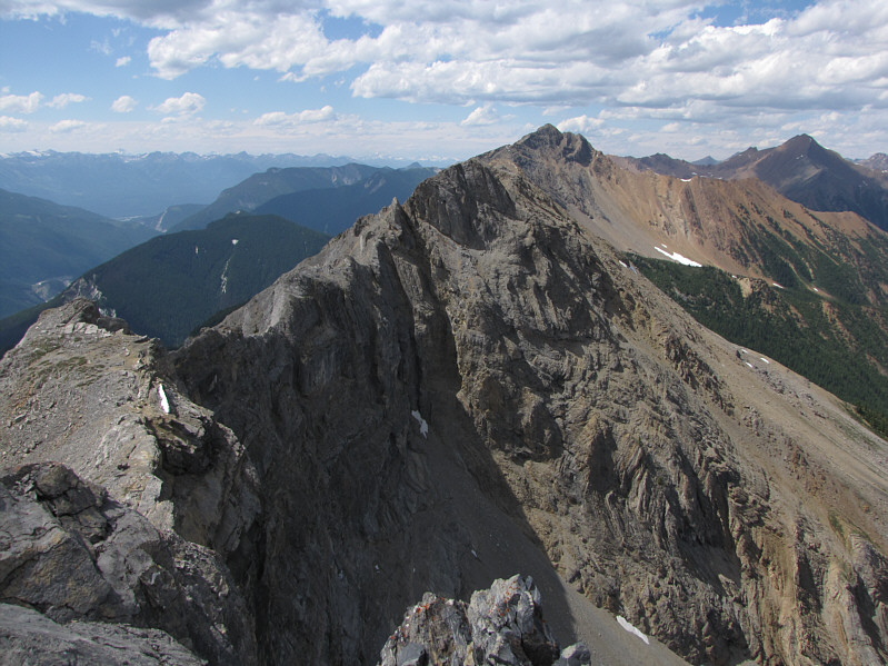
Here is a more comprehensive view of the connecting ridge to GR232303 from the first true high point.  The true summit of Mount Hunter is also visible to the right of GR232303.
One of the most beautiful peaks in the area. 
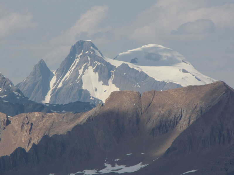
Mount Sir Donald is visible over 50 kilometres away to the west.
The bypass trail goes to the left. This is looking up at GR232803 from near the base of its summit block.
Yikes!  Just getting to the next high point looks tricky enough. 
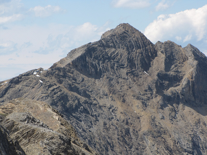
At the end of GR232803's summit ridge is this view of the remainder of the route to Mount Hunter.
Very interesting syncline and anticline formations. Here is a zoomed in view of Mount Hunter's summit block.
It's a bloody long way back to the trail head from here... 
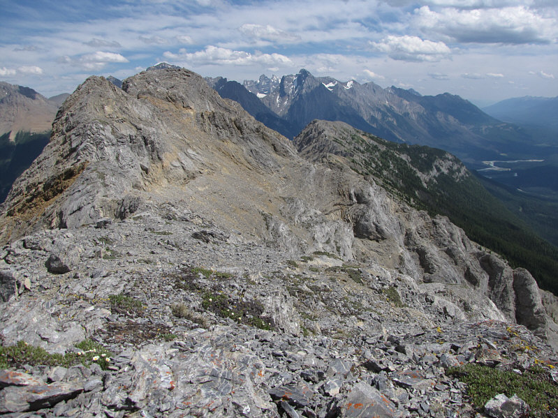
This is looking back southeast along the ridge.  The summit of GR232803 is on the left.
Sigh.  Back to the drawing board... Sonny turns his back on Mount Hunter and climbs up the summit ridge of GR232803.
Not a bad consolation prize, I suppose. The summit of GR232803 has an elevation of about 2528 metres.
I think the snow-clad mountain is known unofficially as Jones Peak. Mount Mummery (left of centre) is visible to the far north.
Still pretty nice views for a GR! 
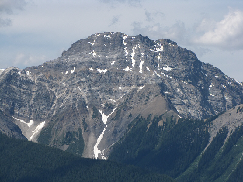
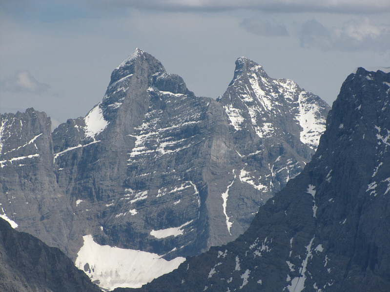
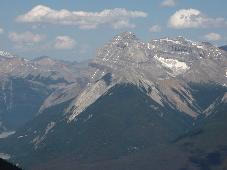
The view to the southeast includes Mount Vaux (left) and Chancellor Peak (centre).
A couple of peaks that I will probably never climb. Also visible to the southeast are the Goodsir Towers.
I'm still not sure where Alan Kane's scramble route tops out... 
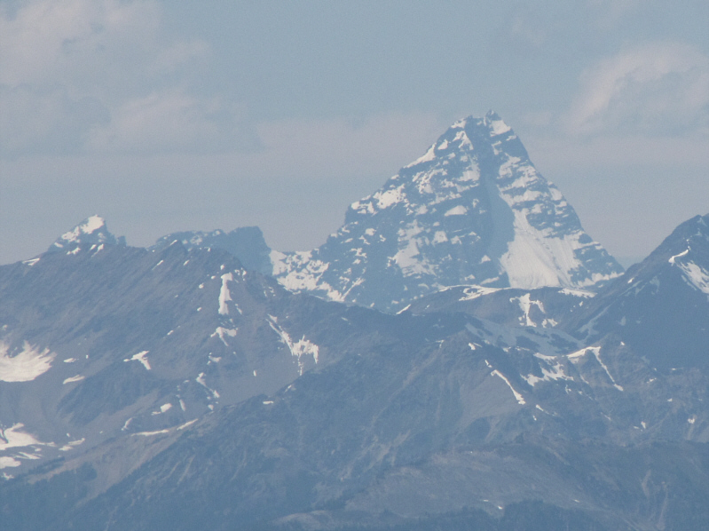
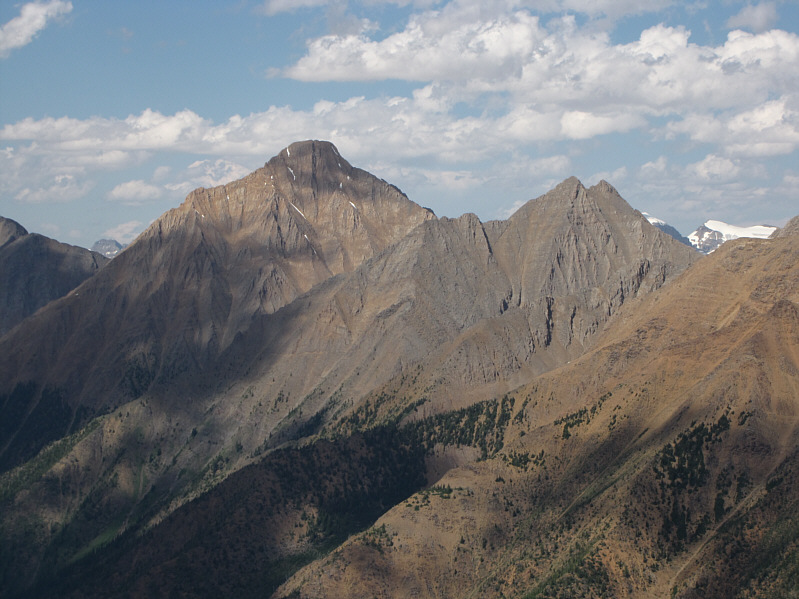
Here is a closer look at Mount Vaux.
Sorta the ugly sister of Mount Vaux! Just north of Mount Vaux is Mount Hurd.
Might be worth exploring someday... 
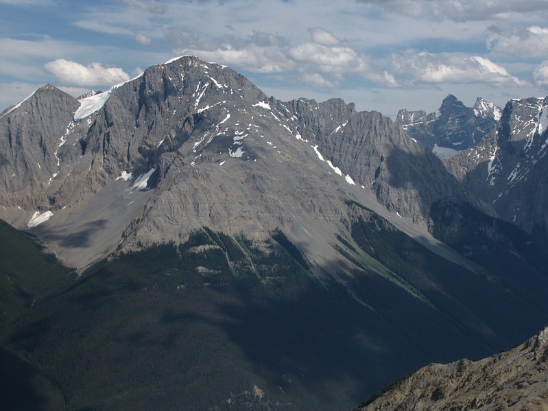
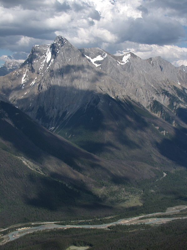
Mount King (left) dominates the view to the northeast.
One of the best Kane scrambles! To the east is Mount Stephen.
Pretty much sums up my mood at this point! Storm clouds begin to gather over Chancellor Peak in this view from near tree line along Mount Hunter's southeast ridge.