


Just below the col separating the west summit from the main summit of Devils Head, we turned eastward and followed some cairns and a beaten path to the crux--a three- or four-metre climb up an overhanging chockstone. We actually ascended a little to climber's left of the chockstone, and although some of the holds were small or awkward, the rock was solid and reliable. Keith had brought along a rope and harness and had also lent me an extra harness in case we had to rappel the crux on descent (there is a belay station just above the chockstone). As we cleared the crux, Keith remarked that he would undoubtedly rappel it on the way down, but I was still undecided. Further up, we enjoyed some more difficult and exposed scrambling before topping out on the broad summit plateau. Keith and I relaxed for an hour at the summit before retracing our steps. Just above the crux, Keith took out his rope, and we both donned our harnesses. Though I still wanted to down-climb the crux, Keith convinced me to do so with a fireman's belay, and he also gave me a quick lesson on rappelling. When we were both ready, Keith ran his rope through the belay station and rappelled the crux, and I followed by down-climbing the same spot while he belayed me from below. In retrospect, I found the down-climb to be easier than expected, and even though I felt the belay to be unnecessary, I appreciated both the added security and the opportunity to learn a new mountaineering skill.
We carefully descended the access gully without incident, but just when I thought the rest of the trip was going to be smooth sailing as we worked our way back across the scree below the immense south face, I triggered a small landslide that was reminiscent of my out-of-control spill on Mount Chephren years ago. The irony of getting road rash on one of the "easier" parts of the mountain was not lost on me as I treaded more cautiously down the remainder of the ridge. The hike out was wearisome, and it did not help that the hot sun was blazing down on our backs for much of the way or that we inadvertently climbed up one of the last obstacles on the ridge by mistake. My GPS came in handy when we were trying to find our way back to the base of the cliffs above the drainage. The descent down the steep slope above the waterfall was probably the worst part of the whole trip, and we were quite happy to be walking horizontally again at the bottom. We eventually forded the Ghost River and retrieved our bicycles for the easy ride back to my car (round-trip time of 11.5 hours). In his trip report, Nugara ranked Devils Head as one of his "favourite scrambles of all time", and now I understand why.
|
|
Keith tries to keep his feet dry while crossing Ghost River. |
|
|
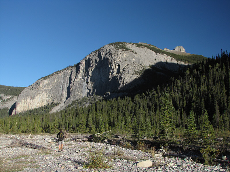
The ridges of the Ghost River Wilderness Area are typically protected by huge cliffs like these. The access drainage is behind the trees at right. The top of Devils Head is also visible above the ridge. |
|
|
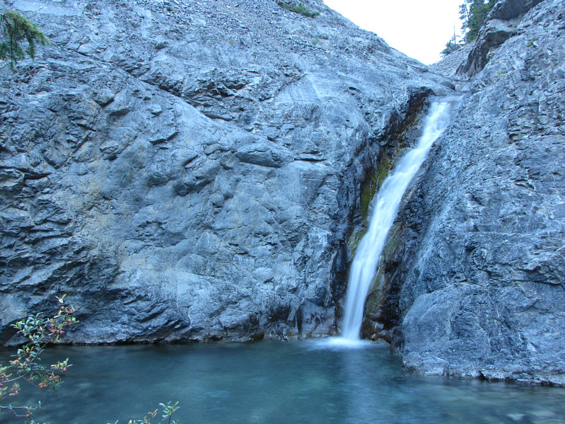
The route to Devils Head leaves the drainage at this waterfall. |
|
|
Keith traverses below the cliffs guarding the upper ridge. |
|
|
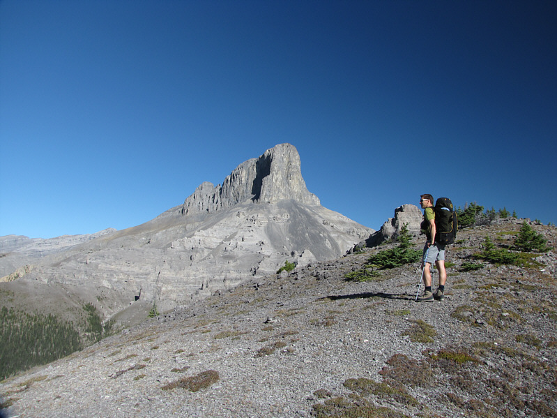
Keith gets his first clear view of Devils Head from the ridge. |
|
|
The obstacle at right is easily bypassed on the left. |
|
|
Keith continues hiking toward Devils Head. |
|
|
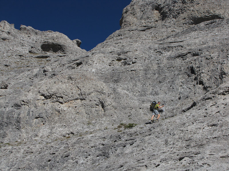
Keith works his way up some interesting rock. |
|
|
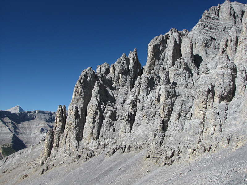
There are some interesting rock formations among the hoodoos. |
|
|
Keith stands beside a giant knob. |
|
|
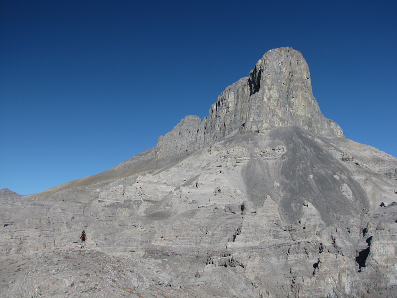
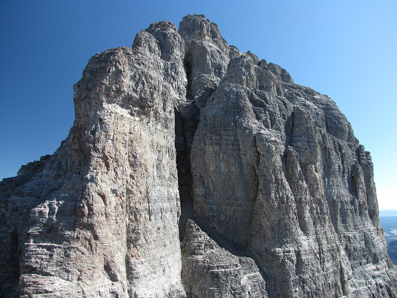
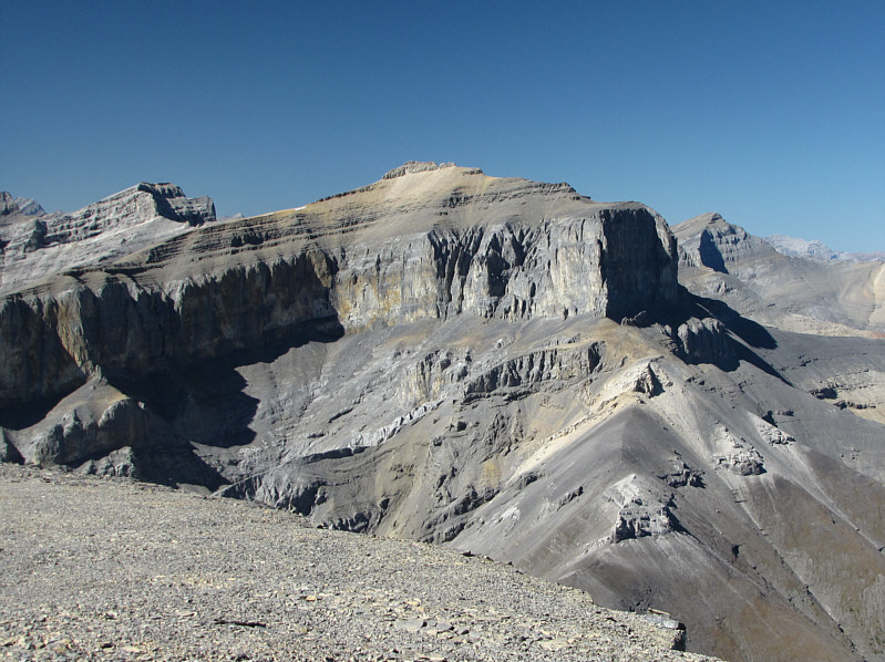
Here is a view of the spectacular east face of Devils Head. |
|
|
Pinnacles guard the entrance to the access gully which is just right of center at the bottom of the photo. On the horizon at far left is Mount Aylmer. |
|
|
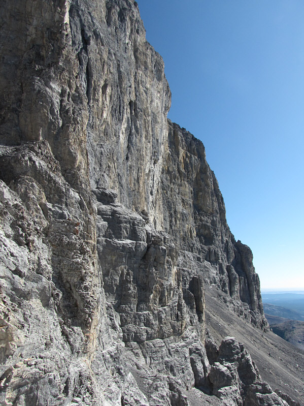
This is a foreshortened view of the immense south face. |
|
|
Keith starts up the access gully. |
|
|
Here is another perspective of the immense south face. |
|
|
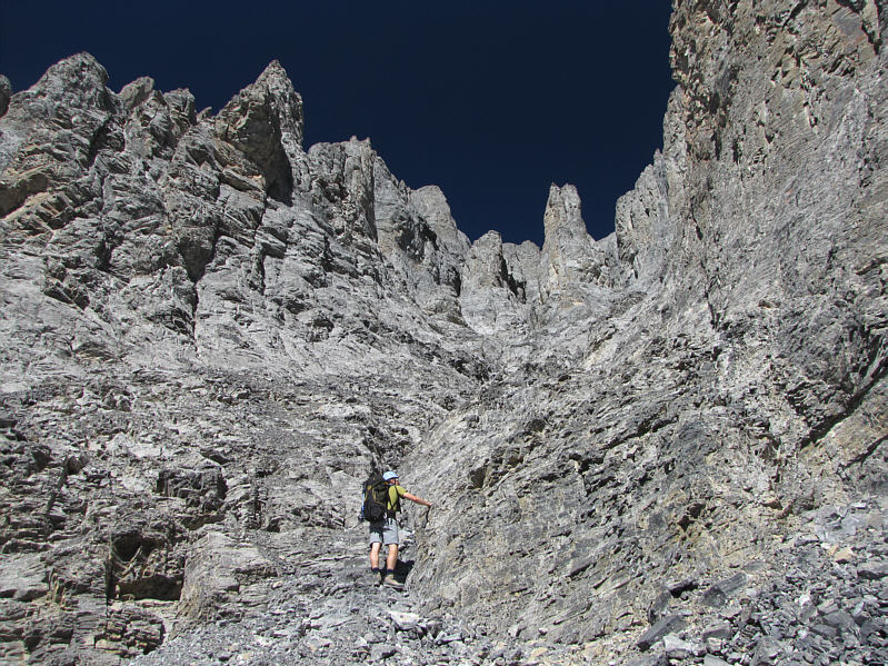
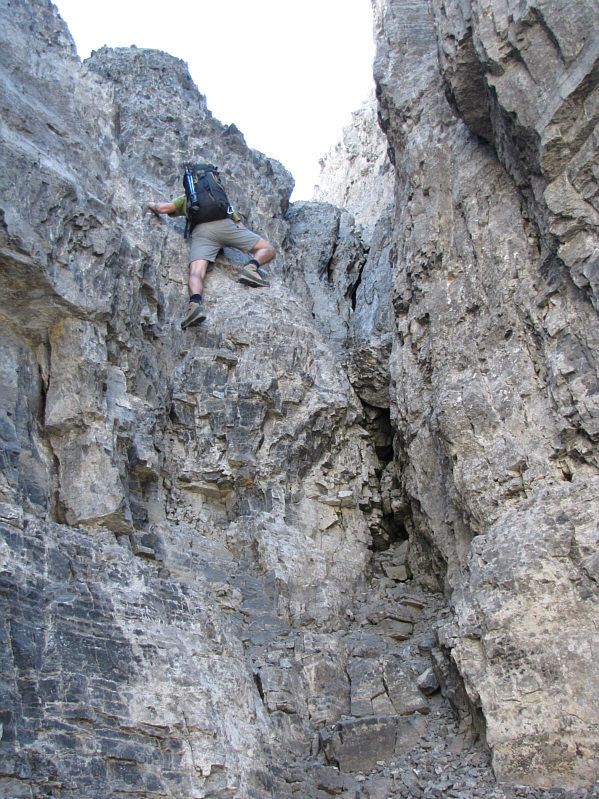
The access gully narrows and gets steeper. |
|
|
The crux is inside the dark crack at center. |
|
|
Keith climbs up the crux. |
|
|
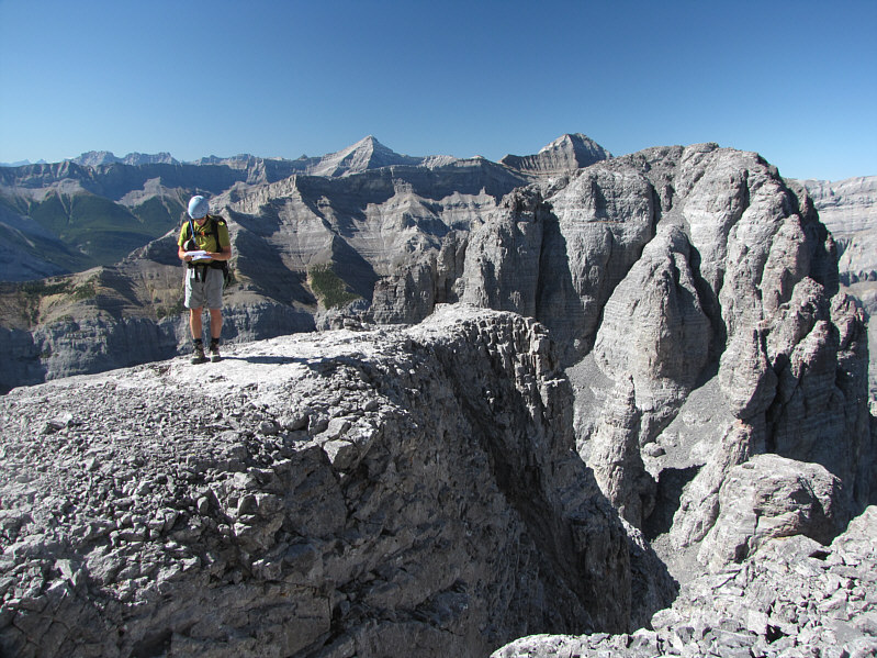
Keith consults the route description after climbing out of the crux. The west summit of Devils Head is at right. |
|
|
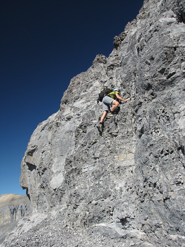
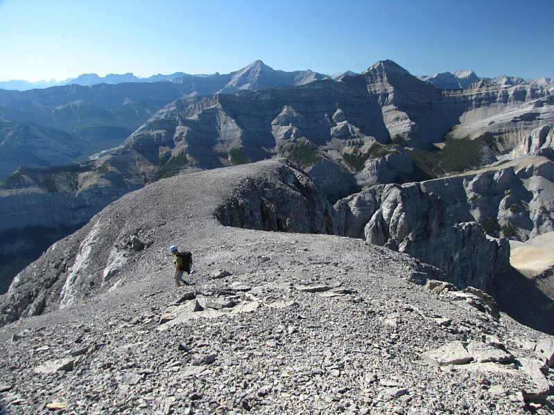
Keith climbs up difficult terrain on the upper mountain. |
|
|
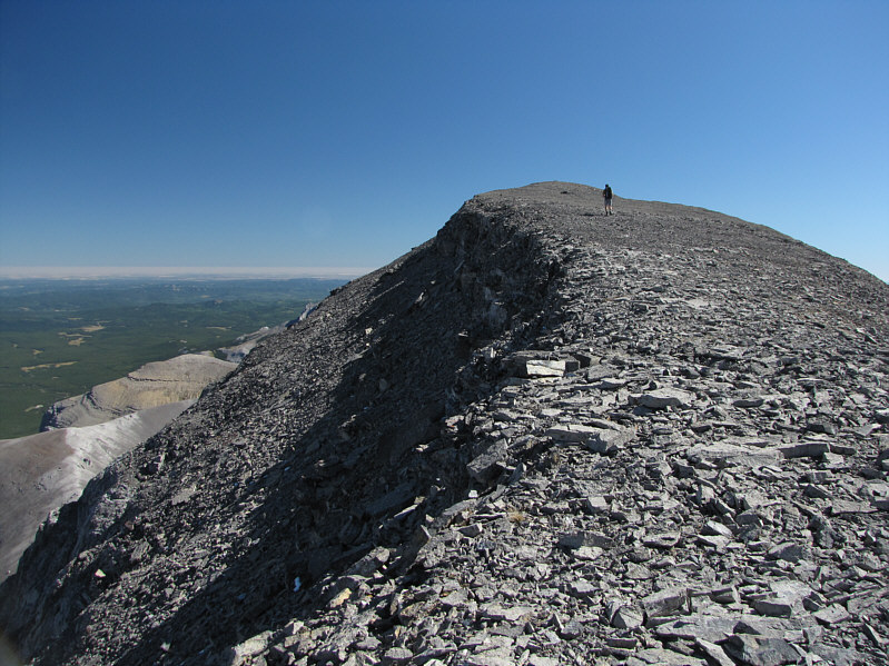
Keith casually strolls up to the summit of Devils Head. |
|
|
Keith and Sonny stand on the 2796-metre summit of Devils Head. |
|
|
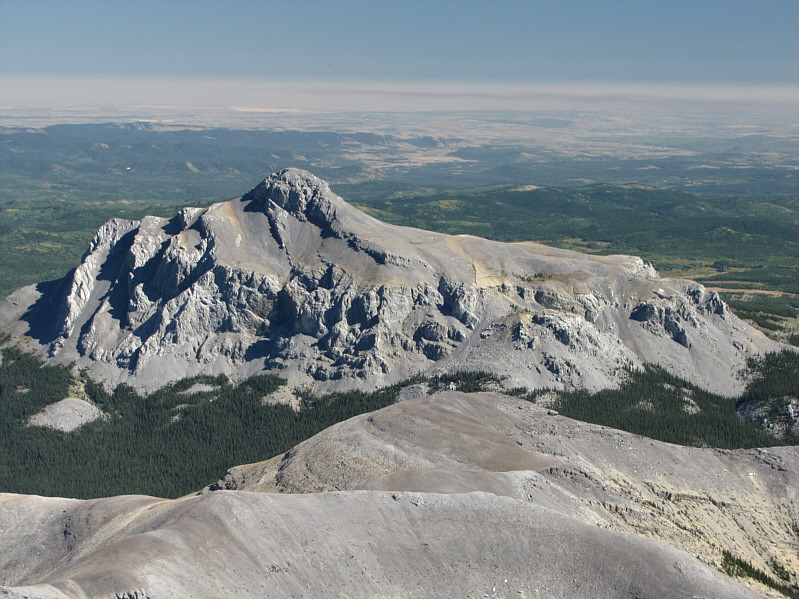
Black Rock Mountain stands out to the east. |
|
|
To the southeast is Phantom Crag. |
|
|
Here is another look at Mount Aylmer to the west. |
|
|
The peak to the northwest is unofficially known as Castle Rock. |
|
|
Keith begins the descent. |
|
|
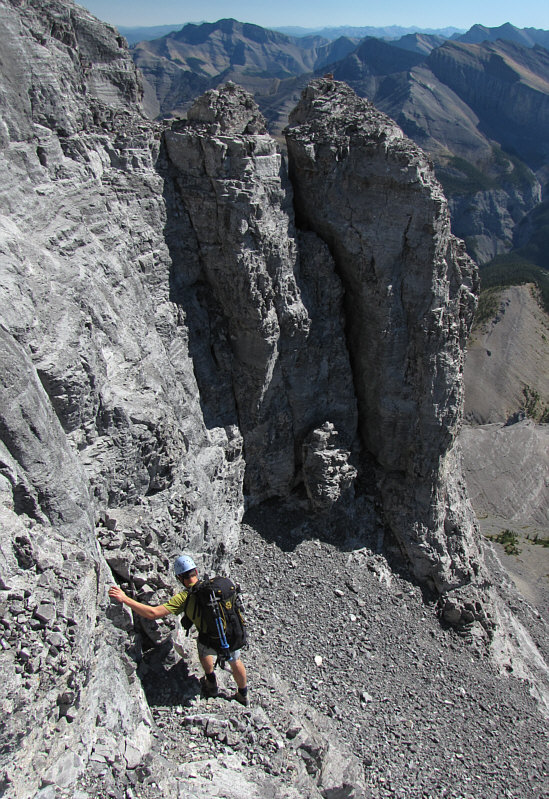
Some of the down-climbs on the upper mountain are almost as tricky if not more so than the crux. |
|
|
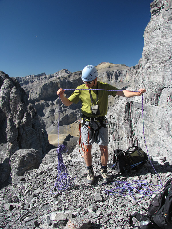
Keith untangles his rope just above the crux. |
|
|
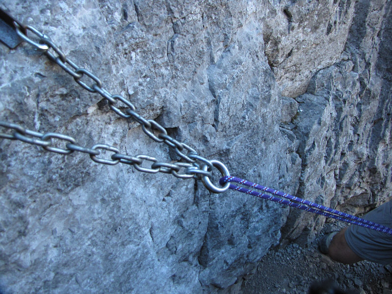
Here is a look at the belay station near the crux. |
|
|
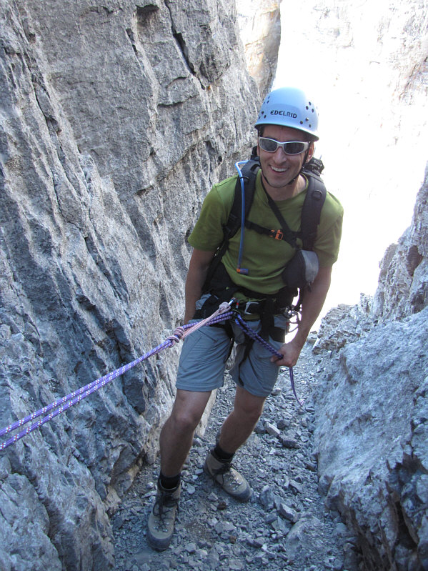
Keith is all set to rappel the crux. |
|
|
Keith hikes down to the hoodoos. The ridge that was used for the approach is just left of center. |
|
|
Here is a closer look at one of the hoodoos. |
|
|
This is one last look at Devils Head from the top of the obstacle that Keith and Sonny mistakenly climbed up. |