BOU AVENUE
Mount Evan-Thomas
Mount Evan-Thomas is the highest peak of the Opal Range in Kananaskis Country, and after reading Andrew Nugara's report of his second ascent via the southwest gully, I knew it would be just a matter of time before I paid a visit.  That visit came on 23 August 2009.  Ascending the steep trail alongside Ripple Rock Creek, I passed a group of four who were on their way up Grizzly Peak.  We exchanged pleasantries, and as our paths diverged, I wistfully recalled my ascent of Grizzly Peak in 2000 when I still had so many "Kane peaks" left to do.  Continuing past where the trail peters out, I contoured around the steep, grassy hillsides and worked my way into the upper valley between Mount Evan-Thomas and Mount Packenham.  Though not obvious on the approach, the gully used by Nugara became more obvious the deeper I hiked into the valley.  The next two hours were spent groveling up nearly 500 metres of loose rubble and steeply-tilted strata to the crest of Mount Evan-Thomas's west ridge.  There is a lot of hands-on scrambling to be had here, but I generally found it more wearisome than fun.  I took a short break on the crest and left my hiking poles here before tackling the remainder of the west ridge and the summit block.  Despite some exposure, the route up this section was dry, and I had no problems reaching the summit cairn.  After a 45-minute break at the summit, I carefully retraced my steps back to where I left my poles.  Though I had entertained ideas of descending the complicated-looking west ridge, I opted to return the way I came up.  The loose rubble in the gully was not the best for surfing; nevertheless, it took me only about 45 minutes to stumble my way down to the bottom.  The stumbling continued on my ensuing hike out the valley, and my beleaguered feet would feel no respite from all the side-hill bashing until I finally regained the trail on the south side of Grizzly Peak.  From there, the hike back to my car was straightforward (round-trip time of less than 8.5 hours), but the group of four that had gone up Grizzly Peak were long gone.  It would have been nice to share a post-scramble drink with them.
Getting over to the valley ain't gonna be easy! 
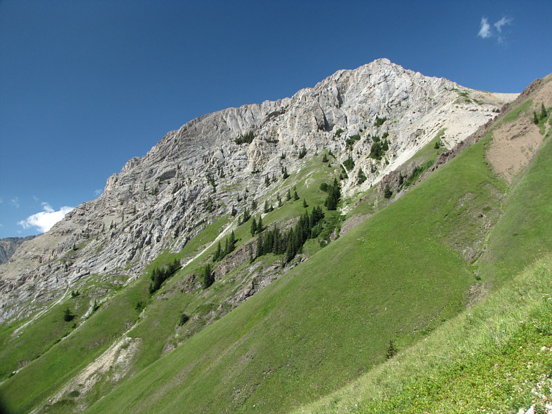
This is a foreshortened view of Mount Evan-Thomas from near where the trail peters out.  The valley to the right gives access to the southwest gully.
It's easier climbing up these hillsides than traversing them. 
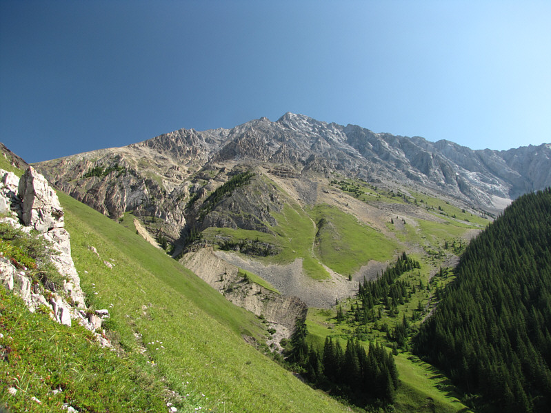
This is looking west to Grizzly Peak from the slopes of the upper valley.
It's as steep as it looks in this photo. 
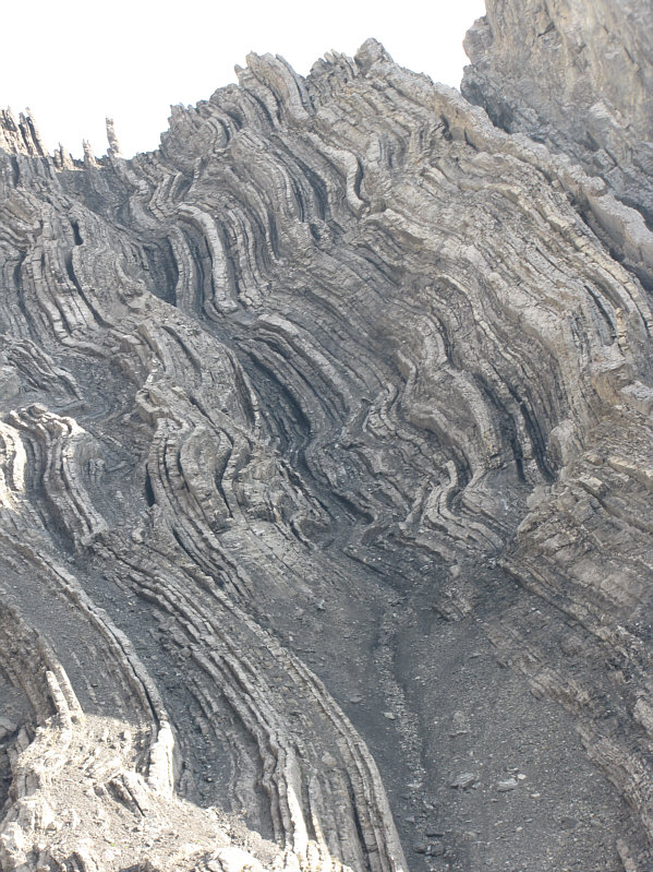
This is an example of the steeply-tilted strata in the gully.
This would have been more enjoyable without the howling wind. 
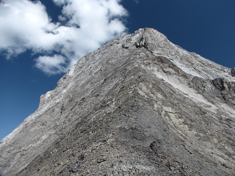
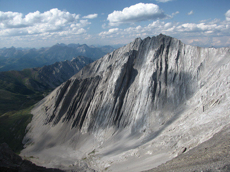
This is the summit block as seen from where the gully tops out on the west ridge.
There are actually some route options here. 
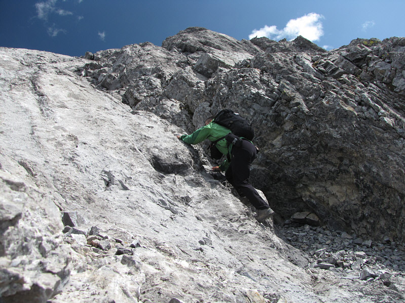
Sonny scrambles up the obvious crack just below the summit.
Interestingly, quite a few people have ascended this peak more than once. 
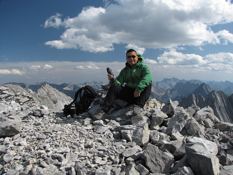
Sonny holds the register canister on the 3085-metre summit of Mount Evan-Thomas.
Gillean Daffern refers to the lake as "North Fork Tarn". 
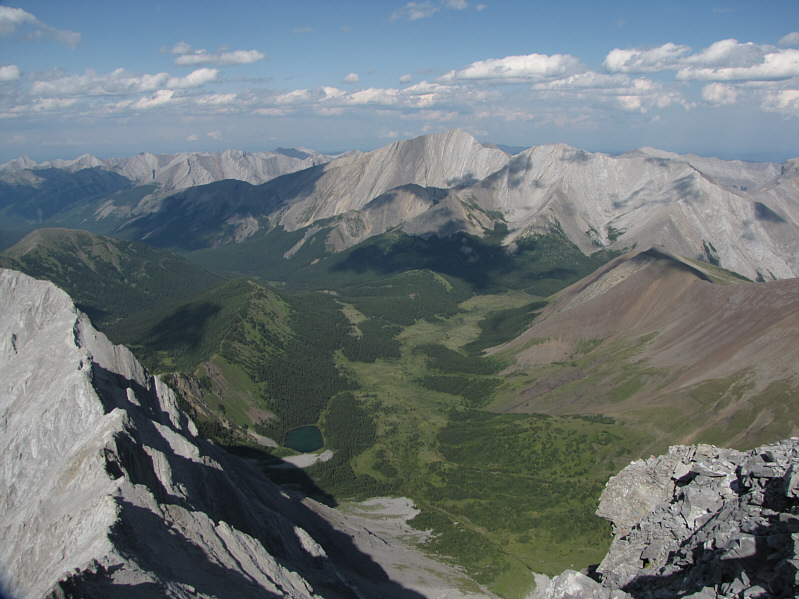
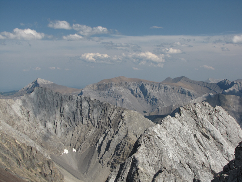
This is looking northeast toward the Fisher Range.  Fisher Peak is at centre on the horizon.  Evan-Thomas Lake is also visible at bottom left.
Mount Rae is also visible on the horizon just left of center. 
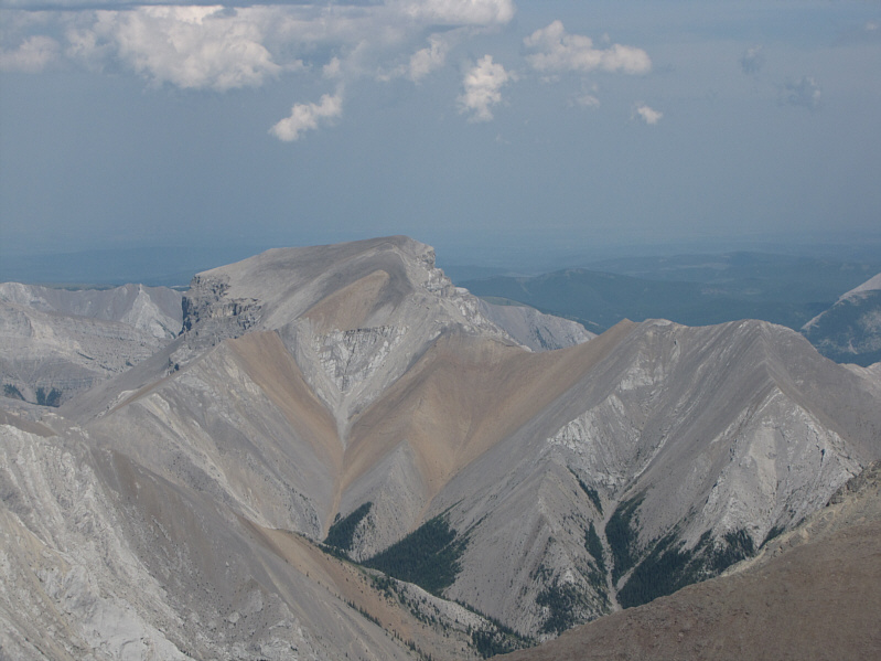
Mount Packenham dominates the view to the south.
And that west ridge doesn't look like a cakewalk either! Grizzly Peak looks diminutive to the west.
And at far left on the horizon is Mount Assiniboine! The view to the northwest includes Opal Ridge and numerous peaks of the Kananaskis Range.
Cool patterns in the scree! To the east, Mount Romulus looks unusual from this side.
More scree heaps than you can shake a stick at! Also visible to the east on the horizon are (L to R) Mount Glasgow, Mount Cornwall, Banded Peak and Outlaw Peak.
Doesn't look easy to ascend from here... This is Mount Potts (unofficial name) as seen from the west ridge of Mount Evan-Thomas.
Strangely, it reminds me of spaghetti! These are some interesting-looking strata on the north side of Mount Packenham.
Despite the lack of technical difficulty, I can't say that I really recommend this route for ascent. 
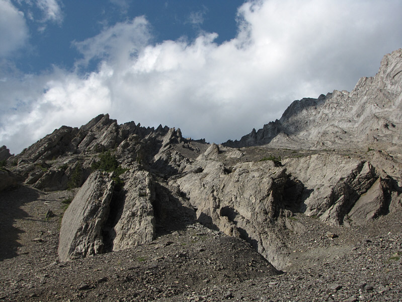
Here is a last look up the southwest gully from the bottom.