


After a couple of hours of pleasant hiking, I reached the basin and caught my first glimpse of Avalanche Mountain and its southwest ridge. While the upper mountain appeared reasonable enough to climb without a rope, the ridge looked more troublesome with several pinnacles that would have to be surmounted or bypassed and one particularly steep drop-off that looked impregnable. I tried not to worry about it too much as I hiked up through sub-alpine meadows to a sign signifying the end of the official trail. From there, I followed a well-worn route up to the crest of the ridge. Predictably, the ridge became more challenging the higher I climbed. Occasionally, I dropped down on climber's right to bypass some of the steeper pinnacles, but generally, I stuck pretty close to the crest. The aforementioned drop-off is a wall about 5 or 6 metres high--the main crux. I managed to climb up an exposed corner system to climber's right of the wall and immediately suppressed thoughts about how unnerving the down-climb would be on my descent. After a few more sections of difficult scrambling, I was finally back on more moderate terrain, but I still had a lot of climbing ahead of me. Encountering some snow patches made me regret leaving my ice axe and crampons in the car, and I simply avoided them as much as possible.
About 6.5 hours after starting out, I finally reached the top of Avalanche Mountain's west peak which is the gazetted true summit with an accepted elevation of 2861 metres. Actually, I was not even aware that Avalanche Mountain had a double summit until I looked across to see the east peak which looked equally as high if not higher. I scrambled partway down to the col separating the two peaks but was stymied by a large smooth slab which seemed impossible to get around. Snow still plastered the steep terrain on skier's right of the slab, and I was not about to risk going that way without an ice axe and crampons. The terrain to skier's left of the slab looked just as terrifying, but after some careful studying, I found a route that looked feasible though it was still quite exposed. My biggest concern was the solidness of the rocks. I double-checked every handhold and foothold as I slithered down and around the smooth slab toward the col. A short but unavoidable traverse across the snow chute on the north side of the col had me pining for my ice axe again, but I was soon scrambling comfortably up to the top of the east peak. It took me about 40 minutes to get over to the east peak, and after spending less than 20 minutes there, it took me another 27 minutes to return to the west peak.
While descending the upper mountain, I half-considered descending the
southwest face in order to avoid the crux on the ridge, but I knew there
were some serious cliff bands at the bottom of the face and was not
certain if I could circumvent them. Adhering to the old adage,
"better the devil you know than the devil you don't know", I decided to
retrace my steps down the ridge and tackle the crux. As I reached
the top of the wall, I noticed some old slings and wondered how I could
have missed them on the way up. A short rappel would have greatly
simplified things of course, but without a rope, I had to down-climb the
corner system I had ascended. This was as difficult as I had
expected. Holds were few, and much of the rock was smooth and
down-sloping. At one point, I was literally clinging by my
fingertips as I searched fruitlessly for the next foothold. I
eventually just let go and dropped about 6 inches to the next ledge
down--not a big deal except for the alarming exposure below the ledge.
Once I cleared the crux, I began to feel a little easier, and I
eventually escaped the ridge to skier's left and skated down
shallow-angled snowfields into the sub-alpine meadows of the basin.
I soon picked up the Avalanche Crest trail and put my mind on cruise
control during the long but uneventful descent back to the parking lot.
Because of the lateness of the day, I did not see anyone else in the
parking lot, but I wished I could have told that lady, "Yes indeed.
I did go all the way to the top."
|
|
One of the first clear views from the trail is that of The Rampart. |
|
|
Mount Abbott (left) and Mount Afton are also visible fairly early in the trip. |
|
|
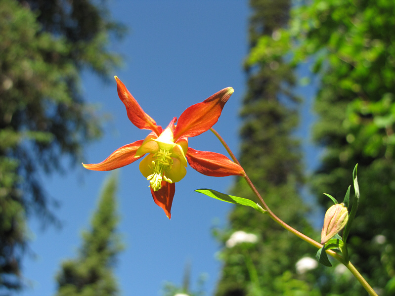
A columbine looks brilliant in the sunshine. |
|
|
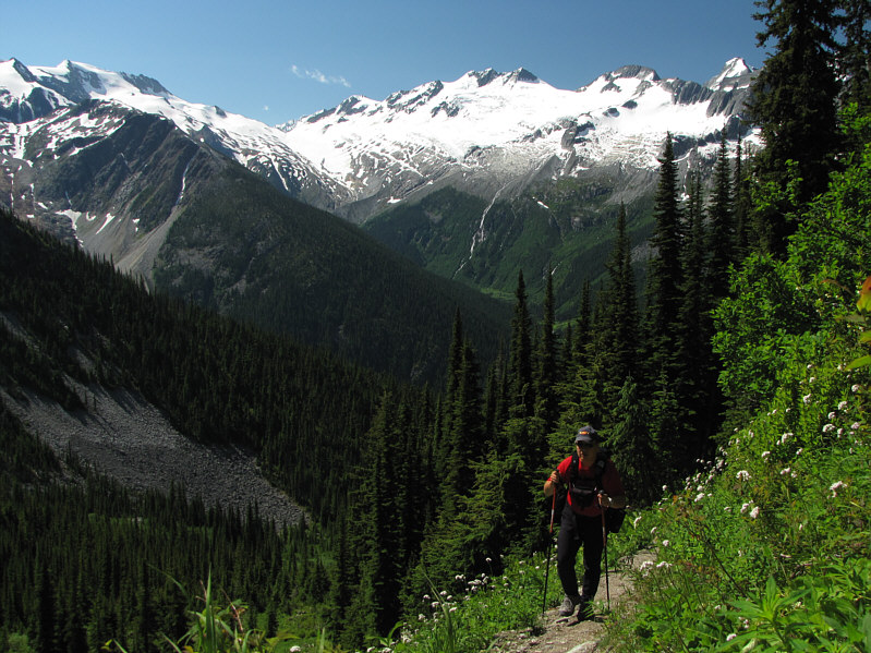
The views begin to really open up near tree line. |
|
|
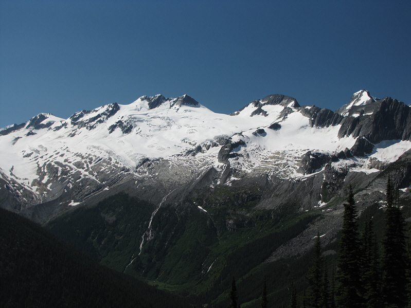
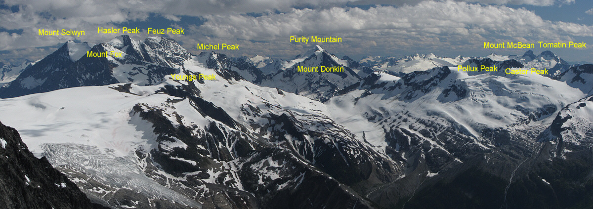
The Asulkan Glacier is surrounded by numerous peaks including Pollux and Castor Peaks (just left of centre), The Dome (right of centre), and The Rampart. The snowy peak behind The Rampart is Mount Swanzy. The gap between Castor Peak and The Dome is known as Sapphire Col. |
|
|
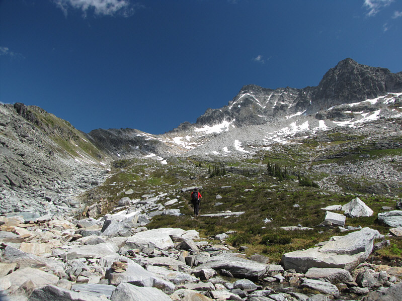
Sonny enters the basin. Avalanche Mountain is just right of centre. |
|
|
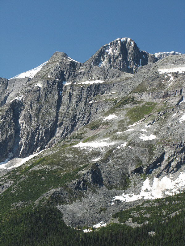
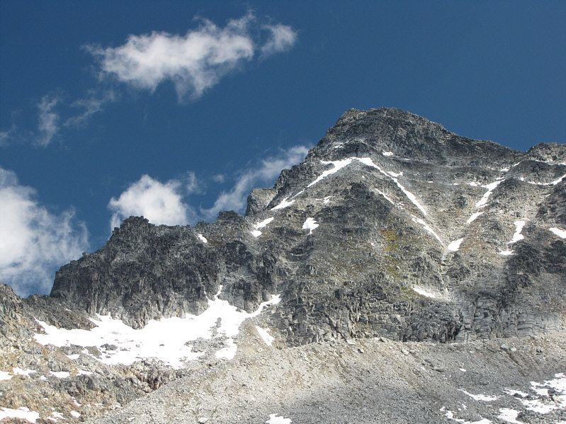
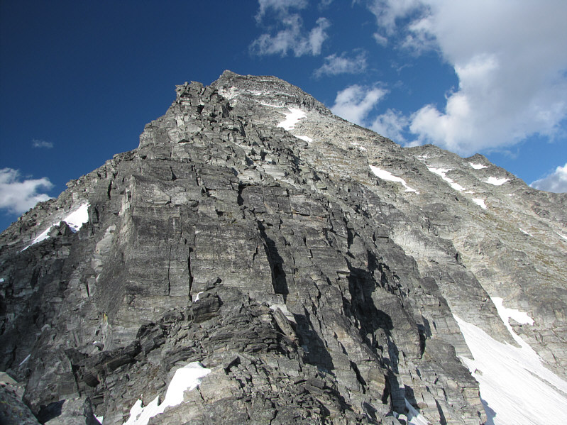
Here is a closer look at Avalanche Mountain. The main crux is the drop-off on the ridge at far left. |
|
|
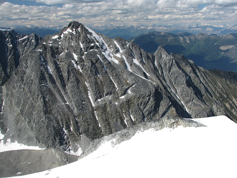
Peaks visible from this vantage point on Avalanche Mountain's southwest ridge include Cheops Mountain (far left), Ursus Minor Mountain (dead centre), Grizzly Mountain (right of centre), and Mount Sifton (far right). |
|
|
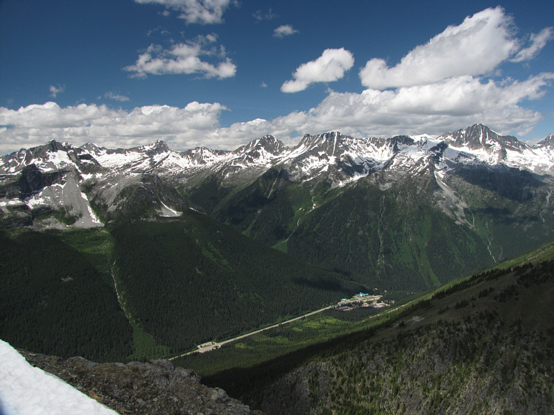
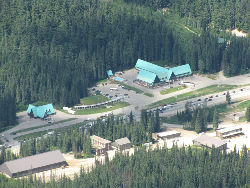
Here is a closer look at the gas station (left), info centre (note the grassy roof), and hotel (right) at Roger's Pass. |
|
|
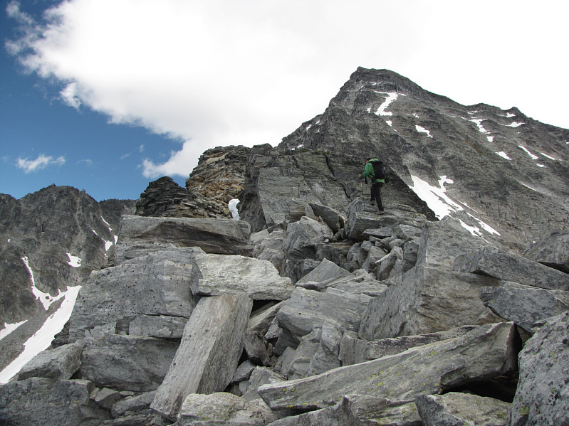
Sonny continues up the southwest ridge of Avalanche Mountain. |
|
|
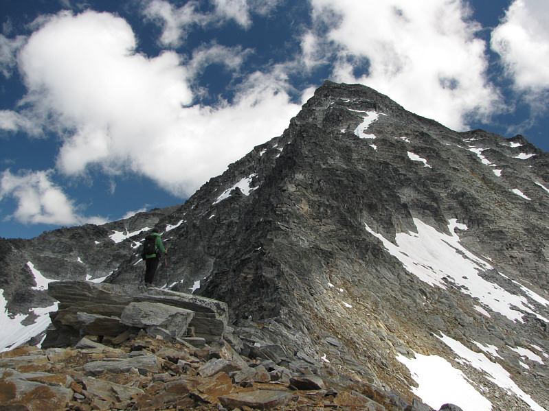
Sonny pauses to study the remainder of the ridge. |
|
|
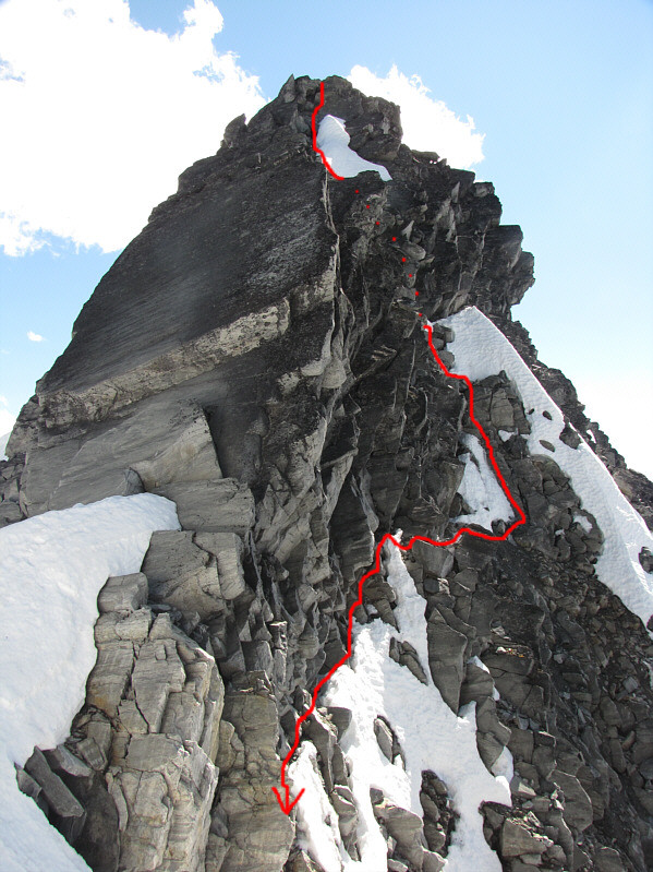
This is the main crux on the southwest ridge. The route goes up the corner system just right of centre. |
|
|
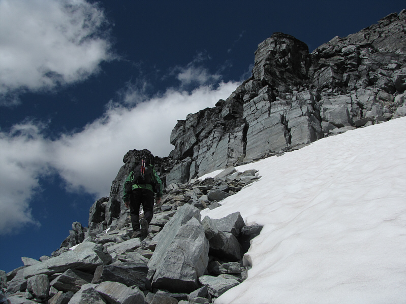
Sonny continues to grind his way up the southwest face. |
|
|
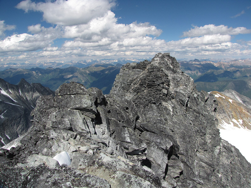
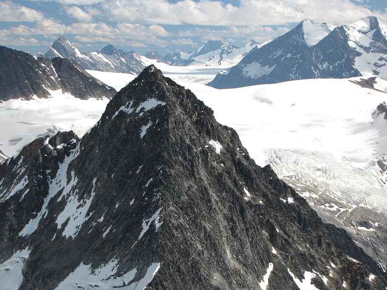
This is the east peak of Avalanche Mountain as viewed from the west peak. |
|
|
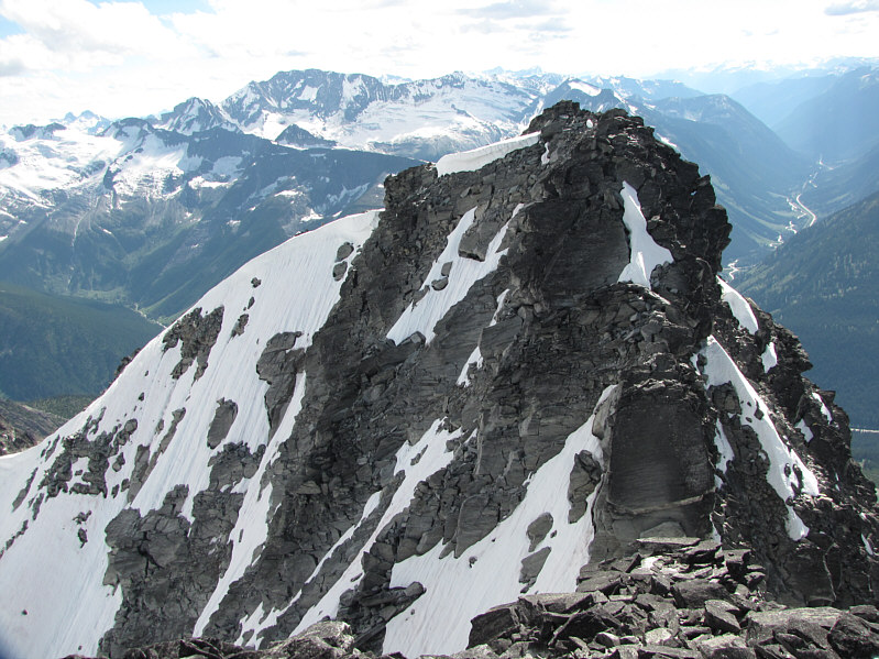
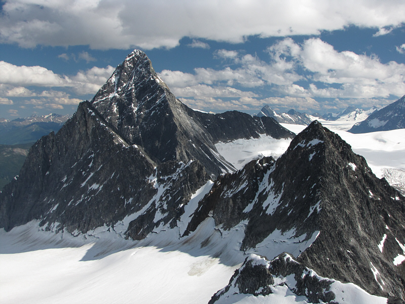
This is looking back up at the west peak from near the col separating the two peaks. Sonny's approximate descent route is shown. |
|
|
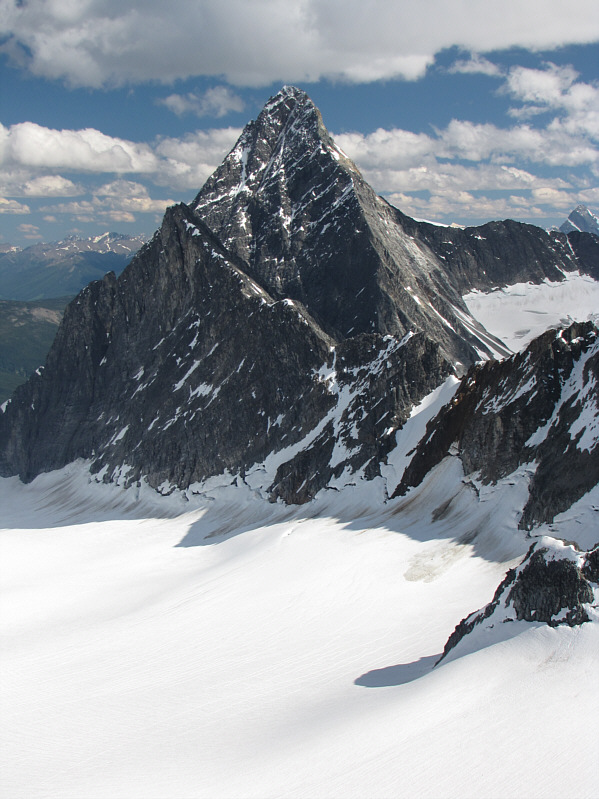
This is the west peak of Avalanche Mountain as viewed from the east peak. |
|
|
Sonny sits on top of the east peak. |
|
|
North of Avalanche Mountain is Mount Macdonald. |
|
|
To the northwest are the multiple peaks of Mount Rogers (left). Hermit Mountain is also visible at far right. |
This is a partial panorama to the south of Avalanche Mountain.
 |
To the southeast, Eagle Peak partially obstructs the view of Illecillewaet Neve. The pointy peak at far left is Mount Macoun. Slightly right of centre on the horizon is Mount Duncan (flat top). |
 |
Uto Peak is barely discernible against the north face of Mount Sir Donald. |
 |
Here is another look at Uto Peak, Mount Sir Donald, and Eagle Peak (right). |
 |
Avalanche Glacier lies to the east. Across the valley is Bald Mountain. |
 |
Here is another look at the main crux along the southwest ridge. |
 |
This is the impressive west face of Eagle Peak. |
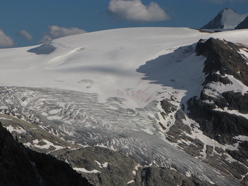 |
This is the Illecillewaet Neve and Glacier. Mount Selwyn is visible at upper right. |
 |
Here is one last look at Mount Sir Donald peeking over the southwest ridge of Eagle Peak. |
 |
This is looking up nearly a vertical mile at the east (left) and west peaks of Avalanche Mountain from Roger's Pass. |
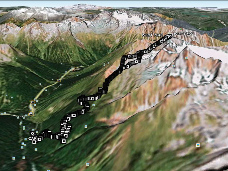 |
This is the route as viewed in Google Earth. |
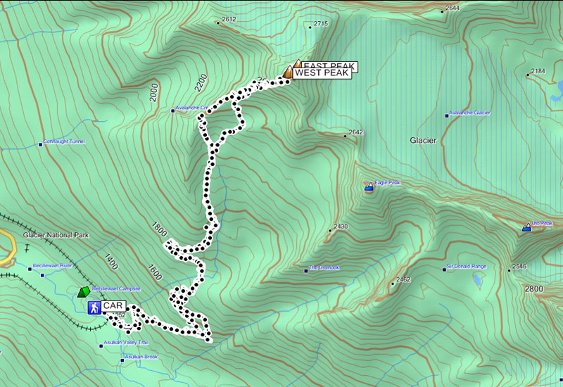 |
Total Distance: 14.5 kilometres Round-Trip Time: 12 hours Total Elevation Gain: 1696 metres |