BOU AVENUE
Hyndman Peak
Hyndman Peak is the highest of the Pioneer Mountains of central Idaho and the shortest of the state's nine fabled 12,000-footers.  A prized objective that is well-described on numerous websites as well as Tom Lopez's Idaho: A Climbing Guide, Hyndman Peak is also the easiest of the Idaho 12,000-footers to climb and demands nothing more than a long approach on a good trail and some easy scrambling (Class 2) on the upper mountain.  Camping at nearby Sawmill campground and anticipating a long and hot day, I got up at what seemed like the middle of the night on the morning of 1 October 2010 and ate a couple of bananas as I drove to the trailhead for Hyndman Peak.  After crossing the north fork of Hyndman Creek on a footbridge just below the parking area and pit toilet, I set a good pace up the reclaimed road which runs alongside the main fork.  The brilliant moon illuminated the road nicely, and the temperature was cool but comfortable for hiking.  As I took the turnoff to Hyndman Basin about 4 kilometres from the trailhead, the sky began to brighten, and I climbed steeply up a big hill before crossing a creek near a deserted horse camp.  Somewhere around here, I got my first glimpse of Hyndman Peak's pyramidal form which motivated me to push on up the next big hill.  From the top of that hill, the well-defined trail rises gradually toward the back of the basin until it disappears in a boulder field well short of the col separating Hyndman Peak from Old Hyndman Peak.  Instead of continuing cross-country to the col as suggested by most route descriptions, I began angling up a shallow but distinct drainage on the south face of Hyndman Peak.  I took a short break here after moving into direct sunlight for the first time of the day.  When I resumed climbing, I eventually worked my way over to the southeast ridge to take a look over the precipitous east face.  The rest of my ascent was an unremarkable but easy plod up the ridge, and though it had taken me nearly 6 hours to reach the summit, I felt surprisingly fresh.  I spent the next 1.25 hours taking photographs, eating a delicious lunch and examining the interesting contents of the summit register box.  For my descent, I followed numerous beaten paths down the south face and regained the trail in the basin without any trouble.  The long hike back to the trailhead was uneventful, but I enjoyed the sunny weather, the solitude, and the fact that this entire outing went so perfectly without a hitch.
Unfortunately, pre-dawn starts aren't great for taking a lot of photographs. Sonny enters Hyndman Basin just before dawn.
Only another 3.5 hours to the top from here! 
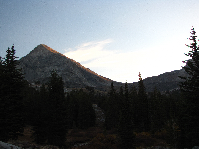
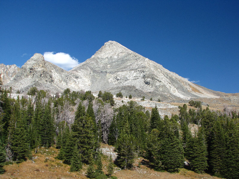
This is one of the first views of Hyndman Peak from the trail.
Looks like it's gonna be a really nice day. 
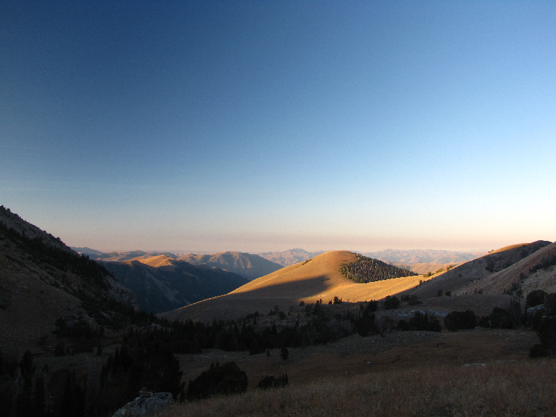
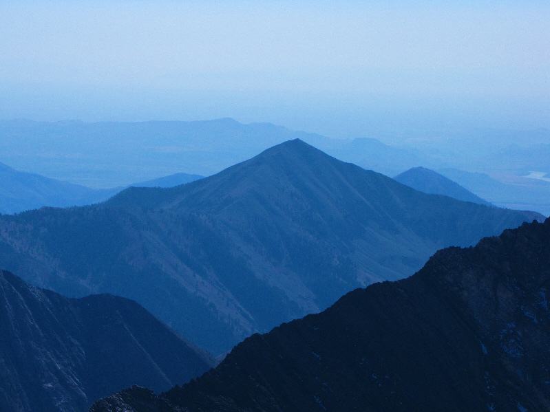
The morning sun illuminates some distant hills to the west in this view from Hyndman Basin.
Some more challenging routes here if Class 2 is not to your liking! 
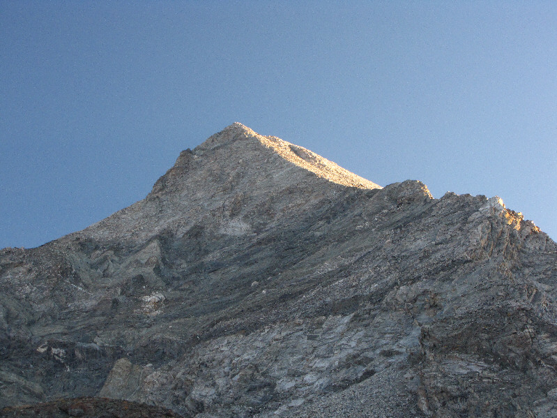
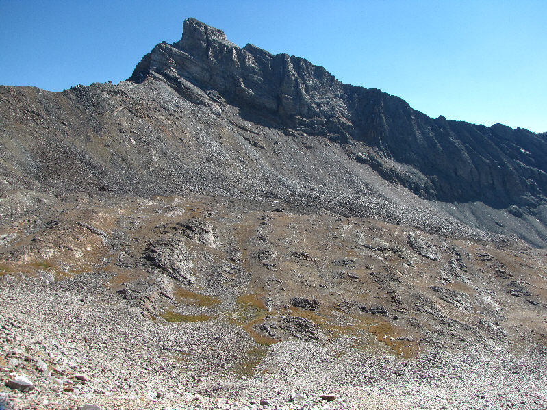
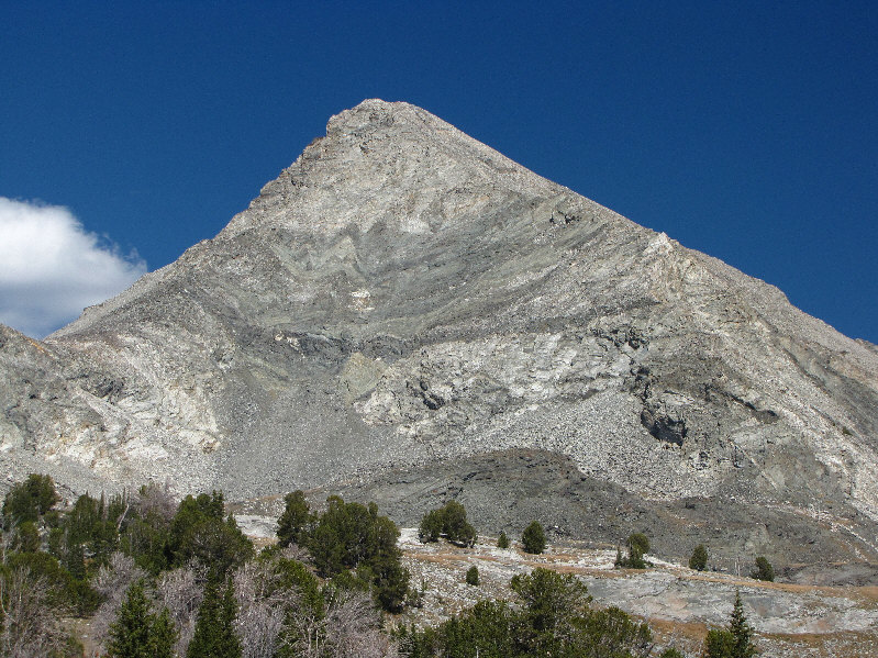
Here is a closer look at the summit block of Hyndman Peak from below.
Maybe it was the 2 bananas I had for breakfast, but I felt really good today. Sonny continues to follow the trail in Hyndman Basin.  Behind him is Old Hyndman Peak.
Another must-do mountain given its visibility from the approach road. 
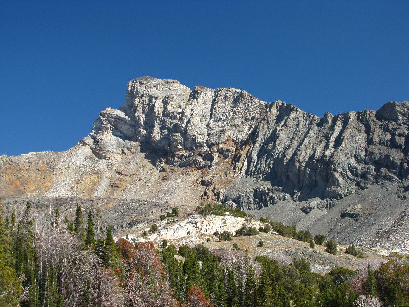
Cobb Peak dominates the south side of Hyndman Basin.
It's still a long slog, but the rubble is generally pretty easy to climb. 
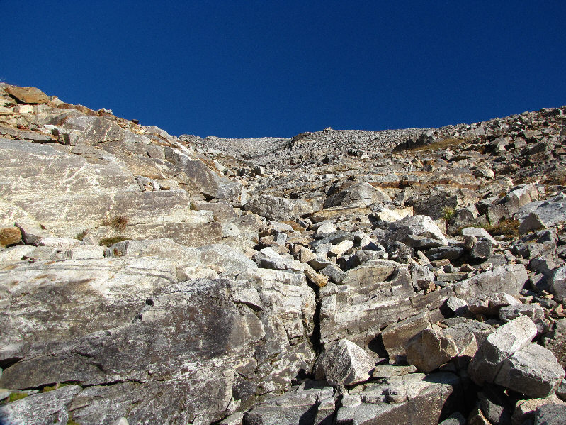
This is looking up the faint drainage on the south face of Hyndman Peak.
About 5 hours from the trailhead and still going strong! Sonny slowly gains altitude.
Studying topo maps, I had considered approaching the peak from this side.  Of course, what looks good on paper... 
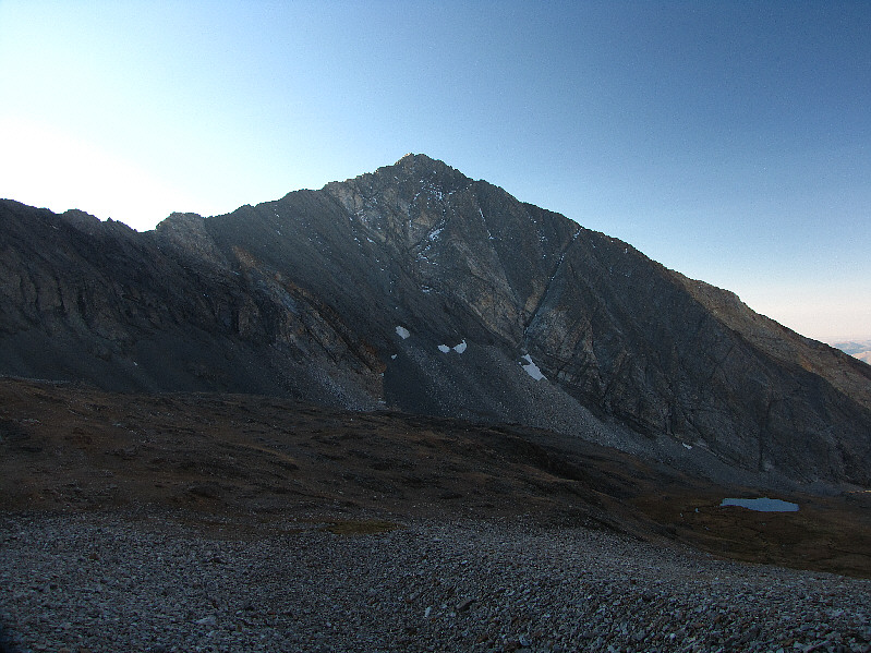
This is the impressive east face of Hyndman Peak.
There's some hands-on stuff here if you make a point of going almost right to the edge! 
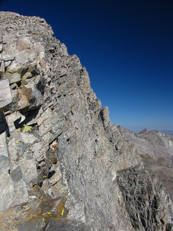
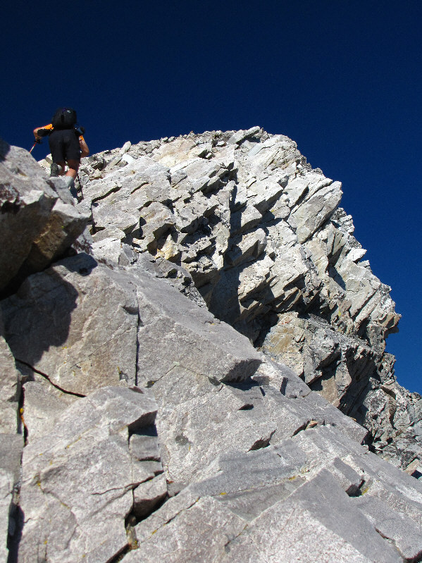
Sonny hikes up the southeast ridge.
Mark Isleifson (www.travelsoftheorangeshirt.com) would be proud of what I'm wearing! Sonny stands on the 3664-metre summit of Hyndman Peak.
The trailhead is somewhere behind the bald hill just right of centre. This is the view to the southwest from the summit.
You could spend a lifetime bagging peaks around here! To the northwest, Duncan Ridge dominates the foreground.  The prominent bump at far right behind Duncan Ridge is known unofficially as Salzburger Spitzl.  At right on the distant horizon are the White Cloud Mountains.
There's a road and campground somewhere down in that valley. 
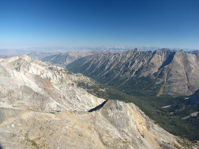
Northeast of Hyndman Peak is Wildhorse Creek valley.  The Lost River Range is visible on the horizon.
Regarding the other 12,000-footers, Lost River Mountain is just out of view to the right, and Diamond Peak is in the Lemhi Range. 
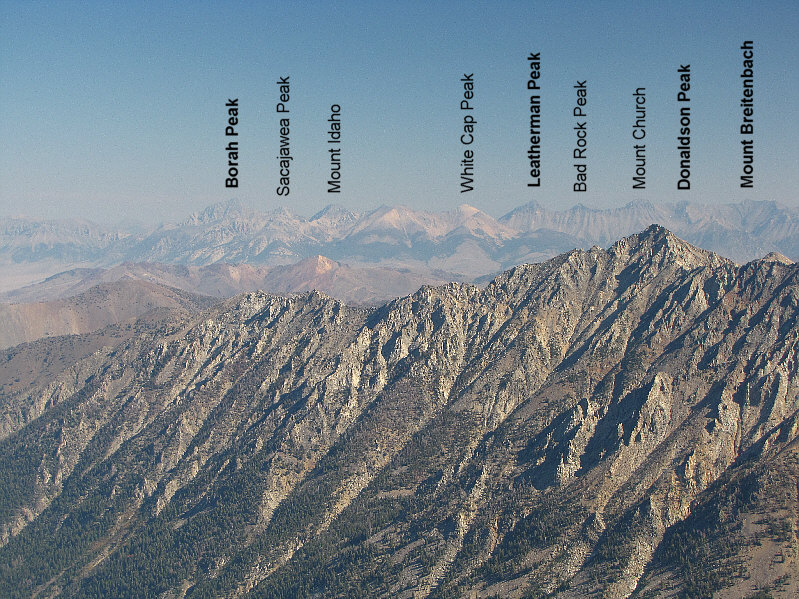
Here is a closer look at the distant Lost River Range (names in bold are official).  Six of the nine Idaho 12,000-footers are visible here.  The high point in the foreground at right is unofficially known as Angels Perch.
If you have a sharp eye, you should easily spot Arrowhead Lake. This is the view to the east.  Brocky Peak is one of the more technically demanding mountains in the vicinity.
I bet that tarn is much bigger in the spring. This is an aerial view of a tarn in Hyndman Basin.  Note the trail at bottom right.
Wonder what story is behind the bicycle gear... 
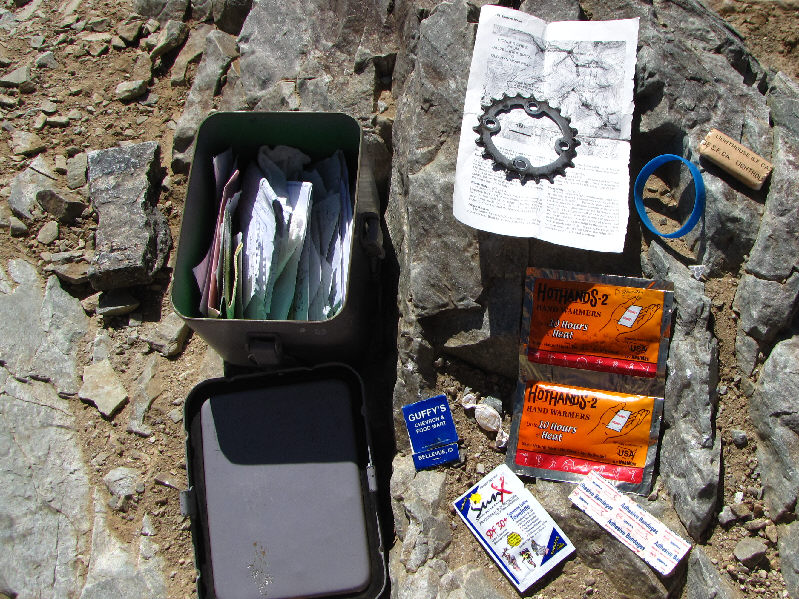
The summit register box contains all sorts of stuff.
There is also a Devils Bedstead West which is 248 metres shorter and is not visible in this photo. The Devils Bedstead East (white-topped peak) is partially hidden behind Goat Mountain (unofficial name) in this view to the north.
Another beautiful peak I would like to climb in the future. Grays Peak can be seen to the south over the northeast ridge of Cobb Peak.
Earlier in the day, I saw what looked like 3 goats scampering on the rubble slope below Old Hyndman Peak 
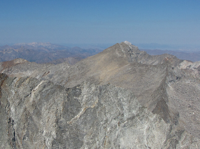
Old Hyndman Peak towers over Hyndman Basin.
Skinny dip, anyone? 
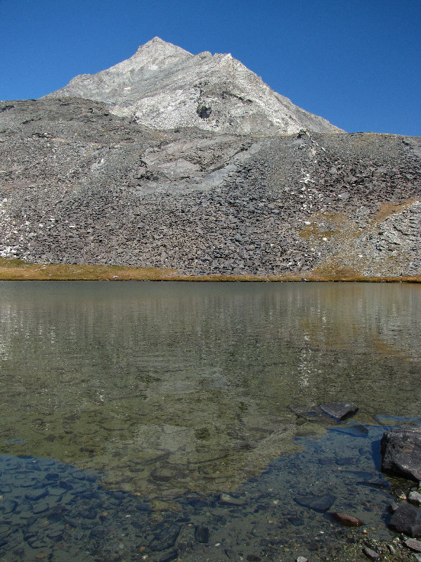
Another tarn sits below the southwest ridge of Hyndman Peak.
It's got more wrinkles than the younger Hyndman Peak! Here is one last look at Old Hyndman Peak.
Now there's a sexy peak! Hyndman Peak looks brilliant in the afternoon sun.
How do you pronounce "pyramidal"? Here is a last close look at Hyndman Peak's pyramidal form.
I'll take these over mosquitoes and horseflies any day! There are many grasshoppers like this one in the area.
This valley is also the access route for Old Hyndman Peak. McIntyre Peak (left) and Jacqueline Peak are a couple of unofficially-named mountains in the next valley south of Hyndman Basin.
So this is what I missed seeing in the dark this morning! 
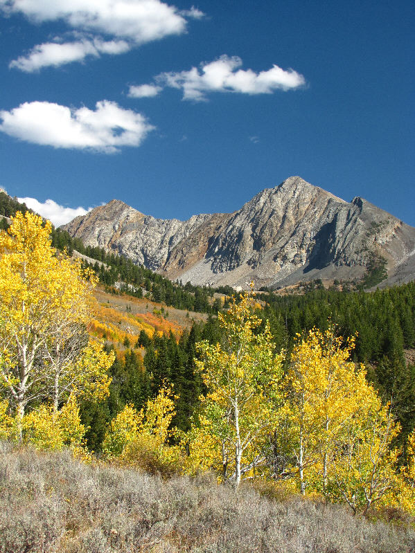
The trees along Hyndman Creek display some exceptional colours on this day.
The track is edited slightly as I was getting some crazy readings on my GPS that day. This is the route as viewed in Google Earth.
Maybe add 0.5 km distance and 150 m elevation gain. Total Distance:  19+ kilometres
Round-Trip Time:  10 hours 34 minutes
Total Elevation Gain:  1518+ metres

GPX Data