


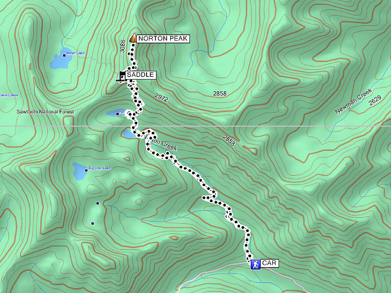
Round-Trip Time: 5 hours 30 minutes
Total Elevation Gain: 881 metres
|
|
The moon slowly sets behind an unnamed ridge somewhere along the trail to Norton Lakes. |
|
|
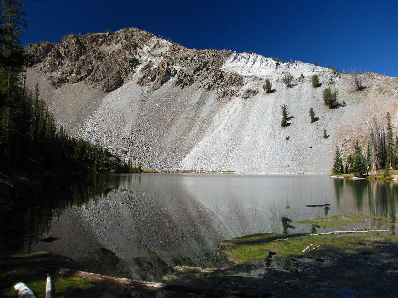
An unnamed ridge is reflected in Lower Norton Lake. |
|
|
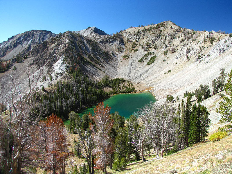
There are some remarkable colours in Lower Norton Lake. |
|
|
Sonny looks across Upper Norton Lake. |
|
|
Here is a view of Upper Norton Lake from the switchbacks. |
|
|
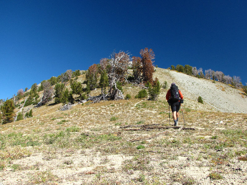
At the saddle, Sonny turns up the beaten path. |
|
|
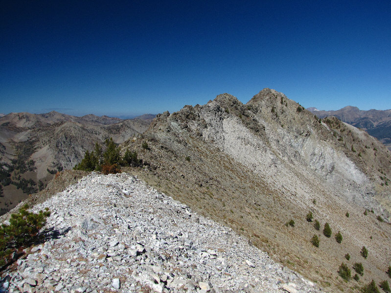
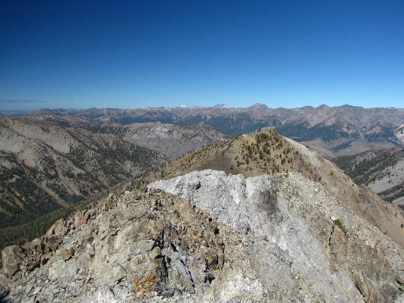
This is looking north along the summit ridge toward the true summit of Norton Peak. |
|
|
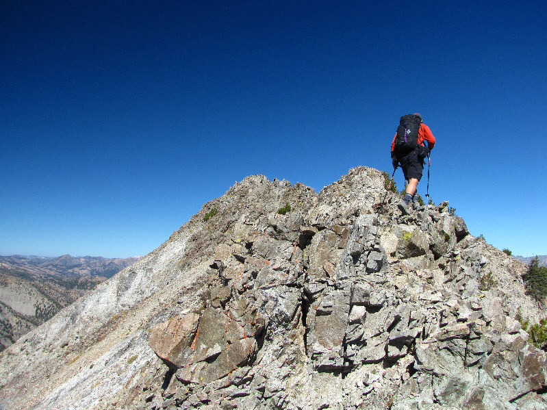
Sonny traverses the summit ridge. |
|
|
Some sort of wooden surveyor's tower is tethered to the 3148-metre summit of Norton Peak. |
|
|
This is looking north from the summit. On the horizon just right of centre is Castle Peak (with a bit of white on its right flank). |
|
|
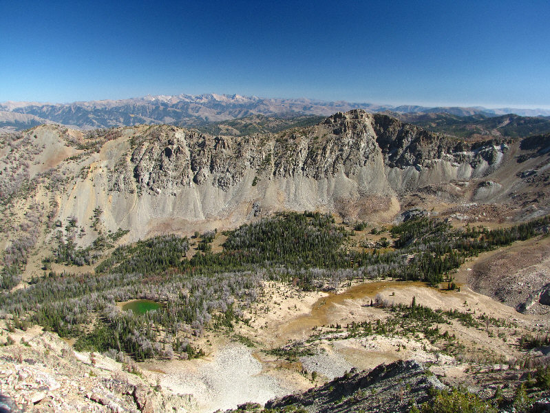
A small unnamed tarn lies in the bowl to the east. The 3100-metre peak across the bowl at right is unnamed. On the horizon are the Pioneer Mountains. |
|
|
Miner Lake draws the most attention to the west. |
|
|
Here is a zoomed-in shot of Castle Peak to the north. |
|
|
Here is a closer look at the 'heart' of the Pioneer Mountains--(L to R) Hyndman Peak, Old Hyndman, and Cobb Peak. |
|
|
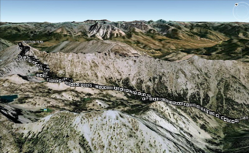
This is the route as viewed in Google Earth. |
|
|
Total Distance: 12.9 kilometres Round-Trip Time: 5 hours 30 minutes Total Elevation Gain: 881 metres |