Photo courtesy of Kelly Bou


Round-Trip Time: 6 hours 51 minutes
Total Elevation Gain: 1284 metres
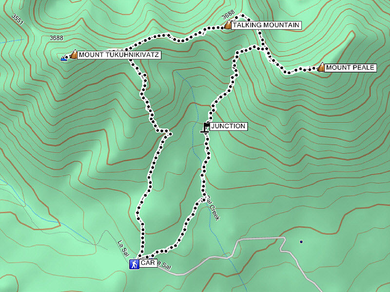
Not to be denied, I put on some warm layers and began following the beaten path behind the sign at the pass. The route follows the path over a small rise before joining briefly with a 4WD road heading up the obvious coulee between Mount Peale and its eye-catching neighbour to the west, Mount Tukuhnikivatz. At a cairned junction, the route leaves the road and climbs up the main gully west of Mount Peale. The proper route follows the gully all the way to the ridge crest before turning eastward toward the summit. I made the mistake of leaving the gully prematurely only to retreat after floundering in ankle-breaking rubble. Upon gaining the ridge crest, I encountered no further difficulties on my way to the summit. While it was still severely windy at the top, the cloud ceiling had lifted a little allowing some views of the surrounding peaks. The long and undulating connecting ridge to Mount Tukuhnikivatz looked enticingly easy to hike, and the opportunity to tag a second peak was too good for me to pass up.
I quickly retraced my steps down the summit ridge of Mount Peale before running into a gentleman from Colorado who was going in the opposite direction after having first climbed Mount Tukuhnikivatz. We had a nice chat before going our separate ways. Further along the connecting ridge, I stopped at the top of a nondescript hump to take a few photographs. Unbeknownst to me at the time, this hump actually has a name and is unofficially known as Talking Mountain. Immediately west of Talking Mountain's summit is a short string of rugged pinnacles called the Razor Fang. While the fellow from Colorado sounded like he was emotionally scarred after surviving an epic traverse of the Razor Fang, I found the moderate scrambling (avoidable if so desired) here to be a pleasant diversion from the rest of the somewhat boring plod between Mount Peale and Mount Tukuhnikivatz. Because of the rounded contours on Mount Tukuhnikivatz's summit block, the hike up the last 150 metres or so seemed like it would never end.
Completing the loop back to La Sal Pass, I backtracked a little to a
southeast-trending grassy ridge and followed it down into the same coulee
mentioned earlier. This is also the usual ascent route for Mount Tukuhnikivatz,
but given the steepness of the slope, I was glad I did not begin my hike
at this end. Toward the bottom of the grassy ridge, I picked up a
good trail and followed it easily out to La Sal Pass as the weather began
to deteriorate. Kelly was feeling cold after spending all afternoon
in the car waiting for me; thus, I quickly warmed up the car and drove us
back out to the highway. With a steady rain falling, we eventually
checked into a motel in the nearby town of Monticello and wrapped up the
day with a forgettable dinner.
|
|
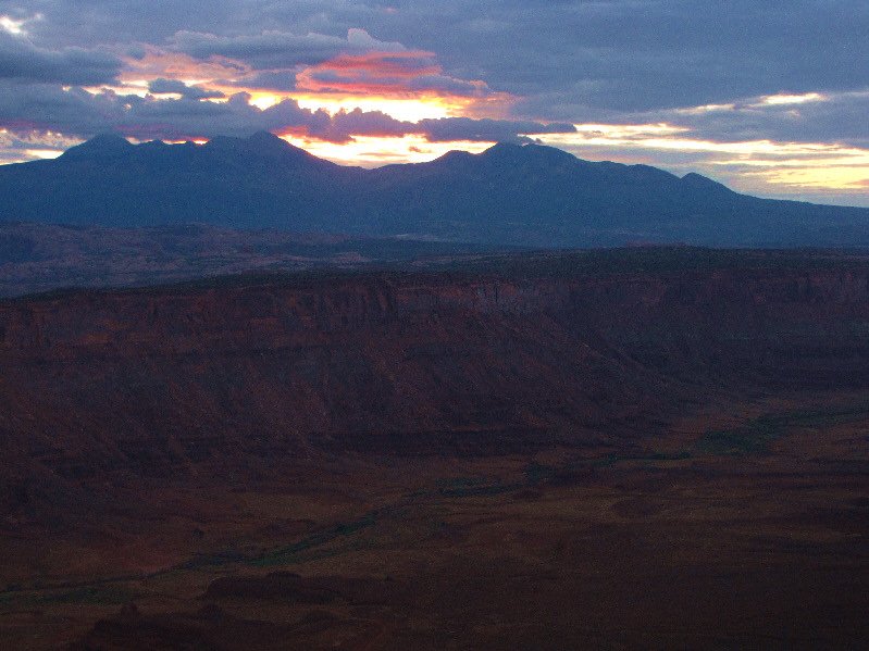
The sun rises behind the La Sal Mountains as seen from Anticline
Overlook. The dip at centre is La Sal Pass. Mount
Tukuhnikivatz is just left of the pass. Photo courtesy of Kelly Bou |
|
|
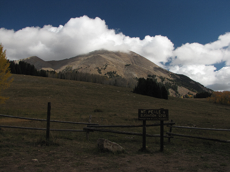
As seen from La Sal Pass, clouds obscure the summit of Mount Peale. |
|
|
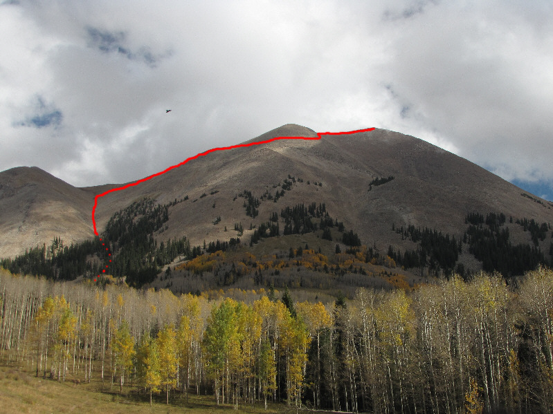
Here is a clearer look at the ascent route on Mount Peale. |
|
|
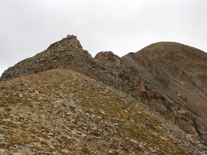
This is looking up the coulee from the 4WD road. The Razor Fang is visible at centre with Talking Mountain partly hidden behind the trees. |
|
|
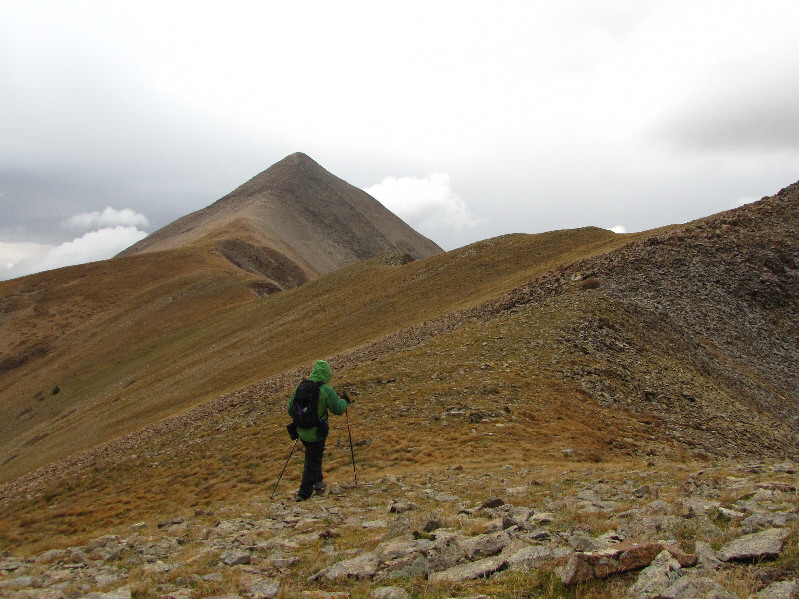
A lone hiker walks along the ridge toward Mount Tukuhnikivatz. |
|
|
The ascent gully is steep and narrow. |
|
|
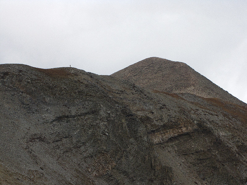
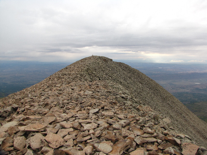
The summit of Mount Peale comes into view. |
|
|
Sonny pushes up the final slope to the summit. |
|
|
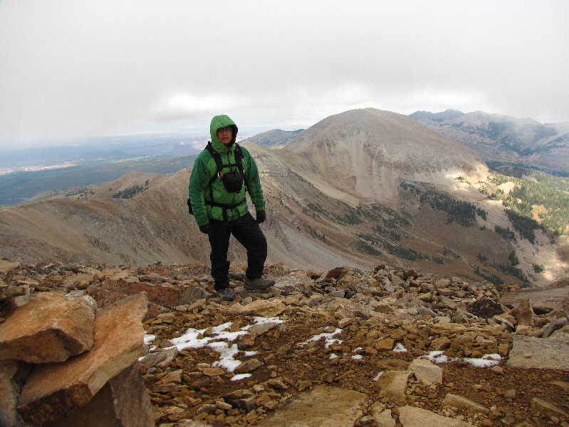
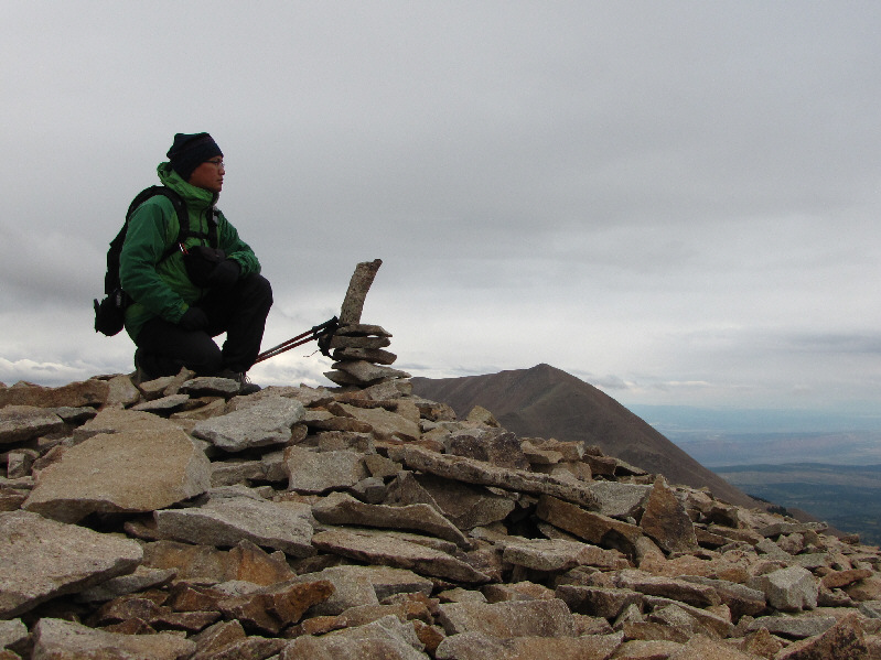
Sonny stands on the windy 3873-metre summit of Mount Peale. Behind him is Mount Mellenthin. |
|
|
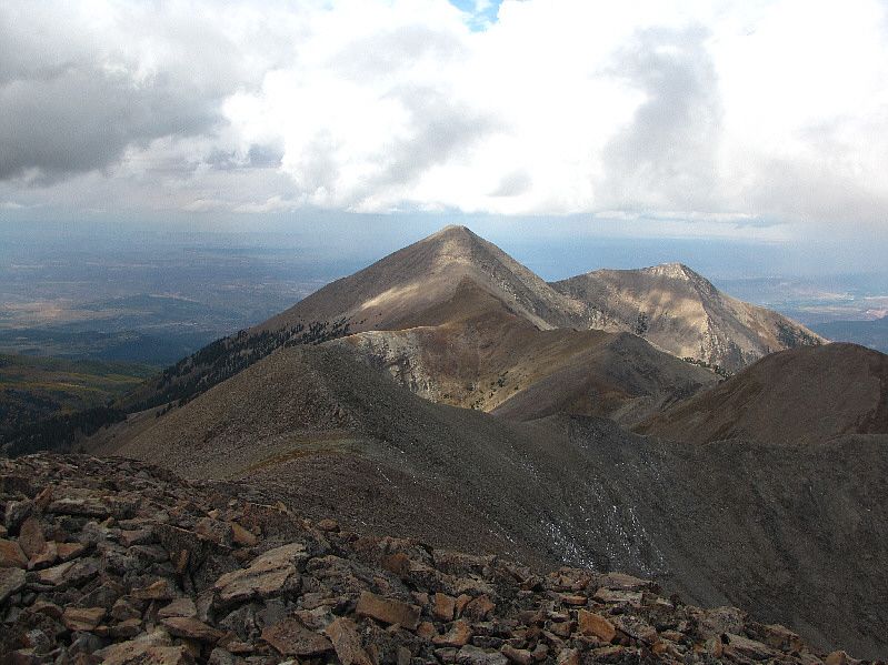
Mount Tukuhnikivatz sits to the west. To its right is Little Tuk (unofficial), and in shadow at far right is Talking Mountain. |
|
|
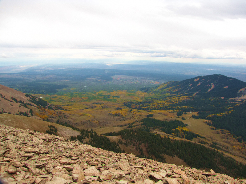
The peak to the southwest is appropriately called South Mountain as it is at the south end of the La Sal Range. La Sal Pass is also visible at right. |
|
|
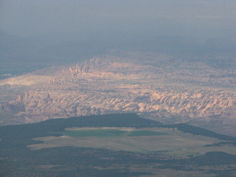
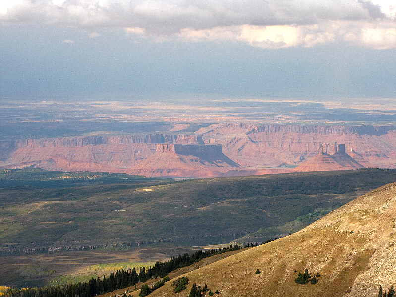
Some of the "slickrock" formations near Moab are visible to the northwest. |
|
|
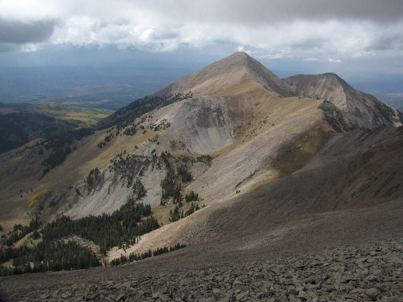
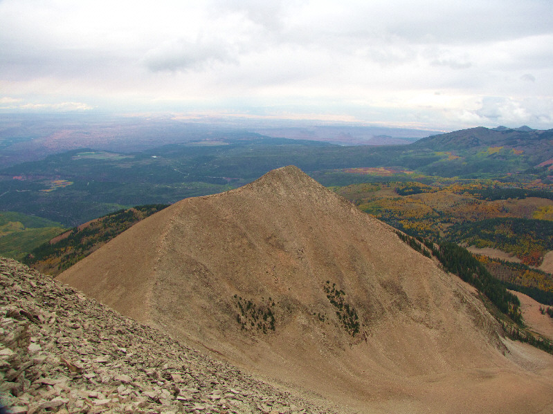
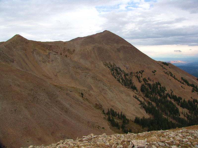
Here is another look at Mount Tukuhnikivatz from near the top of Mount Peale's ascent gully. |
|
|
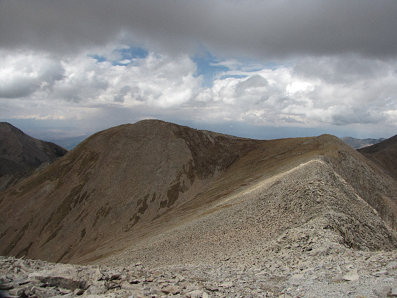
Talking Mountain (3728 metres) is the high point of the connecting ridge between Mount Peale and Mount Tukuhnikivatz. |
|
|
Some of the interesting rock formations near the village of Castle Valley are visible to the northwest from Talking Mountain. At centre is Parriott Mesa, and on the right are Castle Rock (also known as Castleton Tower) and Priest and Nuns. |
|
|
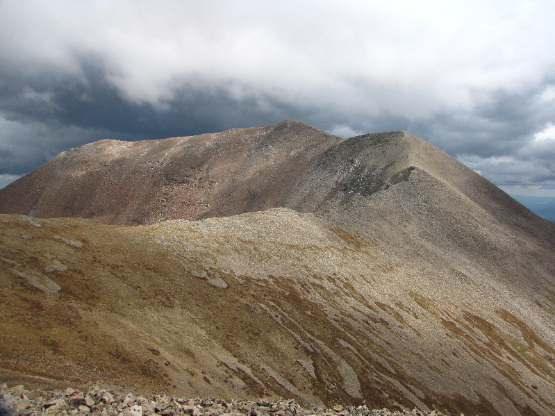
This is the view of Mount Peale from the summit of Talking Mountain. |
|
|
This is the view of Mount Tukuhnikivatz from the summit of Talking Mountain. |
|
|
This is looking back up at the Razor Fang from below. |
|
|
Sonny continues along the connecting ridge to Mount Tukuhnikivatz. |
|
|
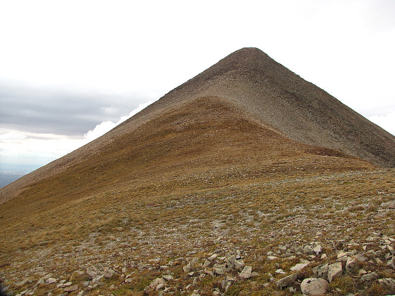
The east ridge of Mount Tukuhnikivatz looks deceptively short. |
|
|
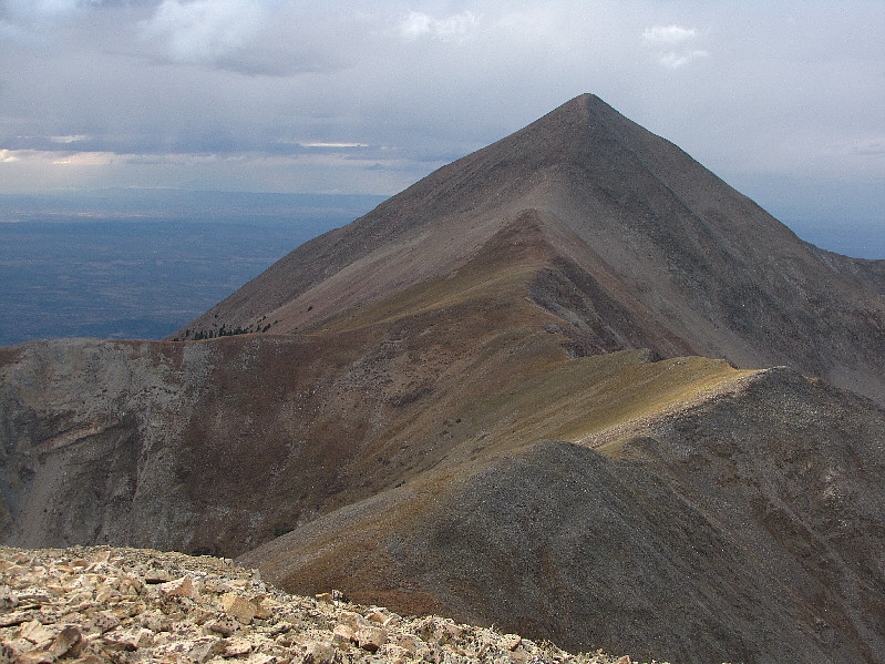
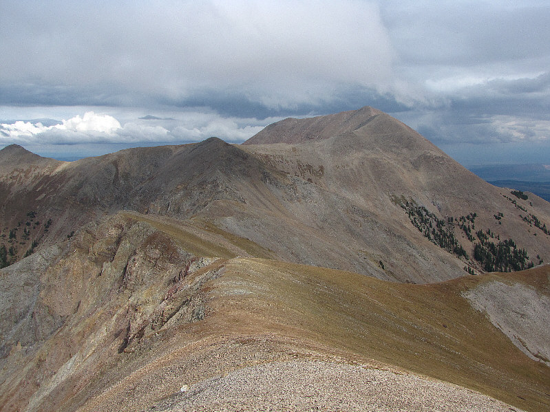
From partway up the east ridge of Mount Tukuhnikivatz, this is looking back along the connecting ridge all the way to Mount Peale. The dark bump just left of centre is Talking Mountain. |
|
|
This is looking west from the true summit (3799 metres) of Mount Tukuhnikivatz. The cairned summit in the distance is only slightly lower. |
|
|
Sonny kneels at the cairned summit (3798 metres) on Mount Tukuhnikivatz. Mount Peale can be seen in the distance. |
|
|
La Sal Pass is visible to the southeast. |
|
|
To the northwest is Little Tuk. |
|
|
The rest of the La Sal Range stretch away to the northeast. All names are official. |
|
|
Here is one last look at Talking Mountain (far left) and Mount Peale from the southeast-trending grassy ridge. |
|
|
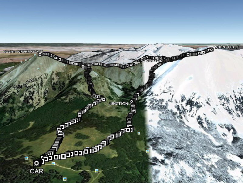
This is the route as viewed in Google Earth. |
|
|
Total Distance: 11.3 kilometres Round-Trip Time: 6 hours 51 minutes Total Elevation Gain: 1284 metres |