BOU AVENUE
Mount Elbert
On 8 June 2011, Kelly Bou and I hiked to the top of Mount Elbert, the highest peak in the Rocky Mountains of North America.  Arriving the day before in Leadville, Colorado, I was dismayed by how much snow was still on the mountain, and at one point, I even considered abandoning the climb.  After some further research on 14ers.com and studying the mountain more closely, I gauged that the northeast ridge was probably dry enough to climb although I still had concerns about the snow pack below tree line.  In any case, I felt that, considering how far we had traveled to get to the mountain, we were obliged to at least give it a try.  The next morning, we ate a quick breakfast in our motel room before driving to the North Mount Elbert Trailhead.  Our hike started out well, and we had no problems until about half a kilometre from tree line where the trail disappeared in deep snow.  Some shadier sections were still supportive enough to walk on, but more often than not, we were sinking and floundering in the snow.  After about 45 minutes of very frustrating postholing, we finally broke out of the trees and snow and regained the trail much to our relief.  Our travails were far from over though.  As we continued upwards, Kelly and I both began noticing how we seemed to be taking longer than usual to catch our breaths.  The thin air at that altitude (about 60% as much oxygen as at sea level) had a marked impact on our bodies, and consequently, we slowed our pace and made a conscious effort to regulate our breathing in order to control our heart rates.  The hike up the foreshortened northeast ridge, though technically easy, seemed to drag out considerably.  By the time we staggered onto the summit, we were hardly in a celebratory mood as Kelly had developed quite a headache while I had hints of one.  A couple of guys who came up the east ridge (the other standard route) helped snap a summit photo for us, and we returned the favour.  None of us lingered for long because of an uncomfortable blustery wind.  Except for Kelly bruising her shin while plunge-stepping a snow slope, our descent down the same route was generally uneventful.  The postholing below tree line was not as bad going downhill, and once we cleared the last snow patch, we easily cruised back to the trailhead.  Stopping for dinner later on at a Nepalese restaurant in the town of Silvethorne helped to clear our heads a bit, and we eventually checked into a nice hotel in Denver to close out the day.
It doesn't look like much, but the distances are deceiving. 
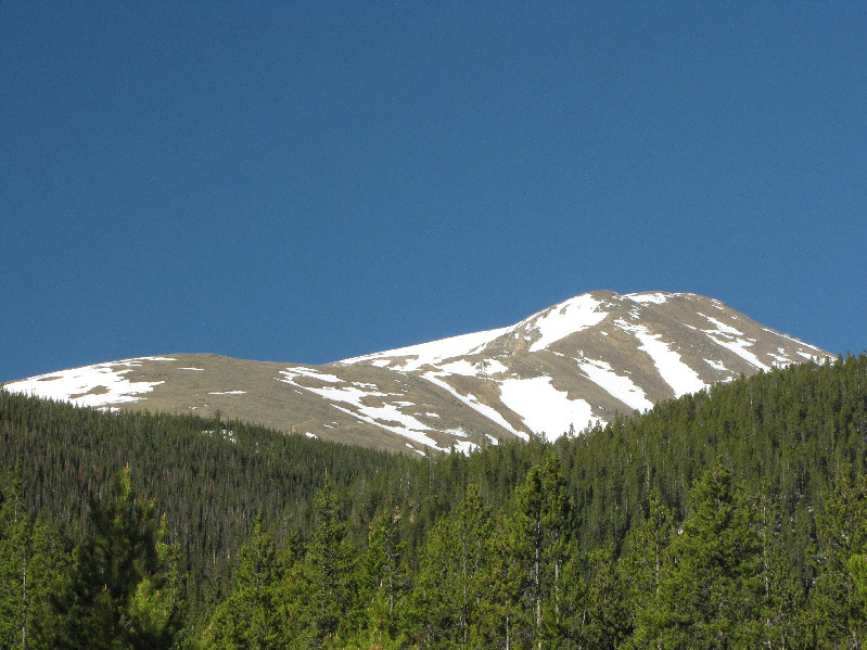
This is the view of Mount Elbert from the north trailhead.
We're already at an elevation of 3200 metres here! 
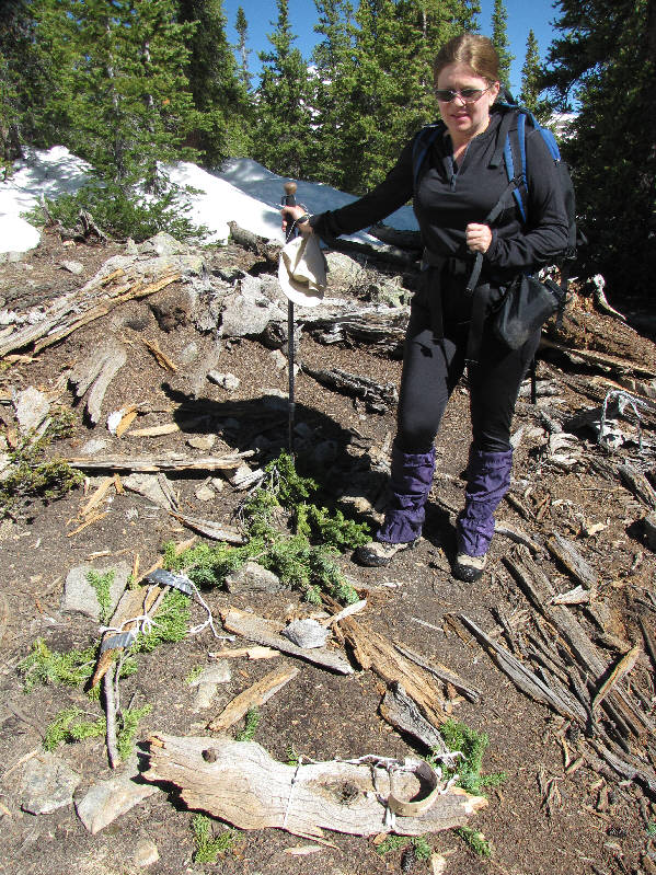
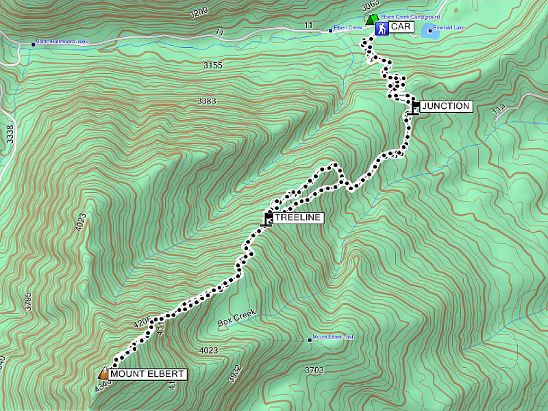
Kelly reaches the turnoff to Mount Elbert.
We should have maybe picked these up to use them! Kelly notices a couple of makeshift snowshoes someone had cobbled together using tree bark, string, and duct tape.
Some misery coming up! Kelly approaches the start of the deep snow.
Only 800 metres of climbing left from here...sigh. Kelly regains the trail at tree line.
The left skyline ridge is the other standard route from the south. 
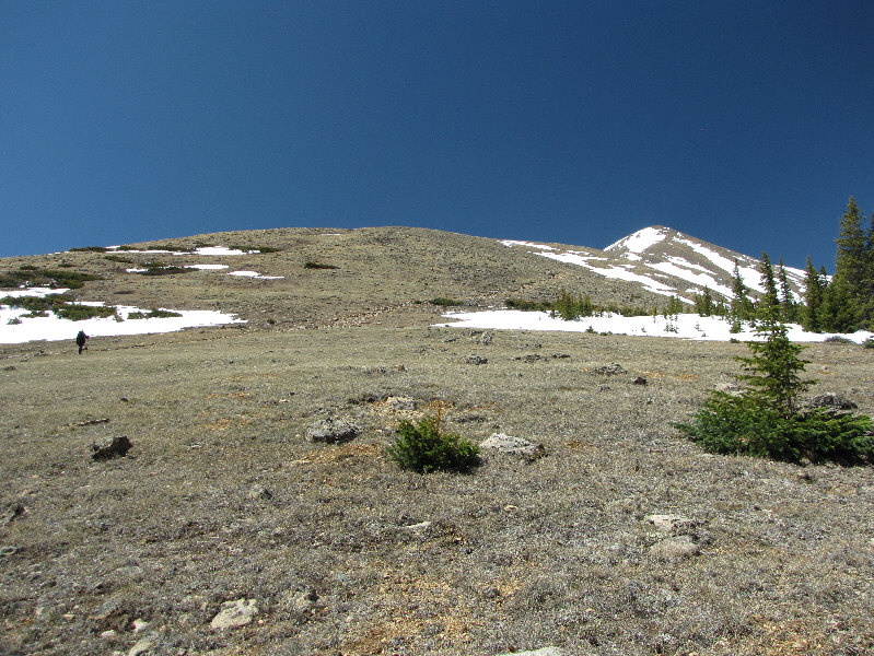
The trail goes up the steep slope on the right.  The summit is not yet visible from here.
Mount Massive is shorter than Mount Elbert by a mere 12 feet. 
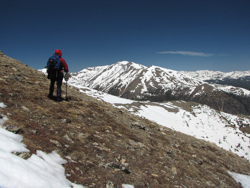
Kelly pauses to catch her breath and admire the view of Mount Massive to the north.
Man, this is getting boring...pant, pant, pant... 
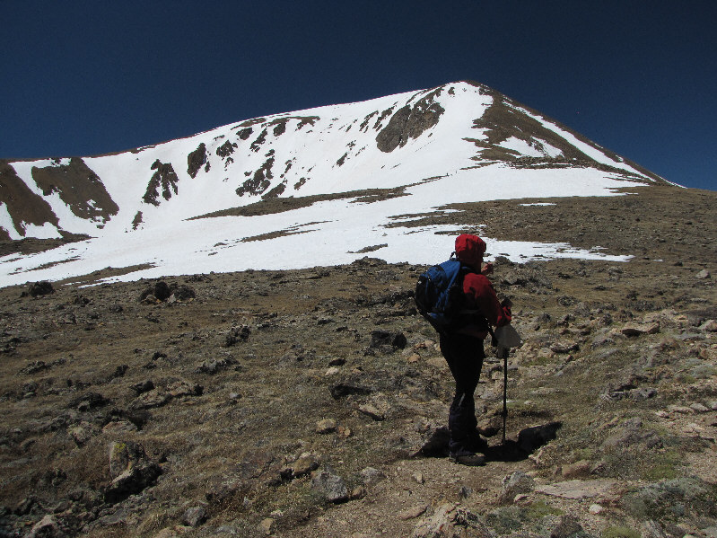
Sadly, the summit is still not visible from here.
It's probably too faint to see in this photo, but on the far horizon at left is Pikes Peak. 
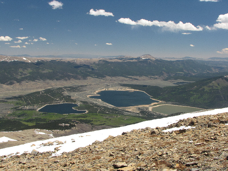
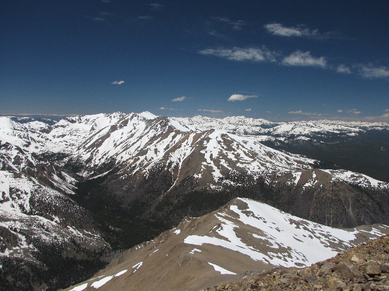
The bodies of water from left to right are Mount Elbert Forebay, Twin Lakes, and Upper Lake.  Right of centre in the distance is West Buffalo Peak.
She was a trooper! 
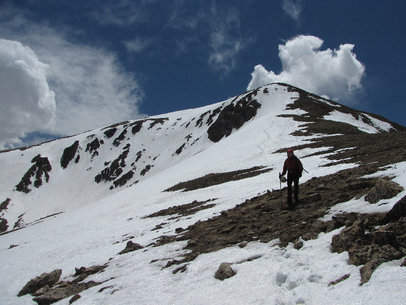
Kelly keeps plodding up the ridge.
How can we possibly climb any higher?? 
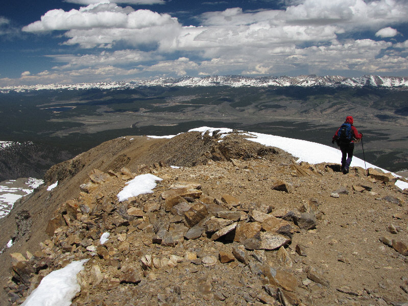
The end is near, but technically, the summit is still not visible from here!
Despite our headaches, we actually look like we enjoyed our 5.5-hour ascent! At long last, Sonny and Kelly stand together on the summit of Mount Elbert (4403 metres).
La Plata Peak is the 4th highest mountain in the Sawatch Range. 
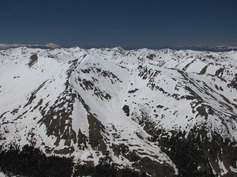
Looking south, La Plata Peak at right is another '14er'.
French Mountain is short of being a '14er' by about 60 feet. French Mountain (foreground) lies to the west.  The striking peak on the horizon at far left is Mount Sopris.
About.com mentions that in the 1970's, there apparently were some people who unsucessfully tried to build up enough rocks on top of Mount Massive so that it would surpass Mount Elbert in height! Mount Massive dominates the view to the north.
Our descent would take about 3 hours. Kelly leaves the summit to begin the long descent.  The town of Leadville is visible just left of distant centre.  Turquoise Lake is also visible at far left.
Unfortunately, the snow was too soft and shallow for glissading. Kelly skirts in and out of the snow slope on the way down.
These look a bit different than the usual ones I see in the Canadian Rockies. 
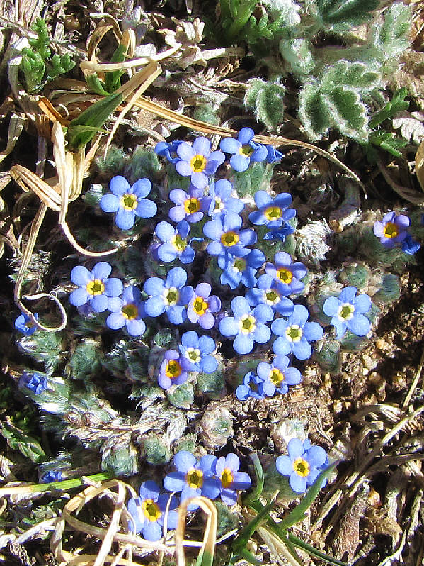
Alpine forget-me-nots are always a cheerful sight in the mountains


Beautiful.

Here is a last look at Mount Elbert from Halfmoon Road.


Time to start planning for Mount Whitney... Total Distance:  15.3 kilometres
Round-Trip Time:  8 hours 56 minutes
Net Elevation Gain:  1337 metres

GPX Data