


Total Distance: approx. 12 kilometres
Round-Trip Time: 10 hours 37 minutes
Net Elevation Gain: 1432 metres
Upon clearing the last trees, I was a little shocked to find some seemingly impassable cliff bands guarding the upper ridge. Closer inspection revealed a couple of breaches, and I was soon atop the cliff bands getting my first look at Mount Sinclairs summit block. My work was not yet done though as I proceeded to scramble over and around several tricky gendarmes (crux) before grinding up an interminable scree slope. My energy flagged considerably on this last slope likely because of a lack of conditioning as well as a lack of sustenance. For some inexplicable reason, I had neglected to bring an energy drink (I had some Tang, but it is a poor substitute for Gatorade), and although I had brought a lunch, the warm weather that day killed all my appetite. Despite developing leg cramps, I persevered and finally dragged myself onto the summit. Following a half-hour stay on top, I began descending but paused shortly after when my cel phone began ringing! With my phone buried in my pack, I was not able to answer the call, but a friend left a voicemail asking if I was interested in golfing the next day. Hoping to avoid expensive roaming charges, I impulsively sent him a text message saying that I would play. Only when I resumed my descent did I begin to wonder if I would even be able to stand up straight the next day let alone play golf.
I made fairly good progress retracing my steps back over the gendarmes and down the upper ridge, but bushwhacking through the forest became more problematic as the sun disappeared behind the horizon. In my haste to lose elevation, I had more than one nasty spill in the growing darkness. To make matters worse, my GPS was becoming unreliable because of weaker satellite signals in the forest. Hearing rushing water at one point, I momentarily thought that I may have overshot the main trail and descended right to Kimpton Creek. I quickly dismissed this possibility, but nevertheless, my GPS indicated that I was too far to skier's left of the side creek. I started thrashing my way to the right and even picked up a decent game trail which I followed for some distance. Suddenly, I slipped a few metres down a steep embankment and lost one of my hiking poles. As I collected myself on the steep slope, I could not tell if my missing pole was above or below me. I dug out my headlamp but was dismayed to find that my batteries were dead. Luckily, I had a keychain LED as a backup light, and I quickly spotted my missing pole just above me. What really worried me was when I pointed the light downwards only to see a black abyss. Then I remembered some of the cliff bands I had seen on the uphill side of the trail on the way in and realized that I had inadvertently stumbled upon them in the dark. I knew the main trail was not far below me, but as tempting as it was to slip down the cliffs, I could not risk the possibility of breaking an ankle or worse.As I stood there contemplating all this,
the ground beneath my feet began to crumble, and I instinctively dug my
hands into the dirt of the embankment and scrambled desperately back up
to the game trail from which I had slipped. Safely back on the game
trail, I sat down and allowed my GPS to slowly acquire a more reliable
signal. The GPS eventually indicated that I was indeed above and
close to the main trail, but it also showed that I was now some 300
metres to skier's right of the side creek. I immediately
backtracked along the game trail, and shortly thereafter, I regained the
distinct trail on the north bank of the side creek. The rushing
water I had heard earlier turned out to be the side creek itself!
Such are the hazards of bushwhacking in the dark. I took a lengthy
break to quench my thirst and collect myself before starting back along
the main trail. Even this last leg of the trip was not without its
share of misery as I took another head-over-heel tumble and struggled to
maintain my balance for much of the hike out. Thankfully, my drive
home late at night was without incident. I even golfed the
following day, but that is an epic tale for another day.
|
|
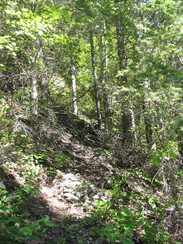
This is the turnoff from the Kimpton Creek trail. |
|
|
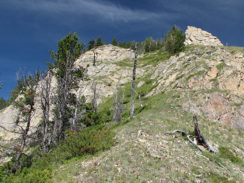
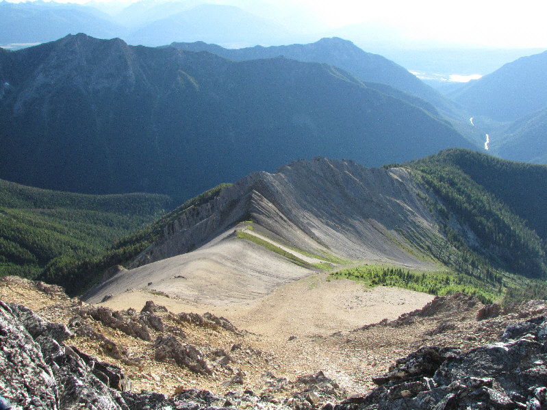
These cliff bands along the ridge offer some respite from the bushwhacking. |
|
|
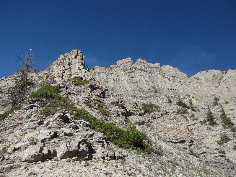
The terrain above treeline is surprisingly complex. It is feasible to climb up and around either side of the striking pinnacle at left. |
|
|
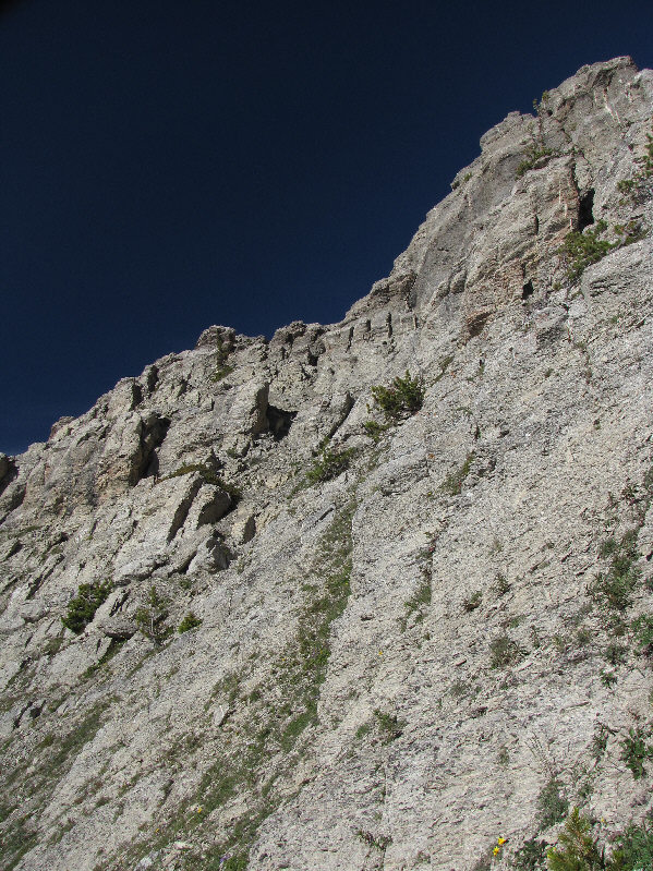
This is the terrain to climber's left of the aforementioned pinnacle. |
|
|
Sonny begins to climb up a short chimney. |
|
|
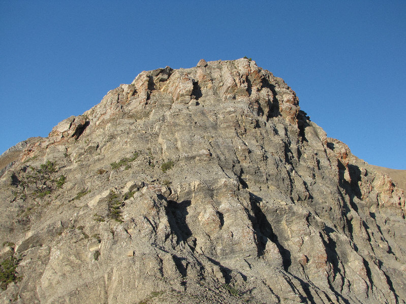
This is the first clear view of Mount Sinclair's summit block. Note the antenna and building on the summit ridge. |
|
|
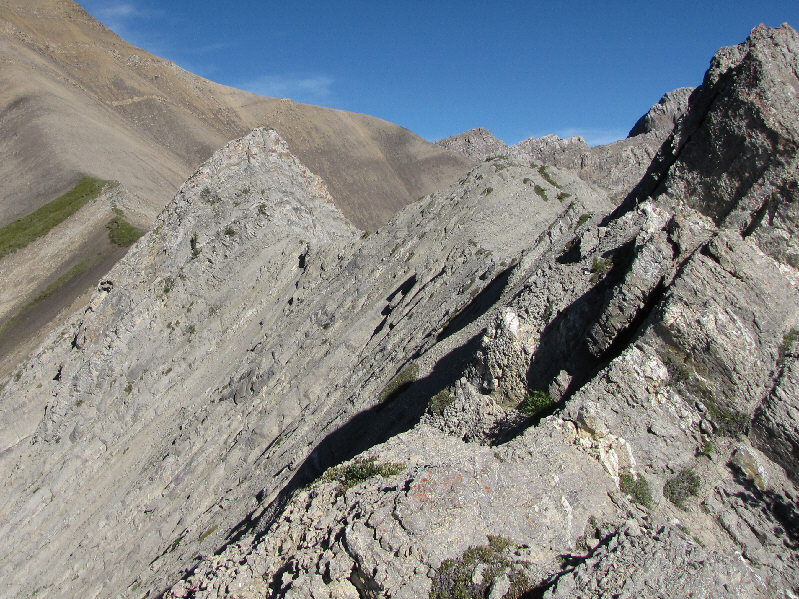
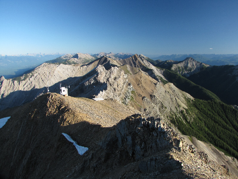
There are still a few obstacles on the ridge to overcome. In particular, getting by the shadowy block at upper right requires an exposed and awkward traverse while the pyramidal cone at left entails some moderate to difficult scrambling. |
|
|
Here is a closer look at the antenna and building. A helicopter platform is also visible at right. |
|
|
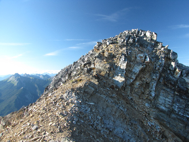
These are the last few metres before the summit. |
|
|
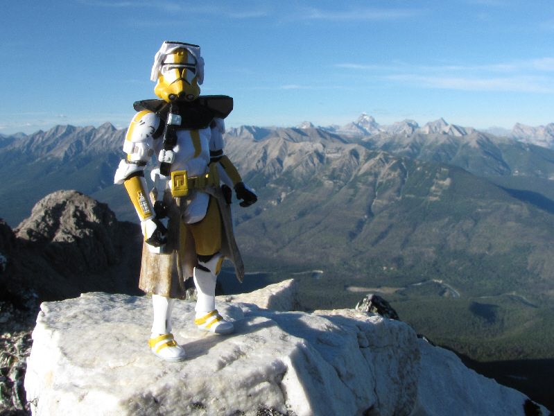
Sonny stands on the 2659-metre summit of Mount Sinclair. |
|
|
This is looking back down the west ridge. |
|
|
Here is the view north into the Kootenay River valley. |
|
|
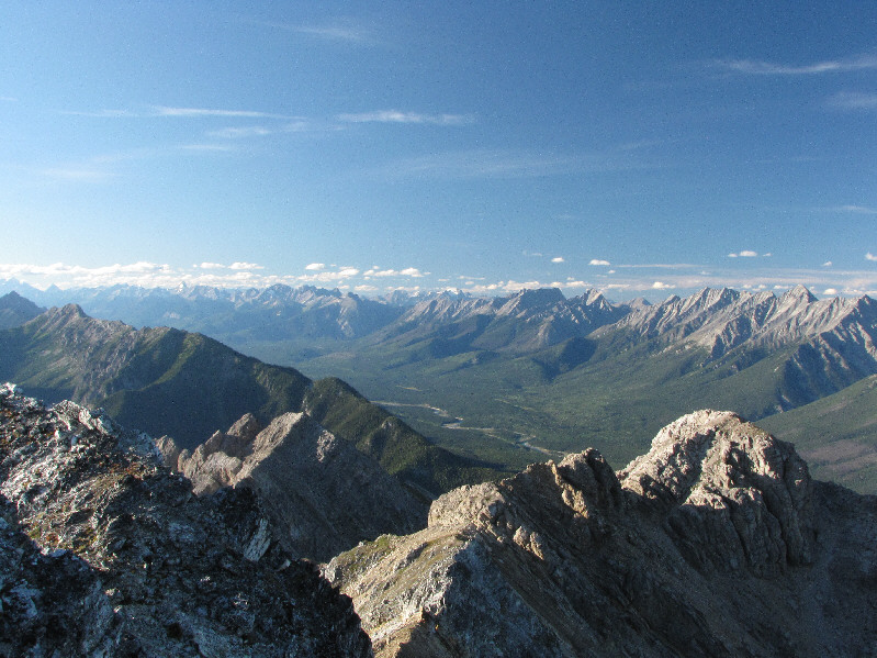
Mount Assiniboine, Aye Mountain, and Eon Mountain attract all the attention to the northeast. |
|
|
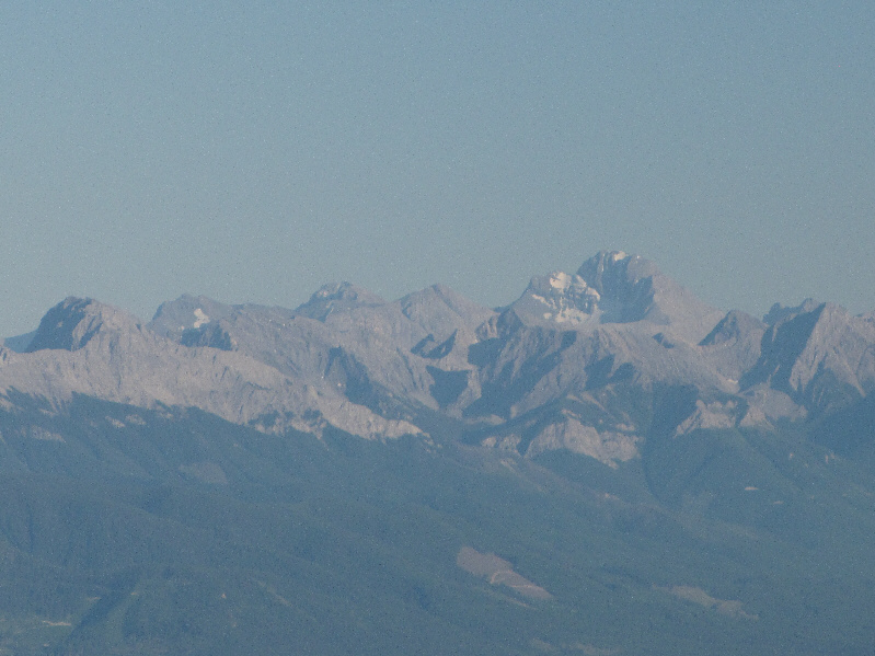
Here is a closer look at Mount Assiniboine. Also visible are Mount Sturdee and Lunette Peak. |
|
|
Some of the more prominent peaks on the eastern horizon include Mount Sir Douglas (far left), the Royal Group (right), and Mount Joffre (far right). |
|
|
Over 80 kilometres away to the southeast is Mount Harrison. |
|
|
The Stanford Range stretches away to the south. |
|
|
Here is a closer look at the aforementioned pyramidal cone along the west ridge. |
|
|
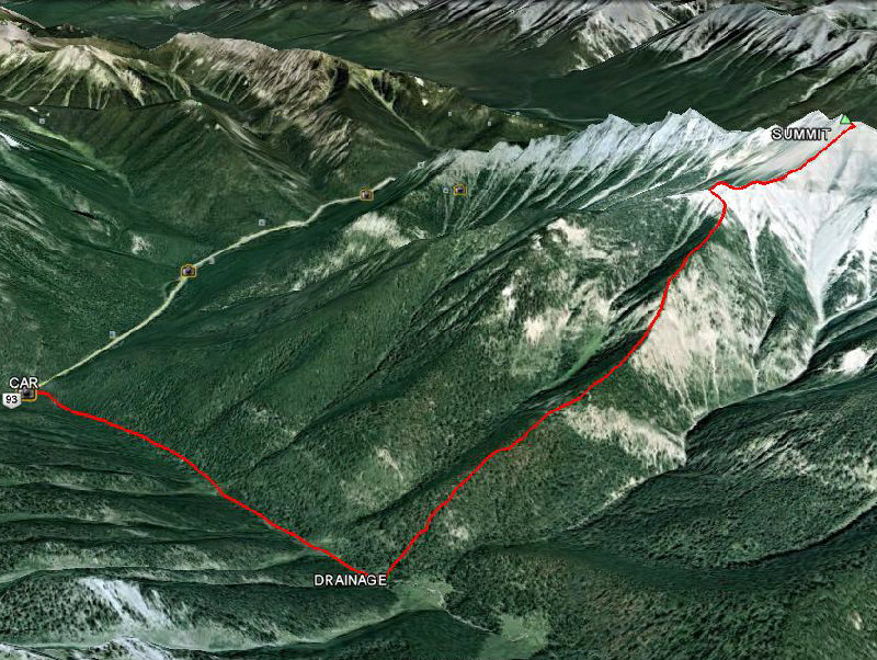
This is the route as viewed in Google Earth. |
|
|
Total Distance: approx. 12 kilometres |