BOU AVENUE
Wheeler Peak (New Mexico)
My plan to climb several peaks during my week-long visit to New Mexico fell disappointingly short due to some unforeseen circumstances--withering hot weather, forest closure due to extreme fire hazard, and smoky air from Arizona wildfires.  As such, I was highly motivated to tag New Mexico's high point, Wheeler Peak, on 6 June 2011 before heading north into Colorado later that day.  Kelly Bou and I arrived at Taos Ski Valley early that morning, and we began our trek from the Bull-of-the-Woods trailhead (signed with restroom).  One of two popular routes for Wheeler Peak as described in Summitpost.com, the Bull-of-the-Woods trail is longer and entails more elevation gain than the Williams Lake route, but it is also a gentler ascent and is much more scenic.  We had no issues until we reached tree line where the trail was partially obscured by some snow patches.  Fortunately, we were able to skirt around or even walk atop the snow patches and pick up the trail further on.  After weaving around the top of Fraser Mountain, the trail drops briefly into forest before climbing back up into La Cal Basin.  Because there was still a lot of snow in the forest, we took a short cut and hiked cross-country into the basin in order to save some elevation loss and possibly a lot of postholing.  Once we regained the trail, we still had a lot of climbing ahead of us, but the rest of the ascent was pretty straightforward.  Along the way, we were thoroughly entertained by a herd of sheep and numerous marmots that populate the area.  More animal encounters would follow.  Soon after we arrived at the summit, Kelly and I were swarmed by a family of golden-mantled ground squirrels who were obviously accustomed to entertaining human visitors.  The bold and persistent critters were literally all over us, and they did not stop pestering us until we finally left the summit.

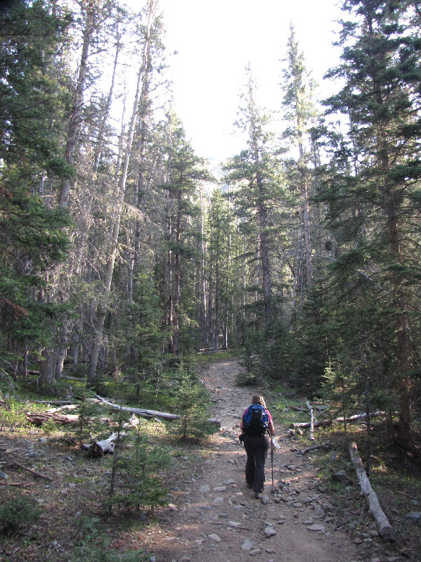
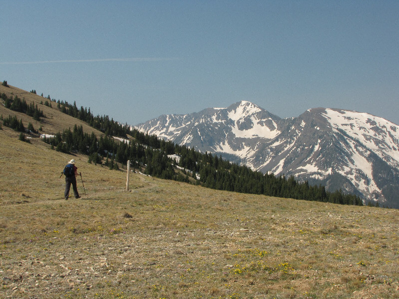
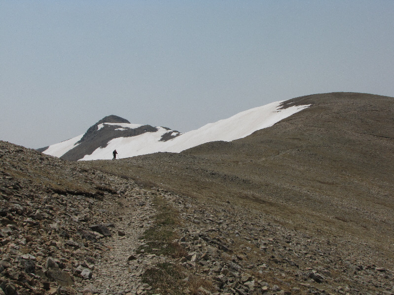
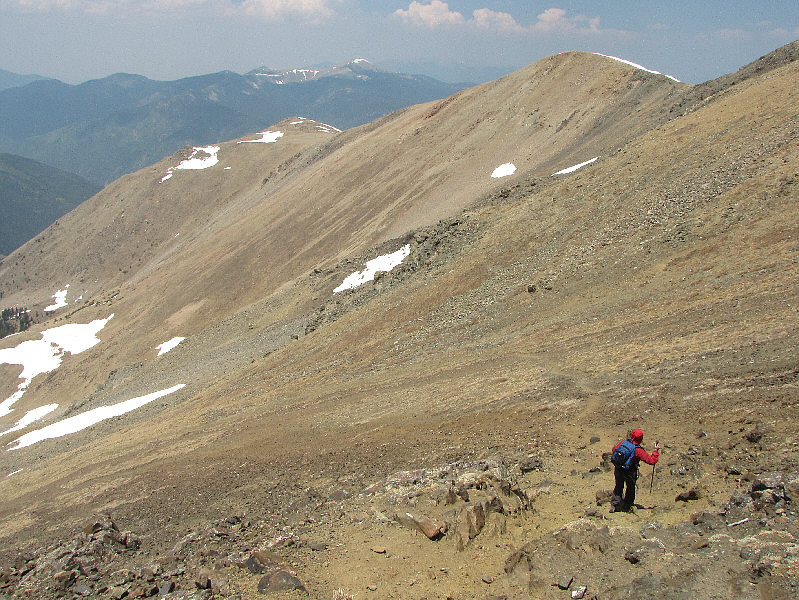
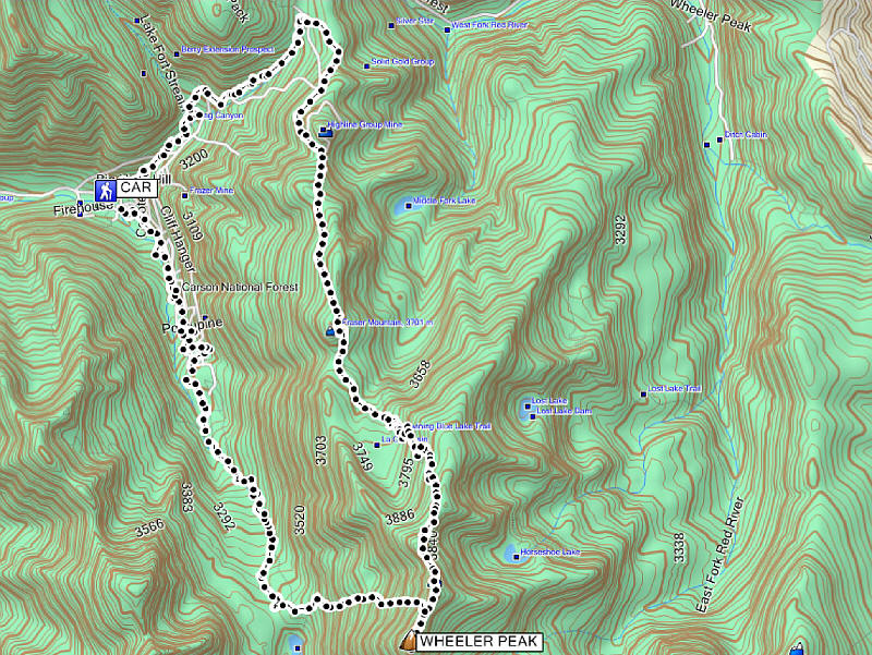
For our return trip, we chose to 
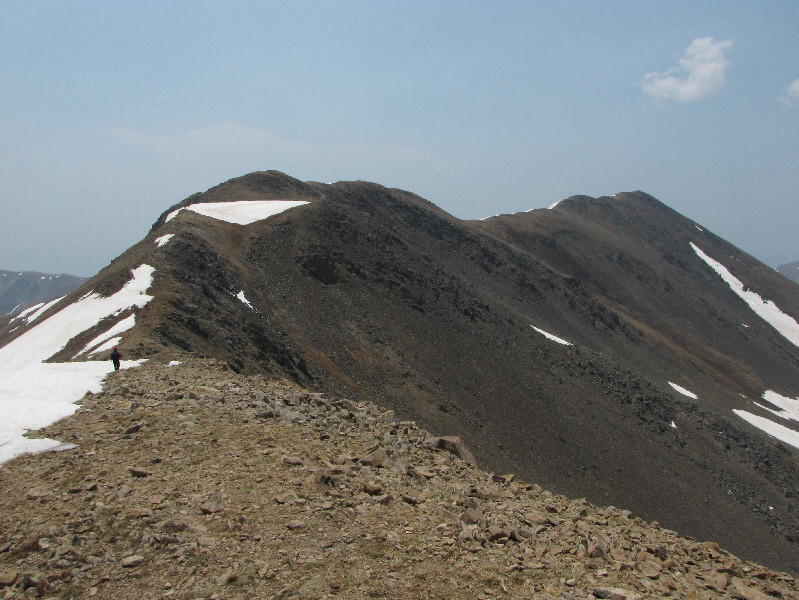
descend the Williams Lake route which loses 500 metres of elevation over 
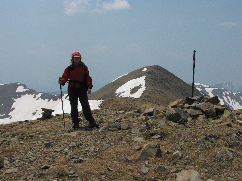
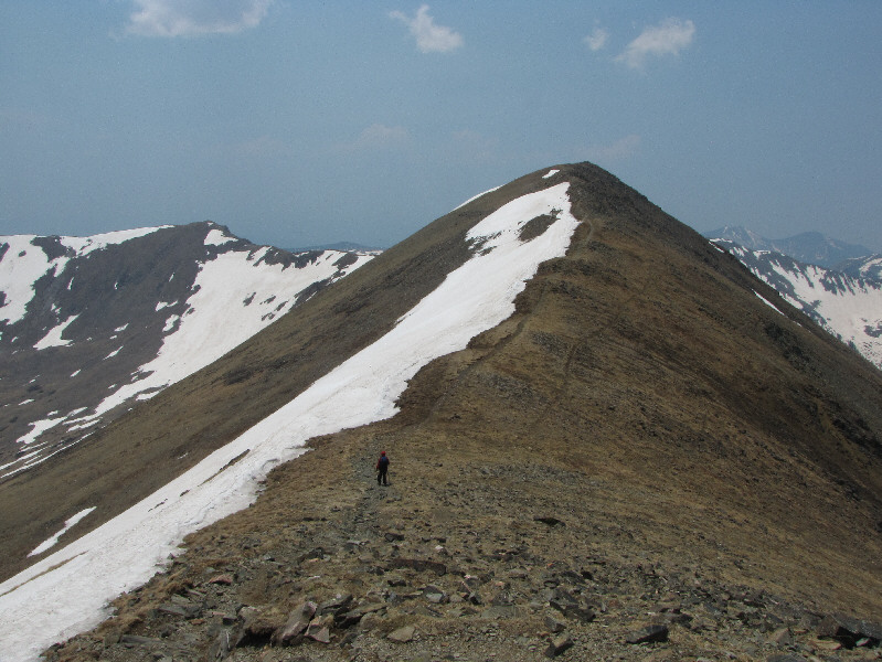
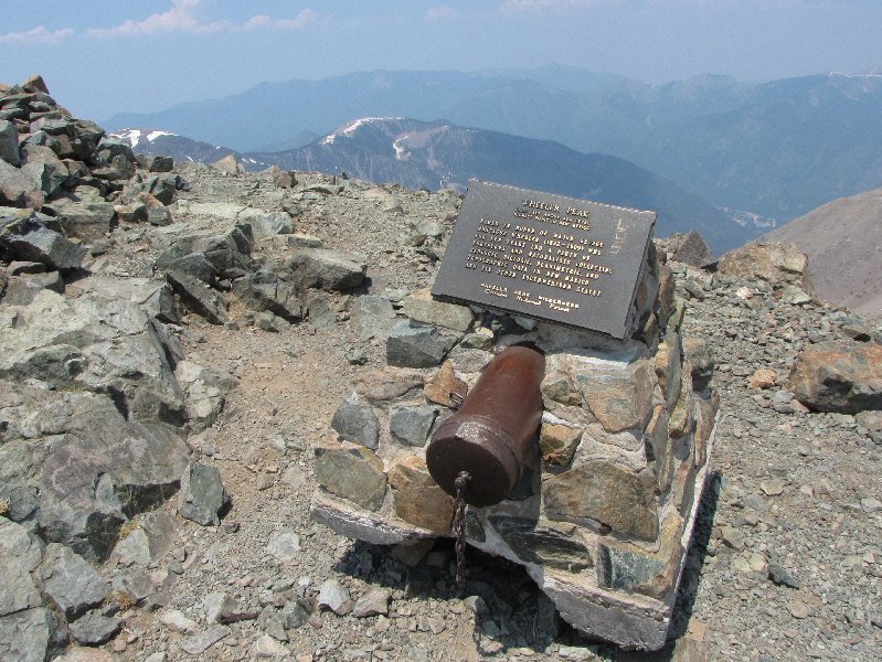
a distance of 1 kilometre from the summit ridge down Wheeler Peak`s northwest 
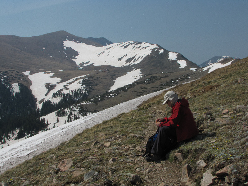
face.  Partway down, we ran into a fellow from Alabama who was sweating profusely as he laboured up the same route we were descending.  I chatted with him briefly and wished him well, but in retrospect, I would not climb up Wheeler Peak this way.  Further down the face, 
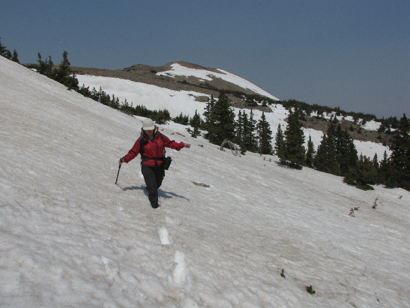
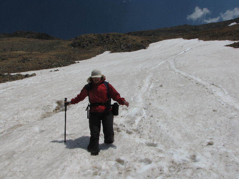
Kelly and I had some fun glissading several long snow-filled gullies, and 
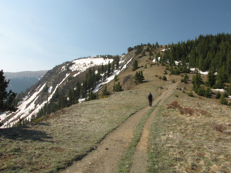
in seemingly no time, we were off the face and into the trees below.  Unfortunately, there was still a lot of deep snow in the trees, and although others, including the guy from Alabama, had previously broken trail through the snow, we still found it tedious to hike through.  Once we cleared the last snow patch, we were able to pick up the pace on the trail, but when we reached the Williams Lake trailhead, it still took us the better part of an hour to pick our way through a maze of roads and vacation homes to get to the Bull-of-the-Woods trailhead.  Putting our adventures in New Mexico behind us, Kelly and I drove to Alamosa, Colorado and checked into the Days Inn (one of the best motels of our trip) there before getting some Chinese food for dinner.
It's a nice gentle climb--a good way to start the trip! Kelly hikes up the trail in the cool and quiet forest.
We left the trail to hike up the grassy clearing through the trees. Already at an elevation over 3500 metres, Kelly approaches tree line up ahead.
Hmmm...had I known it was named peak, I would have taken the extra 5 minutes or so to tag Bull-of-the-Woods Mountain! Kelly has no problems walking across this large snow patch.  Behind her is Bull-of-the-Woods Mountain (3547 metres), and on the horizon at left is Gold Hill (3874 metres).
The name, "Kachina Peak", doesn't appear on any topo maps I could find. Kelly picks up the trail again further along the ridge.  In the distance are Lake Fork Peak (3926 metres) and unofficially-named Kachina Peak (3804 metres).
Again, had I known that Fraser Mountain was a named peak... Kelly stops for a snack near the summit of Fraser Mountain (3707 metres).  La Cal Basin is visible in the distance as is the summit of Wheeler Peak (dark ridge just left of centre).
We postholed a bit, but overall, the snow was still pretty firm. Going off-trail in La Cal Basin, Kelly traverses another snow patch.
We saw them descend from the ridge we were heading up. A herd of sheep graze in La Cal Basin.
Though we kept to the trail, it was tempting to hike cross-country instead. The trail switchbacks numerous times up this slope toward the skyline ridge.
Though it had an entire hillside to maneuver around, this sheep nearly ran right over me! A straggler hurries to join the herd.
We saw a lot of marmots in La Cal Basin, but this one seemed genuinely curious about us and let us get quite close. A curious marmot pokes its head out of a hole near the trail.
The peak in the distance is a false summit. Kelly finally reaches the crest of the ridge.
Only about 50 metres of elevation gain left from here! The summit of Wheeler Peak is visible again at far right.  At centre is Mount Walter.
After all the desert terrain we had been through, it was nice to see a real lake again. Northeast of Mount Walter, the aptly named Horseshoe Lake is still partially frozen.
Less than 15 minutes to the summit of Wheeler Peak from here! Kelly stands beside the signed cairn on the 3996-metre summit of Mount Walter.  Wheeler Peak is only about two thirds of a kilometre away.
The sign reads 4005m (after conversion), the USGS topo map reads 4003m (also after conversion), and my GPS and TopoUSA read 3996m! Here is a closer look at the inscription on the sign.
The Williams Lake route joins the trail at this saddle from the right. Kelly hikes the last stretch before the summit.
Someone really needs to empty the register container of all the crap that's in there... The inscription on the plaque reads:

"WHEELER PEAK

13,161 FEET ABOVE SEA LEVEL
HIGHEST POINT IN NEW MEXICO

NAMED IN HONOR OF MAJOR GEORGE MONTAGUE WHEELER (1832-1909) WHO FOR TEN YEARS LED A PARTY OF SURVEYORS AND NATURALISTS COLLECTING GEOLOGIC, BIOLOGIC, PLANIMETRIC, AND TOPOGRAPHIC DATA IN NEW MEXICO AND SIX OTHER SOUTHWESTERN STATES

WHEELER PEAK WILDERNESS
CARSON NATIONAL FOREST"

The plaque, the USGS topo map, and my GPS actually all agree on the elevation here! Sonny and Kelly stand on the 4011-metre summit of Wheeler Peak.
It's funny how Old Mike Peak actually looks higher from here... To the southeast are Old Mike Peak (3996m) Simpson Peak (3955).
It would be fun to come back and bag a few more peaks in this wonderful area. Lake Fork Peak dominates the view to the southwest.  Peeking above the ridge at left is Vallecito Mountain (3853 metres).
I made sure it wasn't actually chewing... A golden-mantled ground squirrel licks the salt from Sonny's pack.
The Williams Lake route is looking good for our descent! This is looking back north toward Mount Walter.  Fraser Mountain is also visible at far left as is Gold Hill at extreme left on the horizon.
One of them actually crawled onto Kelly's back a couple of times! The golden-mantled ground squirrel on the right seems to have settled down while the one on the left is still looking for trouble!
Don't you just wanna take one home?? The "settled" one hunkers down in the wind.
Like the ground squirrels, the marmots must know the habits of summit visitors. A marmot coincidentally shows up just as Kelly and Sonny prepare to leave the summit.
This must be a great ski run in the winter. Kelly descends the trail on the Williams Lake route.
Best part of the day! Kelly gets up after glissading down this snow patch.  Click on the photo to see a video (3.6 MB) of Kelly glissading another snow patch.
It doesn't look it, but there's a lot of snow still in the trees. Williams Lake is barely visible behind the trees down in the valley.
My favourite outing on our vacation!

Total Distance:  21.5 kilometres
Round-Trip Time:  9 hours 28 minutes
Total Elevation Gain:  1338 metres

GPX Data