
Right off the bat, I nearly made the mistake of hiking up the Bluerock Creek interpretive trail with its big attractive sign, but a quick check of Daffern's guidebook pointed me in the right direction. Walking to the back of the nearby closed equestrian campground, I found the start of the Sheep River horse trail and followed it to the signed junction with the proper Bluerock Creek trail. The trail was frequently muddy on this day due to recent snowfall, and the significant elevation drop to cross Bluerock Creek was very annoying both on the way in and later on the way out. Despite all this, the trail was more scenic than I had expected which helped to alleviate some of the monotony of the long approach.
Just beyond the last trees, I arrived at the wooden bench and horse rail as described by Daffern. Leaving the trail here, I scrambled up the open ridge to the top of what Daffern calls "Kiska Mnoga Iyarhe (Ram Mountain)". From here, I had a good view of the major cliff band guarding the south ridge. Spirko circumvented this cliff band far to climber's left by losing significant elevation, but in his report, he later learned from Daffern that it is "possible to stay on the ridge and ascend a chimney". I could see an obvious gully to climber's left of the ridge, but for some odd reason, I had it in my head that Daffern's chimney was somewhere out of sight to climber's right. Steep and partially filled with snow, the gully did not look very appealing anyway as I continued up the ridge crest.
Upon reaching the base of the prominent gendarme blocking the ridge, I was dismayed to find nothing but impassable cliffs to climber's right. A quick look up the face of the gendarme quashed any notions to free-climb it, and I briefly considered aborting the trip right there. With nothing to lose, I decided to contour along the base of the cliffs and check out the aforementioned gully. With melting snow complicating matters somewhat, I found a couple of spots in the gully that were awkward to get up, but overall, the route--this is Daffern's chimney--is reasonable for any competent scrambler. After clearing the gully, I climbed up to a cairn that I spotted above me and subsequently regained the ridge.
The remainder of the undulating ridge to the summit is mostly easy
scrambling, but there are still a few tricky sections along the way that
require careful route-finding (all obstacles should be circumvented to
climber's left). Over 6.5 hours after leaving my car, I stepped up
to the summit cairn of Bluerock Mountain, and less than 20 minutes later,
I was retracing my steps back to my car. My return trip was long
but uneventful. I had no problems descending Daffern's chimney and
only needed my headlamp for the final few kilometres of easy trail.
Of greater concern were the numerous cattle wandering on the road on my
drive out in the dark.
|
|
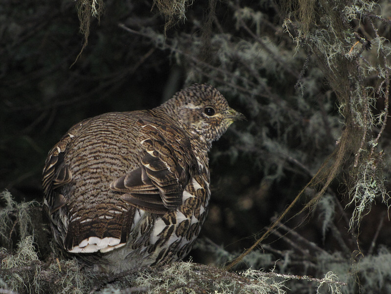
A spruce grouse gets ready to flee from its perch on a tree branch. |
|
|
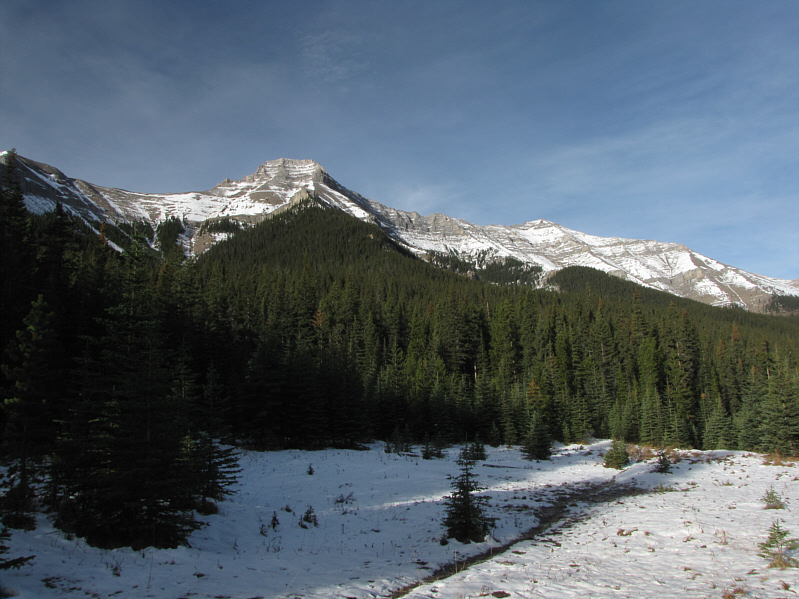
GR565088 (left) and GR555096 (East Peak of Mount Burns) are visible from a small clearing along the trail. |
|
|
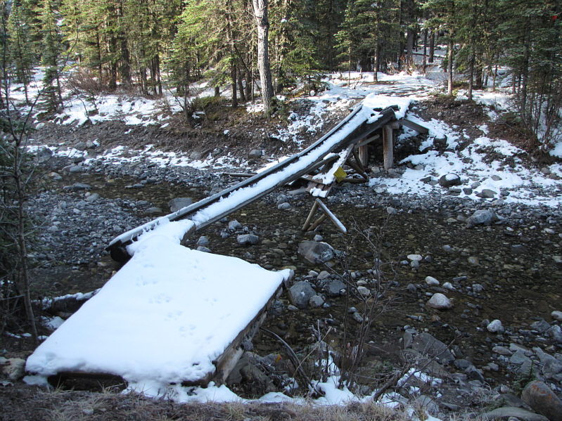
The bridge over Bluerock Creek is in desperate need of repair. |
|
|
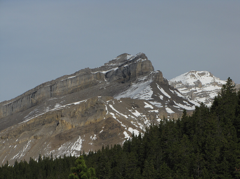
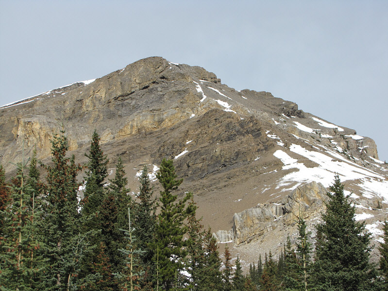
Here is the first clear view of Bluerock Mountain from the trail. The snowy summit is at far right. |
|
|
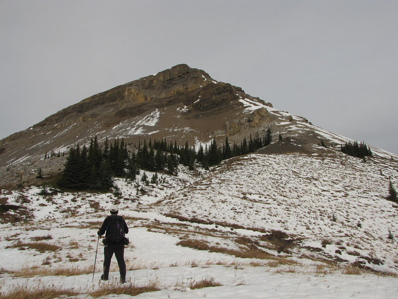
Kiska Mnoga Iyarhe looks a bit daunting at first, but a reasonable route goes up the right-hand slope. |
|
|
Sonny leaves Bluerock Creek trail (visible at bottom right) and begins ascending Kiska Mnoga Iyarhe. |
|
|
Some of the terrain below Kiska Mnoga Iyarhe is loose, but the scrambling is not difficult. |
|
|
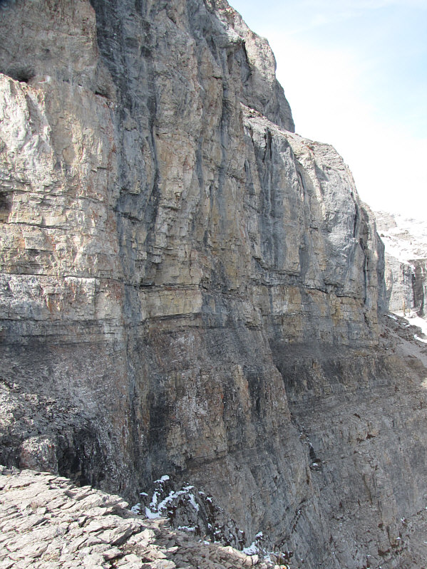
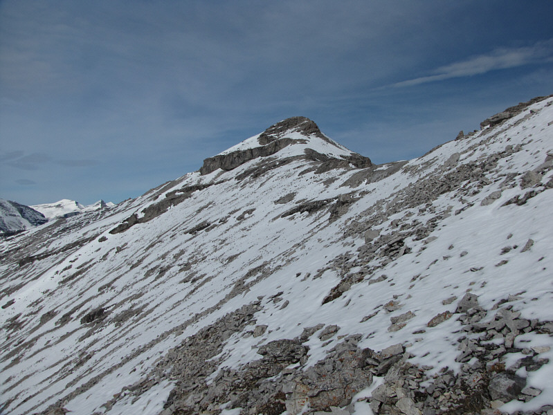
From the top of Kiska Mnoga Iyarhe is this view of the major cliff band guarding the south ridge of Bluerock Mountain. The only visible weakness is a snow-filled gully (crux) a little left of centre. |
|
|
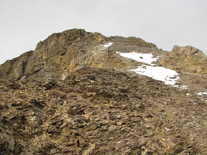
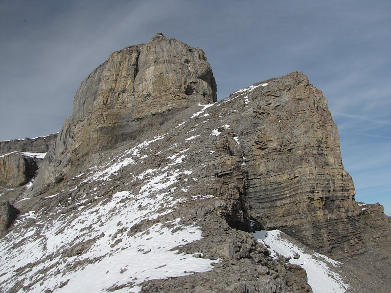
This is just below the prominent gendarme blocking the ridge. The access gully is visible at far left. |
|
|
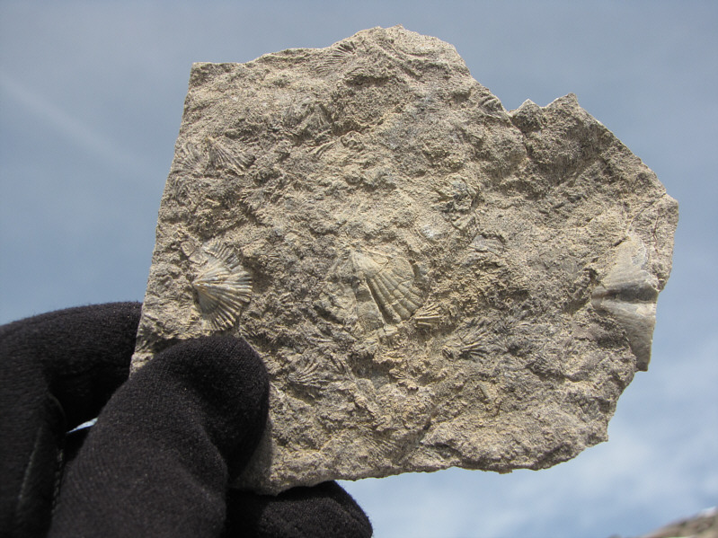
Sonny holds up a rock fragment containing fossils. |
|
|
Here is a closer look at the gendarme. |
|
|
The east side of the gendarme offers no easy access to the ridge above. |
|
|
Mount Burns (left of centre) is the sprawling mountain to the west in this view from above the access gully. |
|
|
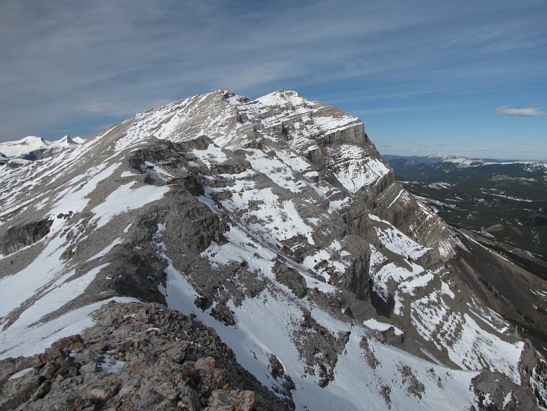
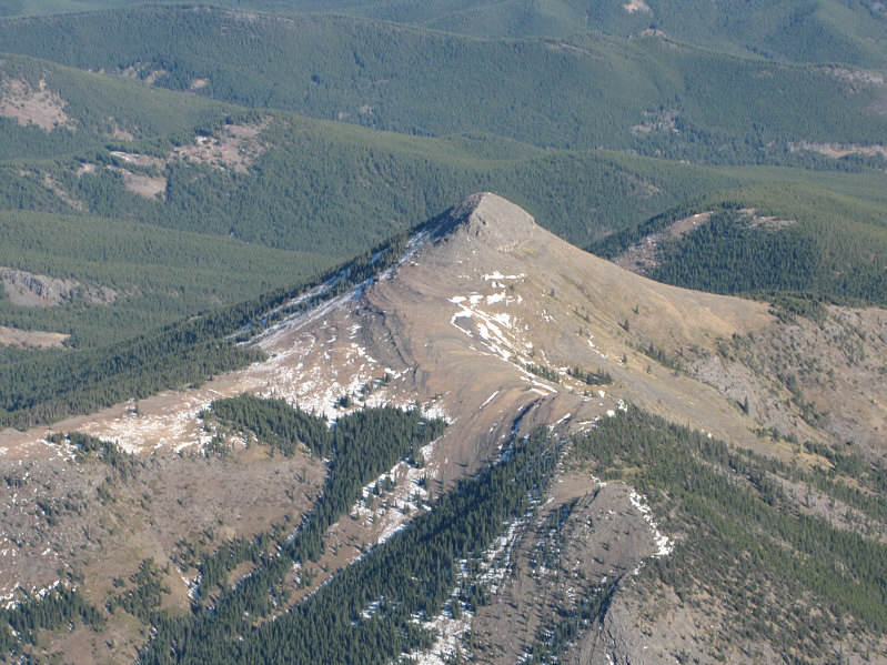
This is one of the many false summits along Bluerock Mountain's south ridge. |
|
|
Bluerock Mountain's true summit is still a considerable distance away. |
|
|
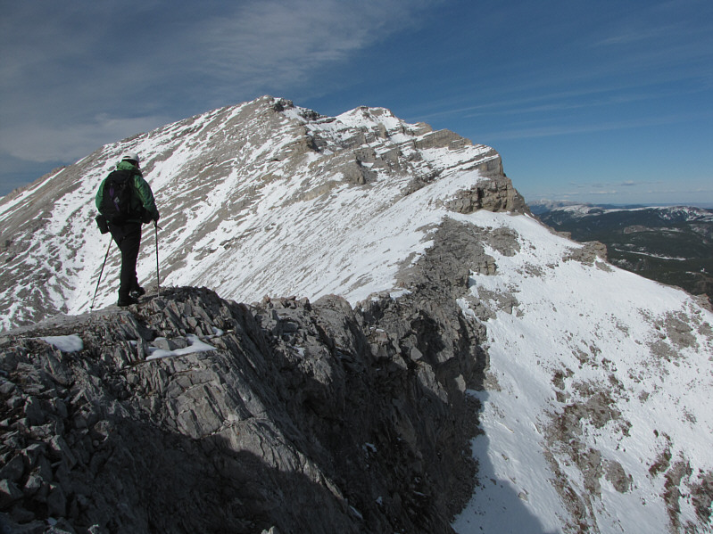
Sonny traverses a narrow section of the ridge. |
|
|
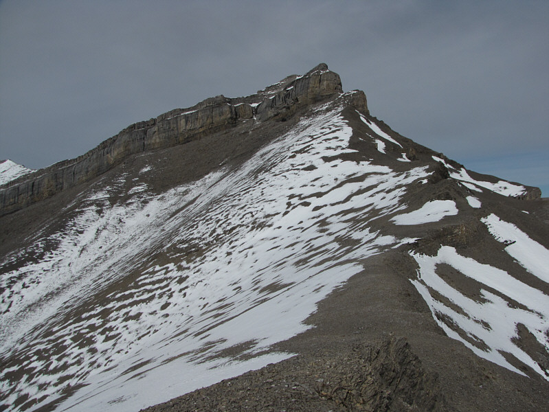
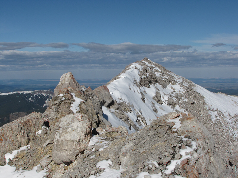
Here is the remainder of the route from the last significant false summit. |
|
|
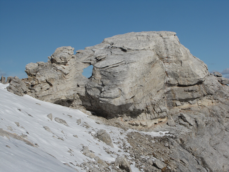
A window can be seen in a rock outcrop not far below the summit. |
|
|
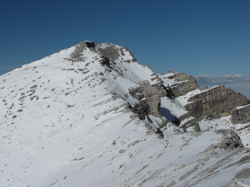
The true summit is within sight. |
|
|
Sonny stands on the 2782-metre summit of Bluerock Mountain. |

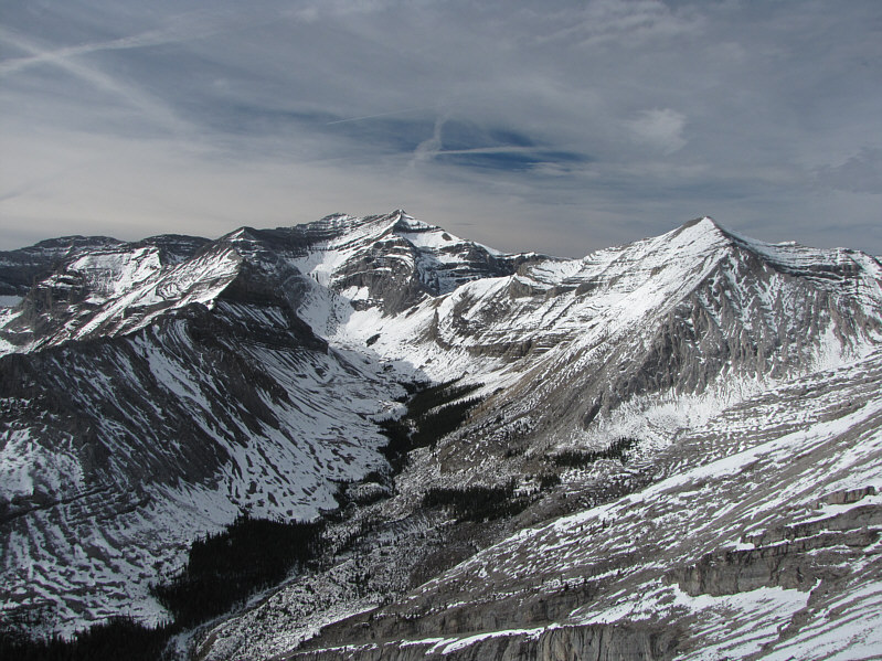
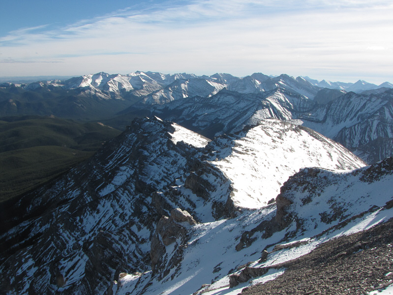
The view to the northwest includes many familiar Kananaskis Country peaks.
 |
Threepoint Mountain sits to the north. |
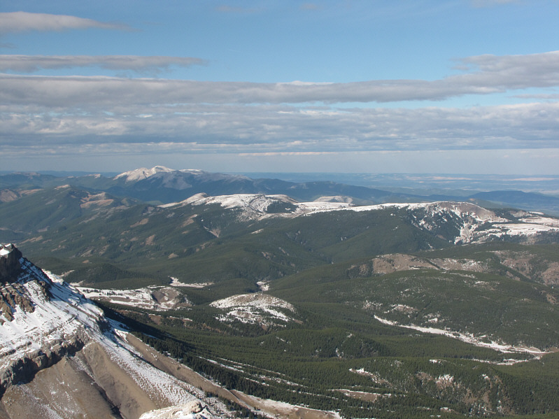 |
The northern view also includes Moose Mountain on the left horizon and the bare plateau of Foregetmenot Ridge and Mountain. |
 |
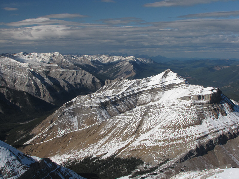
To the east is Mount Ware. |
 |
This is looking back along the south ridge of Bluerock Mountain. |
 |
South of the last significant false summit is this large cave which was documented in Bob Spirko's trip report. |
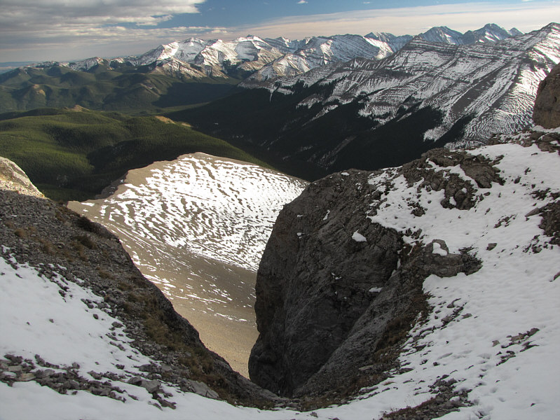 |
This is looking down the access gully from the top. |
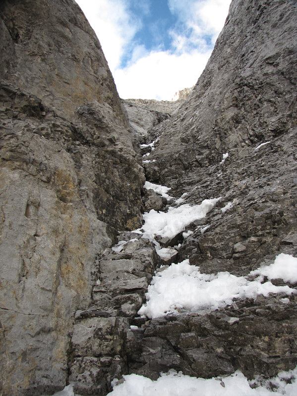 |
This is looking up the access gully from the bottom. |
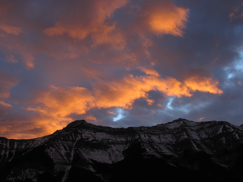 |
The last rays of sunshine for the day illuminate the clouds above GR565088 and GR555096. |
 |
Another beautiful day in the Canadian Rockies draws to a close. |
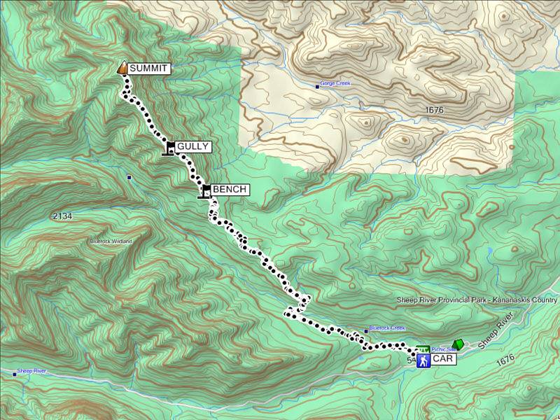 |
Total
Distance: 23.5 kilometres Round-Trip Time: 11 hours 30 minutes Net Elevation Gain: 1187 metres Total Elevation Gain: 1459 metres |