


The southwest outlier of Gunsight Mountain dominates the view to the northeast.


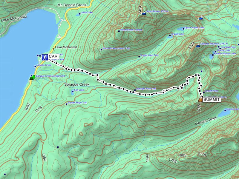
Kelly and I ate a quick breakfast at our campsite on the morning of 1 September 2012 before driving to the trailhead near Lake McDonald Lodge. The trail was already quite busy when we began our hike, and we shared the trail with numerous fellow hikers as well as a string of horses carrying supplies and tourists to Sperry Chalet. Though views were limited for the first several hours, I enjoyed walking through the forest of predominantly cedar and hemlock trees. Besides, we were kept busy trying to side-step all the horse dung on the trail! Toward the head of Sprague Creek valley, the trees began to thin out, and we were finally able to enjoy views of the surrounding peaks and ridges. We even managed to find wild raspberries and huckleberries to eat along the trail which significantly slowed our progress. At one point, a hoary marmot came bounding down the trail as if to greet us like our cats do at home, but at the last second, the marmot veered off the trail and detoured around us before disappearing into the bushes. Beyond Sperry Chalet, we enjoyed dung-free hiking all the way up to Lincoln Pass where we turned right and followed a beaten path without difficulty to the summit of Lincoln Peak.
Given the numerous hikers we encountered on the trail including
several at Lincoln Pass, I was a little surprised that we had the summit
all to ourselves. Regardless, Kelly and I were very pleased with
the far-reaching views granted by this relatively low peak, and despite a
cool breeze, we hung out at the summit for 50 minutes before commencing
our descent. On our way out, we were pleasantly surprised to see a
family of goats--papa, mama, and baby--near the bridge over Sprague
Creek. Like the goats near Logan Pass, these ones had little fear
of people and let us get pretty close to them. Besides one clumsy
spill on my part due to fatigue and inattention, the rest of our return
trip was fairly mundane. We ate pizza at Jammer Joe's Grill and
Pizzeria near the trailhead before returning to our campsite to retire
for the night.
|
|
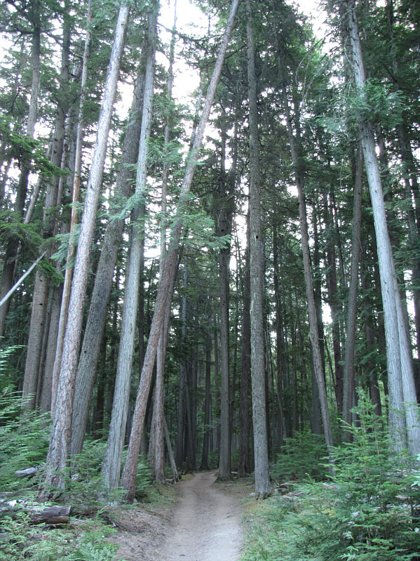
The trail winds its way through forest for the first several kilometres. |
|
|
Kelly stops to take photographs from the bridge over Snyder Creek. Crystal Ford (for horses) is just slightly upstream of the bridge. |
|
|
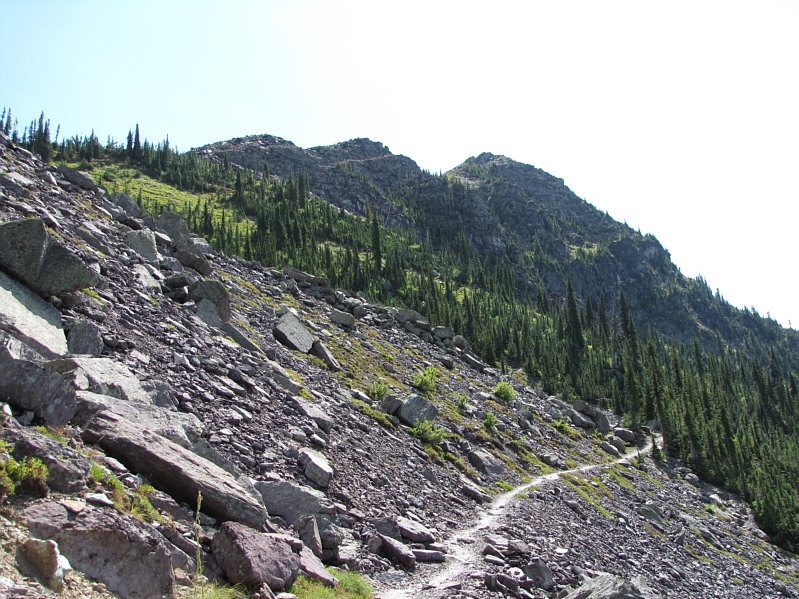
The trees begin to thin out as the trail gains elevation. |
|
|
Sperry Chalet can be seen perched atop cliffs on the opposite side of the valley. |
|
|
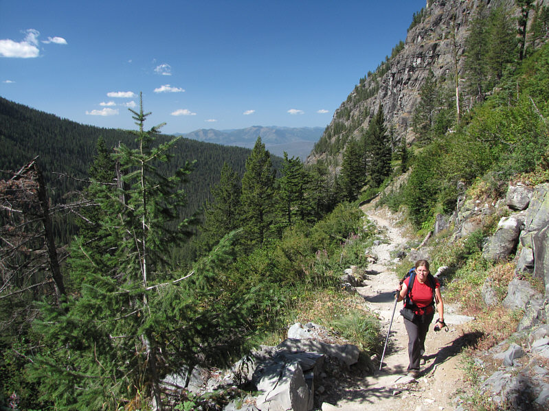
Kelly heads further up the valley. The trail winds around to the forest on the right. |
|
|
At the trail junction for Comeau Pass, a young hoary marmot comes out for a peek at passing hikers. |
|
|
Kelly approaches the dining room of Sperry Chalet. |
|
|
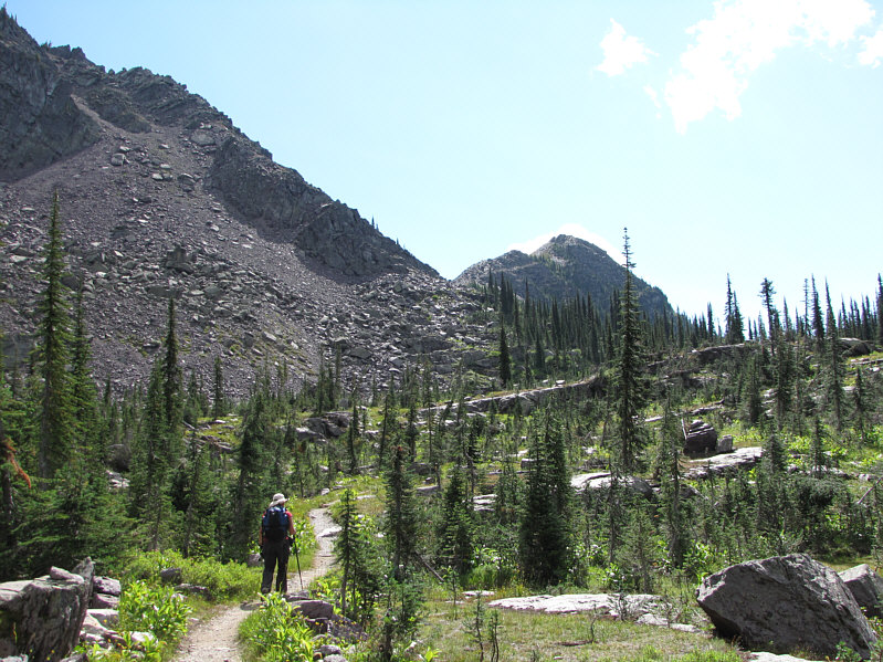
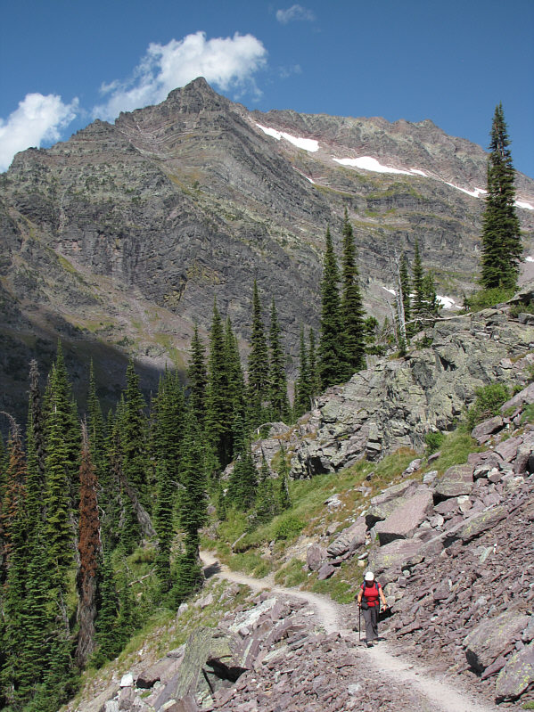
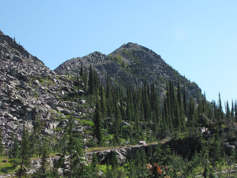
Kelly continues along the trail toward Lincoln Peak. |
|
|
The trail rises gently below the northwest side of Lincoln Peak. |
|
|
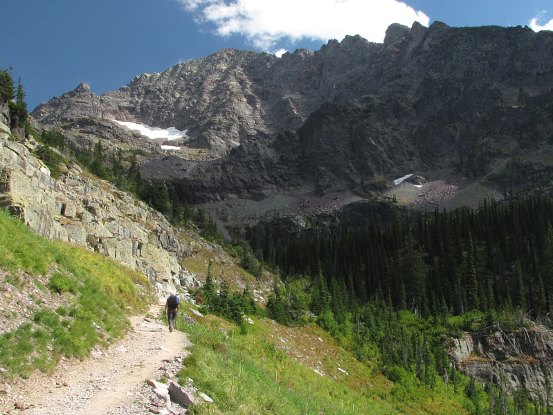
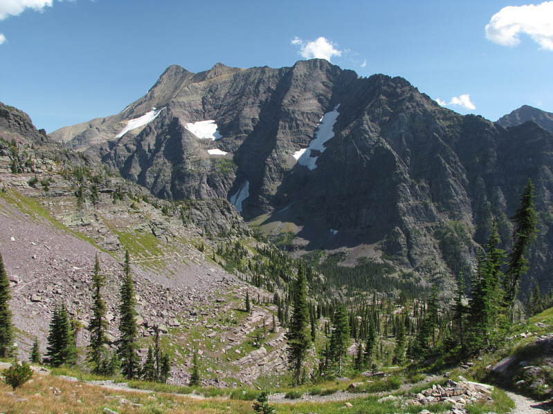
Edwards Mountain is prominently visible throughout the ascent from Sperry Chalet to Lincoln Peak. |
|
|
Mount Jackson is visible to the east from Lincoln Pass. |
|
|
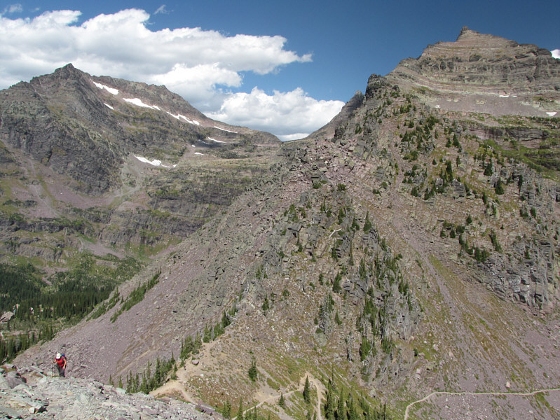
Kelly climbs up from Lincoln Pass. At left is Edwards Mountain, and at right is the southwest outlier of Gunsight Mountain. |
|
|
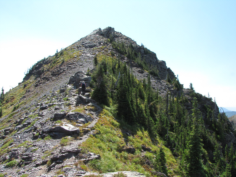
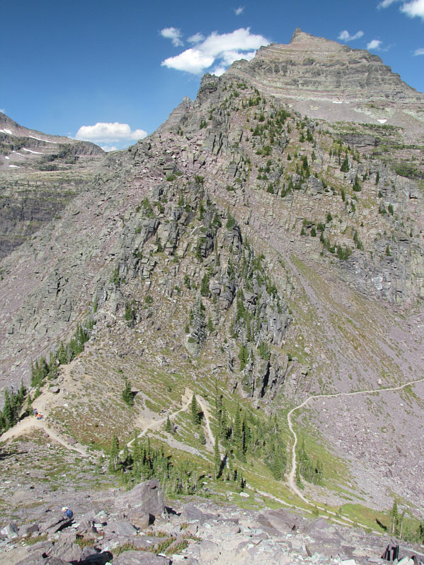
The north ridge of Lincoln Peak presents no serious difficulties. |
|
|
Kelly bypasses some daunting rock outcrops. |
|
|
Kelly and Sonny stand atop Lincoln Peak (2260 metres). |
|
|
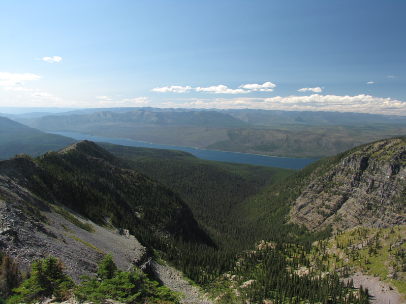
Lake McDonald is the most striking feature to the west. |
|
|
Stanton Mountain and the Mount Brown Lookout are visible to the northwest behind the intervening ridge. |
|
|
Edwards Mountain towers above Sperry Chalet (lower centre). |
|
|
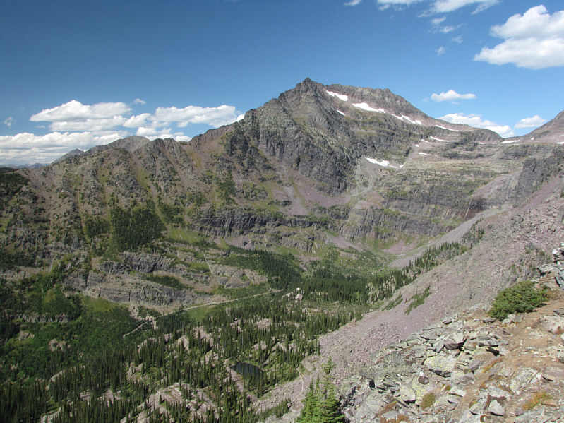
The southwest outlier of Gunsight Mountain dominates the view to the northeast. |
|
|
The eastern view includes Mount Jackson and Lake Ellen Wilson. Gunsight Pass is also visible at far left. |
|
|
Here is a closer look at Mount Jackson. |
|
|
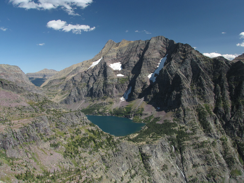
This is a more comprehensive view to the east which includes Lincoln Lake (lower right). |
|
|
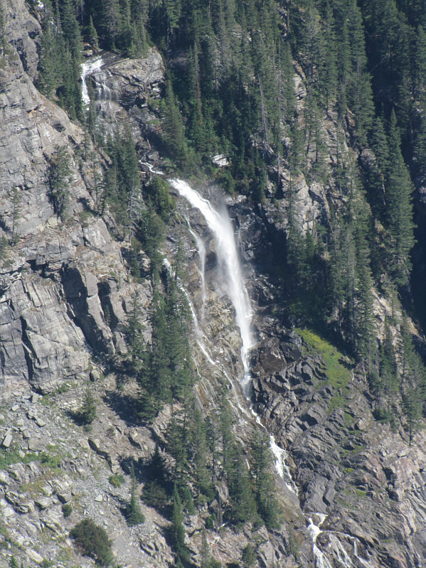
Beaver Chief Falls delivers water from Lake Ellen Wilson to Lincoln Lake. |
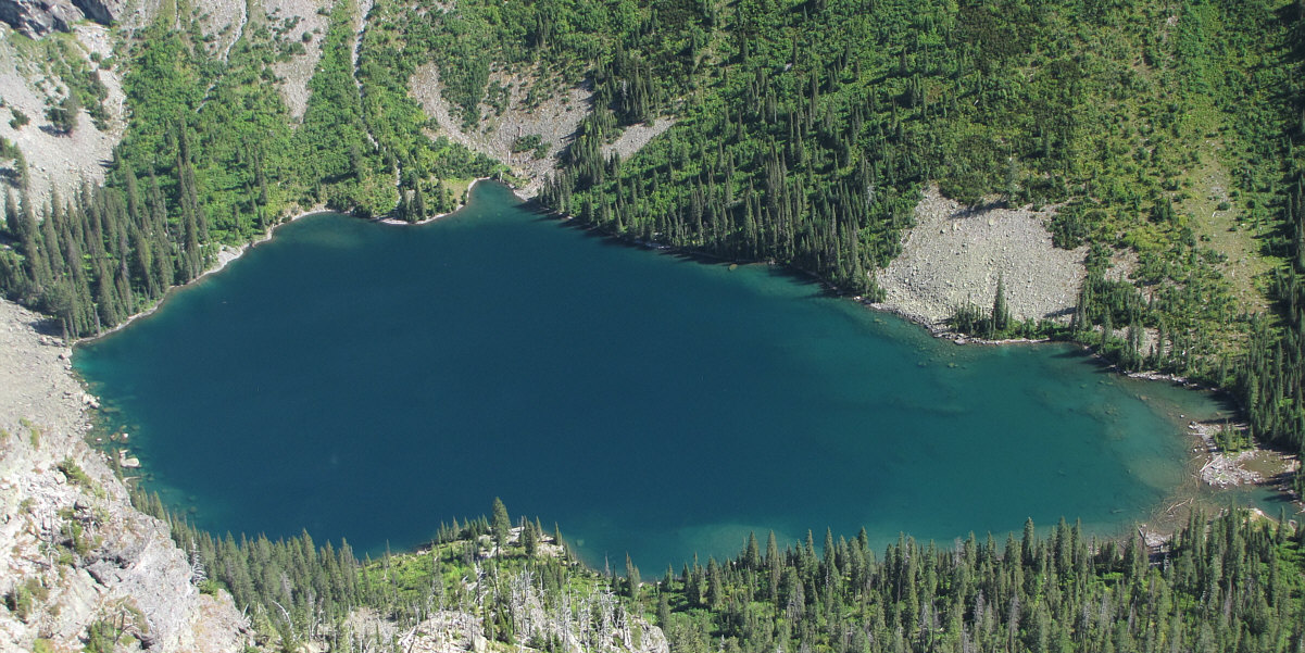
Lincoln Lake sits over 800 metres below the summit of its namesake peak.
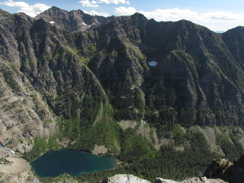 |
Besides Lincoln Lake, the southeast view includes Walton Mountain (upper left). |
 |
Kelly descends back to Lincoln Pass. |
 |
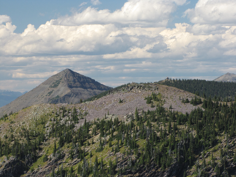
Here is a last look at Lincoln Peak from near Sperry Chalet. |
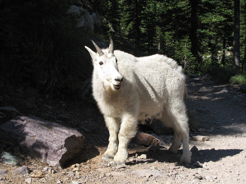 |
A male mountain goat appears to have an astonished look on his face. |
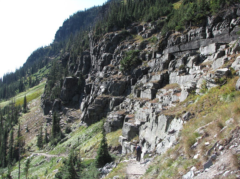 |
Kelly hikes past some blocky terrain on her way back to the trailhead. |
 |
Total
Distance: 24.6 kilometres (approximate)* Round-Trip Time: 10 hours 51 minutes Net Elevation Gain: 1228 metres * Because GPS signals were spotty for much of the forested sections of the trail, I measured a round-trip distance of 20.4 kilometres using MapSource's Distance Tool. According to www.sperrychalet.com, the total one-way distance to Lincoln Peak is 7.7 miles which equates to a round-trip distance of 24.6 kilometres. I believe this figure to be more accurate and possibly even slightly conservative. |