BOU AVENUE
Divide Mountain
When I drove to Montana's Glacier National Park on the morning of 8 June 2013, I had plans for a big day of hiking, but when the border crossing took longer than expected, I opted for a less committing trip in the form of Divide Mountain.  Where Highway 89 crests a ridge about 9.5 kilometres out of the town of Saint Mary, I turned onto an obvious access road leading to the base of Divide Mountain's north ridge.  From the parking area, I noticed a treed ridge which looked like a feasible route up the east side of a cliff face guarding the north end of the mountain.  A party of four ahead of me appeared to continue along a gravel road to the west side of the cliff face, and I decided to follow them since I figured they knew where to go.  When I got around the west side of the cliff face though, the group had mysteriously disappeared, presumably up the mountain.  Regardless, I started scrambling up the rubble slope and eventually caught up to them at a dilapidated lookout hut partway up the north ridge.  Pushing on from there, I enjoyed a very pleasant ascent up the remainder of the ridge which presents few, if any, difficulties.  After spending about half an hour enjoying the superb summit views, I retraced my steps back to the hut and continued down the aforementioned treed ridge which worked out well even though parts of the route are heavily eroded.  Returning to my car, I drove out the access road and headed further south to the Two Medicine Lake area to find a camping spot for the evening.
After a long drive, it's nice to get out and start walking. 
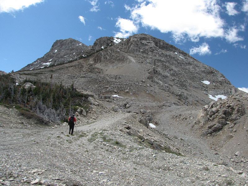
Sonny starts up a gravel road near the north end of Divide Mountain.  Both the right-hand skyline and the treed ridge at left are feasible routes.
High clearance helps, but a 2WD could probably make it to the parking area. 
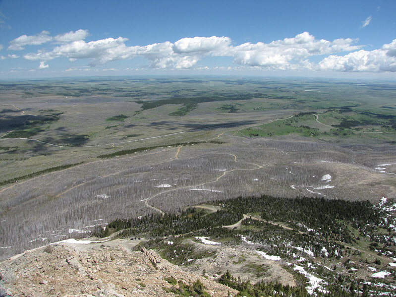
From the north ridge, the access road can be seen winding through a burnt forest.
You could leave your hands in your pocket for much of the ascent! The north ridge of Divide Mountain is uncomplicated.
Seems like everyone stops here on their way up Divide Mountain. 
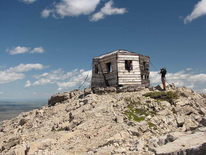
An old lookout hut sits on the ridge at 2353 metres.
I saw another hiker brave the exposed cliffs to retrieve a lost hat. Crazy idiot! 
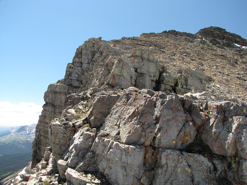
Impressive cliffs line the east side of Divide Mountain.
The great thing about Divide Mountain is that there are no false summits! 
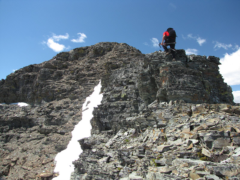
Sonny climbs over a short rock step near the summit.
She was born the same year as me. 
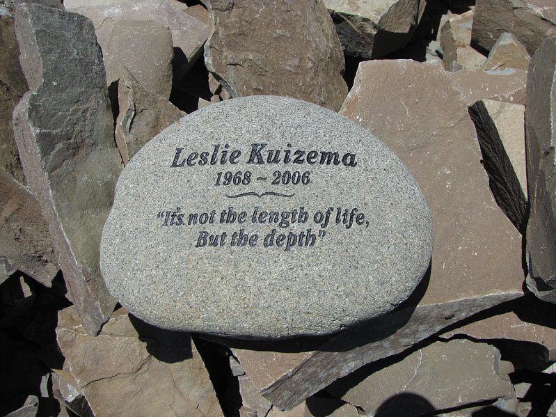
Among the summit rocks is this memorial.
So much reward for so little effort! Sonny enjoys the views from the 2632-metre summit of Divide Mountain.
Sure, it's a little higher, but would the views be any better? 
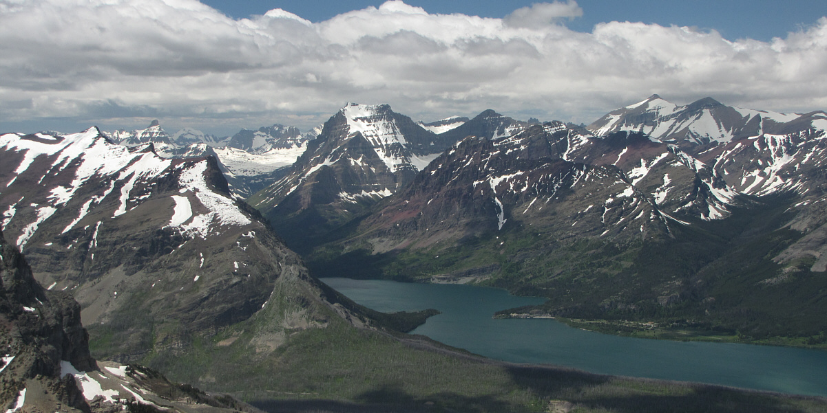
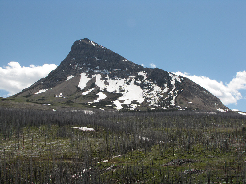
White Calf Mountain dominates the view to the south.
There is much to explore here! A plethora of peaks stretch away to the southwest.  Mount James (left) and Mount Stimson (centre) are the two that stand out the most.

Pretty nice views for such a minor summit!

Notable peaks to the west include Reynolds Mountain (distant left), Going-to-the Sun Mountain (centre) and Mount Siyeh (right).

And Canada is somewhere in the distance... 
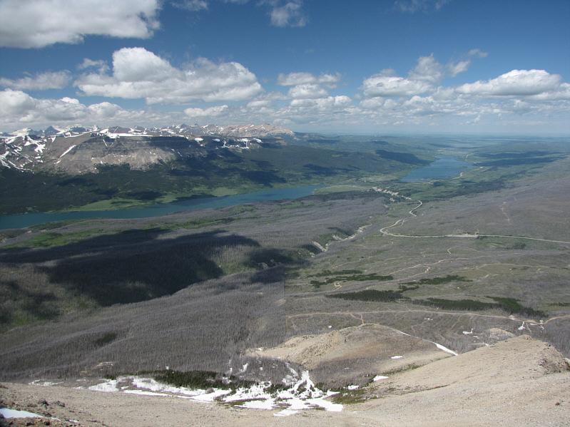
Saint Mary Lake and Lower Saint Mary Lake are the most notable landmarks to the north.
Great place to meet women! Divide Mountain has a lot of visitors on this day.
Stimson, Stimson, Stimson... Here is a closer look at Mount James, Mount Stimson, and Medicine Owl Lake.
Looks like it's still ski season there. Far to the west, Reynolds Mountain and Mount Vaught are still snowbound.
Going-to-the-Sun Mountain looks like its top has been chopped off or is hidden in the clouds! Here is another look at Going-to-the-Sun Mountain beyond Saint Mary Lake.
Ladybug orgy! 
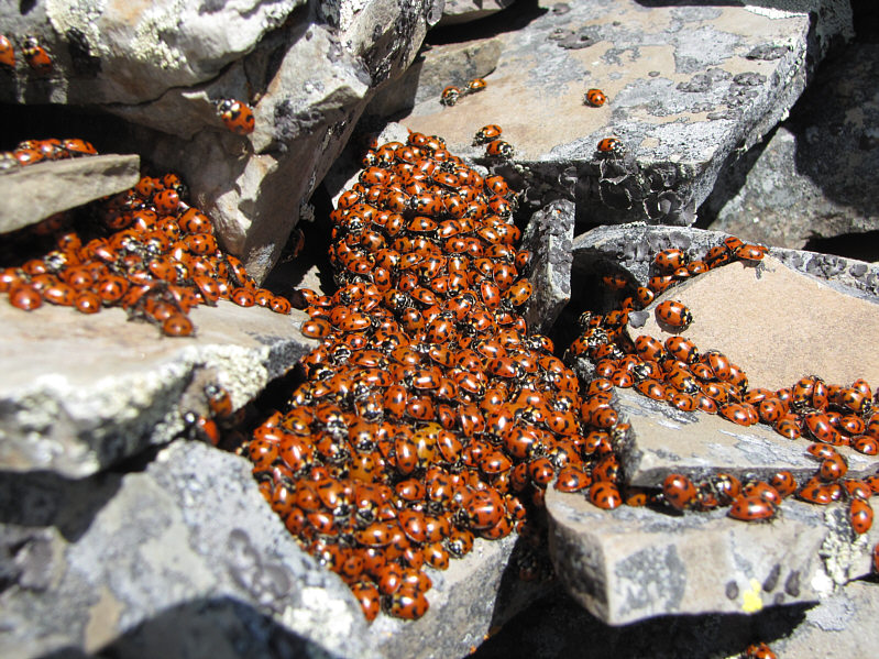
Ladybugs gather like this to keep warm.
I think Mike Holmes should do a show here... The lookout hut is worth checking out again on descent.
Better views than from my apartment condo! 
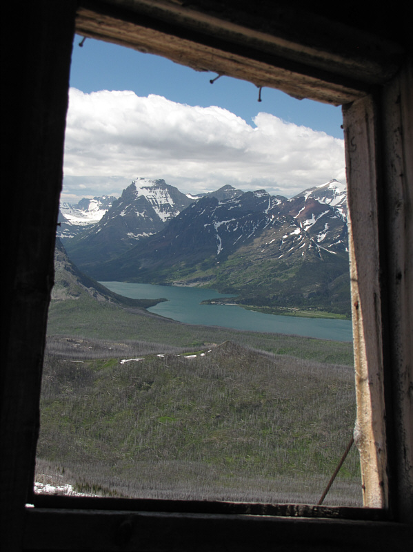
The view from inside the hut is not bad.
Current owner of the lookout hut! A hoary marmot hunkers down among the rocks.
Spot the hut? Here is a more comprehensive view of Divide Mountain's north ridge.
A real gem of a trip! Total Distance:  3.1 kilometres
Round-Trip Time:  3 hours 6 minutes
Net Elevation Gain:  573 metres
I would return for a second ascent of this mountain in 2018.