
Round-Trip Time: 5 hours 20 minutes
Net Elevation Gain: 1016 metres
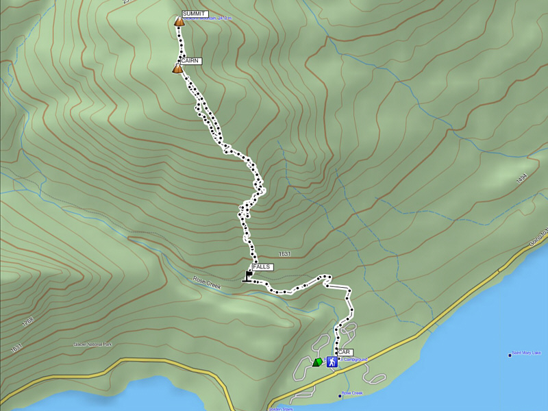
As described in J. Gordon Edwards' A Climber's Guide to Glacier National Park, the approach for Otokomi Mountain is via the official trail to Otokomi Lake which starts beside the camp store at the Rising Sun parking lot. On this day, the parking lot was closed, and I had to park on the access road between the store and the campground. Par for the course, I mistakenly began hiking through the campground only to find myself on the wrong side of Rose Creek (outlet stream for Otokomi Lake). After backtracking to the proper trailhead (signed), I hiked for about half an hour to a hairpin bend where a small creek spilled over the trail. A route description from Summitpost.org recommends leaving the trail at this point, and I followed suit. Though steep, the bushwhacking through the trees was light, and shortly thereafter, I emerged from the forest and began toiling up a vast scree slope. There are a few cliff bands on this slope, but I easily avoided them all by sticking more or less to climber's left. I eventually settled into an easy but long plod up a broad ridge which was heavily foreshortened and seemingly interminable. When I reached a large cairn on what looked like the summit, my GPS stated that the actual summit was still a few hundred metres to the north. From my perspective, the rolling terrain to the north actually looked lower, but taking no chances, I took a quick altitude reading at the cairn before proceeding northward. There was no marker of any sort in the vicinity of the actual summit, but when I took another altitude reading, I was surprised to find that the elevation was indeed higher albeit by only a few metres. Although I was still unconvinced by the GPS reading, I felt assured that I had reached Otokomi Mountain's high point one way or another. Returning to the cairn, I stopped briefly to snap some uninspiring photographs before retracing my steps back down the mountain. Descending the vast scree slope was probably the most tedious and unappealing stretch of the entire outing, and despite the growing darkness, I was actually relieved to be bushwhacking through the forest again. Subsequently, I had no problems finding the trail and hiking out.
When I had started hiking in the late afternoon, I had no worries
about descending in the dark, but I did have some concerns about making
it back to the Carway/Piegan border crossing before they closed for the
evening (11:00 PM). After returning to my car, I quickly changed
and wasted no time driving to the border crossing where I managed to get
through customs with about 15 minutes to spare.
|
|
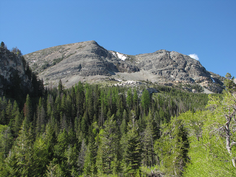
This is the southeast end of Otokomi Mountain as seen from near Rising Sun Campground. |
|
|
Summitpost.org suggests leaving the trail at this spot. |
|
|
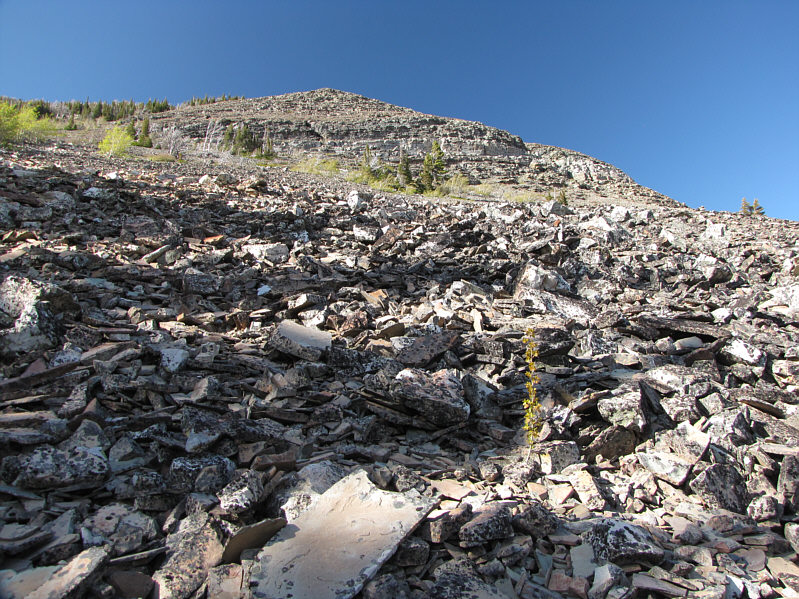
A steep rubble slope is the reward for breaking out of the forest. |
|
|
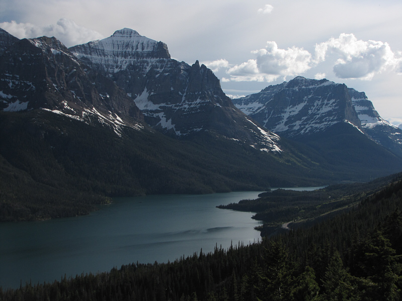
Little Chief Mountain is the striking peak across Saint Mary Lake. |
|
|
The angle relents a bit on the upper mountain. |
|
|
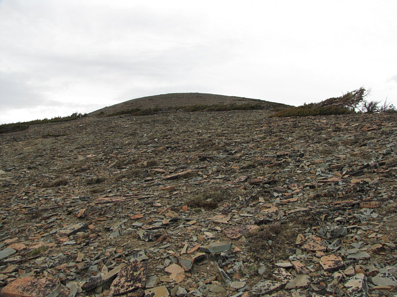
Because of foreshortening, this section is longer and farther than it looks. |
|
|
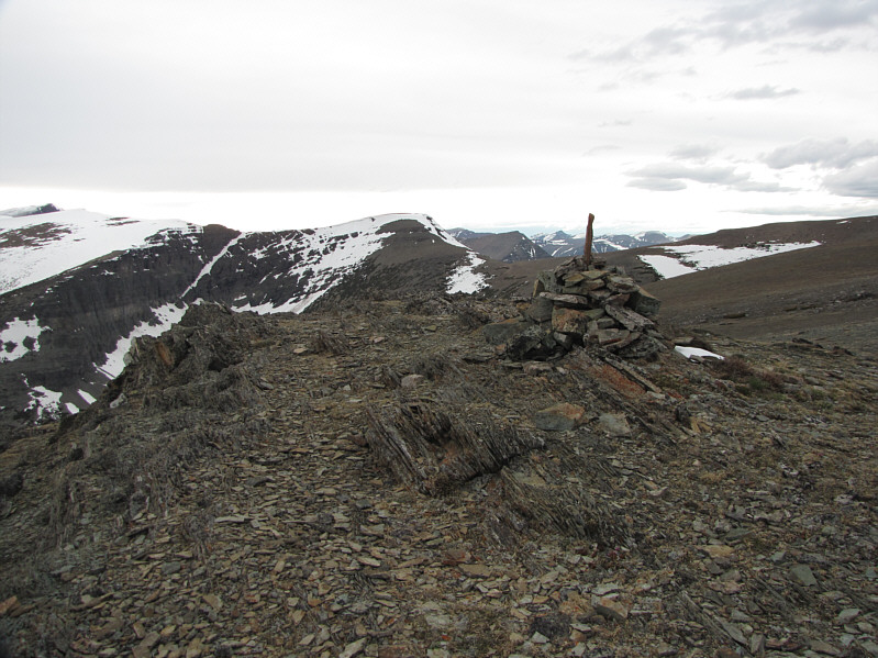
A cairn (2412 metres) marks what appears to be the summit of Otokomi Mountain. |
|
|
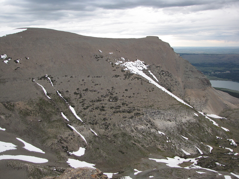
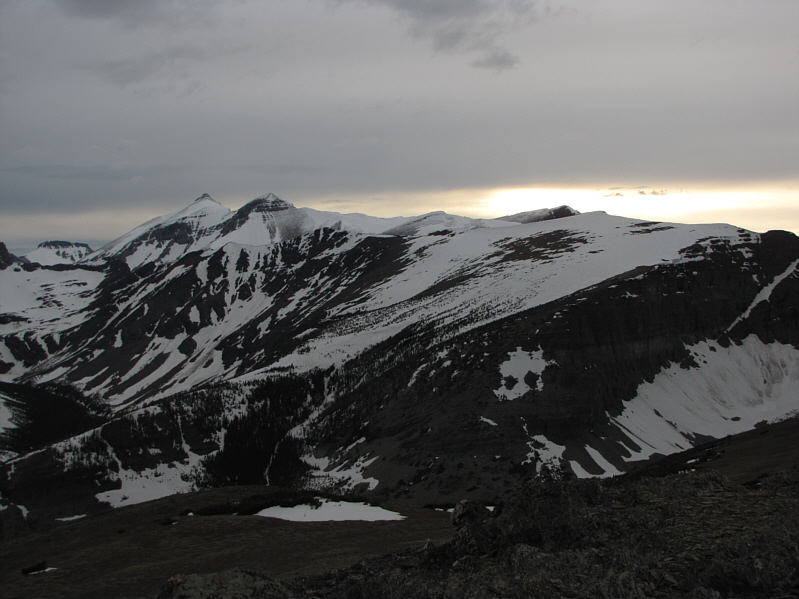
East Flattop Mountain (left) is aptly named. |
|
|
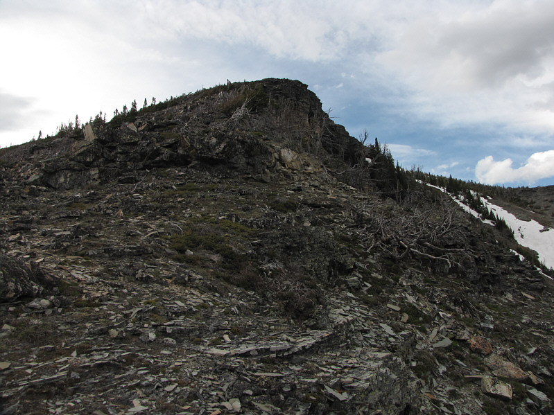
This is looking back along the broad summit ridge from near the official summit (2418 metres) of Otokomi Mountain. |
|
|
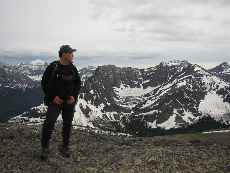
Back at the cairn, Sonny pauses to admire the surrounding view which includes Goat Mountain and frozen Goat Lake. |
|
|
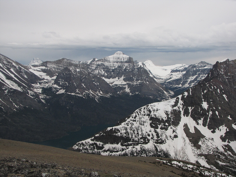
Here is another look at Little Chief Mountain to the southwest. Other notable peaks include Mount Stimson (distant left) and Blackfoot Mountain (snow clad). |
|
|
To the west are Mount Siyeh and Cracker. |
|
|
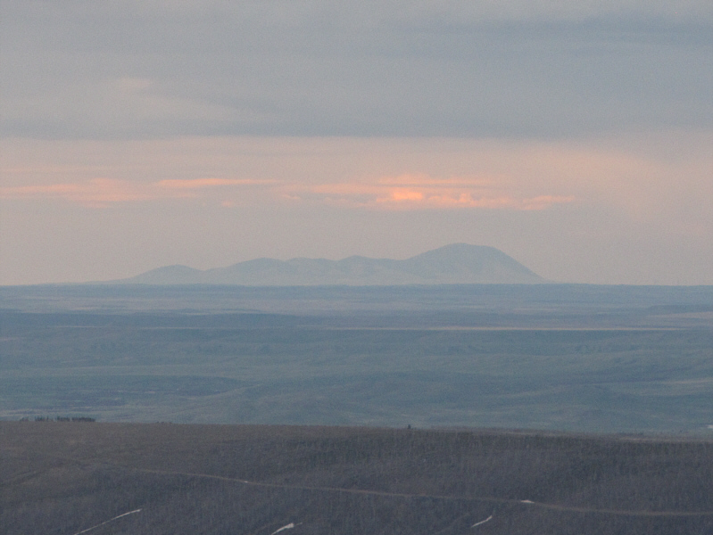
West Butte of Sweet Grass Hills rises on the eastern horizon. |
|
|
Total Distance: ~9.5 kilometres Round-Trip Time: 5 hours 20 minutes Net Elevation Gain: 1016 metres |