BOU AVENUE
Mount Outram
On 23 June 2013, I ascended Mount Outram near British Columbia's Manning Provincial Park.  As described in Jack Bryceland's 103 Hikes in Southwestern British Columbia, the trip up Mount Outram is a grueling endeavour entailing nearly 1800 metres of elevation gain albeit mostly on a well-maintained trail.  From the parking lot, I easily followed the signed trail which briefly joins an old road before entering forest.  Despite the general lack of views, I welcomed the shade of the trees as the morning sun was already unbearably warm.  For the next several hours, all I could do was march steadily up the never-ending switchbacks with only a couple of level sections and a tricky creek crossing to alleviate the monotony.  Harassing mosquitoes ensured that I did not dawdle on the trail though.  Shortly after the creek crossing, I met a party of four with backpacking gear on their way down, and I found reassurance that masochism was not a trait unique to myself.

After crossing some open slopes filled with glacier lilies, I inadvertently surprised a young lady who was napping on a snow patch right on the trail near tree line.  She had decided to forego continuing up with her friends since she had already climbed Mount Outram the previous year.  Already quite weary, I was tempted to plop down beside her, but instead, I kept slogging up the open ridge which was largely still covered with snow.  Footprints left behind by those ahead of me made it easy for me to climb up some of the steeper patches of snow, but I was still regretting wearing only light hiking shoes which quickly became wet.  I eventually ran into the young lady's companions who were descending, and I became hopeful that the summit was near.  Foreshortening, however, is severe on this mountain, and the final grind up to the summit ridge took far longer than I was expecting.

There are two summits of similar height at the top of Mount Outram.  The south summit is easy enough to reach and, on this day, had a geocache stashed in its sizeable cairn.  Reaching the north summit requires a couple of downclimbs, one of which is fairly exposed.  My GPS showed that the north summit is higher by 7 metres although I am doubtful about the accuracy of that figure (nevertheless, most other trip reports I found on the Internet agree that the north summit is higher).

Just as I was about to leave the north summit, rain began to fall.  I quickly scrambled back up to the south summit to retrieve my hiking poles before beating a hasty retreat down the upper mountain.  Slowly getting completely soaked, I plunge-stepped down several large snow patches which enabled me to lose elevation quickly.  The situation got a bit more dire though when a mist rolled in and obscured visibility in all directions.  Suddenly, I had no distant landmarks to aim for although I had a good idea that I still had to traverse quite a distance to skier's left to regain my ascent route.  Without having to consult my GPS, I managed to find my way back to the open ridge I came up, and from there, it was a simple matter of retracing my steps down to the main trail.  A long and boring descent ensued, but at least the rain chased away most of the mosquitoes.

Upon returning to the trailhead, I threw all my wet gear into my car and promptly drove into the nearby town of Hope where I checked into an inexpensive motel to enjoy a hot shower and a nice warm bed.
Some have remarked that the marmot's head more closely resembles that of a bear. 
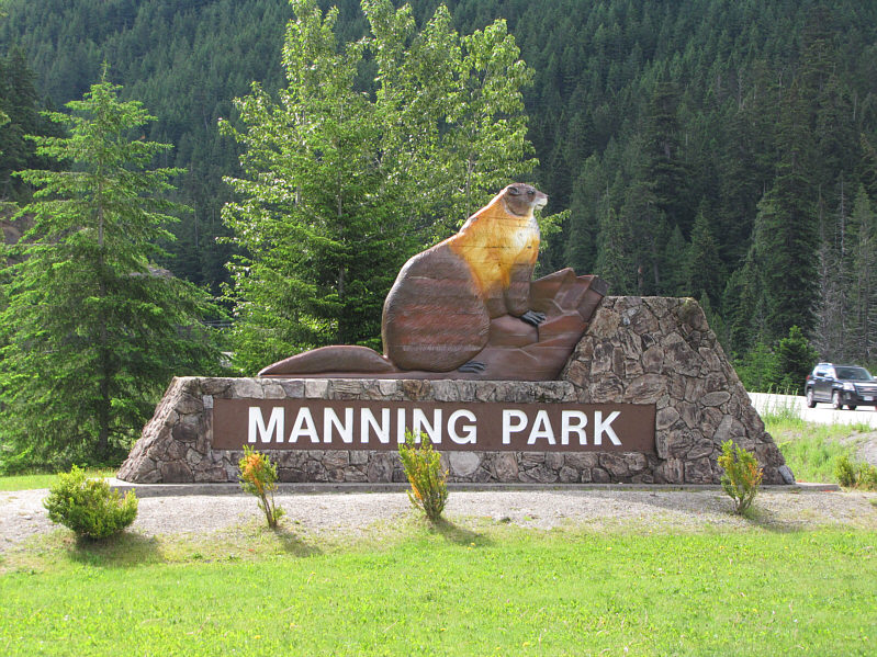
A wooden marmot adorns the sign at the west entrance to Manning Provincial Park.
Outhouses are just on the other side of the bridge! 
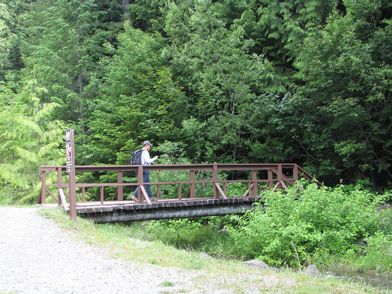
Sonny crosses a creek right at the trailhead.
A road that was never finished... 
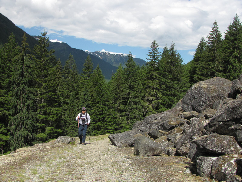
Sonny hikes along the historic "Engineers Road".
Don't expect any views for quite awhile! 
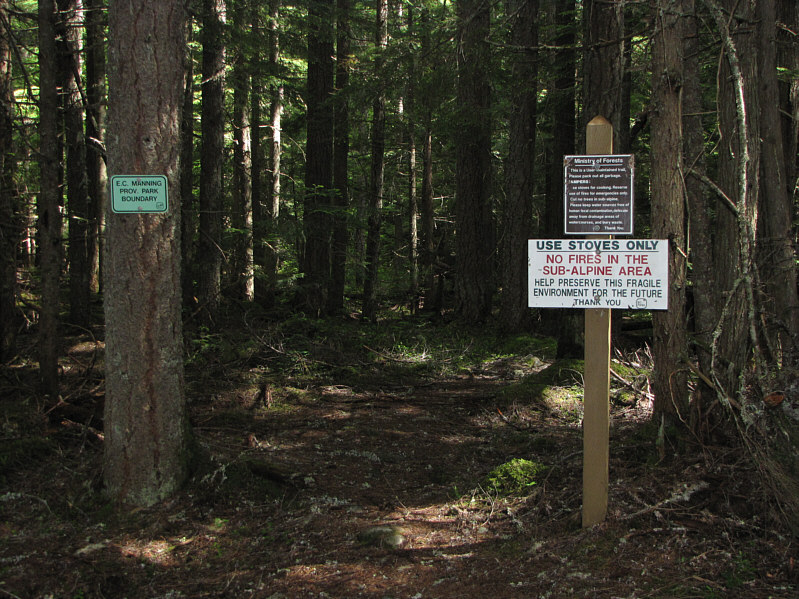
Strangely, the trail to Mount Outram is mostly outside the provincial park.
On a clear day, Mount Baker would be visible in this direction. 
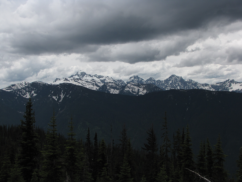
One of the first open views is to the southwest.  At left is Silvertip Mountain.
Beats looking at tree trunks! 
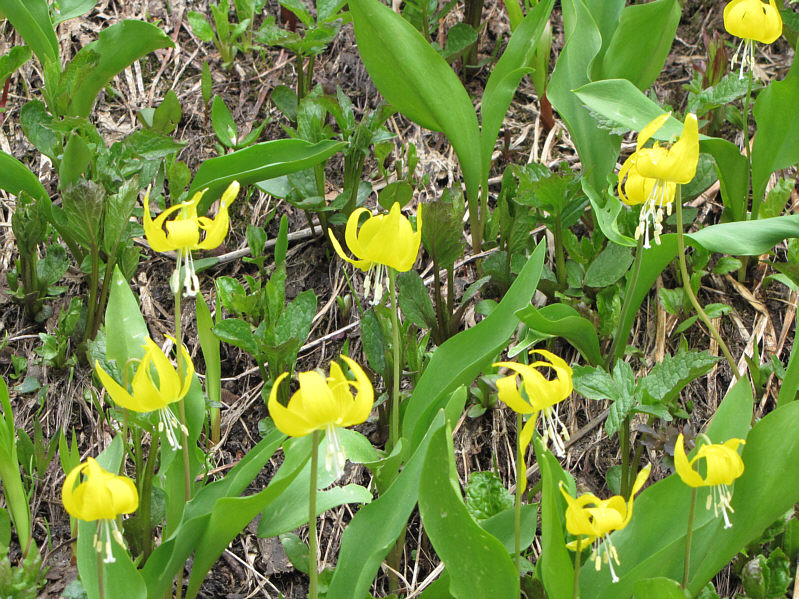
Glacier lilies are in abundance here.
Watch out for napping women on the trail near here! 
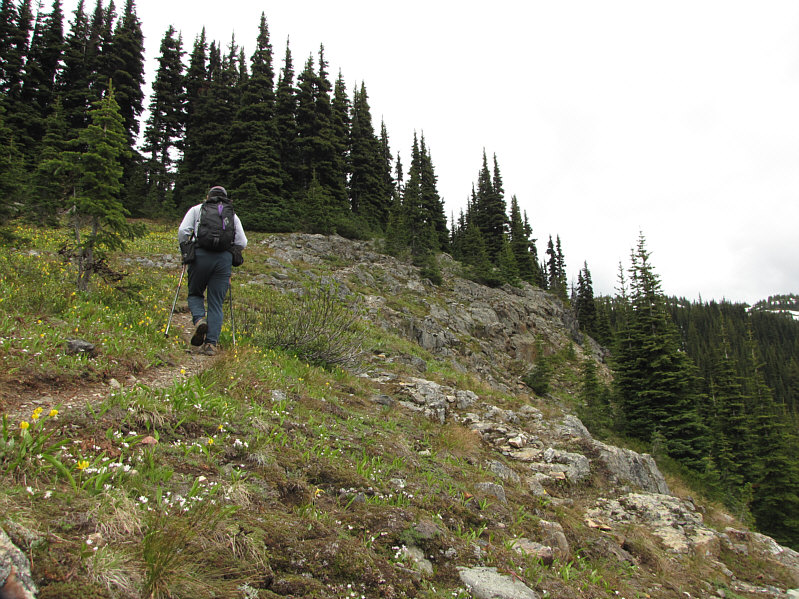
The trees start to thin out.
Of course, the summit is not visible here. The route continues up the left hand ridge.
Probably looks nicer when the sky is blue... 
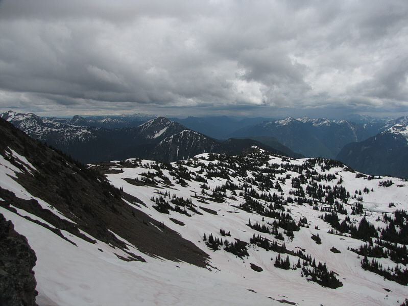
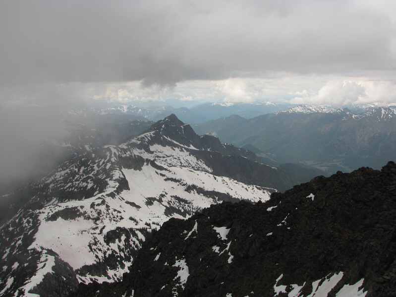
This is looking east into the bulk of Manning Provincial Park.

I will probably have to move out here to do more exploring...

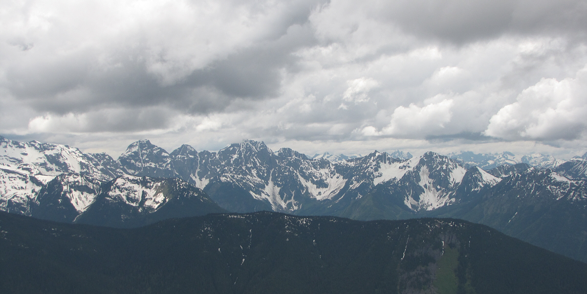
Here is a more comprehensive view to the southwest.

I wish I was already heading down! 
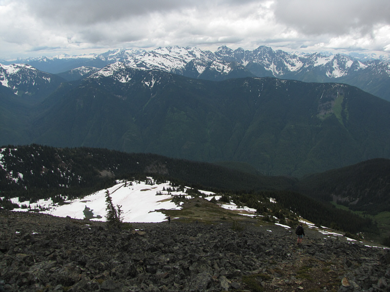
Other hikers make their way down the open ridge.
The summit is the bump at left...I think... 
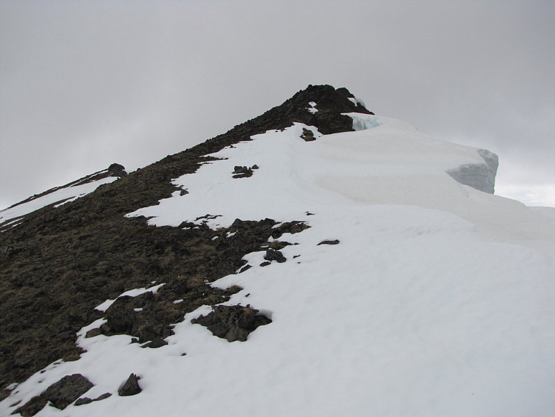
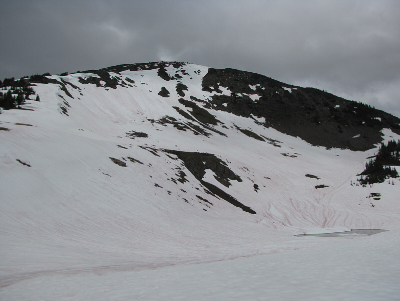
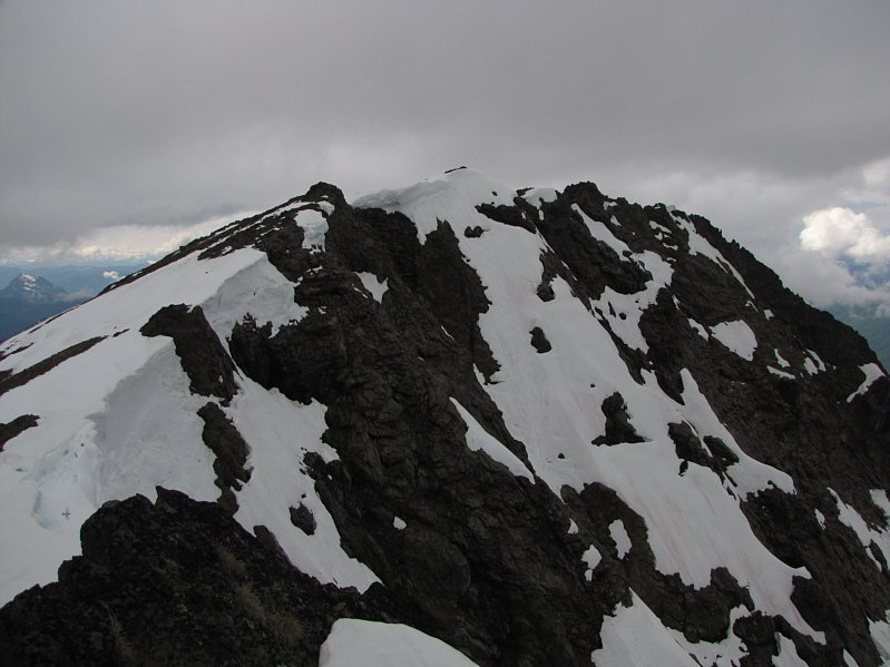
Cornices cling to the summit ridge.
These birds look a little malnourished! 
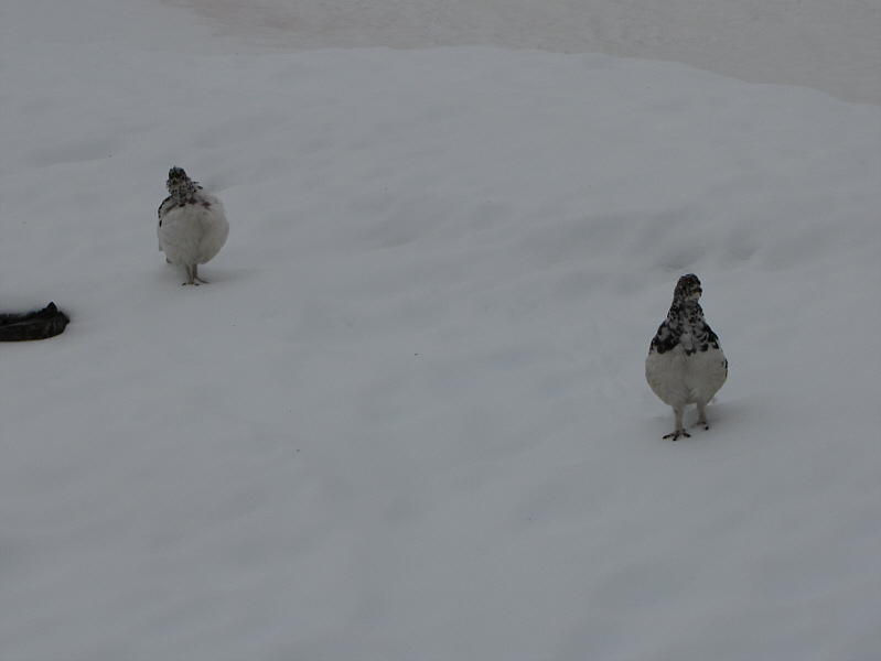
A couple of ptarmigans dance along the summit ridge.
Careful that you don't stray onto the cornices as you traverse the summit ridge. 
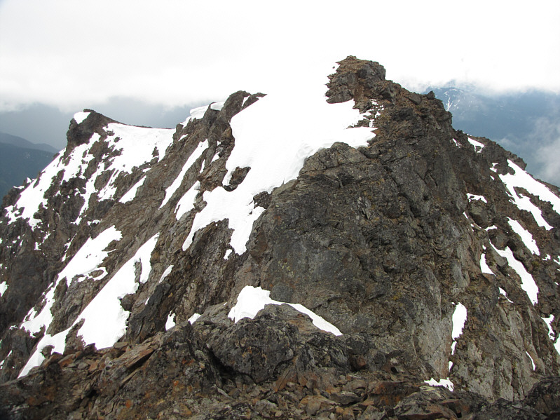
Mount Outram has an impressive north face.
The north summit definitely looks higher. 
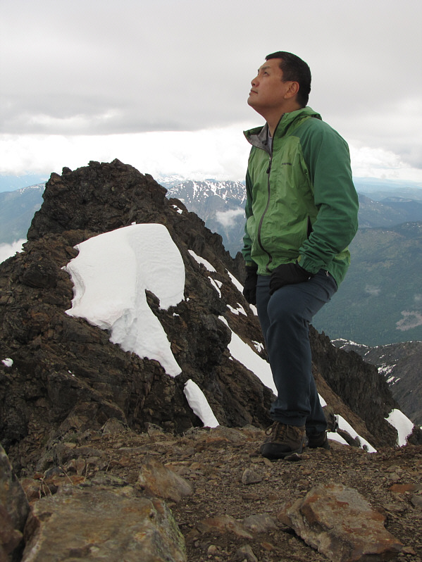
Standing on the 2448-metre south summit, Sonny wonders if he will be able to scramble over to the north summit (background) before it starts to rain.
I wonder if it has ever been climbed... This is the northeast outlier of Mount Outram.
Now the south summit looks higher! 
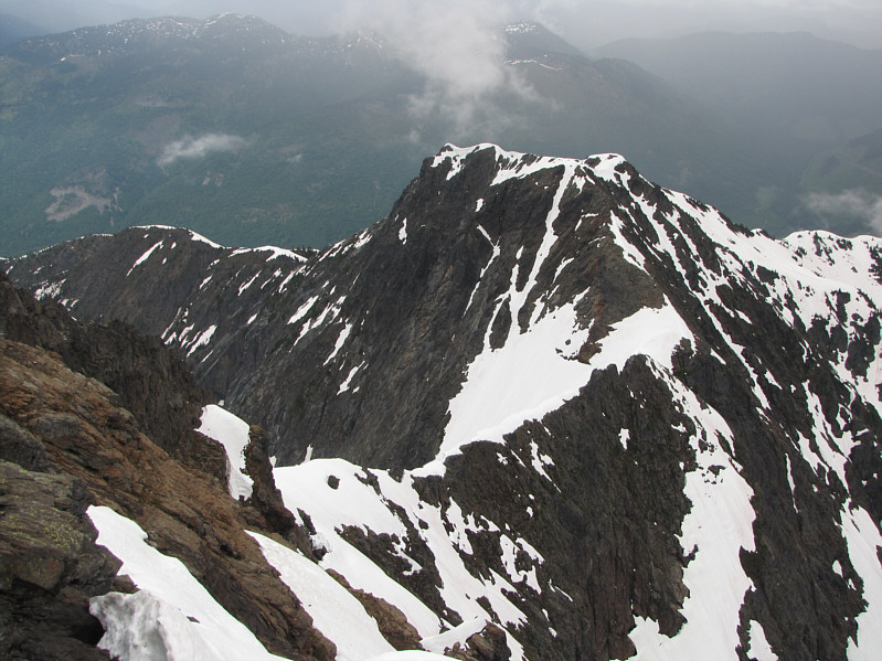
Here is the south summit as viewed from the north summit.  The crux downclimb is below and right of center.
Expedia sucks balls! 
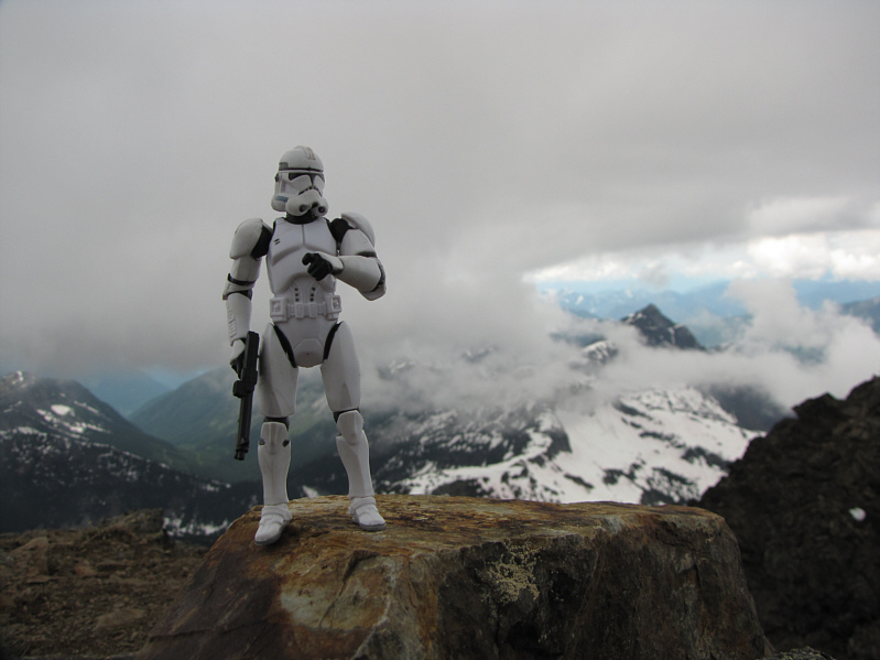
The Expedia Gnome lives on the 2455-metre north summit of Mount Outram!
This was about all I could snap on my camera before the rain came... Unofficially-named Mount Hatfield is the striking peak to the northwest.
They should move that useless footbridge at the trailhead up to here! 
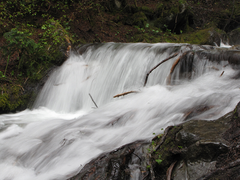
Seventeen Mile Creek can be tricky to cross when it is flowing like this.
Just kidding. Do not eat!! 
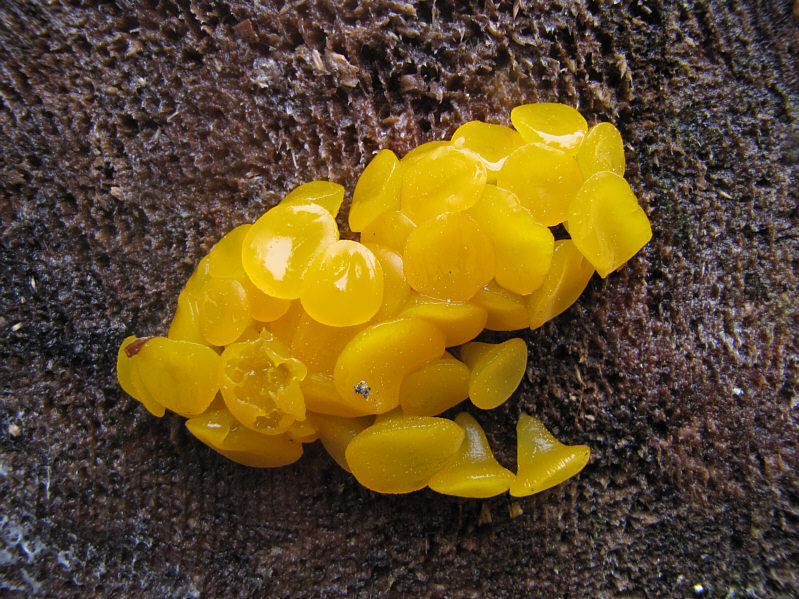
Free natural gummies can be found stuck to logs!
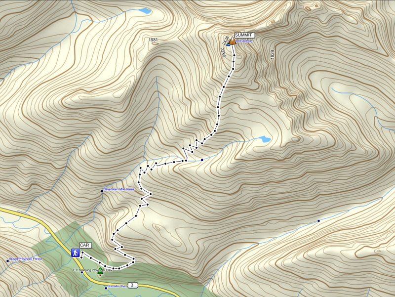
What a slog. Save this for a bluebird day 'cause without the views, this peak ain't worth the effort. Total Distance:  ~18.0 kilometres*
Round-Trip Time:  9 hours 25 minutes
Net Elevation Gain:  1762 metres

 * Route shown and Total Distance are approximate.