BOU AVENUE
Miners Peak

On 31 December 2014, I hiked up Miners Peak near Canmore, Alberta.  I actually woke up late that morning with a bit of a headache and briefly considered staying home, but after a week of holiday gatherings and general lethargy, I was itching to get out for some fresh air and exercise.  Besides, it would have been a shame to let such a nice day go to waste.  As it turned out, I got to the trailhead so late that there was little daylight left, but since the hike up Miners Peak shares the same approach trail as the immensely popular Ha Ling Peak, I was confident that I could reach the top at least before sunset.  The snow-covered trail was well-trodden and easy to hike, and I met a lot of other hikers who were on their way down.  One young lady was sliding down the trail on her butt like she was on a bobsleigh run which only served to make the trail more hard-packed and icy.  There was also a guy holding a Slurpee cup with straw as he sauntered down the trail which reminded me of Julian with his glass of rum and Coke from Trailer Park Boys.  I was alone by the time I reached tree line, and although the turnoff to Miners Peak is obvious, I was not sure which of several bumps was the actual summit.  I would later learn from others' trip reports that the easternmost bump is the actual summit while the three bumps to the west are sometimes referred to as The Three Miners.  None of the bumps poses any serious challenges, and in the end, I simply tagged all of them just to be sure.  I descended mostly in the dark, but with my headlamp, I had no issues.  Miners Peak fills the bill nicely as an easy winter objective, and for me, this trip was a fine way to close out the year.
No beavers in the canal today. The East End Of Rundle is reflected in the canal near the trailhead.
From here, it looks like the Three Miners are higher than Miners Peak. The Three Miners (right) and Miners Peak (left) are visible from the trail junction with Ha Ling Peak.
Looks very pyramid-like from this angle. Ha Ling Peak looks striking to the north.
Hmm...Peechee doesn't look any easier from this side... The late day sun illuminates the tops of (L to R) Mount Inglismaldie, Mount Girouard, and Mount Peechee.
I still wasn't sure that this was the actual summit. Sonny stands on the 2475-metre summit of Miners Peak.
Wonder what all the Canmorites are doing down there... Grotto Mountain sits to the east beyond the town of Canmore.  Cougar Creek, responsible for a lot of damage during the 2013 floods, is also readily visible.
Miners Peak is really just a shoulder of Mount Lawrence Grassi. 
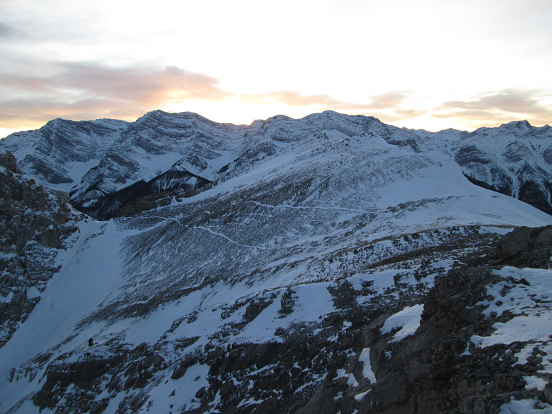
Mount Lawrence Grassi dominates the view to the southeast.
The Three Miners kinda look higher; I better go tag them to be sure! Goat trails are discernible below the Three Miners a short distance away.
Kinda looks like a big nipple here... 
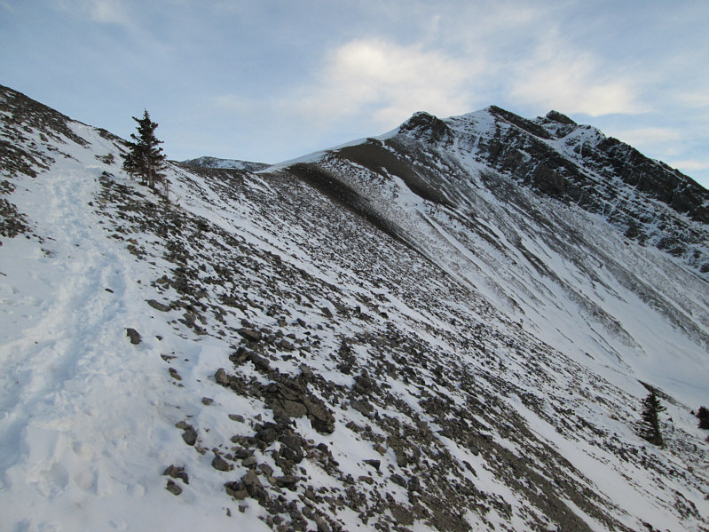
Miners Peak looks a little more distinct from below the First Miner.
It's easier to get to than it looks. Here is the Second Miner as seen from the First Miner.
A little bit more challenging to climb this one, but not much. 
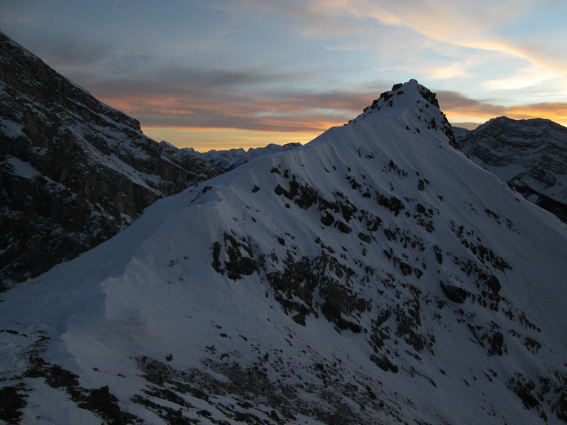
Here is the Third (highest) Miner as seen from the Second Miner.
Wow, I thought this would be higher than Miners Peak, but it isn't! Sonny watches the fading light of day from the top of the Third Miner (2474 metres).
I think the memorial is for someone who died in a motor vehicle accident in New Brunswick. A wooden memorial is tethered to the cairn on top of the Third Miner.
Can you also spot Pilot Mountain from here? Mount Rundle sticks up prominently to the northwest.
Sure, it's pretty, but I'm also freezing my tail off in the cold wind up here! On this day, the sky is exceptionally colourful at sunset.

Time to get off this rock and go home!

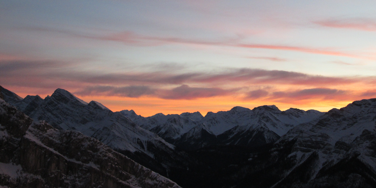
Another beautiful day in the Canadian Rockies comes to an end.

Makes for an easy and generally safe winter trip. Total Distance:  6.9 kilometres
Round-Trip Time:  3 hours 34 minutes
Net Elevation Gain:  825 metres

GPX Data

I would return for a repeat ascent in 2021.