BOU AVENUE
Chaffen Ridge
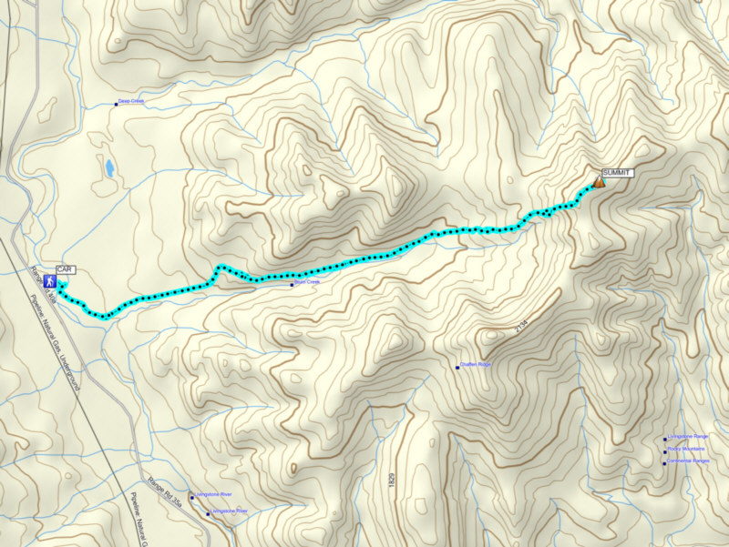
On 23 May 2015, I joined Bob Spirko for a
hike up to the high point of Chaffen Ridge in the Livingstone Range of
southwest Alberta. Bob had previously ascended the ridge from the
east but stopped well short of the high point due to limited daylight.
For this trip, Bob used Google Earth to map out a shorter approach from
the west utilizing an old exploration road which runs along Bruin Creek.
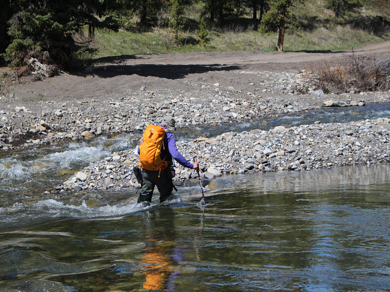
This route is pretty straightforward except for the necessity to ford
Livingstone River near the start.
After turning off the main road
about 18 kilometres south of the junction with Highway 532, we parked
among some random camping sites before walking down to the river to scout
for a reasonable place to cross. For some reason, the embankments
on the far side of the river here are all quite high and steep, and it
took us awhile before we found a suitable crossing. We dashed back
to the car to gear up and to pick up our hip waders before returning to ford
the river. Although we both made it across safely, I was a bit
unnerved by the strength of the current which, at the deepest part of the
crossing, threatened to sweep us off our feet if we were not careful.
After ditching our hip waders on the other
side of the river, we climbed up the embankment and almost immediately
picked up a double-track heading eastward through a fence. This
double-track quickly leads to the aforementioned exploration road, and
except for one detour to avoid some unnecessary elevation gain and loss,
we followed the road without much fuss up the Bruin Creek valley.
We eventually left the road to hike up a succession of clearings--a sort
of "glade-hopping"--in order to reach the crest of Chaffen Ridge.
Travel was generally easy even in the trees. A few lingering snow
patches guarded the high point, but these were less of a hindrance than
the numerous cow patties we had to sidestep.
After a lengthy and comfortable stay at the
high point, we retraced our steps back down the valley. The weather
turned out to be very warm on this day, and the shade of the forest was
most welcome for much of our hike out. Re-crossing Livingstone
River was thankfully also uneventful, and we finished the short hike back
to my car still wearing our hip waders.
Be sure to check out Bob's trip report
here.
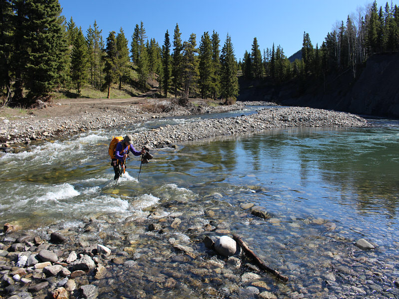 |
Bob fords Livingstone River. |
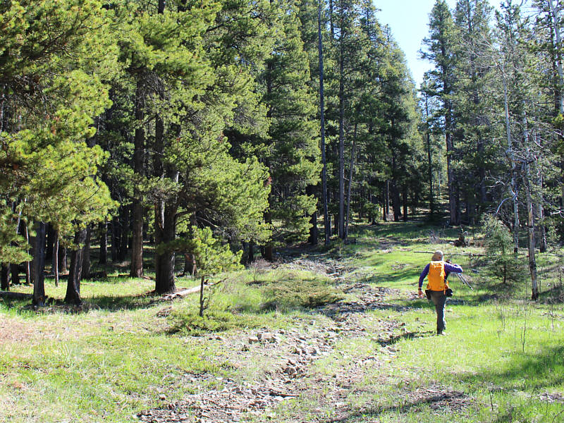 |
Bob follows an old exploration road up
the valley. |
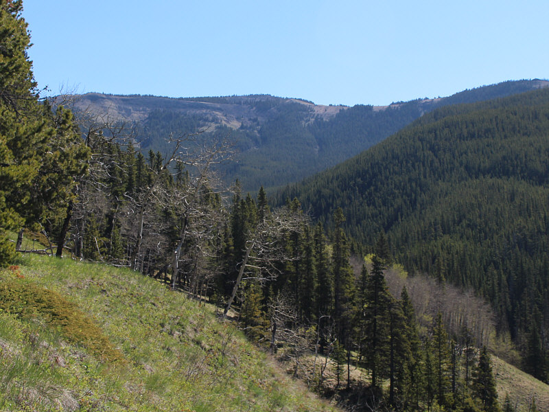 |
A clearing in the forest provides a
glimpse of Chaffen Ridge in the distance. |
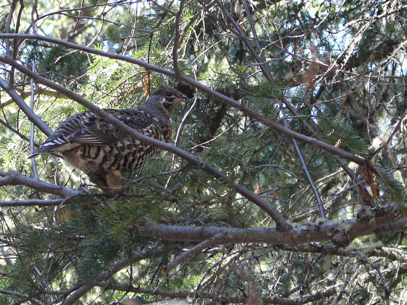 |
A spruce grouse tries to look
inconspicuous on a tree branch. |
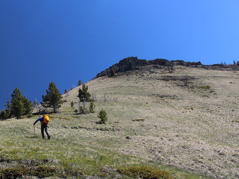 |
Bob climbs up a steep slope below the
ridge crest. |
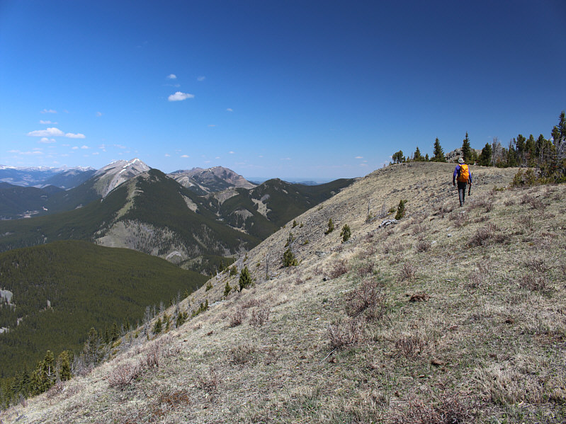 |
Bob hikes along the ridge crest toward
the high point. |
Bob pauses to look north at some familiar peaks
including Coffin Mountain, Saddle Mountain (barely distinguishable),
and Sheep Mountain.
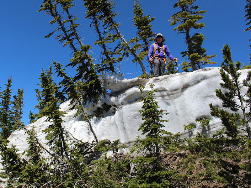 |
Bob stands atop a thick snow patch not
far from the high point. |
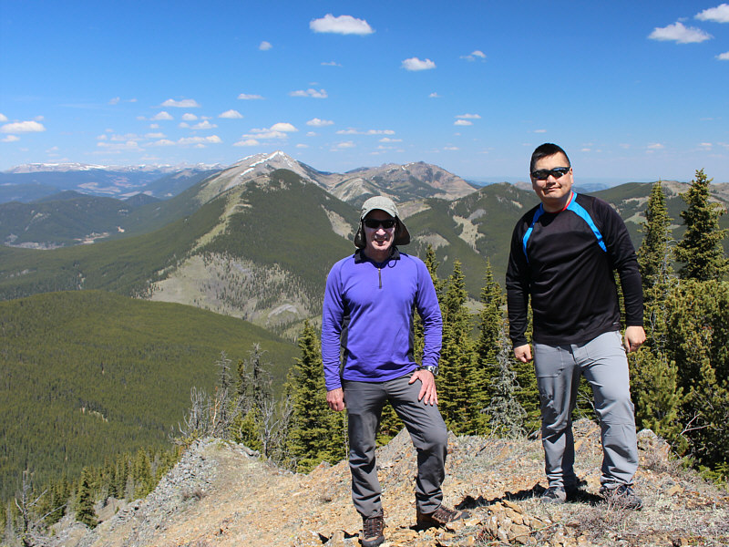 |
Bob and Sonny stand on the 2228-metre
high point of Chaffen Ridge. |
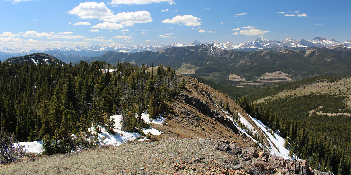
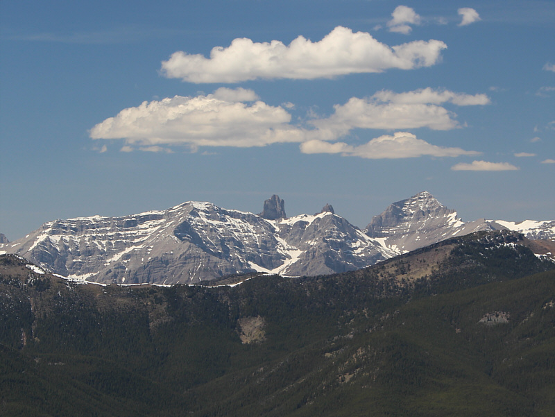
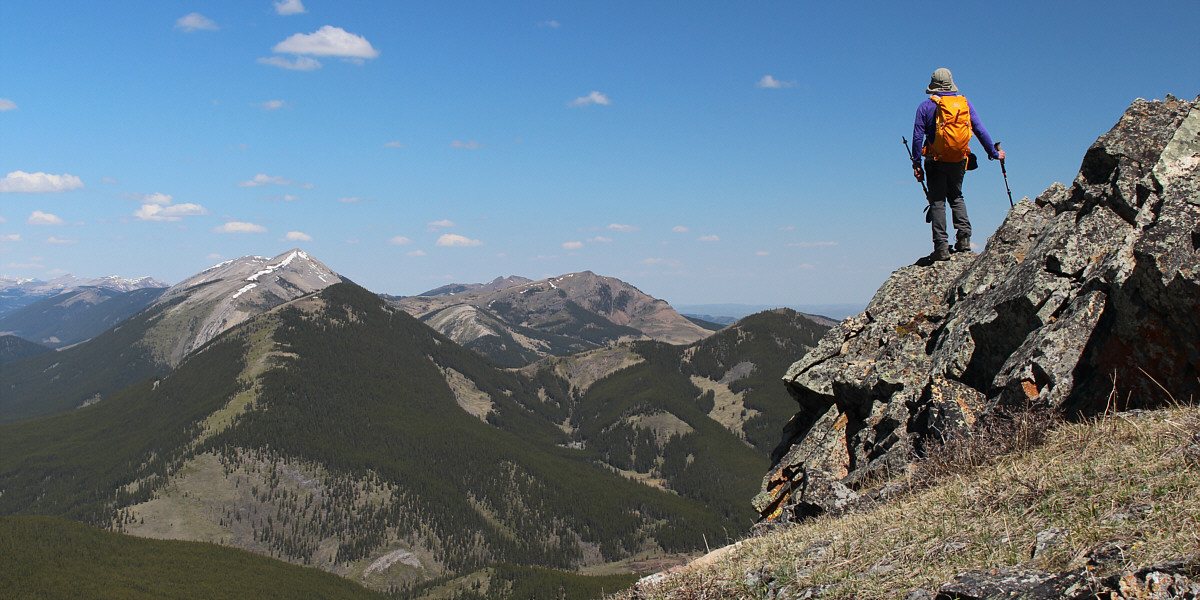
The High Rock Range stretches across the horizon to
the southwest.