BOU AVENUE
Mount Dyson
Bob Spirko and I ascended Mount Dyson in the
Sheep River region of Alberta's Kananaskis Country on 15 February 2015.
Partly inspired by
Steven Song's and Rafal (Raff) Kazmierczak's ascent the week before,
Bob and I knew that conditions would be ideal to tag this lowly summit.
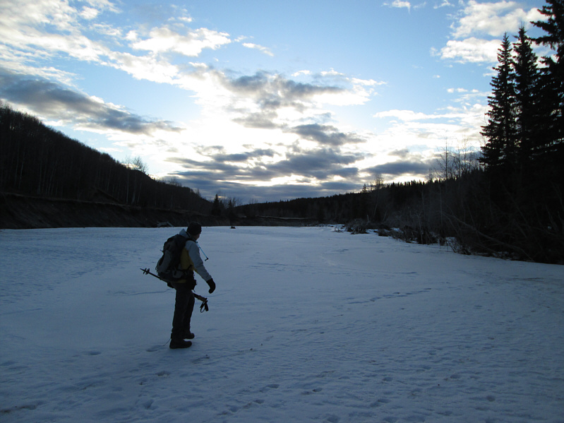
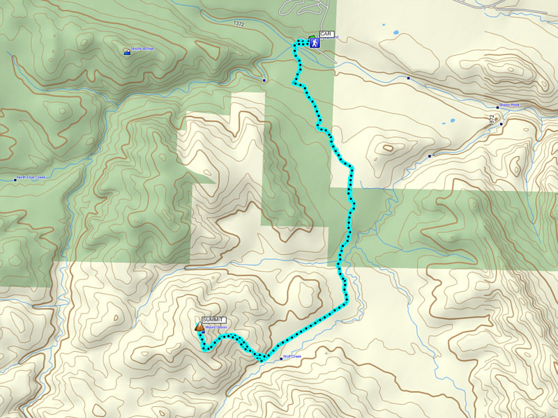
We had no problems crossing the frozen Sheep River near the start of the
hike and picking up the Wolf Creek trail on the other side. Snow coverage was
either thin or supportive enough that we did not need snowshoes,
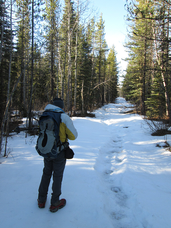
but many sections of trail were
covered in pure ice and dangerously slippery. While Bob had the
foresight to bring along ice cleats, I simply muddled along the edges
wherever the ice covered the trail. At a large clearing,
we briefly left the trail to take a short cut across a marshy bog
which, like the river, was conveniently frozen. Upon regaining the
trail, we continued southward to a partially open bench overlooking a
tributary of Wolf Creek. Oddly enough, there was a large group of
people camping here, and their dogs made quite a ruckus when Bob and I
passed by. While Steven and Raff turned west here to ascend the northeast ridge
of Mount Dyson, Bob
and I followed the route described in Gillean Daffern's Kananaskis
Trail Guide (4th Edition, Volume 4) and dropped down to cross the
tributary. Climbing up the other side, we soon merged onto a cut line
which runs parallel to Wolf Creek and leads to the base of Mount
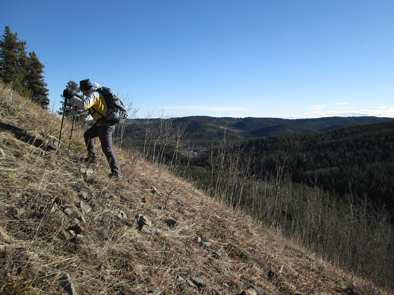
Dyson's southeast slopes. Ascending these open slopes was a
bit of a grunt, but there is nothing technically difficult here. We
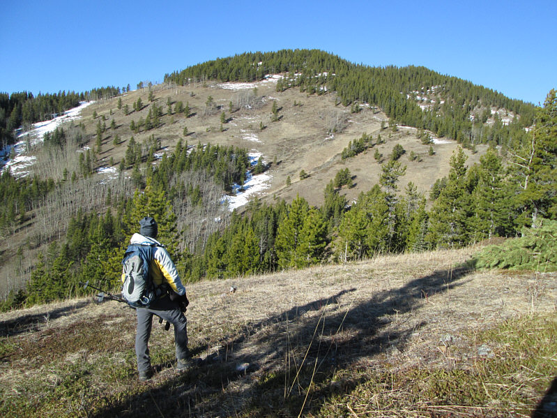
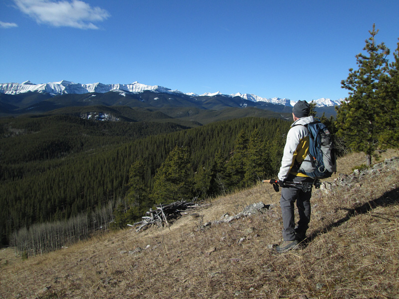
eventually climbed up to a clearing on the south ridge where we were
granted some respectable views of the mountains to the west. From
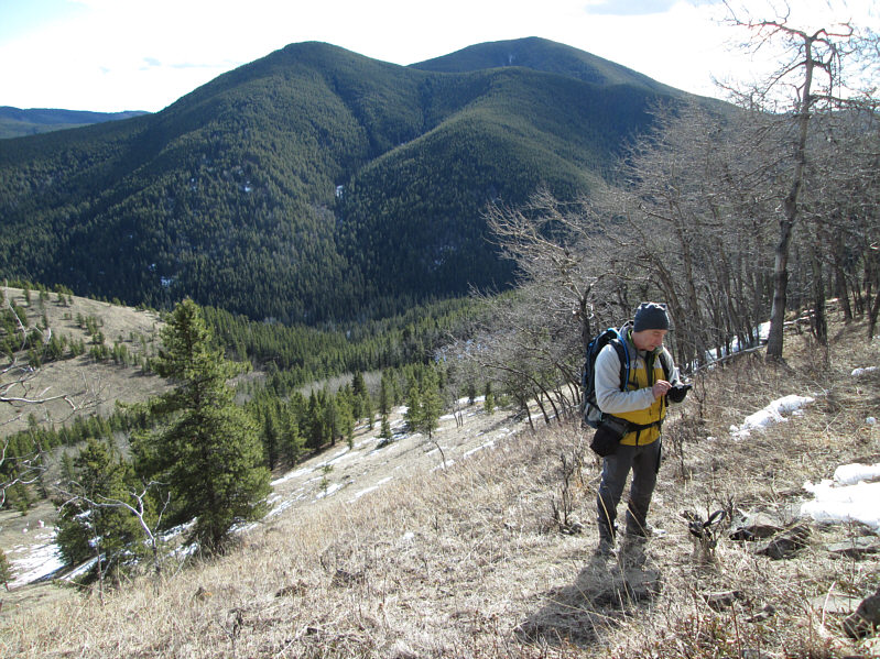
there, we headed north until we found the forest-covered summit
which was expectedly anticlimactic. We took a few requisite
photographs before retreating to the clearing to enjoy a well-deserved
lunch. Our return trip was largely uneventful; even the campers and
dogs had disappeared.In
retrospect, I can barely recommend Mount Dyson as a worthwhile winter
objective and only because Wolf Creek trail is itself surprisingly
interesting to hike, snowshoe, or even ski (last winter, I made it as far
as the tributary on cross-country skis). In spring or summer, the
Sheep River would likely be too problematic to cross, and Wolf Creek
trail would also probably be unpleasantly muddy.
Be sure to check out Bob's trip report
here.