BOU AVENUE
Frosty Mountain
I have driven through British Columbia's Manning Provincial Park on many occasions, but for some reason or another, inclement weather has always thwarted my attempts to hike in the core area of the park.  In particular, I have long been interested in hiking up Frosty Mountain, the highest peak within the park.  Frosty Mountain sits just north of the American-Canadian border and has two distinct summits.  The East Summit is sharply-defined and easily accessible by a well-maintained trail as described in Jack Bryceland's 103 Hikes in Southwestern British Columbia and Matt Gunn's Scrambles in Southwest British Columbia.  The slightly higher West Summit is one of several bumps along a complex ridge which entails Class 3 scrambling with some mild exposure.  Given the lack of route descriptions on the Internet for the West Summit, this extension to the hike up the East Summit has not proven to be popular.

After spending the previous night in a hotel in the nearby town of Hope, I was hoping for some favourable weather as I drove to the trailhead at Lightning Lake on the morning of 5 September 2015.  The hike to the East Summit is long but not difficult.  The trail starts off with some nicely graded switchbacks before climbing steadily up onto a broad plateau.  A long flat stretch leads to open meadows with an abundance of larches--a good reason to do this trip in the Fall.  The trail then climbs up to a junction on the east ridge of Frosty Mountain before terminating at the East Summit.  On this Saturday, the trail was very busy all the way from the trailhead to the East Summit, and fresh snow on some sections of trail did not deter most hikers.  A cool breeze on the East Summit had most people there hunkered down inside a large wind break which some have referred to as the "hot tub".  Rather than stopping to socialize, I continued along the connecting ridge to the West Summit.  This involves descending loose rubble to a col before climbing over and around several pinnacles along the ridge.  Some route-finding is necessary here as there are no cairns or beaten paths to help point the way.  I tended to stay to climber's left of the ridge crest to bypass the more difficult sections.

It took me about 90 minutes to traverse between the East and West Summits.  After a brief stop on the West Summit, I easily hiked over a couple more bumps to the westernmost high point of the summit ridge.  On the strength of some vague recollections about a trip report that mentions ascending Frosty Mountain from the west end of Lightning Lake, I continued down the northwest ridge in hopes of completing a similar loop only in reverse.  I had no issues reaching tree line, but from there, the descent became a lot more complicated.  After a short bushwhack through some tedious undergrowth, I came upon an obvious drainage which was initially easy to descend.  As I lost elevation though, the drainage became increasingly choked with vegetation and deadfall.  The steep angle of the slope and some flowing water also made the footing in the drainage treacherously slippery, and I eventually abandoned it to take my chances in the trees.  This was no picnic either as I had to contend with probably some of the most heinous bushwhacking I have ever endured.  A lot of thrashing and cursing ensued, and I was mentally frazzled by the time I finally stumbled out of the bushes onto the trail on the south side of Flash Lake.  I took a quick break here to re-fuel and to rid myself of any lingering profanities before commencing a long march back to the trailhead in the dark.  Thankfully, the drive back to my hotel in Hope was short, and I enjoyed a restful sleep before heading home the next day.

In retrospect, I am not certain if there is a better line to take to get down Frosty Mountain's northwest ridge although any other line could not, in all probability, be any worse than the one I took.  After re-examining the aforementioned trip report, I am somewhat curious about where the author had gone up the ridge seemingly unbothered by the nasty bush.  However, I am definitely not curious enough to go back and find out firsthand.
You won't find tranquility here though...at least not at this end of the lake! Lightning Lake is one of the most popular places to visit in Manning Provincial Park.
Lots of people tend to congregate here as well... The rustic cabin at Frosty Creek Camp is a nice place to take a break on the way to Frosty Mountain.
Very oddly-shaped mountain...must be a thrust fault in their somewhere! Frosty Mountain comes into view as the trees thin out.
This would be a magnificent place to visit on a clear Fall day. Larch trees are abundant on the approach to the East Summit (right).
The last bump on the right looks like the highest point, but it's not. 
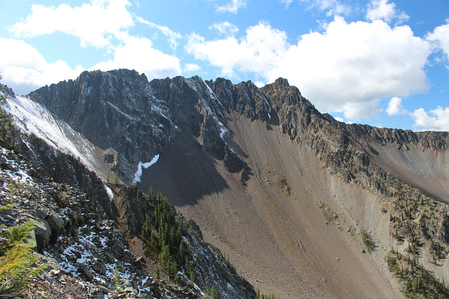
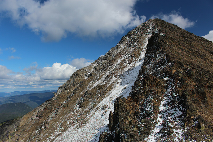
From this vantage point, it is difficult to tell which bump on the ridge is the West Summit.
They were planning to do the longer loop to Windy Joe Mountain and seemed a bit surprised that the trail junction is on top of the ridge. A couple of backpackers work their way up the ridge.
The trail is very busy today! A group of hikers descend the trail in front of the East Summit.
I've seen more people on this mountain than the last 5 mountains I've been on combined! A number of hikers can be seen on the east ridge of Frosty Mountain.
Not sure which direction the caution sign is referring to... 
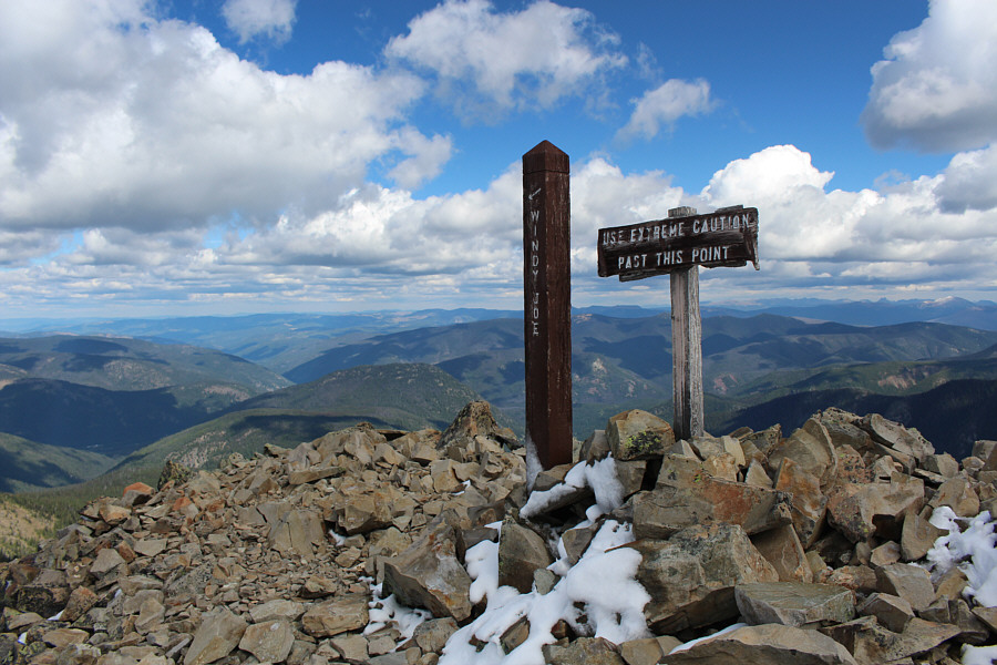
The trail junction to Windy Joe Mountain sits on the crest of the ridge.
It's like this mountain has a good side and an evil side! Here is the view of both the East Summit and West Summit from the trail junction.
If you look really closely, you might be able to spot the two backpackers coming up the ridge. This is looking back along the east ridge from near the East Summit.
Oddly enough, this is the gazetted summit of Frosty Mountain even though the West Summit is higher! 
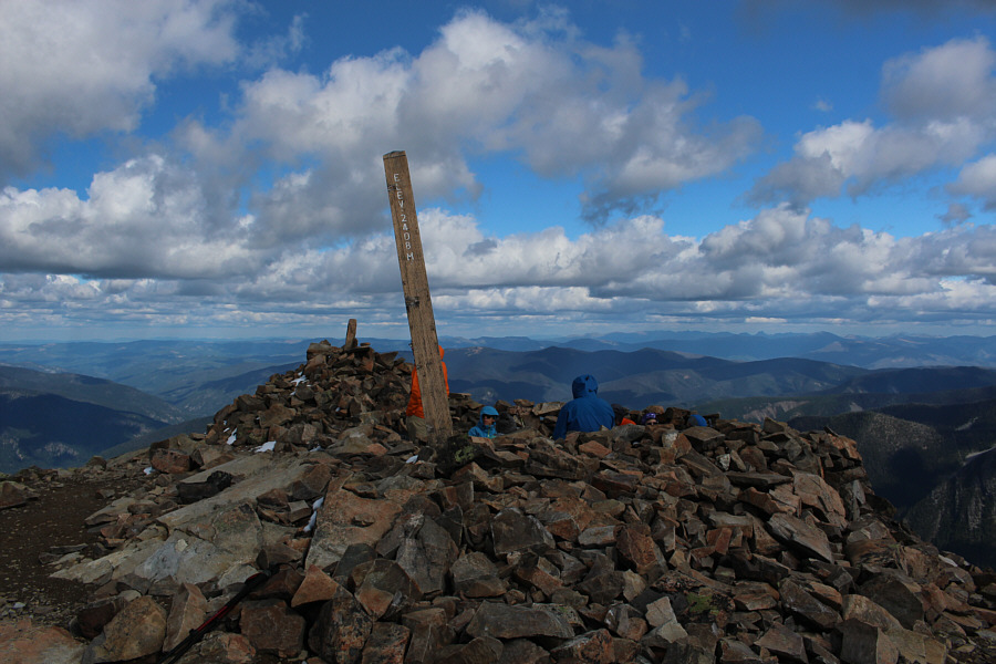
Hikers try to huddle out of the chilly wind on the East Summit (2397 metres*) of Frosty Mountain.

*As measured with my GPS.

 Good place to sneak across the border, eh?

Castle Peak on the American side of the border dominates the view to the south.


And understandably, it is not a popular extension of the hike up to the East Summit! 
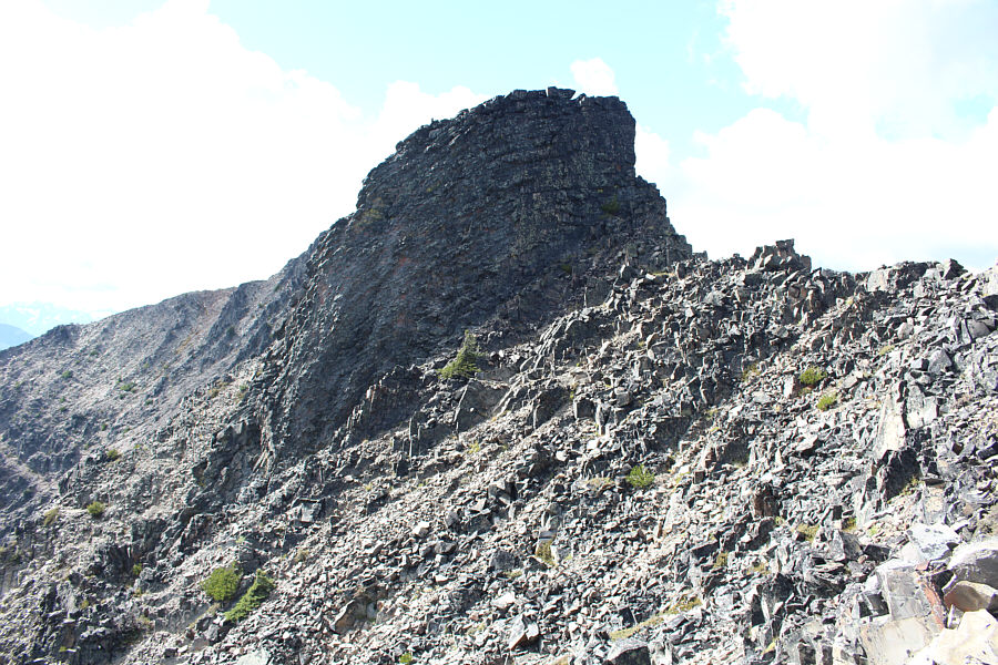
The connecting ridge to the West Summit is a Class 3 scramble.
Lotsa loose rocks coming down here--might be unpleasant going back up this... This is looking back up at the East Summit from near the low point of the connecting ridge.
This is where the fun begins! Several pinnacles guard the connecting ridge to the West Summit.
Probably the crux of the ascent. This pinnacle can be circumvented at bottom left.
No ostentatious wooden pillar on this summit! 
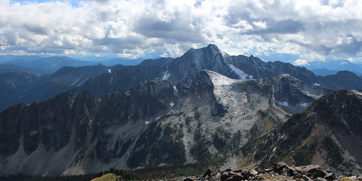
Sonny kneels on the West Summit (2416 metres) of Frosty Mountain.
The tarns are probably seldom visited. Lying southwest of the East Summit, the two tarns in the hanging valley at bottom right are on the Canadian side of the border.
There is probably a scramble route from the other side...maybe. 
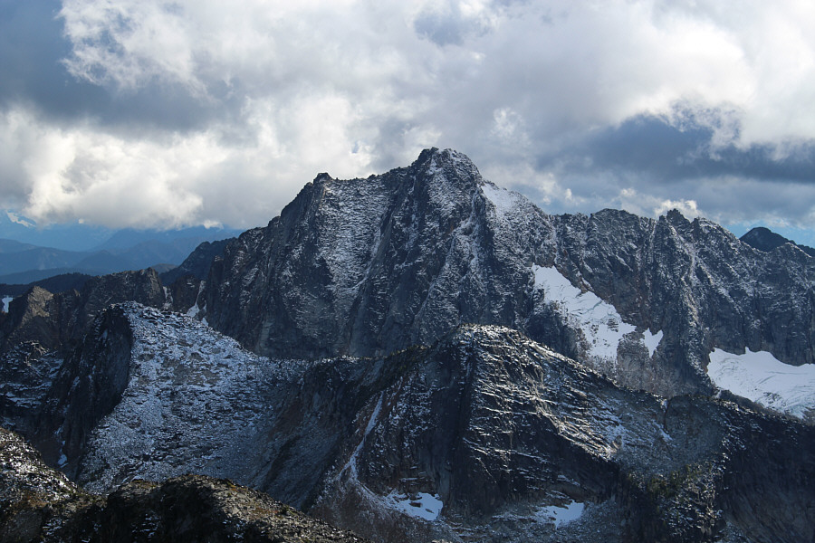
Here is a closer look at Castle Peak.
Since I'm up here, might as well go tag the rest of them! 
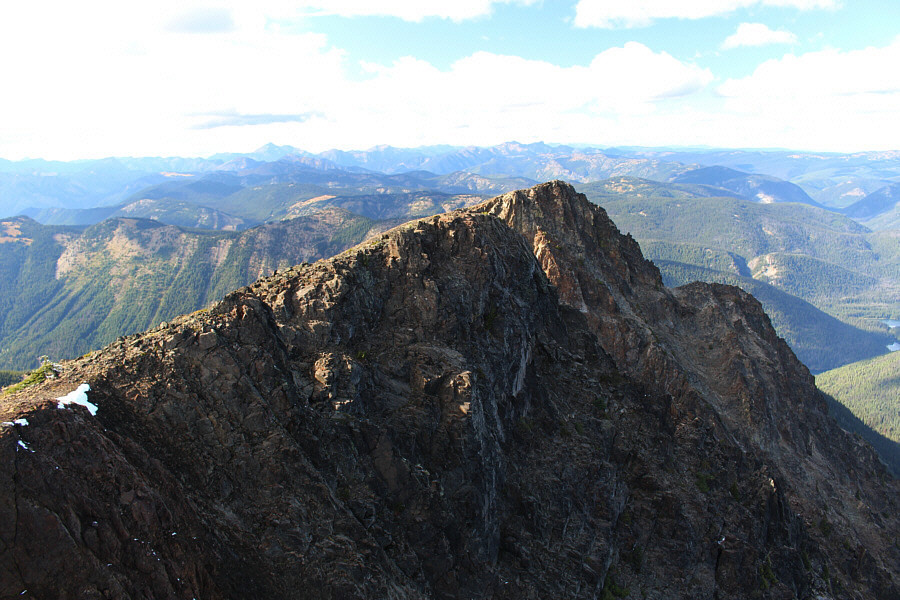
Despite earlier appearances from the approach trail, the remaining high points along the west ridge are easy walk-ups.
The mountain looks totally different from this angle. The next high point along the ridge grants this view of the West Summit's dramatic north face.
On the hike in, I actually thought this was the West Summit. 
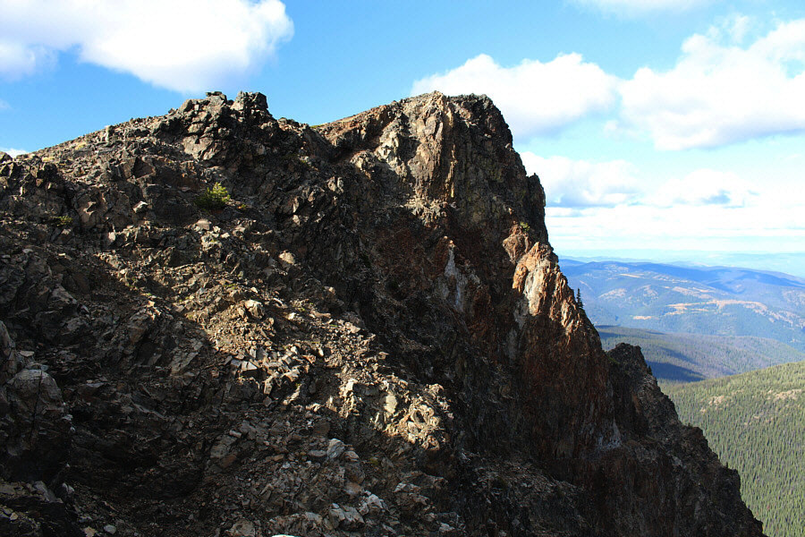
The westernmost high point is only a few minutes away.
Looks unappealing to go all the way back to the East Summit, but that would be my recommended route of descent! 
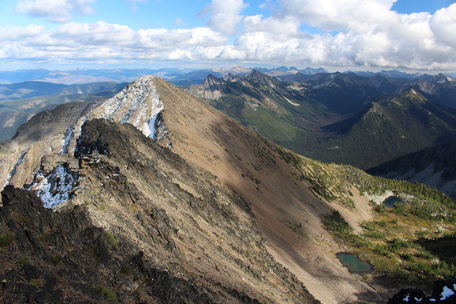
Here is another look at the East Summit and West Summit of Frosty Mountain from the westernmost high point.
Tempting as it may be to descend this ridge, it is highly NOT recommended! The broad northwest ridge looks inviting as an alternate descent route.  Lightning Lake is partially visible at right.
It's been a fun trip so far up to this point... Here is one last look at Frosty Mountain from its northwest ridge.
Prepare for a hellish descent from here! 
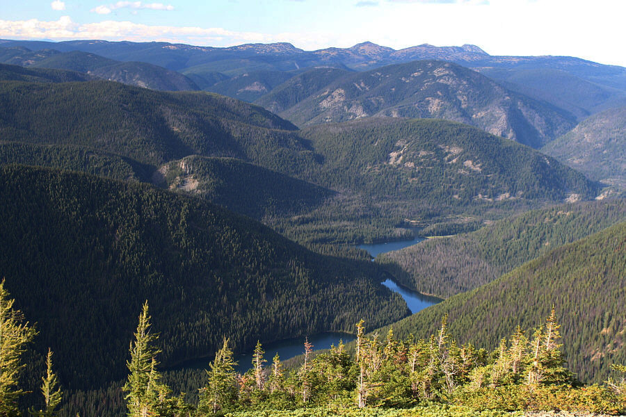
From this vantage point on the northwest ridge just above tree line, Lightning Lake appears to be three separate lakes.  Visible on the horizon are Fourth Brother Mountain (left of centre) and the three peaks of Three Brothers Mountain.
Make no mistake...the drainage is NOT your friend! 
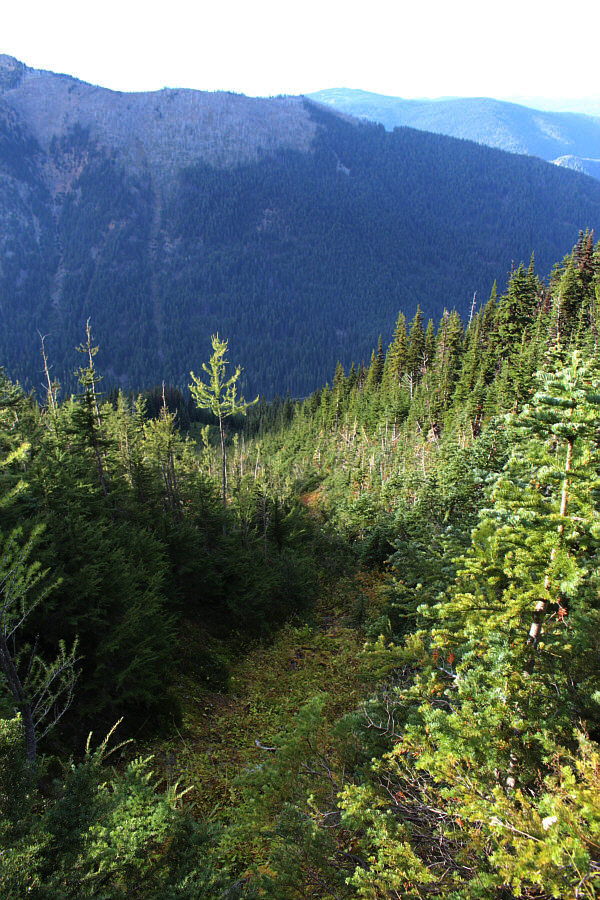
A drainage provides some relief from the thick bush.
A nice scramble, but don't take my descent route!! Total Distance:  21.1 kilometres
Round-Trip Time:  10 hours 17 minutes
Net Elevation Gain:  1165 metres

GPX Data