BOU AVENUE
Mount Collembola
On 25 June 2016, Bob Spirko, Zosia Zgolak and I climbed up Mount Collembola in Alberta's Kananaskis Country (this would be Bob's second ascent of the unofficially-named outlier of Mount Allan).  The weather did not look promising when we left Calgary that morning under a steady rain, but by the time we arrived at the trailhead, the rain had already stopped.  As per Gillian Daffern's route description in Kananaskis Trail Guide, we followed the Mount Allan Centennial Trail for about 5.5 kilometres before turning off a spur trail marked with a small cairn near tree line.  The spur trail petered out shortly thereafter, but we were soon out of the trees and hiking up the obvious north ridge of Mount Collembola.  We encountered few difficulties for most of the ascent until we reached the crux just below the summit.  As per Daffern's directions, we traversed along a grassy ledge to climber's left for about 50 metres or so before scrambling up a steep gully.  While the gully was thankfully snow-free, the wet dirt in the gully was still loose and slippery in spots.  Upon clearing the crux, we were only a few steps from the summit cairn.

After taking an extended break on the summit, we descended to the col leading to the lower south summit.  Since we had no aspirations to climb Mount Collembola's south summit or continue further to Mount Allan, we dropped down into the bowl encircled by the two mountains.  Here, we visited the largest of the Jubilee Tarns which Daffern refers to as Queen's Tarn.  Feeling adventurous, we even ditched our socks and boots to wade across the shallow waters to a circular island with a small high point that I dub "Queen's Tarn Peak" (no cairn, so first ascent?).  Although walking up this tiny mound was painful enough in bare feet, the real crux was cleaning off the sticky mud from our feet after returning to the "mainland".  Following this little bit of fun, we hiked northward through mostly open meadows until we intersected the Mount Allan Centennial Trail.  The subsequent hike back to the trailhead was quick and painless.

Be sure to check out Bob's trip report.
No rain; we lucked out again! 
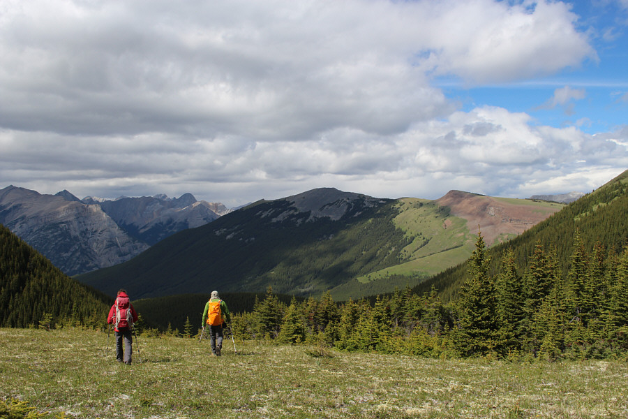
Bob and Zosia pause along the Mount Allan Centennial Trail.  Pigeon Mountain is visible through the mist in the distance.
I get misty, the moment you're near... 
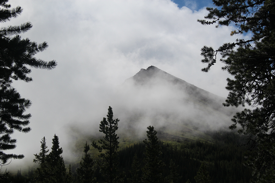
The north ridge of Mount Collembola is partly shrouded by mist in this view from the Mount Allan Centennial Trail.
Which lasts all of about 10 seconds... 
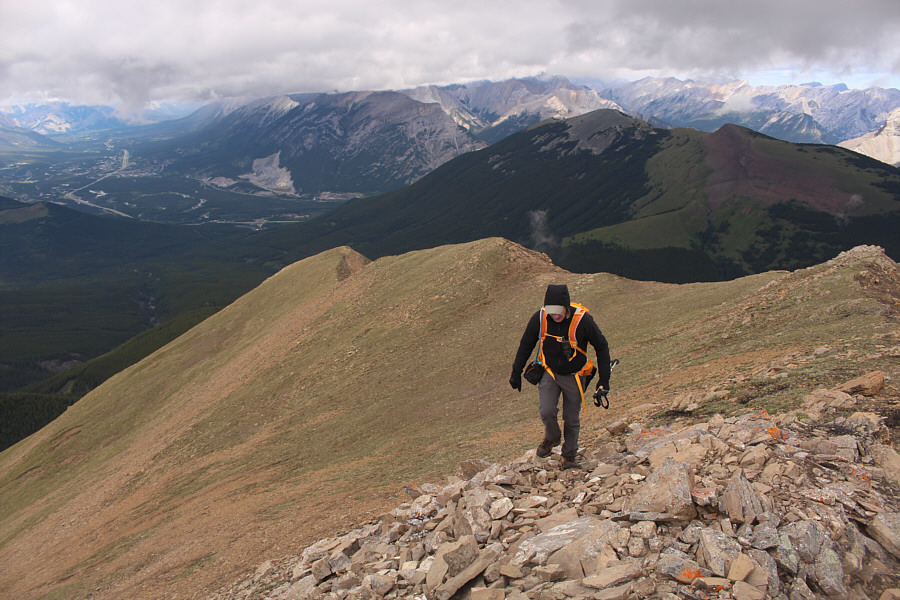
Sonny shows off by going into power-hiking mode.

Photo courtesy of Zosia Zgolak

It's a good grind here! Zosia and Bob climb steadily up the north ridge of Mount Collembola.
This section was easier than it looks. Zosia leads the way up a rocky section of the ridge with Bob trailing behind.
Back in the bowl...back in the bowl... 
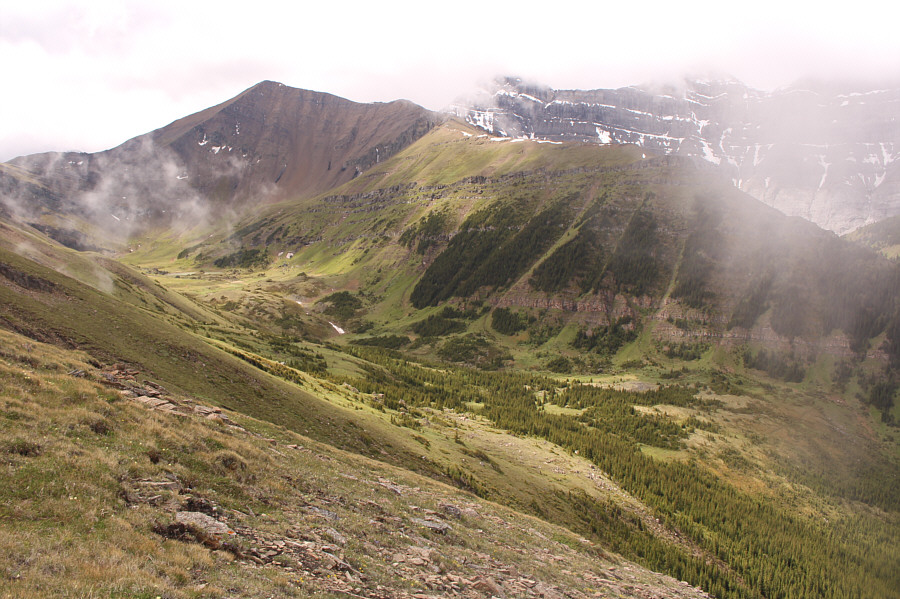
Here is a first glimpse of the bowl below Mount Allan which would be the group's exit later in the day.  Note the Mount Allan Centennial Trail running across the valley at bottom right.
Where the heck is this scary crux?? Bob and Zosia continue up the north ridge which looks pretty tame at this point.
Hmmm...it does look scary! 
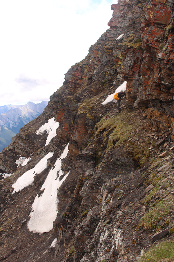
Zosia and Bob catch a glimpse of the crux which is partially hidden by mist.
Great ridge walk so far! 
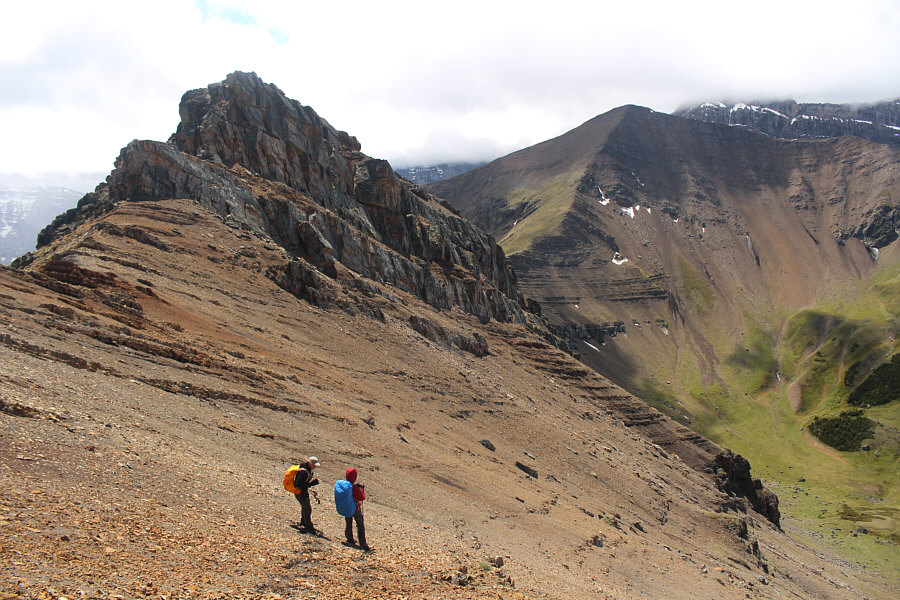
Behind Bob is the north ridge of Mount Collembola.  Behind the north ridge is Pigeon Mountain.
Hmmm...doesn't look very promising from here... Bob and Zosia approach the crux section.
This is where the fun really begins! Zosia pauses at the crux.  The easiest route traverses left along the grassy ledge and goes up a hidden gully near the snow patch at far left.
Just a bit further, Bob... Bob searches for the hidden gully along the grassy ledge.
That's how I like my gullies--loose and dirty! Bob and Zosia scramble up a loose and dirty gully.
Zosia was also the only one sensible enough to bring a helmet! Zosia is focused as she climbs.

 It looks like Bob and I are supporting an amputee!

Sonny, Zosia and Bob stand on the summit of Mount Collembola (2764 metres).


Maybe it's a sign that we should climb it... Zosia sits down to enjoy the summit views.  The peak illuminated by sunshine is Mount McGillivray.
Bob will be writing a guidebook called, "Texting in the Canadian Rockies"! 
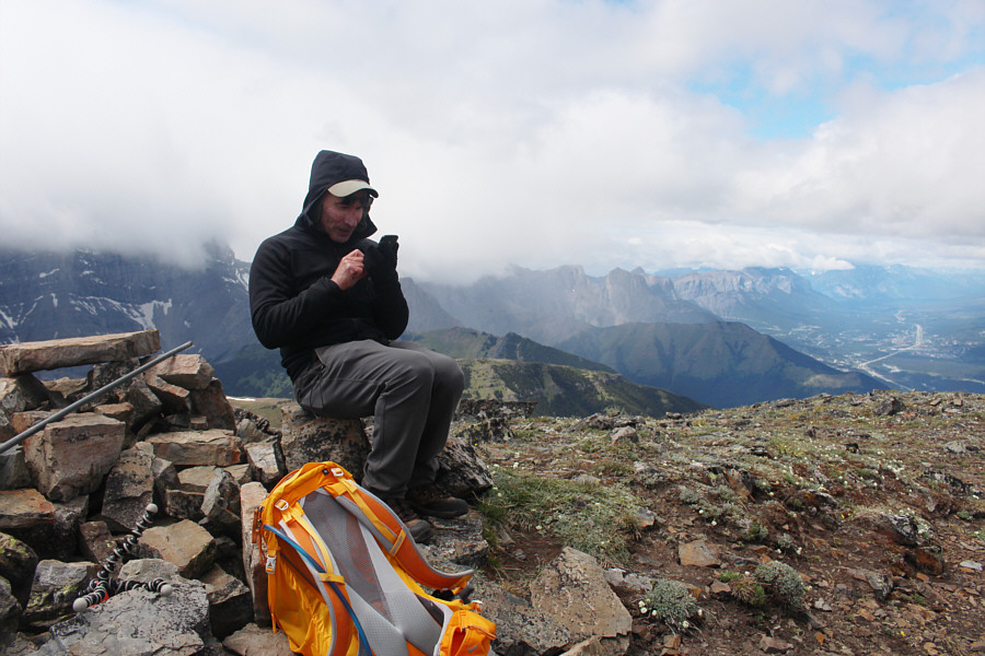
Bob sends a text message to Dinah Kruze who is currently in Moose Jaw, Saskatchewan.
Not the best views, but at least the sun is out! 
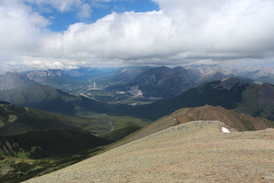
This is looking northwest toward the town of Canmore.  Much of Mount Collembola's north ridge is visible here.
And I haven't climbed any of these yet... 
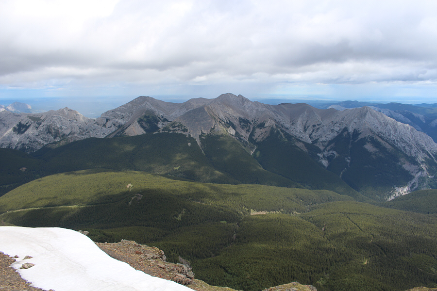
The view northeast across Skogan Pass includes Mount McGillivray (far left), Skogan Peak (right of centre), and Mount Lorette (far right).
Just too lazy today to go up the south summit... Bob and Zosia arrive at the col before the lower south summit of Mount Collembola (left).  Mount Allan is visible at right.
Cue the Nick Rivers tune here...Scree Surfin'...if everybody had a 12-guage... 
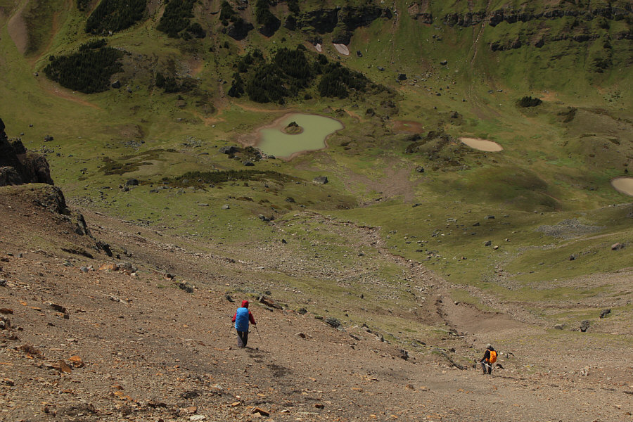
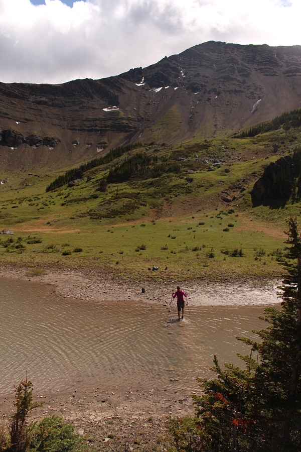
Zosia and Bob rapidly descend into the bowl on loose scree.  Queen's Tarn is the one with the island.
It's a mutant! 
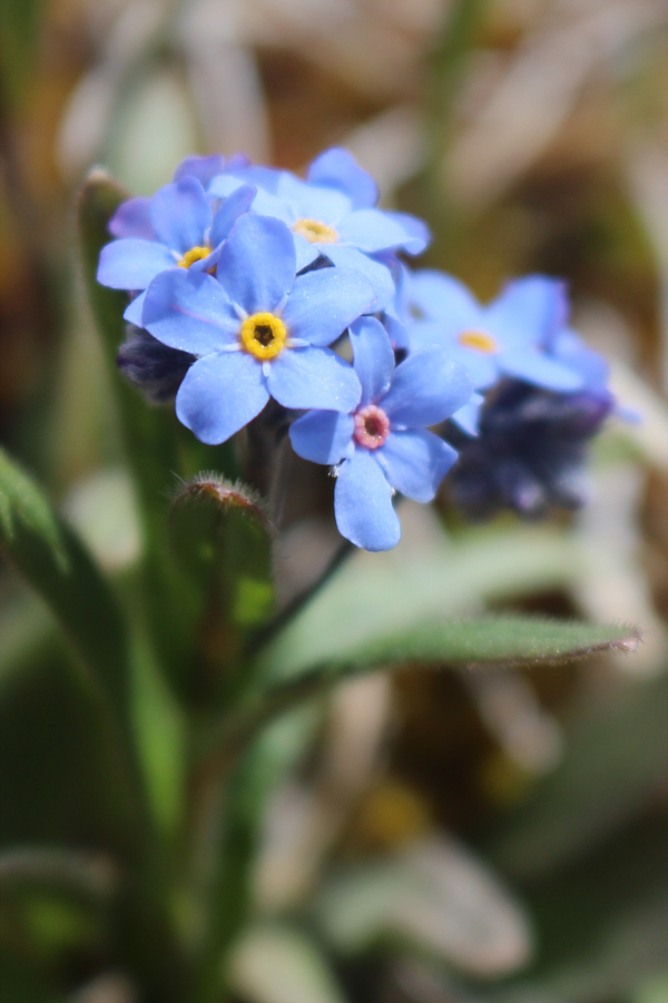
One of these alpine forget-me-nots oddly has a pink centre.
The rest of the tarns are not much more than mud holes. 
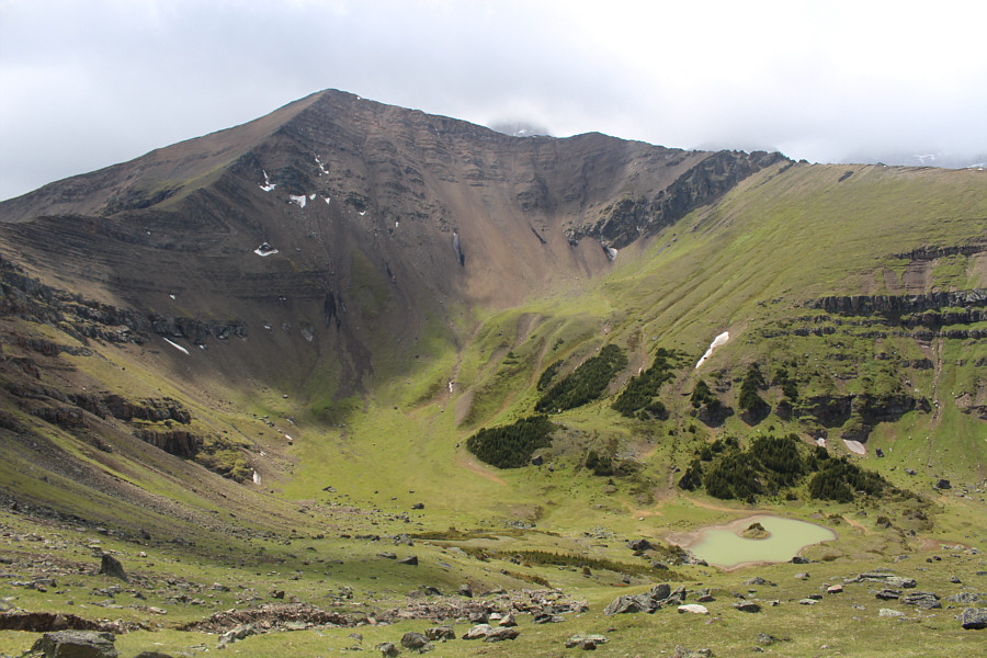
Queen's Tarn is the largest of the Jubilee Tarns and sits below the north face of Mount Allan.
Can you imagine the splash that rock would have made in Queen's Tarn? Bob bags a big rock near Queen's Tarn.
I can't believe everyone was on board with wading across to the island! 
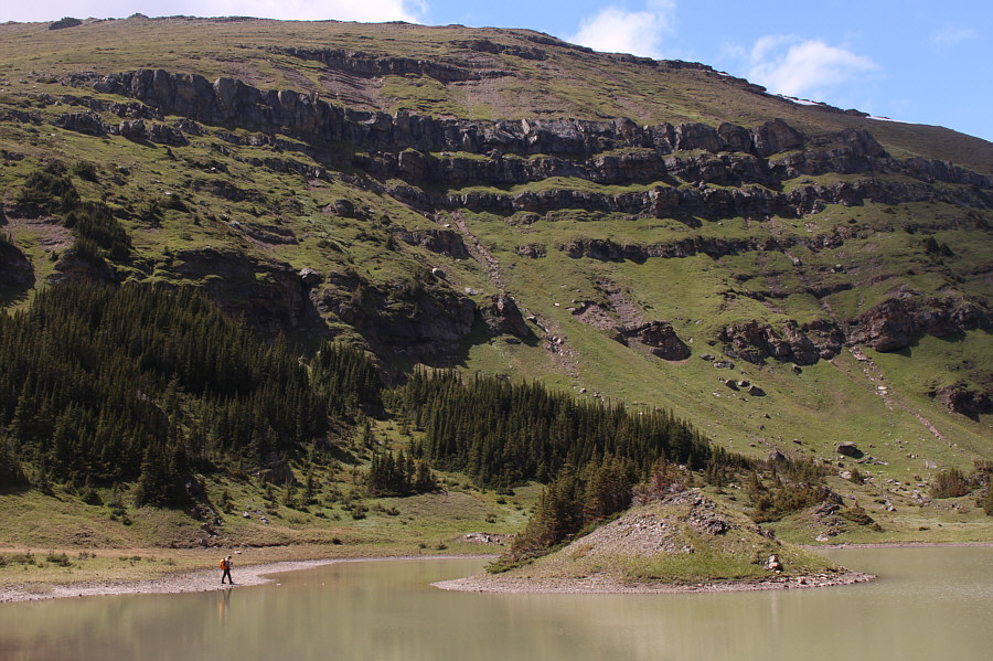
Bob finds the narrowest spot to cross the water.
Where's Moses when you need him?? Sonny prepares to make the crossing over to Queen's Tarn Peak.

Photo courtesy of Zosia Zgolak

I think muddy feet are sexy. 
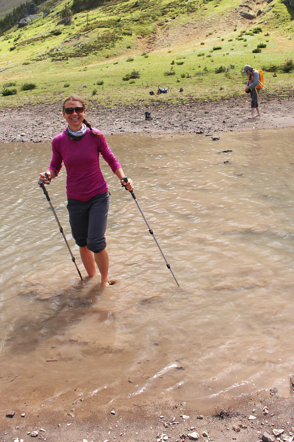
Zosia seems to enjoy getting her feet muddy.
Bob just wants to walk ON water like Jesus! Bob tries to step on some submerged rocks as he crosses the water.
Just a few more steps...OWWWWW!!!! Bob ascends a grassy slope in bare feet.  Behind him is the route from the col between the two summits of Mount Collembola.
Hey, don't laugh. This peak is higher than Mount Yamnuska! Bob, Zosia and Sonny sit on the summit of Queen's Tarn Peak (2257 metres).
Thank goodness there are no bears or sharks here... Zosia returns to the "mainland".
Believe it or not, we're still following a trail here! Some tall bushes threaten to swallow up Sonny.

Photo courtesy of Zosia Zgolak

Good thing too 'cause bushwhacking out this valley probably isn't a lot of fun... Zosia and Bob will soon run into the Mount Allan Centennial Trail on their hike out.
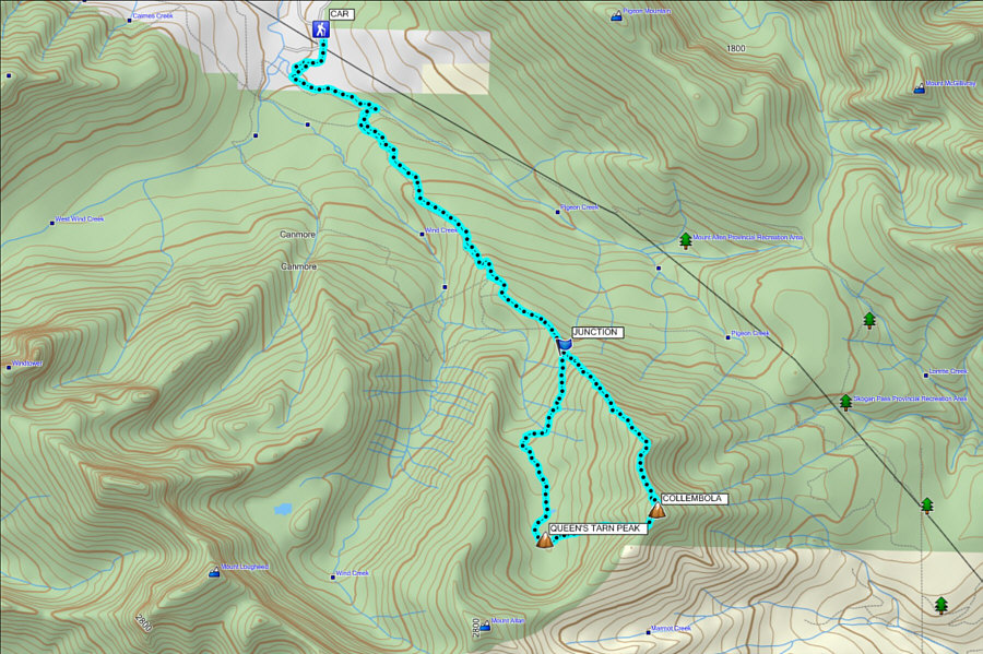
This trip was a blast! Total Distance:  19.9 kilometres
Total Time:  9 hours 12 minutes
Net Elevation Gain:  1332 metres

GPX Data