BOU AVENUE
Mount Ellen
After spending a restful night in a motel in
Hanksville, Utah, Zosia Zgolak and I headed for the nearby Henry
Mountains on 12 October 2016 to hike up Mount Ellen, the highest point in
the range. According to the route description in
Summitpost.org,
there are two different approaches to the trailhead at Bull Creek Pass,
and we hoped to get some updated information on road conditions from the
Bureau of Land Management (BLM) office in town. Before getting
there, we stopped at a local gas station where a lady with a big red
truck full of dogs offered to lead us up to Bull Creek Pass via the
eastern approach since she was headed up there anyway. However,
before Zosia and I had a chance to get back in our car, the lady took off
without waiting for us. Returning to our original plan, we visited
the BLM office which is located near the end of 100 W street in the
southwest corner of Hanksville (the BLM office is incorrectly marked on
Google Maps). The lady in the BLM office recommended that we drive
to Bull Creek Pass via the western approach as the roads were apparently
in better shape there. Heeding her advice, we drove west along
Highway 24 before turning south onto the Notom-Bullfrog Road. At a
signed junction, we turned eastward and began the long drive up to Bull
Creek Pass via McMillan Springs Campground. The dirt road is
generally in pretty good condition, but it is quite steep in a few places
and occasionally rough enough to warrant having a high clearance vehicle.
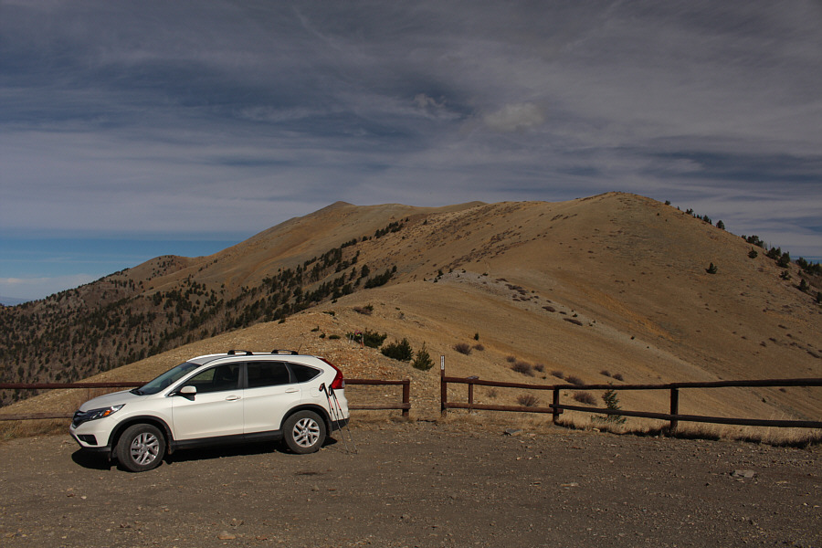
A few kilometres before Bull Creek Pass, Zosia and I were a bit surprised
to see a Honda Civic sedan parked by the side of the road, and it
appeared likely that we would have company on Mount Ellen. The
trailhead at Bull Creek Pass was deserted when we arrived, but just as we
were about to start hiking, the big red truck full of dogs drove by
presumably after climbing up the eastern approach. The truck
stopped at the pass, but the lady we met at the gas station did not get
out of her truck. If I had to guess, I would say that she was
probably just as surprised to see us as we were of her. After a
brief pause, the truck continued along the road down the way we came up
leaving Zosia and me to speculate as to why the lady would take such a
roundabout route to get to wherever she was headed on the west side of
the Henry Mountains.Compared to
the epic drive to get to the trailhead, the actual hike to the top of
Mount Ellen seems almost anticlimactic. We had no problems
following a good trail which heads northward before disappearing on the
broad North Summit Ridge. Except for the presence of a register, the true
summit is hardly distinguishable from the couple of minor bumps leading
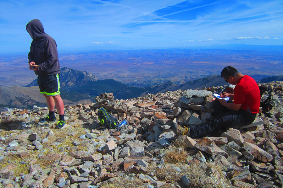
up to it. While we were perusing the summit register, we were joined by a
lone hiker returning from a slightly lower point to the north known as
Mount Ellen Peak (yes, the name seems redundant). The hiker introduced
himself to us as Dwight Wolf, and not surprisingly, he was the owner of
the Honda Civic--actually a hybrid--we saw on the road earlier. It turns
out that his hybrid car's propulsion battery was exhausted by the steep
climb up the road, and hence, Dwight chose to walk the remaining distance
to Bull Creek Pass. We also learned that Dwight is from New Hampshire and
that he was in the midst of a month-long solo peak-bagging road trip. After chatting at length about mountains of all sorts, we exchanged
contact info and parted ways as he headed back to the trailhead while Zosia and I set off for Mount Ellen Peak.
Getting to the top of Mount
Ellen Peak entails a loss and re-gain of about 125 metres, but the going
is easy. After another lengthy stop at this lower summit, we retraced our
steps back over the top of Mount Ellen and returned to the trailhead without
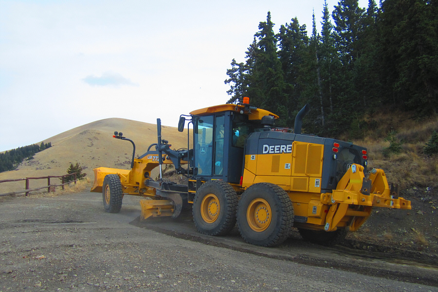
incident. Just as we reached our car, we saw a large grader lumbering up
the same road we had driven and continuing over
Bull Creek Pass. I was a bit surprised to see the road being bladed on
this day, especially since the road condition was not that bad in my
opinion. More importantly, I was thankful that we were late enough
getting back to miss running into the grader on our drive out. Maneuvering on the steep narrow road to get by the grader would have been
tricky. The long drive back to the Notom-Bullfrog road went without a
hitch, but instead of returning to Highway 24, we turned south and drove
into Capitol Reef National Park for our next adventure.

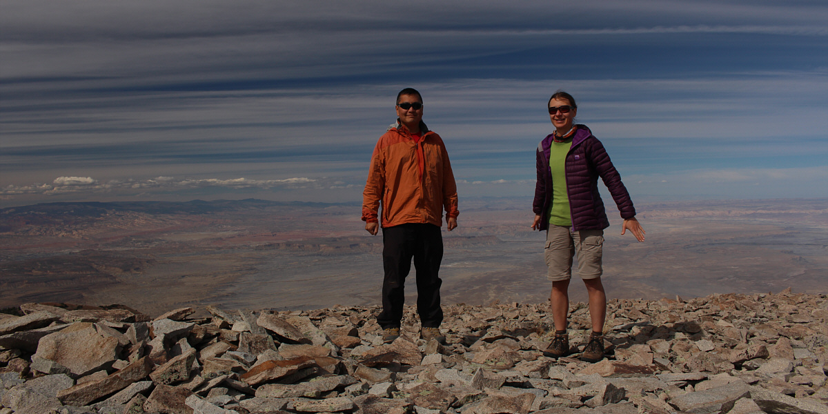
Zosia and Sonny stand on the highest point of Mount
Ellen (3509 metres) and the Henry Mountains.
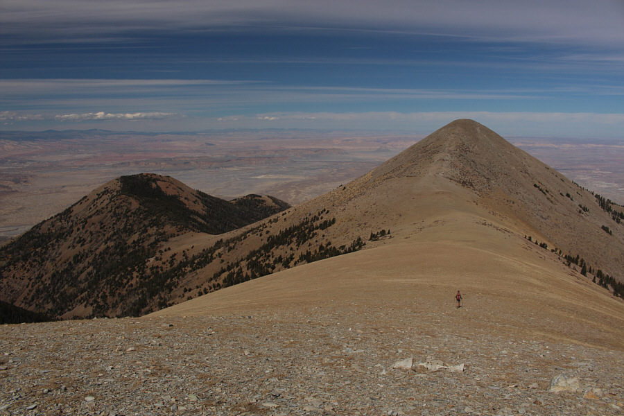 |
Zosia heads for Mount Ellen Peak.
The bump to the left is known as Deer Heaven. |
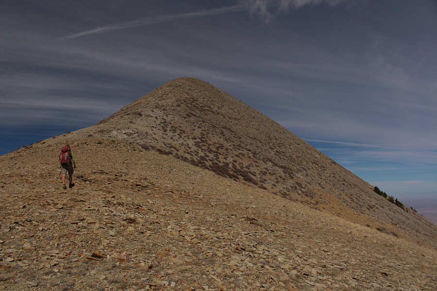 |
The summit of Mount Ellen Peak is
further away than it looks here. |
 |
Zosia holds up what appears to be the
lower jaw bone of a horse. The red can at her feet holds the
summit register for Mount Ellen Peak. |
Sonny and Zosia look like they are ready to launch into
space from the summit of Mount Ellen Peak (3508 metres).
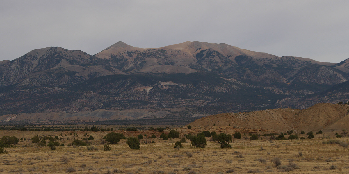
From the road on the drive out, here is a more
comprehensive view of Mount Ellen Peak and the North Summit Ridge of
Mount Ellen which includes the highest point.
 |
Total
Distance: 9.2 kilometres
Round-Trip Time: 4 hours 21 minutes
Net Elevation Gain: 327 metres
GPX Data |