BOU AVENUE
Mount Burke
On 26 July 1997, Dan Millar and I hiked up to Cameron Lookout located on the summit of Mount Burke in the Highwood region of Alberta's Kananaskis Country.  We were camping with our girlfriends for the weekend at Cataract Creek campground, but for reasons long forgotten, only Dan and I were keen on hiking the moderately steep trail up Mount Burke.  As per Gillean Daffern's directions from Kananaskis Country Trail Guide (3rd Edition), we hiked up Salter Creek to the marked turnoff for the Mount Burke trail and settled into a long and gradual ascent through the forest and up the open west ridge. We had no issues whatsoever in reaching Cameron Lookout, and our return trip was uneventful as well.
Dan is living in Hamilton now and doesn't climb mountains anymore. Dan trudges up the trail above tree line.  Cameron Lookout is visible in the distance.
I miss hiking in shorts! 
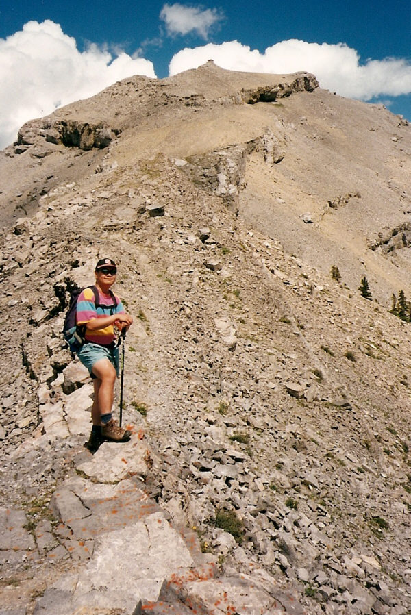
Sonny pauses for a break on his way up to the summit of Mount Burke.
Still looks this way in 2016! 
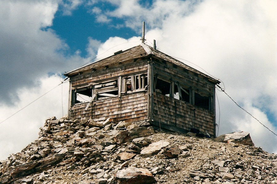
Dan pokes his head out of Cameron Lookout.
I don't think we had any intentions of going to the south summit though. 
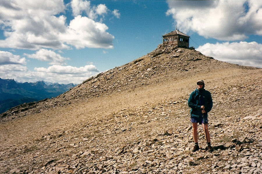
Dan wanders a little bit south of the summit.
As in "halt, or you're gonna fall off the cliff behind me"! 
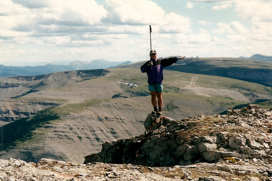
Sonny gives the old Canadian Forces drum major signal for "halt".  Behind him is Plateau Mountain.
It's too bad our girlfriends missed out on this great hike... Dan heads back to the Cataract Creek campground (lower centre).
I still have that 'pride' shirt! Near the campground, Sonny points at Cameron Lookout on top of Mount Burke.
On 7 May 2016, I joined Zora Knezevic, Dinah Kruze and Bob Spirko for an ascent of the North Peak of Burke as described in the 4th Edition of Daffern's popular trail guide.  Because the Cataract Creek campground was still closed for the season, we had to walk an extra kilometre or so along the access road before reaching campsite #73, the launching point for the hike.  Just as Daffern describes, we skirted along the edge of a grove of aspen trees before crossing a logged area and following the left (north) bank of a dry creekbed.  Unable to locate the marked trail promised by Daffern, we began heading up the slope through the forest.  I soon became separated from the others, but since the bushwhacking was not too bad, I simply continued working my way uphill thinking that I would rejoin everyone somewhere higher up.  Meanwhile, Zora, Dinah and Bob actually stumbled onto Daffern's trail which they described as "steep".  I reunited with them just below tree line, and after taking a short break, we continued up the rocky southwest ridge.  Despite appearances, this ridge is mostly just easy scrambling with a few avoidable sections of mild exposure.  I actually enjoyed tackling some of the drop-offs head-on as well as scrambling up Daffern's "tower".  Our ascent of the North Peak ended with a plod up easy scree.

As we relaxed at the top of the North Peak, we contemplated the traverse to the main summit of Mount Burke.  All of us had previously hiked up Mount Burke via the normal route, but this traverse, described in Daffern's guide book, was something novel and offered the opportunity to complete a loop.  After much debate, we finally set off along the connecting ridge.  A buttress guarding the south side of the North Peak looks like it has to be bypassed, but we were able to descend it directly without too much trouble.  We subsequently followed a beaten trail in the scree for most of the way to the main summit.  A lingering snow patch just below a break in the cliff band guarding the summit of Mount Burke had given us pause when we were studying it from the top of the North Peak, but upon closer inspection, the snow patch probably made getting up the break a lot easier than if it were dry.

After another rest stop beside Cameron Lookout on the main summit of Mount Burke, we descended the normal route back to Cataract Creek campground.  Because much of the trail along Salter Creek was wiped out by the floods of 2013, a new trail has developed in the lower reaches.  Resembling a cut-line, this trail is monotonously straight with a couple of rather annoying undulations near the bottom.  Although the trail allowed us a quick descent, I would hate to go up this way.  Daffern predicts that the traverse from the North Peak to the main summit of Mount Burke is destined to become a classic.  If so, there may no longer be a need to ascend Mount Burke via its normal route in the future.

Be sure to check out Bob's report here.
It's kinda peaceful here without all the rowdy campers. 
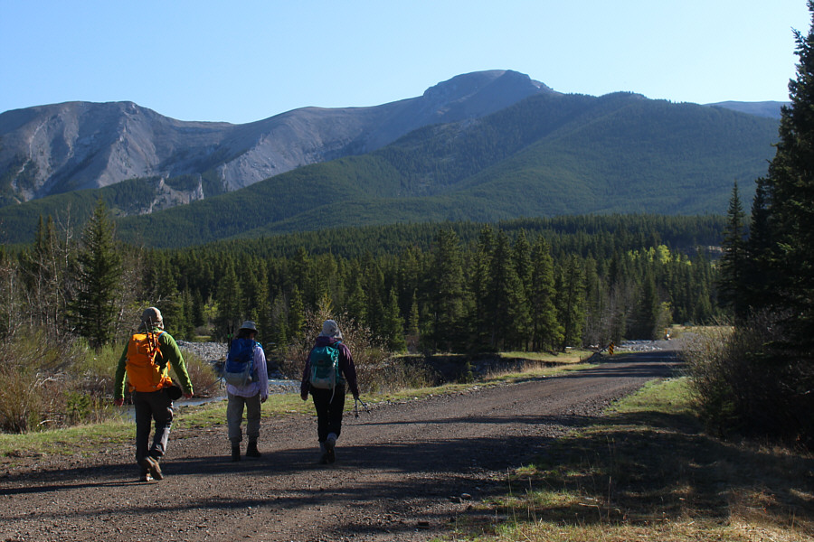
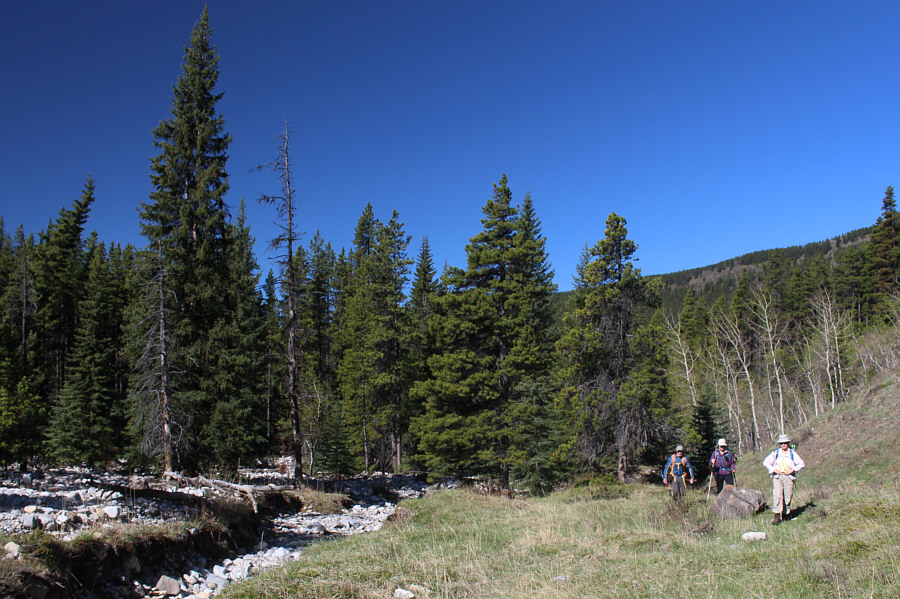
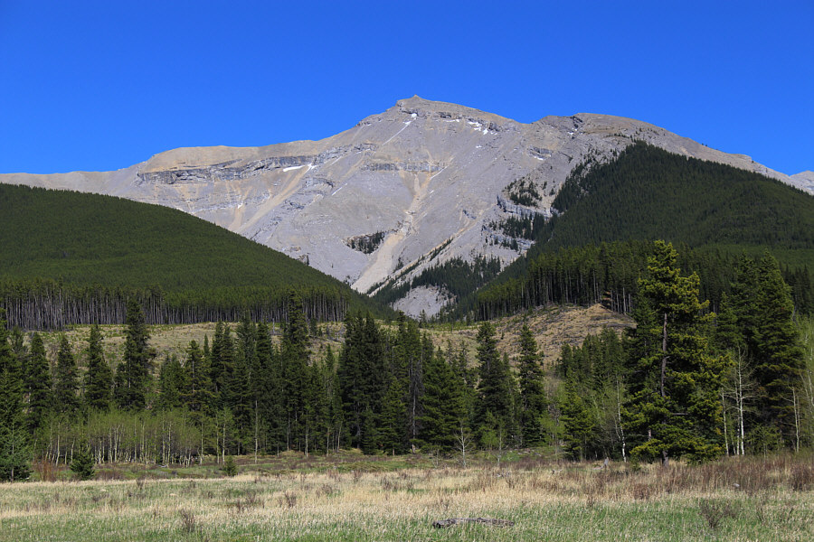
Bob, Zora and Dinah hike along the access road to Cataract Creek campground which is not yet open for the season.  The North Peak of Burke is visible ahead.
So, what if the site is occupied? Just cut through, or stop for a beer? 
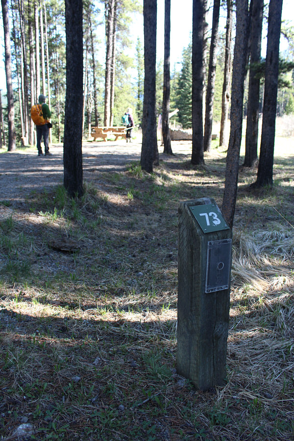
Site #73 is where Daffern suggests to leave the campground.
Too early to be artistic? 
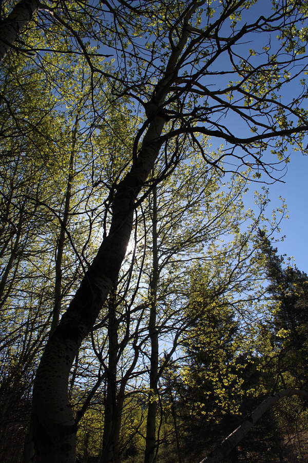
The leaves of aspen trees glow under the morning sunshine.
It's best to stay out of the tedious creekbed. Bob, Dinah and Zora "follow the left bank of the creek upstream" as described by Daffern.
Not that terrible but a bit tedious nonetheless. 
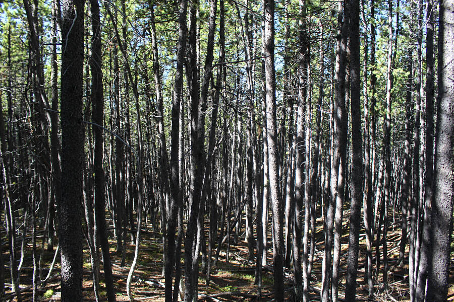
Sonny's ascent route entails a lot of weaving in between trees.
Unbelievable how dry everything is for the beginning of May! Dinah emerges from the trees on the southwest ridge.
Looks interesting ahead... Bob consults Daffern's route description near tree line.
The token flower picture. 
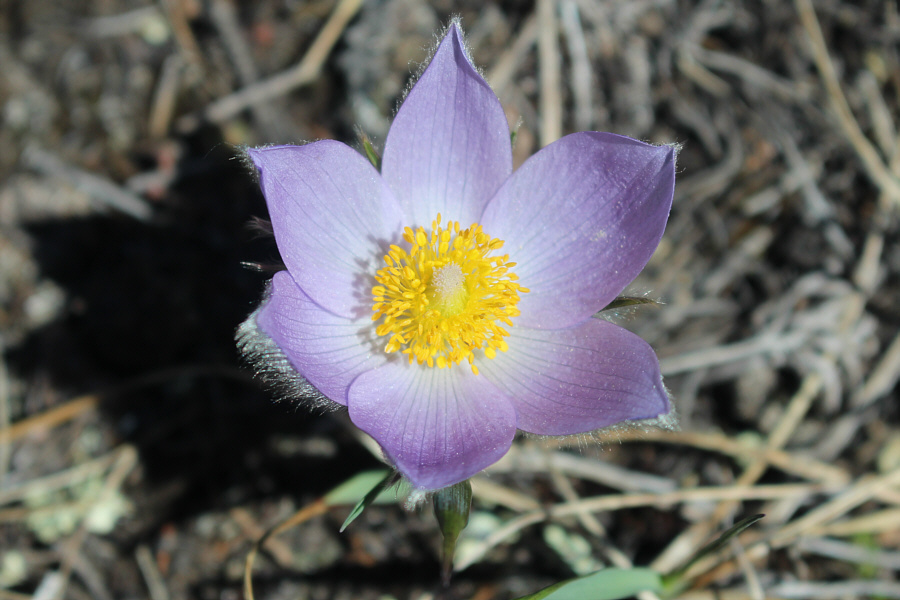
A prairie crocus is in full bloom in the sunshine.
The guy ahead on the ridge was a solo hiker who passed us and also later traversed to the main summit. 
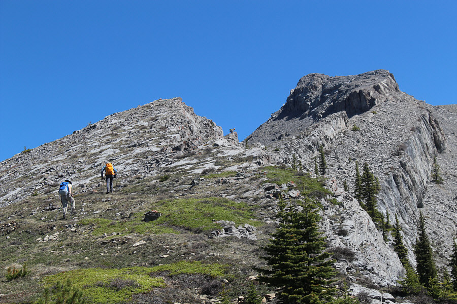
Zora and Bob approach the start of the rocky section.
No handrail needed...just good balance! Daffern suggests using the ridge crest as a "handrail" here.
It's worth scrambling up onto the crest when possible. 
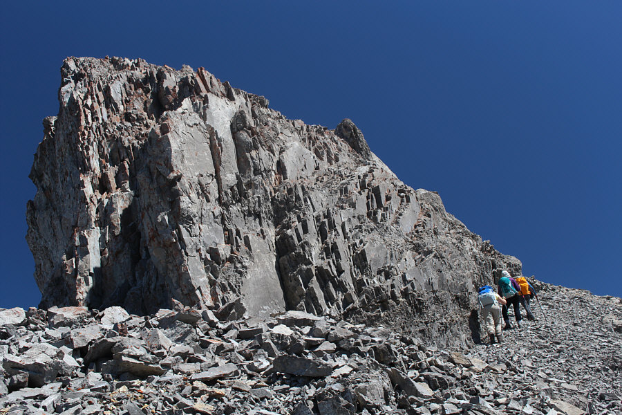
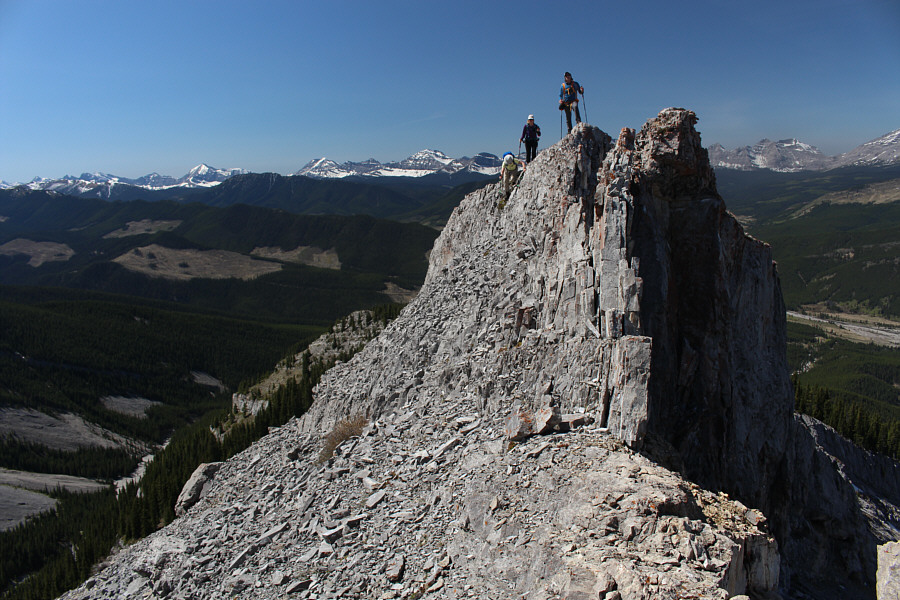
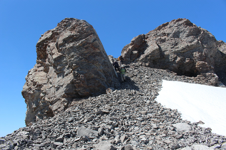
Zora, Dinah and Bob skirt around the right side of Daffern's "tower".
Back on easy street. 
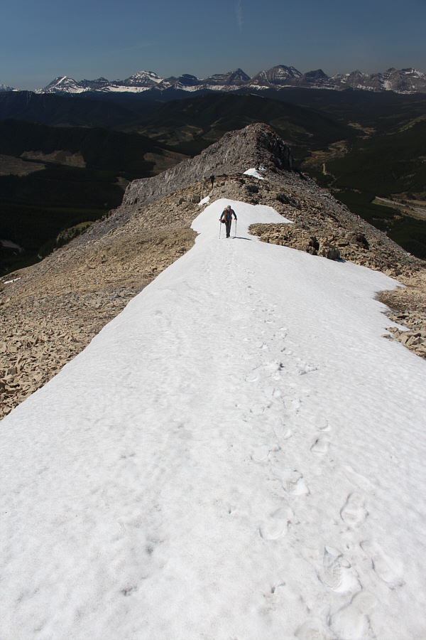
Past all difficulties, Bob hikes up a lingering snow patch.

Boy, do we ever look like a bunch of stiffs!

Bob, Dinah, Zora and Sonny stand on top of the North Peak of Burke (2465 metres).


I inadvertently over-exposed this photograph, but somehow I like it like this! Bob, Zora and Dinah take a well-deserved break.
The unnamed ridge at centre might make for a good hike in the future... 
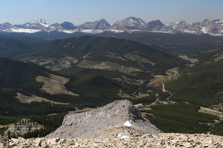
Beyond the "tower" are clear-cuts and peaks along the Continental Divide.
Mist Mountain almost looks like it's already in shape for scrambling; too bad the highway is still closed... 
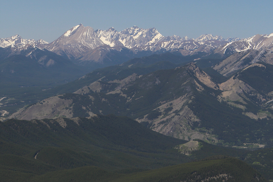
The Misty Range stands out far to the northwest.  In the foreground at right is Junction Hill.
"If we don't do this traverse today, we will never do it." --Sonny 
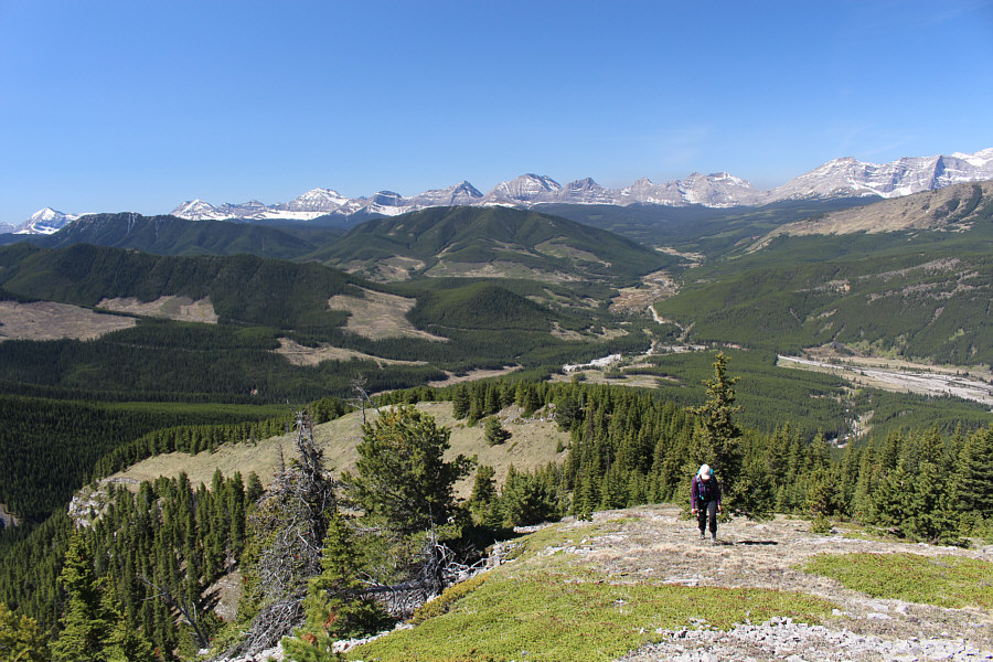
Zora and Dinah begin the traverse to the main summit of Mount Burke.
There is some mild exposure here, but it's not bad. Bob snaps a photograph of Dinah down-climbing a steep section on the buttress guarding the south side of the North Peak.
That was easy! The group descends a weakness in the buttress guarding the south side of the North Peak.
Kinda boring actually... 
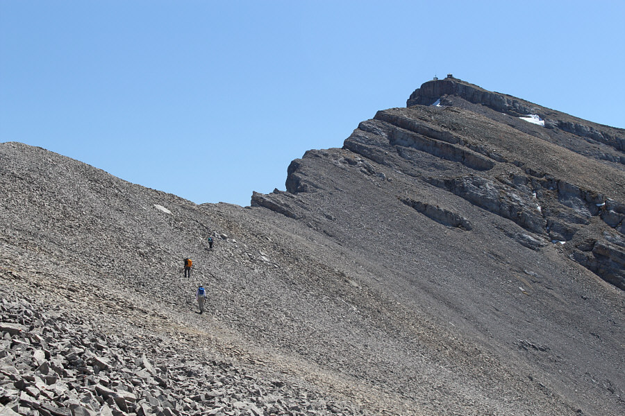
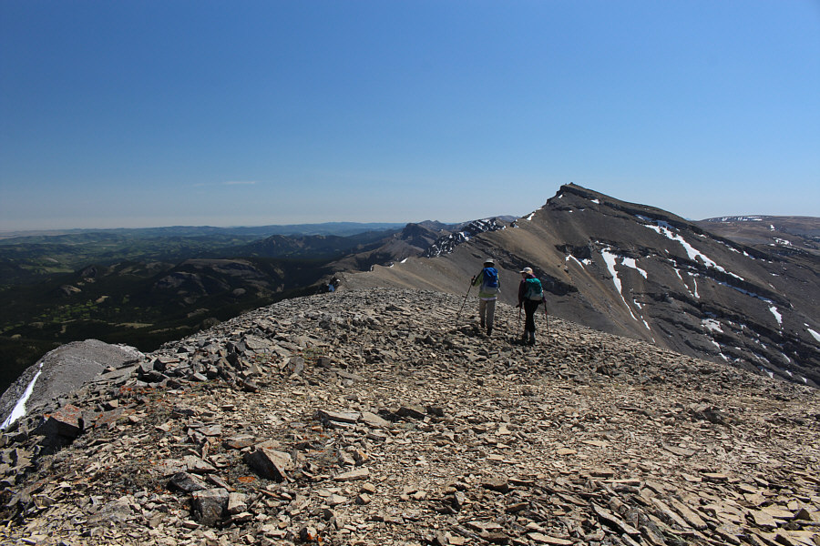
Most of the traverse is easy hiking on a faint trail through scree.
Tackling the ridge head-on might be fun too. The group bypasses a cliff band guarding the ridge.
No turning back now! 
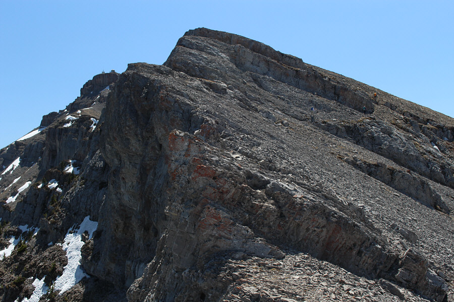
The group approaches the cliff band guarding the summit of Mount Burke.
This might be easier with the snow than without... Dinah crosses the snow patch below the weakness in the cliff band.
Well, technically we're standing beside the summit (occupied by Cameron Lookout) but close enough! Sonny, Dinah, Bob and Zora reach the summit of Mount Burke (2539 metres).
Plateau Mountain is best visited by bicycle. Plateau Mountain dominates much of the landscape to the south.
Some future scrambling objectives? 
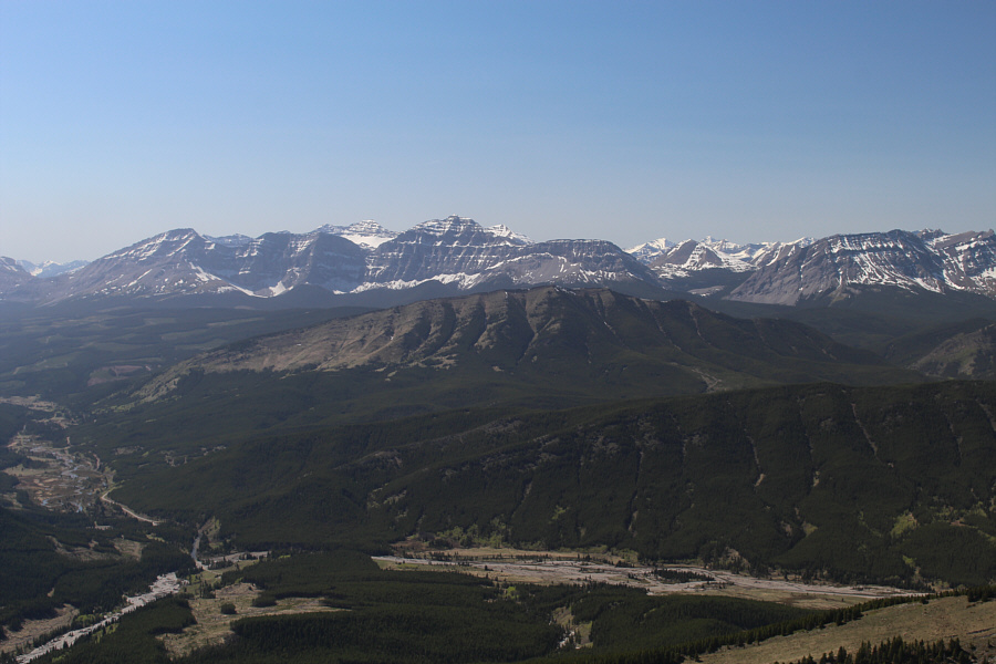
Notable peaks behind Raspberry Ridge (centre) include Mount Etherington (far left), Baril Peak (left of centre), and Mount Armstrong (far right).
Probably just as good going the other way... 
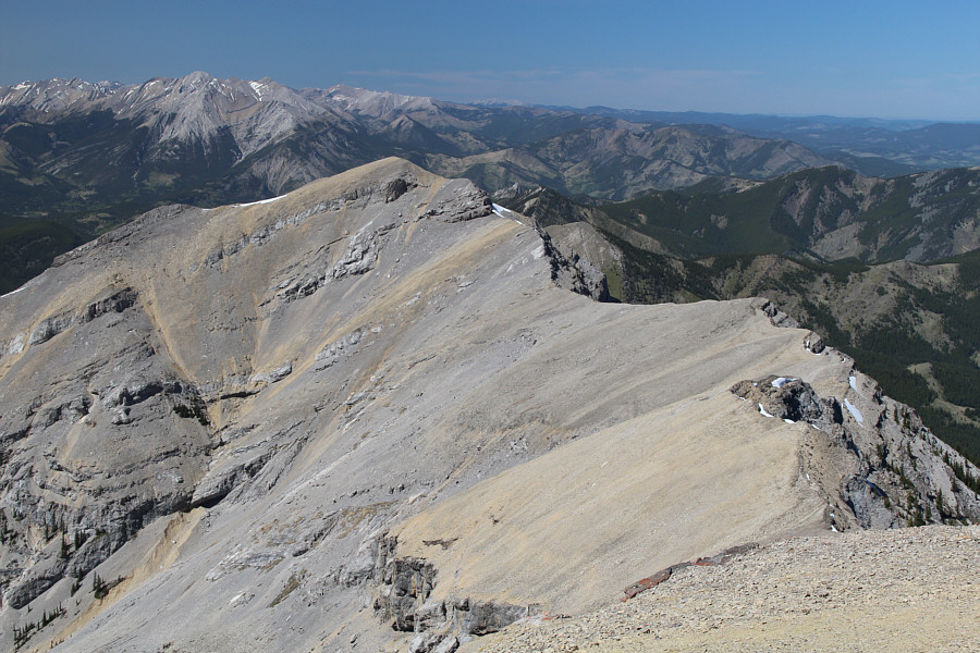
Here is another look at the North Peak of Burke and the intervening ridge.
It's worth comparing this photo with the one taken 19 years earlier of Dan descending--way more clear-cuts! 
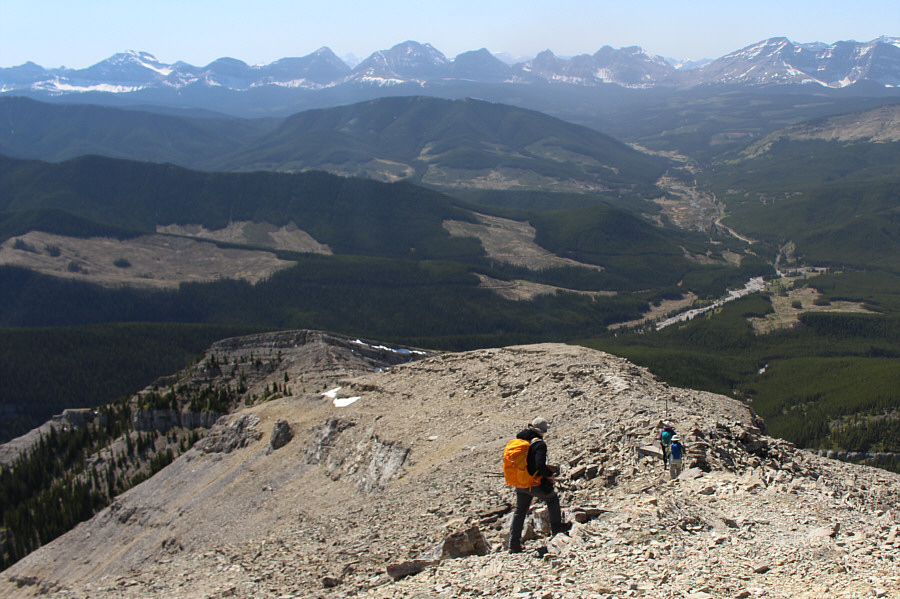
Bob follows Dinah and Zora down the standard route for Mount Burke.
A problem for another day...maybe... 
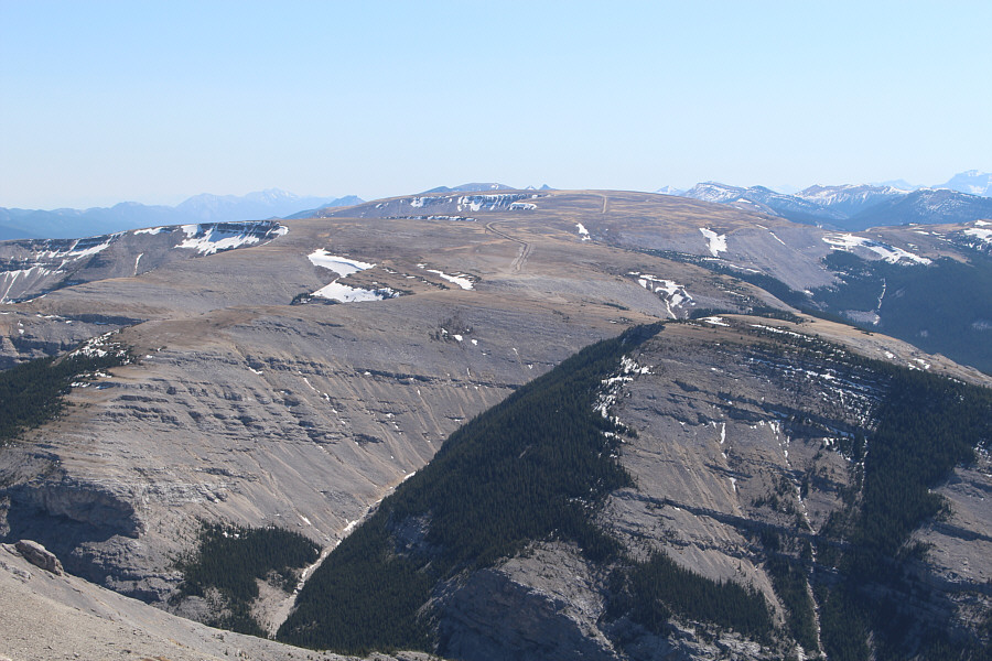
These cliffs render the traverse between Cameron Lookout and the south summit problematic.
I would hate to go up this way! The new trail for Mount Burke is essentially a straight, monotonous cut-line.
Of course, the clear-cut wasn't there 19 years ago... Here is a last look at Mount Burke from the campground access road.  The new trail enters the forest at the top of the clear-cut on the right.
Sure to be a popular trip for future meetups. Total Distance:  14.3 kilometres
Round-Trip Time:  7 hours 55 minutes
Total Elevation Gain:  1101 metres

GPX Data