 |
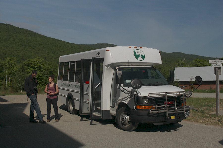
A couple of hikers wait to board the shuttle bus. |
 |
After all the logistics just to get to the northern terminus of the Presidential Traverse, Sonny is happy to be finally hiking. |
 |
A short waterfall cascades over some rocks along Snyder Brook. |
 |
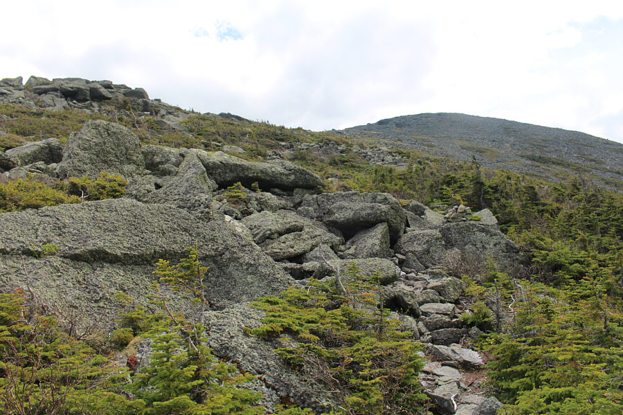
The Watson Path is the most direct route to the summit of Mount Madison, but it is rough and relentlessly steep. |
 |
A sign at tree line serves as fair warning to hikers venturing into the "alpine zone". |
 |
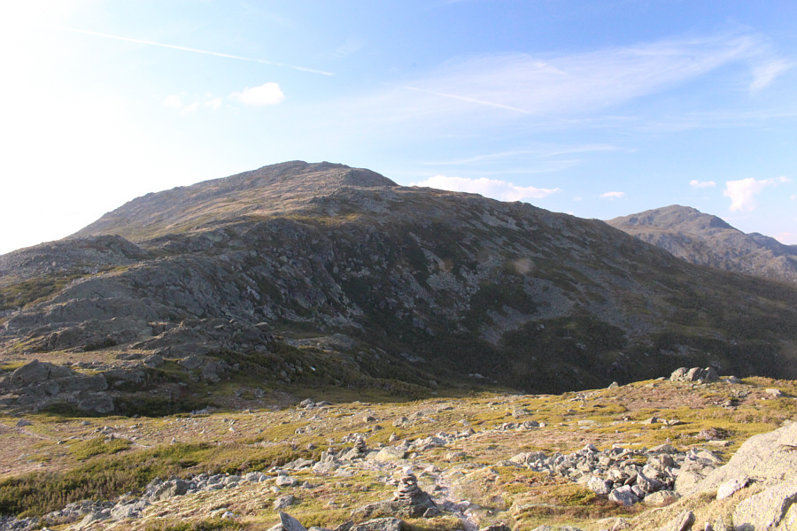
The rounded summit of Mount Madison is visible ahead. |
 |
Sonny reaches the summit of Mount Madison (1634 metres). |
 |
Mount Washington is visible to the southwest. A toll road which runs to the summit is also visible. |
 |
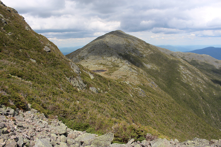
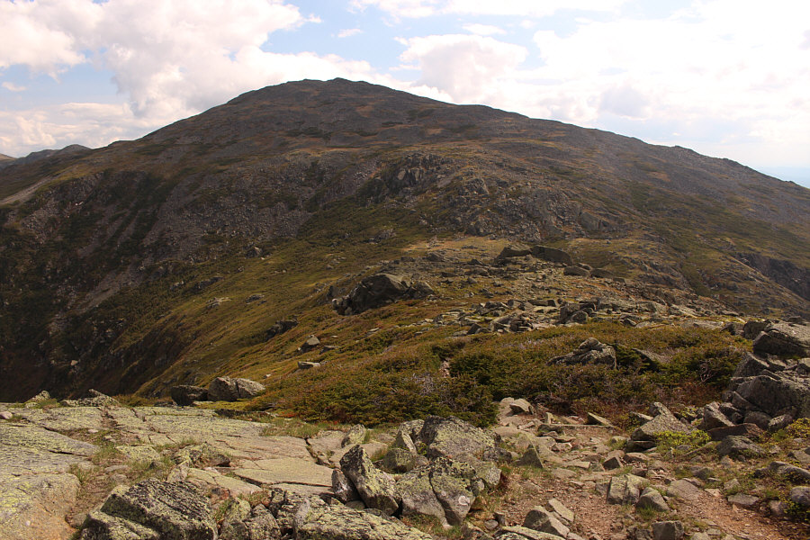
Mount Adams is the next objective along the Presidential Traverse. |
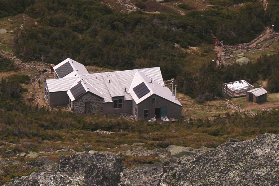 |
Madison Spring Hut is operated by the AMC and is located near the saddle between Mount Madison and Mount Adams. |
 |
A very large quartz outcrop sits near Star Lake below Mount Adams. |
 |
This is looking back at Star Lake and Mount Madison from partway up the trail to Mount Adams. |
 |
A couple of hikers are about to scramble up a steep rocky gully just below the summit of Mount Adams. |
 |
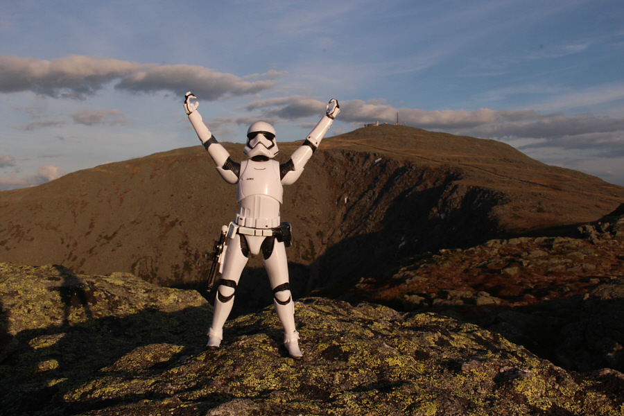
Sonny stands near the summit of Mount Adams (1765 metres) with Mount Madison behind him. |
 |
Southwest from the summit of Mount Adams is Mount Jefferson. |
As I bottomed out at Edmands Col and began the stiff climb up Mount Jefferson, a group of hikers that I had just passed going in the opposite direction suddenly called out to me. They had apparently heard someone call for help somewhere in the vicinity. I honestly did not hear anything, but another group of hikers far above me had also apparently heard a plea for help. The two separate groups of hikers began calling out to try and ascertain the location of the person in distress, and quite frankly, I thought it was rather counter-productive as their voices reverberated throughout the area making it virtually impossible to pinpoint anything. After a lot of fruitless calling back and forth between the two groups, I climbed higher to meet up with the hikers above me and to get a better vantage point to survey the area. The vicinity of Edmands Col is largely comprised of sub-alpine vegetation with very little cover to hide in. Still, I could spot nothing out of the ordinary. The hikers above me apparently tasked another hiker to hurry to the top of Mount Washington to notify the authorities there, but it was uncertain when or if they would even respond with a rescue party, especially without a missing person report or confirmation of an injury. I eventually did hear a voice that was seemingly acknowledging the need for assistance, and there was even a pathetic-sounding toot from a whistle. We tried to ask the person their exact whereabouts in relation to Edmands Col, but there were no coherent responses. Why the person did not keep whistling is a mystery, and after awhile, I was beginning to wonder if we were just hearing the distant voices of the group of hikers I had previously passed. We all eventually agreed that there was not much else for us to do. The distressed person, if there was one, had stopped responding, and trying to find someone in that vast amphitheatre was akin to finding the proverbial needle in a haystack. We all moved on in hopes that, if a person was reported missing, the authorities would know roughly where to look (to date, a Google search has yet to turn up any reports of a person going missing in the White Mountains on 4 June 2016).
After the ordeal at Edmands Col, I continued on to the top of
Mount Jefferson and reached the summit at 5:48 PM. Even this late
in the day, there was still a small crowd of people here, and I
half-wondered about where they were all planning to spend the night.
In fact, I was starting to wonder about where I would be spending the
night.
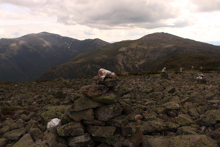 |
Many of the cairns along the Presidential Traverse are topped with a block of quartz which make them stand out from the stark landscape. |
 |
This is looking up the northeast face of Mount Jefferson from Edmands Col. |
 |
This plaque commemorates a founding member of the AMC. |
 |
Sonny manages a weak smile on the summit of Mount Jefferson (1740 metres). |
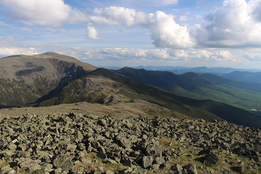 |
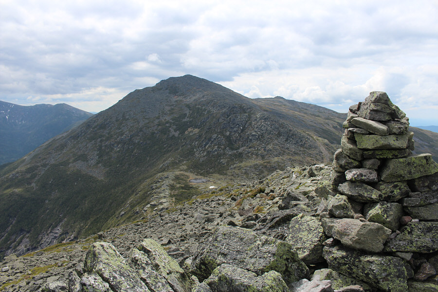
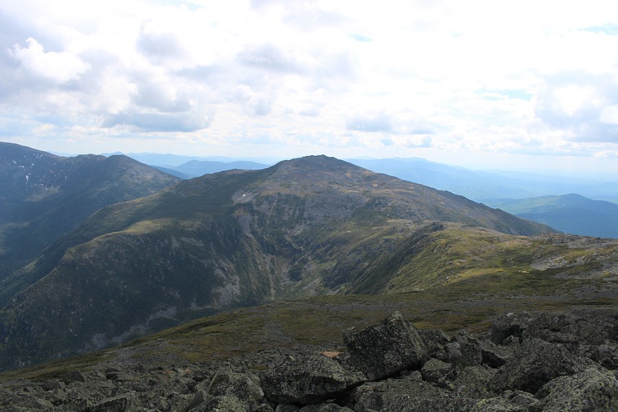
Much of the southern half of the Presidential Traverse is visible to the south from the summit of Mount Jefferson. At left is Mount Washington. |
Incidentally, Mount Clay is named after a US senator and not a US
President, but the state of New Hampshire passed a law in 2003 to have
the name changed to Mount Reagan. Apparently, the new name has not
gained much support from the US Board of Geographic Names or the AMC who
continue to refer to this bump as Mount Clay. It is rare when an
obscure US senator can upstage a famous US President!
 |
This is looking back at Mount Jefferson (left) and Mount Adams (right) from the slopes below Mount Clay. |
 |
Sonny exhibits a rare burst of energy on the summit of Mount Clay (1684 metres). |
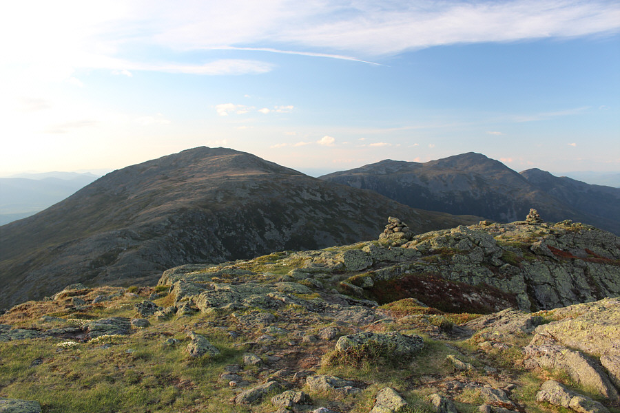 |
Here is another look back at Mount Jefferson, Mount Adams, and Mount Madison from the summit of Mount Clay. |
It was eerily
quiet when I finally arrived at the summit of Mount Washington at 8:42 PM.
Normally teeming with tourists and hikers, the summit area was mostly
deserted except for a few workers from the nearby weather observatory.
On most days, there is normally a line-up to take photos beside the summit sign, but I
had it all to myself on this evening. Unfortunately, all the
tourist amenities, including the restaurant, were closed and locked up by
the time I arrived. I was crushed with disappointment, but faced
with no other options other than to continue hiking well into the night,
I took about a 15-minute break to re-hydrate and put on some warm
clothes. Thankfully, I was able to fill my water bottle under an
outdoor tap, and once that was done, I set off down the south side of the
mountain along Crawford Path which is the name for this section of the
AT.
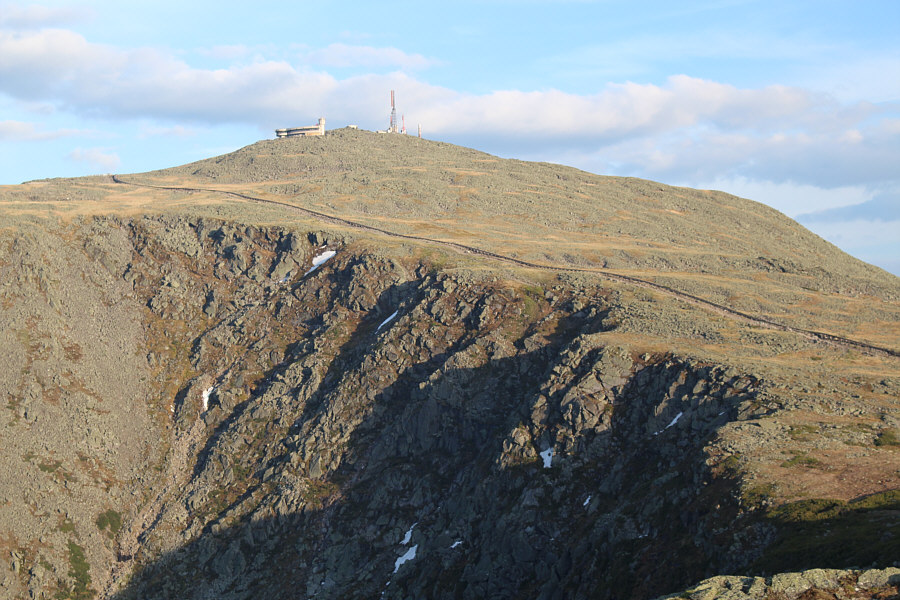 |
The Mount Washington Observatory sits atop its namesake mountain. Also visible is the Mount Washington Cog Railway. |

The sun begins to set on the western horizon.
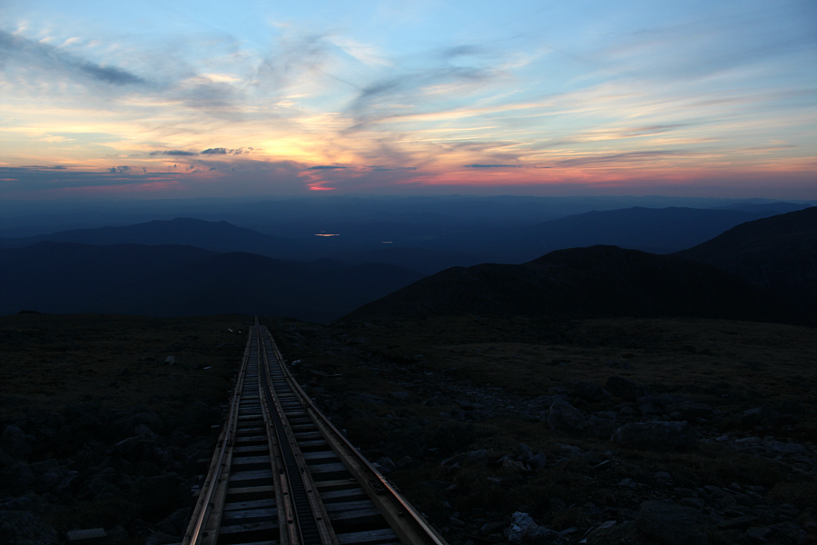 |
The Mount Washington Cog Railway is the second steepest of its kind in the world. |
 |
Sonny reaches the summit of Mount Washington (1917 metres) just after sunset. |
I guess it was inevitable that Murphy's law would take effect just when things were going good because I proceeded to turn down the wrong trail just behind the hut. Map details in my GPS would have made a huge difference here, but because I had no reference points, I was going strictly by trail signs which I had misread in the dark. Fatigue may have also played a part in my poor decision making. It took quite awhile before I realized something was amiss as I happily scrambled down a steep watercourse which was rougher than would be expected for the Crawford Path. When I had dropped about 175 metres or so, I spotted a trail sign with a small map which confirmed that I had taken a wrong turn back at the hut. I had, in fact, partially descended the Ammonosuc Ravine trail. The prospect of climbing back up to the hut was disheartening, but the alternative of descending to another trailhead far from my car was seemingly more unappealing. Actually, had I done my homework and studied the Ammonosuc Ravine trail more closely, I might have considered continuing my descent as the walk back to Highland Center from the trailhead is not unreasonably far (about 8 kilometres on a paved road). Undoubtedly, it would have added extra distance, but at the same time, walking on smooth pavement would have felt like heaven compared to the rocky hell of the Crawford Path. In the end, I opted to climb back up to the hut, and my wrong turn ended up costing me about an hour.
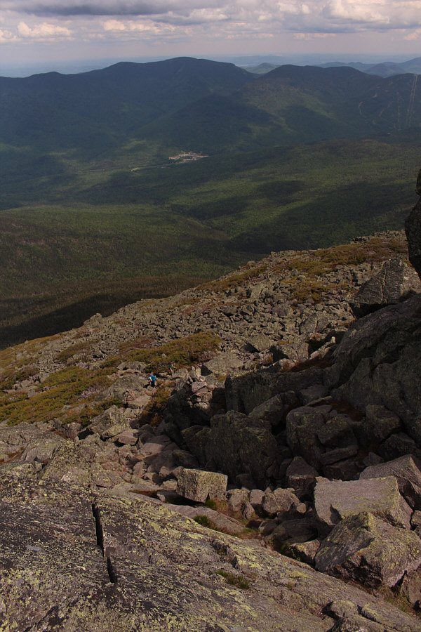
The peaks of the southern half of the Presidential Traverse are not nearly as high or as rugged as those in the northern half, and since it was the middle of the night, I did not see any point in tagging any of the southern summits even though most of them would have required only minimal extra effort. In fact, I may have even walked over one of the summits in the dark without knowing it! As I continued trudging along the Crawford Path, I still got the sense that this was probably a marvelous ridge walk on a clear day, and I regretted not being able to enjoy what surely would have been some amazing vistas. That might be incentive enough to perhaps return in the future to hike this part of the traverse again.
Besides the occasional trail junction sign, my only other point of reference during my hike out was the odometer in my GPS. I knew that the Presidential Traverse, as I was hiking it, was somewhere between 30 and 32 kilometres long, and I kept checking my GPS periodically to monitor how far I had already walked. My progress was exasperatingly slow, and although I like to think that an eight-hour walk alone in the dark would be a spiritual experience with plenty of time to reflect on life and family and friends, the reality was that I was really f**king tired! During the night, I sat down a couple of times to have a catnap, but fortunately, I was always able to rouse myself and limit my stops to only a few minutes at most. The sky began to brighten up as I descended along the south bank of Gibbs Brook near the end of the traverse, and my rental car was a sight for sore eyes (and sore feet) when I finally arrived at Highland Center Lodge at 4:50 AM on the morning of 5 June 2016.
After changing into some fresh clothes, I drove for a bit until I
found a convenience store that was open. I bought a huge cup of
fountain Diet Pepsi and downed a third of it before going to a nearby
rest area to nap for about an hour or so. When I woke up, I felt
refreshed enough to drive the rest of the way back to Saint-Jean
without incident.
 |
Total
Distance: 31.2 kilometres Total Time: 18 hours 43 minutes* Total Elevation Gain: 2674 metres* * Includes about 1 hour and 175 metres added for wrong turn |