BOU AVENUE
Roche Bonhomme
On 8 April 2016, the second day of our 4-day visit to Alberta's Jasper National Park, Kathleen Gallagher, Zosia Zgolak and I set our sights on ascending our accommodations' namesake peak, Roche Bonhomme.  Ignoring the locals' unanimous advice that it was still too early to consider ascending what is also known as "Old Man Mountain", we used Bob Spirko's trip report to find the trailhead near Maligne Canyon parking lot (an unmarked trail heads north into the woods about 350 metres east of the entrance to the parking lot).  Previously observing the mountain from town, we knew that there was still a considerable amount of snow both above and below tree line, but the summit ridge encouragingly appeared to be windswept.  We were under no illusions that this was going to be a cakewalk, but we were also hoping that some of the snow would still be supportive enough to walk on.  The only way to find out was to go and climb the mountain.

Initially, we made good progress lower down, but not surprisingly, our ascent took a turn for the worse when we lost the trail in increasingly deep snow.  Unfortunately, the snow had turned isothermal and was completely unsupportive which meant that we were sinking usually up to our knees and thighs.  Soon after losing the trail, we worked our way up to the crest of a ridge on climber's left which I hoped would have less snow.  Indeed, the snow was shallower here, but the ridge was also choked with nasty deadfall which made travel doubly tedious.  At one point, we came across some flagging tied around a tree, but we could not find any obvious trail or route to follow.  Further up, we encountered less deadfall and even the odd dry patch of ground, but inevitably, we ran into deep snow again.  Our progress slowed to a crawl, quite literally at times!  Zosia did a tremendous job of breaking trail through some of the deepest and steepest sections just below tree line while Kathleen took the lead above tree line and perfected the art of crawling on all fours up the slope!

After nearly four hours of wallowing through deep snow, it was heaven to set foot on treadmill scree just below the summit ridge.  Having already gotten more than she had bargained for on this outing, Kathleen decided to wait while Zosia and I continued up the summit ridge.  Getting to the summit was not nearly as straightforward as I was expecting as we had to steer clear of cornices and negotiate a couple of snowy dips.  Thankfully, the snow here was still supportive which made travel much easier and was a huge boost for our morale.  After tagging the summit, Zosia and I returned the same way to reunite with Kathleen, and together, we retraced our steps back down the mountain.  Plowing through deep snow is much easier going downhill, and we made significantly better progress on our descent which took less than half the time as our ascent.  Other than having soaking wet boots, we emerged from the woods none the worse for wear and felt not only relief but an immense sense of accomplishment at being able to pull off this ascent despite all the advice we received to the contrary.  A celebratory beer and dinner at De'd Dog Bar & Grill later in the evening capped off a most memorable day in the mountains.
Good thing the old man is lying face up; I'd hate to have to climb up the crack of his ass! 
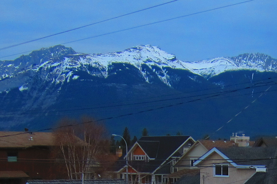
Roche Bonhomme is clearly visible from the entrance to Bon Homme View, the group's accommodations in Jasper.

Photo courtesy of Zosia Zgolak

The building in the distance is a restaurant. Unfortunately, it is closed on this day. Pyramid Mountain is the last view of any sort for the next few hours.
We won't be keeping this pace for long... 
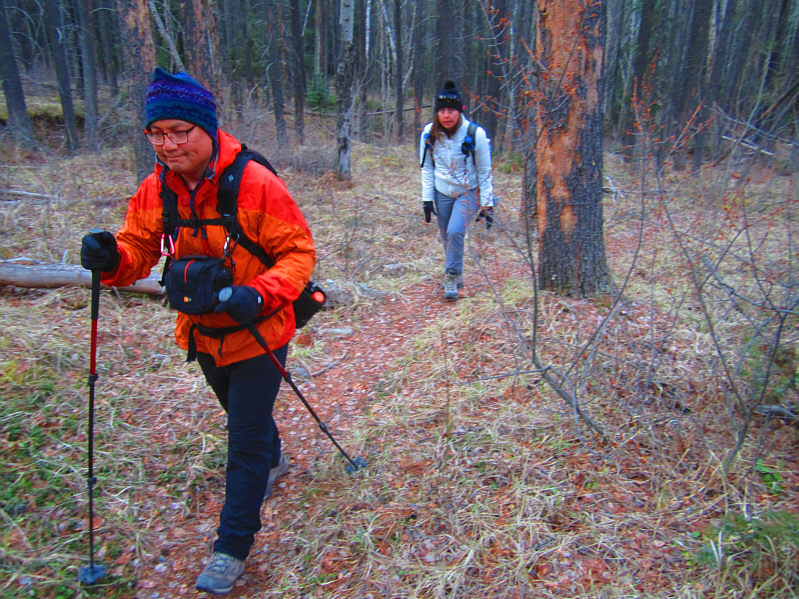
Sonny and Kathleen march smartly up the trail.

Photo courtesy of Zosia Zgolak

Only ankle-deep? No problem! 
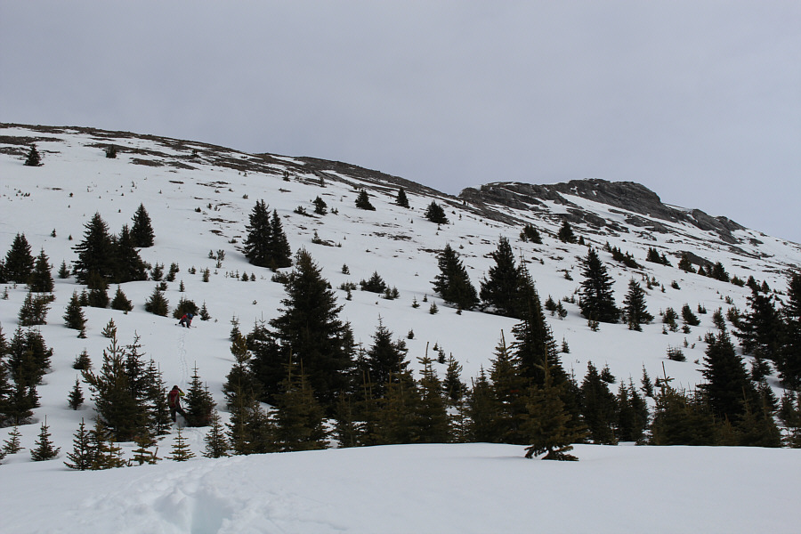
Snow begins to obscure the trail.
Yep, we definitely lost the trail at this point! Sonny begins to wonder if it is even worth continuing.

Photo courtesy of Zosia Zgolak

A lot of the deadfall was hidden under the unsupportive snow; nasty surprises await! 
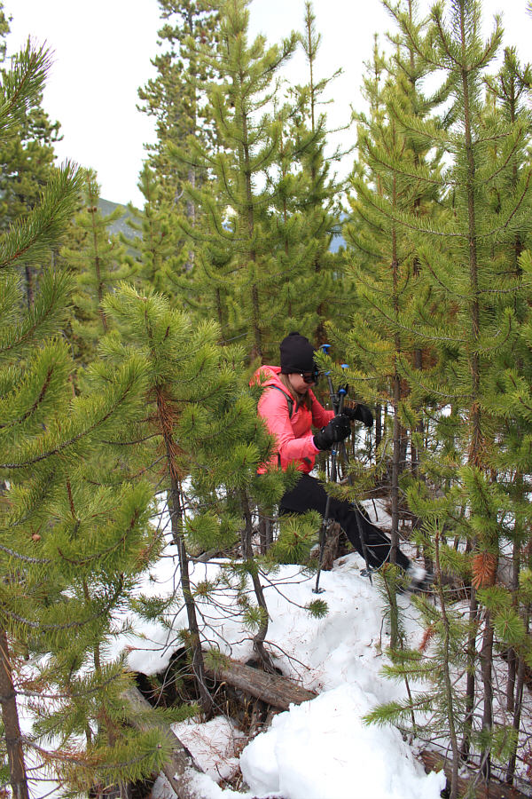
Zosia makes her way up the deadfall-choked ridge.
A quantum of solace. A break in the trees allows a view of Mount Tekarra in the distance.
Ah well, it beats wandering aimlessly around the streets of Jasper...or does it? 
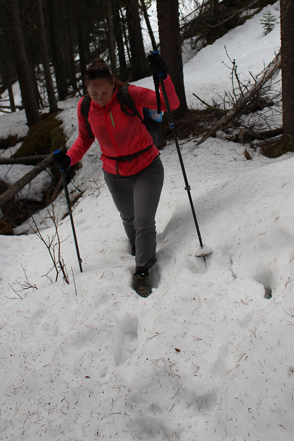
Zosia continues to push upward through deeper snow.  Note Kathleen's wet pant legs.
She's got her war face going now! 
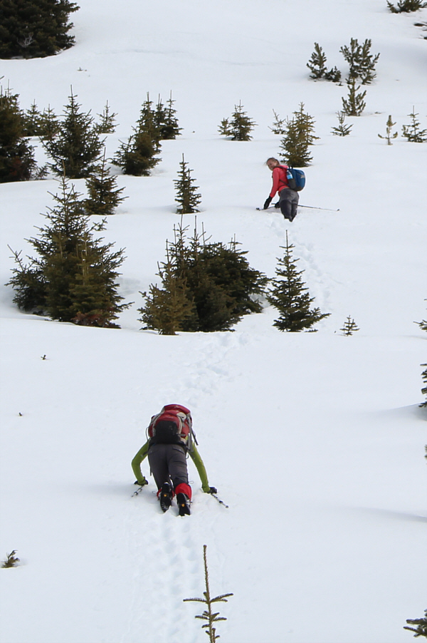
Kathleen hits some really deep snow at tree line.

Photo courtesy of Zosia Zgolak

Look at Kathleen go! The summit ridge is finally in sight.
We're going for broke now! 
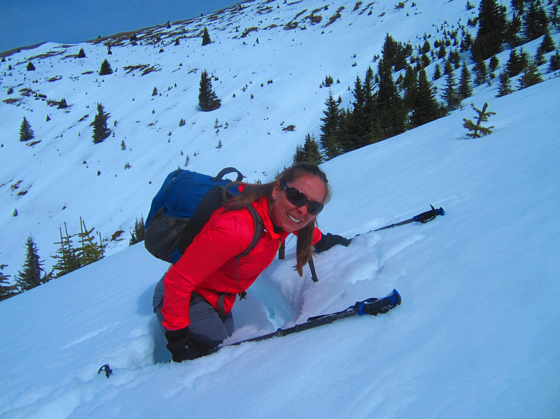
Zosia tries Kathleen's technique of crawling on all fours to distribute her weight more evenly.
So nice to stand on rock again even if it is loose! 
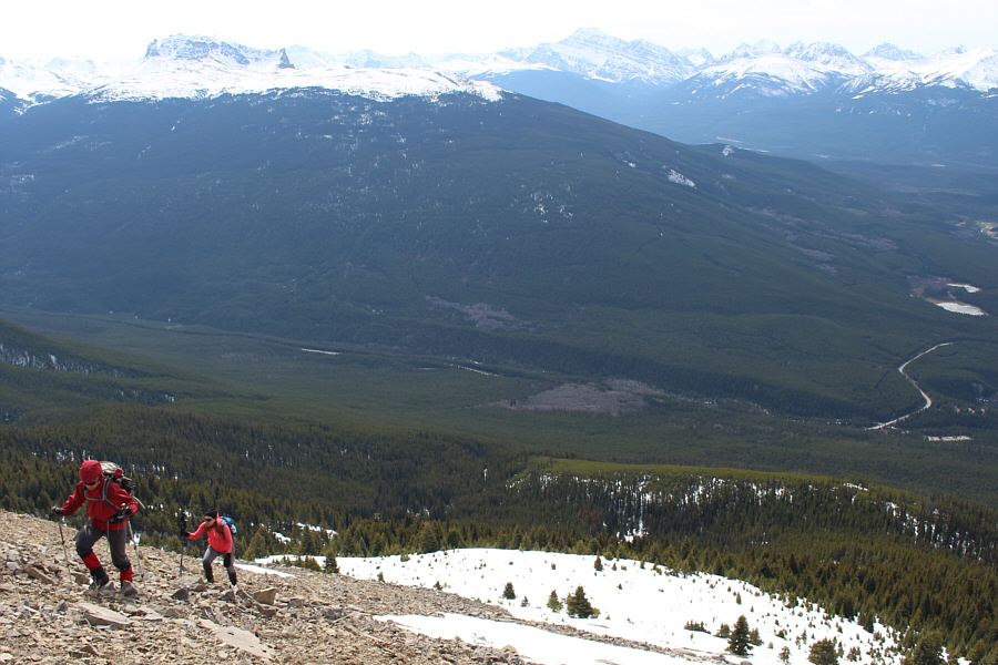
Zosia and Kathleen march smartly up treadmill scree.
Doesn't look so straightforward... 
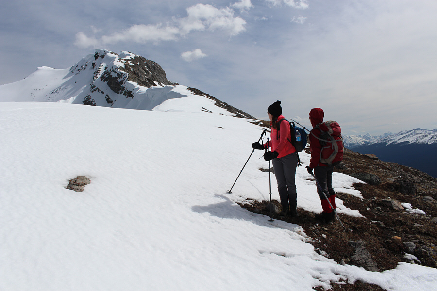
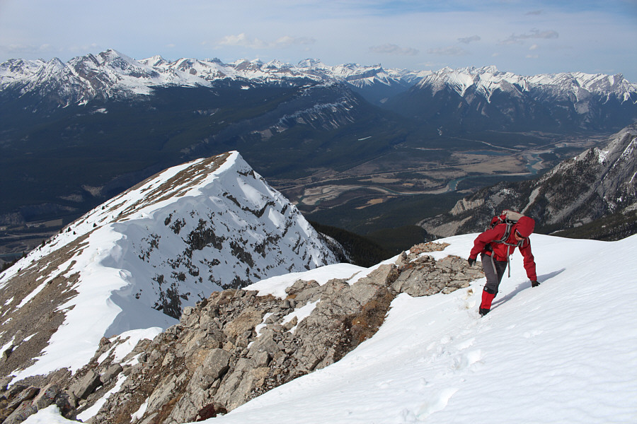
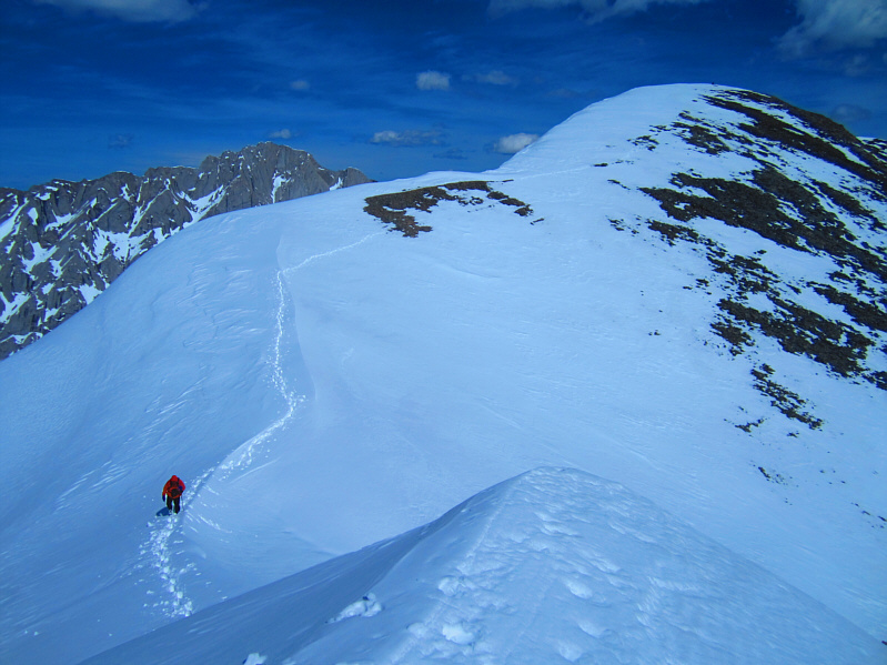
Kathleen and Zosia contemplate the remainder of the ascent along the summit ridge.
It's not visible here, but the exposure to Zosia's left is significant. 
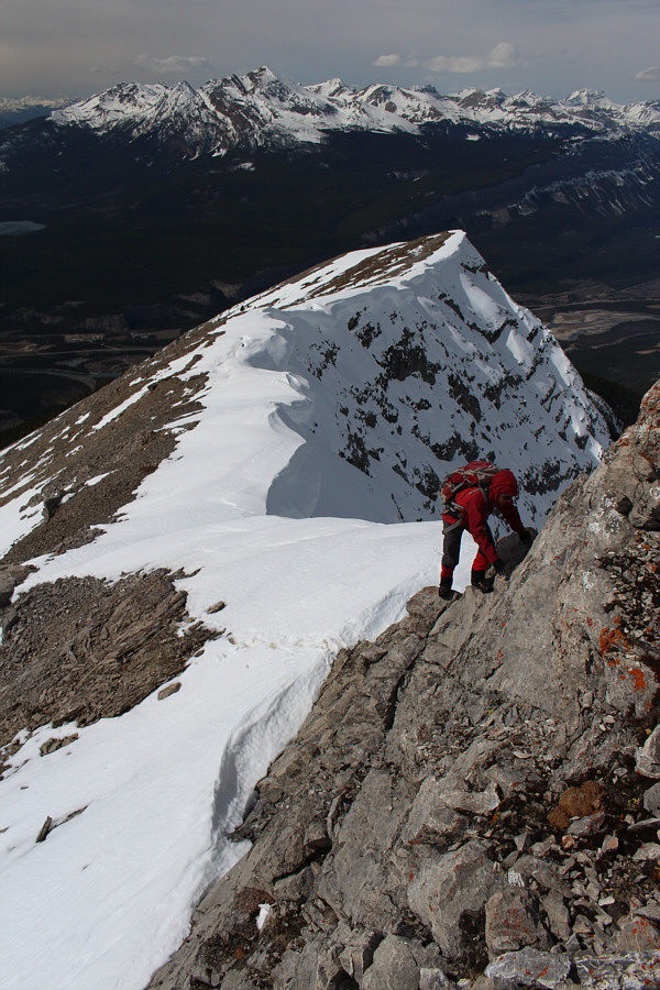
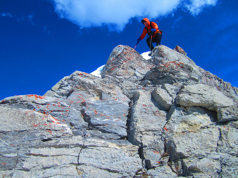
Zosia scrambles up the first significant obstacle along the summit ridge.
Well done, Zosia! Zosia traverses a short snow patch which is unnervingly exposed.
Still a few more surprises to come along this ridge... 
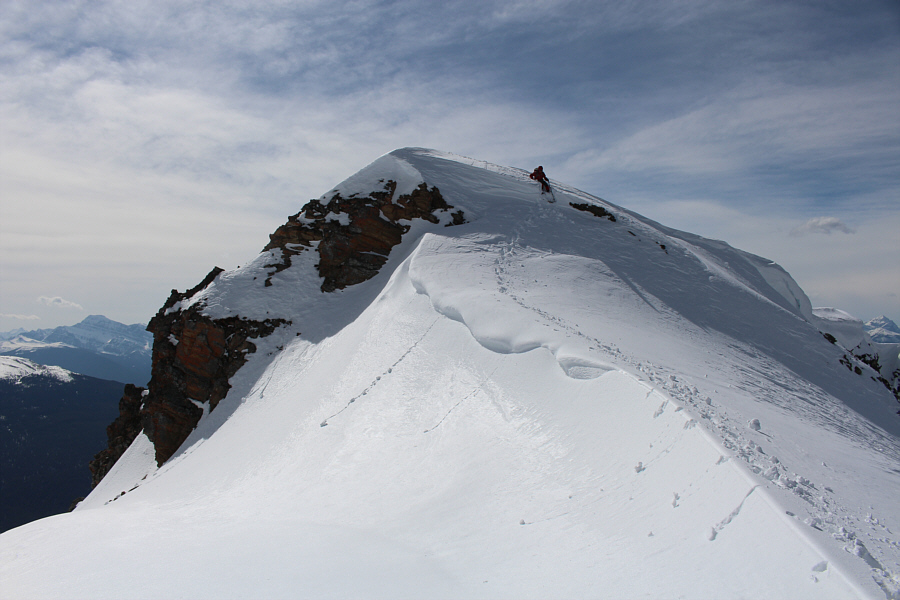
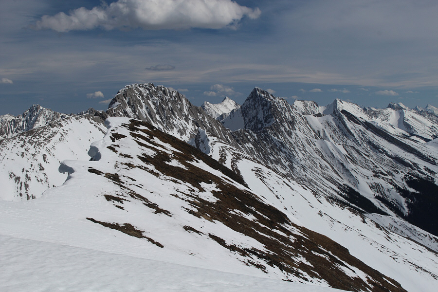
The numerous cornices along the summit ridge are both beautiful and dangerous.  The summit is visible at left.
This was the easier dip! 
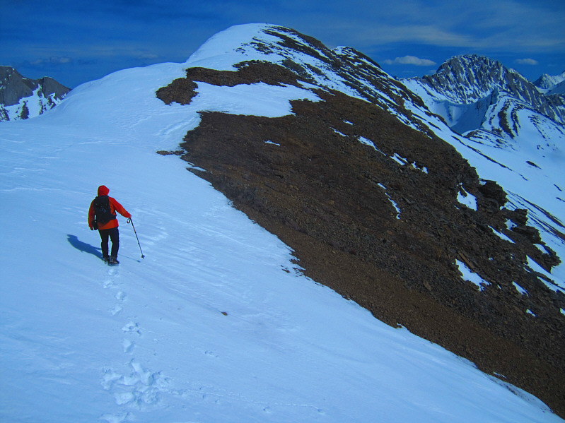
Zosia drops down the first dip along the summit ridge.
It's not. It appears to be smooth sailing the rest of the way to the summit for Sonny.

Photo courtesy of Zosia Zgolak

This was the harder dip! Zosia drops down the second dip along the summit ridge.
All is forgiven when you reach the summit! Sonny and Zosia sit beside the summit cairn on the "forehead" of Roche Bonhomme (2496 metres).
Anyone know if Grisette Mountain can be scrambled? 
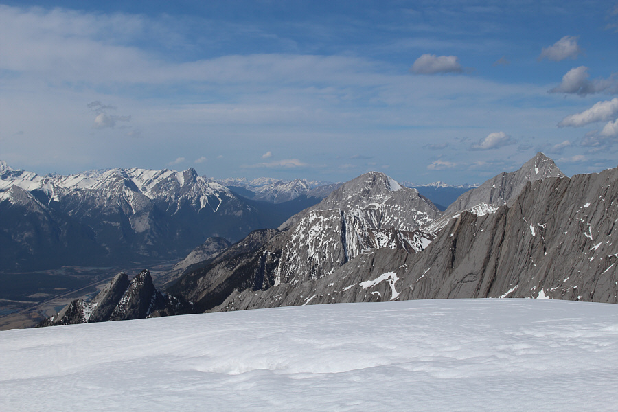
The "nose" of Roche Bonhomme sits in front of Grisette Mountain (left of centre) in this view to the east.
It has been almost 20 years since I hiked the Skyline Trail...maybe it's time for another visit... To the south, a couple of peaks along the famed Skyline Trail--Excelsior Mountain and Mount Tekarra--are readily identifiable.  Also at far right on the horizon is Mount Edith Cavell.
Can you name all the visible lakes? 
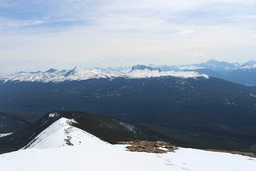
Zosia begins descending the summit ridge.  The town of Jasper can be seen at far left.

Although it is almost invisible in this photo, Mount Robson can be seen at extreme right.

To the west, Pyramid Mountain is the most prominent peak of the Victoria Cross Range.


Hmm...those twin peaks at lower left look kinda interesting... The view to the northwest includes Esplanade Mountain, Gargoyle Mountain, Morro Peak, Hawk Mountain and Mount Colin.

Zosia is more of a mountaineer than she will admit!

Zosia approaches the second dip on her return.


It's a bit awkward to get back up the second dip in these conditions. Sonny retraces his steps to the second dip.

Photo courtesy of Zosia Zgolak

Still looking good, Zosia! Zosia carefully works her way down the summit ridge.
Jump! Sonny descends the last obstacle on the summit ridge.

Photo courtesy of Zosia Zgolak

Post-holing both ways! Kathleen is less than impressed with Sonny's struggles in the snow ahead of her.

Photo courtesy of Zosia Zgolak

When does this trip become easy again?? Kathleen weaves between the trees on the deadfall-choked ridge.
Maybe wait until most of the snow is gone... Total Distance:  12.8 kilometres
Round-Trip Time:  10 hours 24 minutes
Net Elevation Gain:  1329 metres

GPX Data