
Photo courtesy of Zosia Zgolak
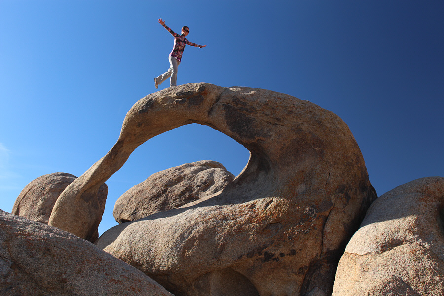
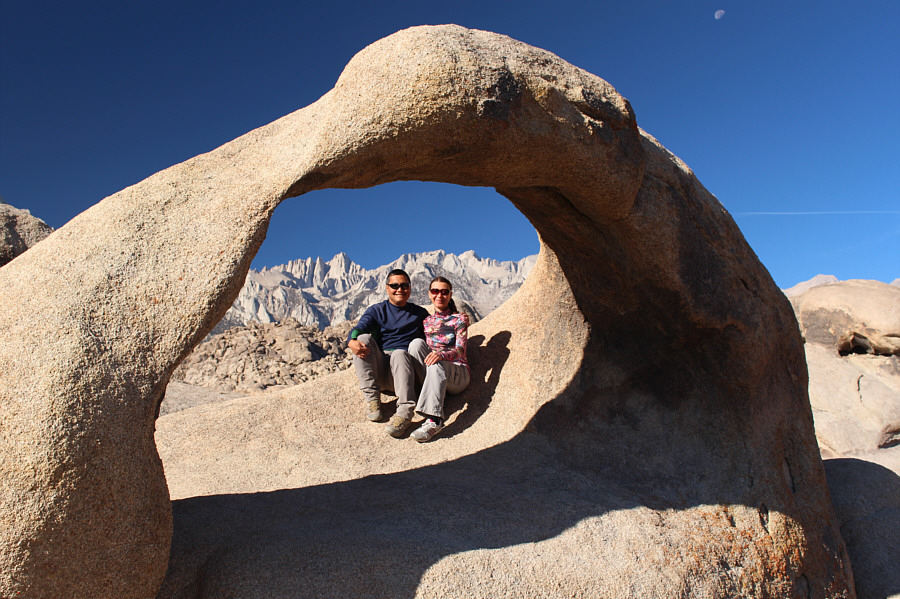
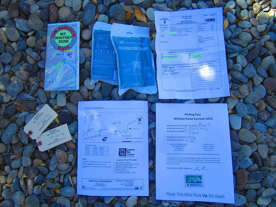
Photo courtesy of Zosia Zgolak
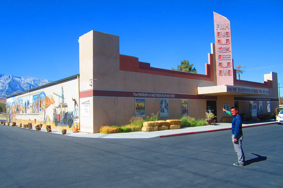
Photo courtesy of Zosia Zgolak
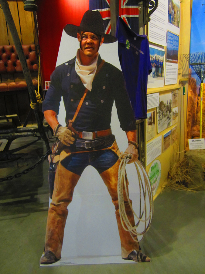
Photo courtesy of Zosia Zgolak
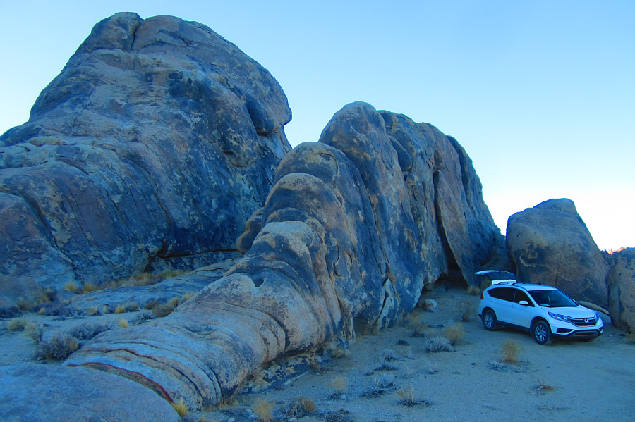
Photo courtesy of Zosia Zgolak
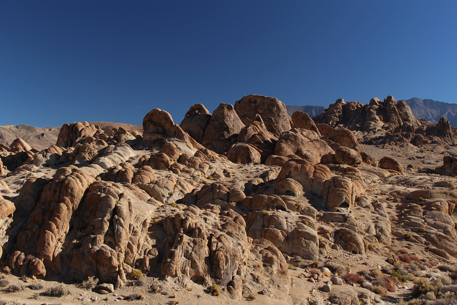
Getting up well before sunrise at Death Valley's Emigrant campground on 20 October 2016, we drove to Lone Pine and arrived just before the visitor centre opened at 8:00 AM. An employee told Zosia to come back at 11:00 AM when the lottery for walk-in permits would officially begin. To kill some time, we visited the Alabama Hills just west of town and wandered for a bit among the piles of fascinating boulders. This area is actually a popular location for Hollywood filmmakers, and many movies have been entirely or partially filmed there.
When we returned to the visitor centre at around 10:45 AM, the
employee who talked to Zosia earlier surprisingly started to process our
walk-in permit for Mount Whitney. As it turned out, there were more
than plenty of day hiking spots available for the following day,
and Zosia and I obtained a permit after filling out a seemingly excessive
amount of paperwork. After leaving the visitor centre, we spent the
rest of the day puttering about in and around Lone Pine. We
eventually ended up back at the Alabama Hills where we found ourselves a
nice camping spot and made preparations for the next day's marathon.
With plans for a very early alpine start, we went to sleep just after
sunset at about 6:00 PM.
|
|
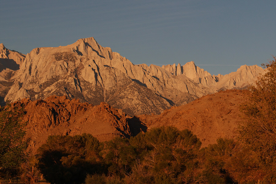
In this view from the visitor centre parking lot, the morning sun lights up the east faces of Lone Pine Peak (left) and Mount Whitney (right). |
|
|
According to the Bureau of Land Management brochure for Alabama Hills, over 400 movies have been filmed here since 1920. Some recent notable films include Tremors, Star Trek Generations, Gladiator, Iron Man and Django Unchained. |
|
|
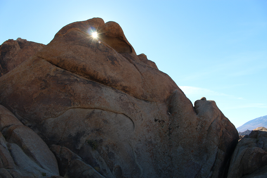
Sunlight streams through a small hole in the rock. |
|
|
Sonny points out Mount Whitney on the
horizon. Photo courtesy of Zosia Zgolak |
|
|
Zosia balances on top of Mobius Arch. |
|
|
Mount Whitney is visible behind Sonny and Zosia in this view through Mobius Arch. |
|
|
The crux of Mount Whitney might be
getting through the bureaucracy of obtaining a permit.
Clockwise from top left are a purchased map, waste alleviation &
gelling (WAG) bags, a hiking permit, a trailhead parking pass, a
trail information sheet, and backpack tags. Photo courtesy of Zosia Zgolak |
|
|
Sonny looks forward to visiting Lone
Pine's film museum. Photo courtesy of Zosia Zgolak |
|
|
There are some fierce-looking cowboys
in the museum. Photo courtesy of Zosia Zgolak |
|
|
This is Zosia's and Sonny's campsite
in Alabama Hills. Photo courtesy of Zosia Zgolak |
For the next several hours,
we hiked the well-graded Mount Whitney Trail in the dark, but the
prevailing moonlight was bright enough that we seldom had to use our
headlamps. We lost the trail briefly among the rocks near Trail Camp but
quickly picked it up again before climbing the endless switchbacks
leading up to Trail Crest. Although the sun had risen by this point and
warmed us up a bit, we remained in shadow for much of the undulating
traverse from Trail Crest to the summit block. This section took
much longer than expected as I was moving slower perhaps because of
fatigue or the altitude. Although Zosia appeared unaffected, I felt just
a slight twinge of a headache. The final plod up to the summit seemed
interminable, but we eventually made it to the Smithsonian Institution
Shelter which, ironically, is not open to the public.
After spending nearly an hour at the top, we wistfully began our long
hike back to Trail Crest and then down to Whitney Portal. Although we
retraced our steps all the way, it was nice to see some of the
spectacular scenery we had missed when we were climbing in the dark. One
disturbing trend we noticed though were the numerous waste
alleviation & gelling (WAG) bags that were left behind by inconsiderate
hikers. These bags are issued to permit holders so that they may pack out
their solid waste and keep the Mount Whitney Trail clean. Both Zosia and
I agreed that it would have been better to not issue the WAG bags at all
and risk having used toilet paper flying about than having so many
plastic bags of "goodies" littering the trail.
Upon returning to Whitney Portal, we retrieved our food and toiletries
from the bear-proof locker and drove back down to Lone Pine. Again, we
experienced no construction delays on our drive out. Appropriately, we
stopped for dinner at Mt Whitney Restaurant in Lone Pine to celebrate our
accomplishment. We then capped off a very long day by driving north and
checking into a comfortable motel in the town of Bishop.
Climbing Mount Whitney marked the culmination of an extraordinary two-week road trip
for Zosia and me which saw us visit 7 US States (including 7 national
parks), climb 9 peaks, and explore 7
canyons. We visited the lowest point in North America (Badwater
Basin) and the highest point in the contiguous United States (Mount
Whitney). We drove over 6300 kilometres and had 1 flat tire.
We slept 4 nights in hotels, 2 nights in Zosia's tent, and 10 nights in
the back of my Honda CR-V. Best of all, I discovered in Zosia a
most reliable and understanding travel companion who shares with me a
similar appetite for adventure, fun and suffering. I can hardly
wait for our next road trip together!
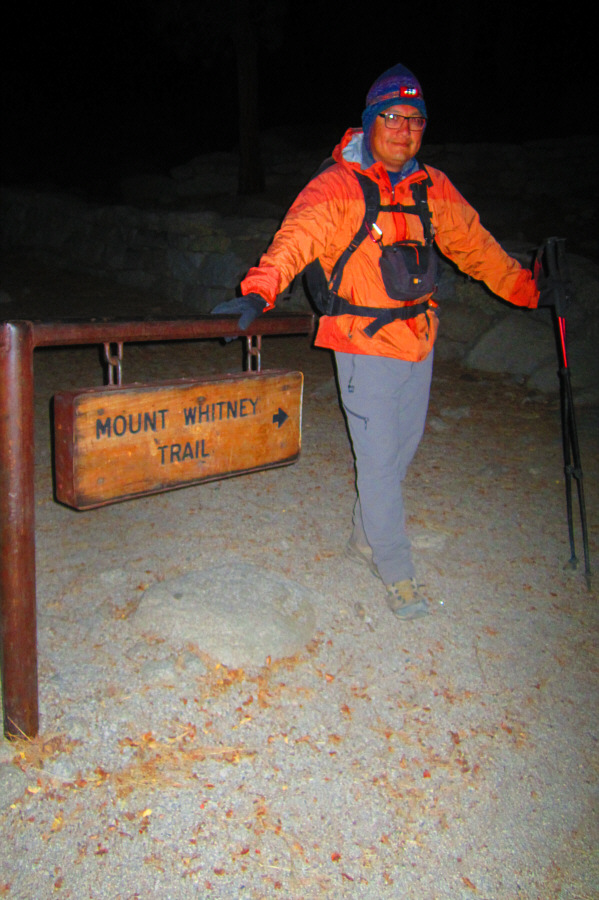 |
Sonny starts hiking at 1:30 AM. Photo courtesy of Zosia Zgolak |
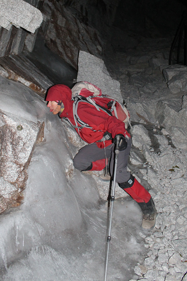 |
Zosia gets her tongue stuck on some ice beside the trail. |
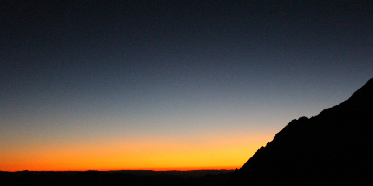
Dawn approaches from the east.
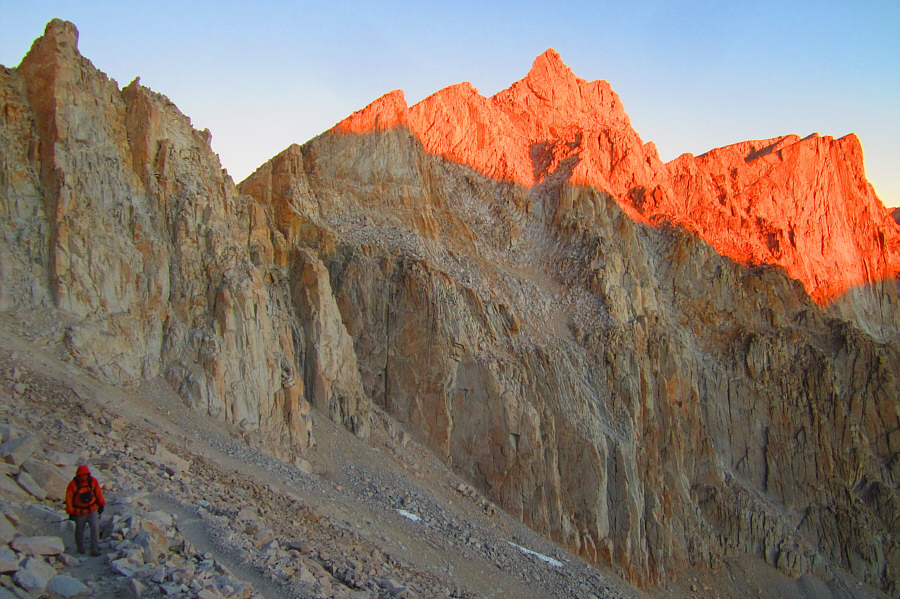 |
Sunlight illuminates the tops of Mount Muir and Mount Whitney as Sonny climbs up endless switchbacks. Photo courtesy of Zosia Zgolak |
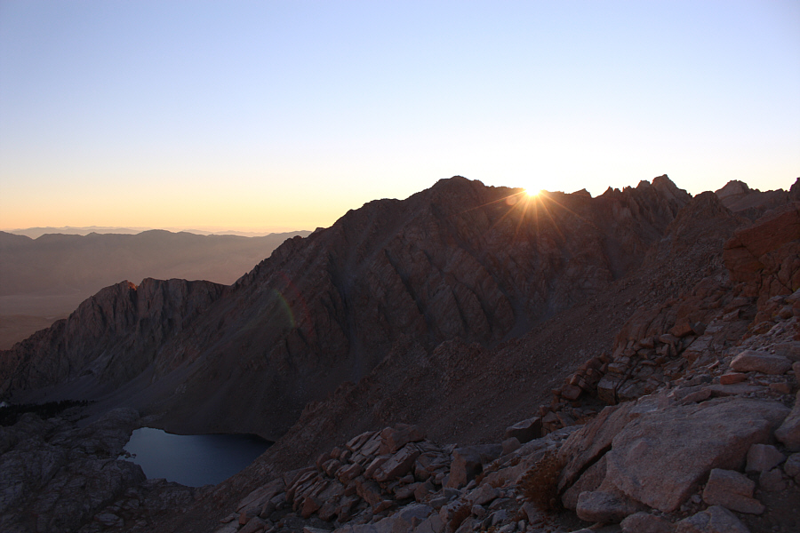 |
The sun rises above Mount Irvine to the east. At bottom left is Consultation Lake. |
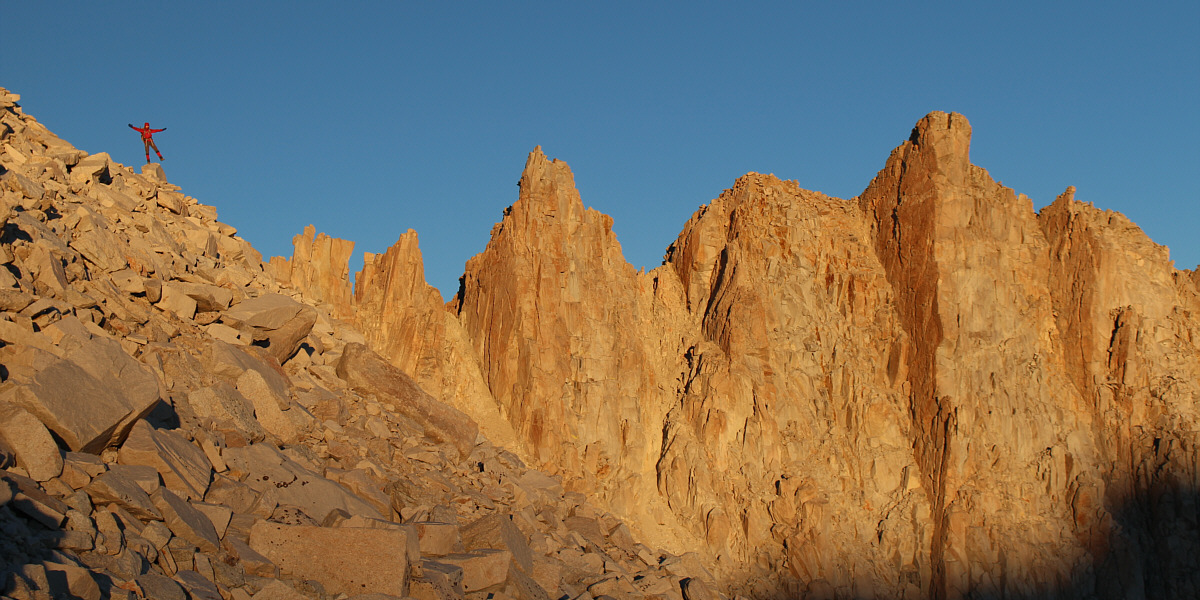
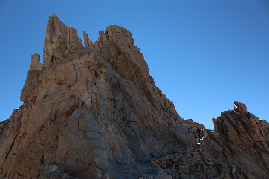
Zosia dances among the pinnacles near the crest of the Sierra Nevada range.
 |
Zosia reaches Trail Crest, the highest trail pass in the United States. |
 |
The Smithsonian Institution Shelter is barely visible at the top of Mount Whitney (left). |
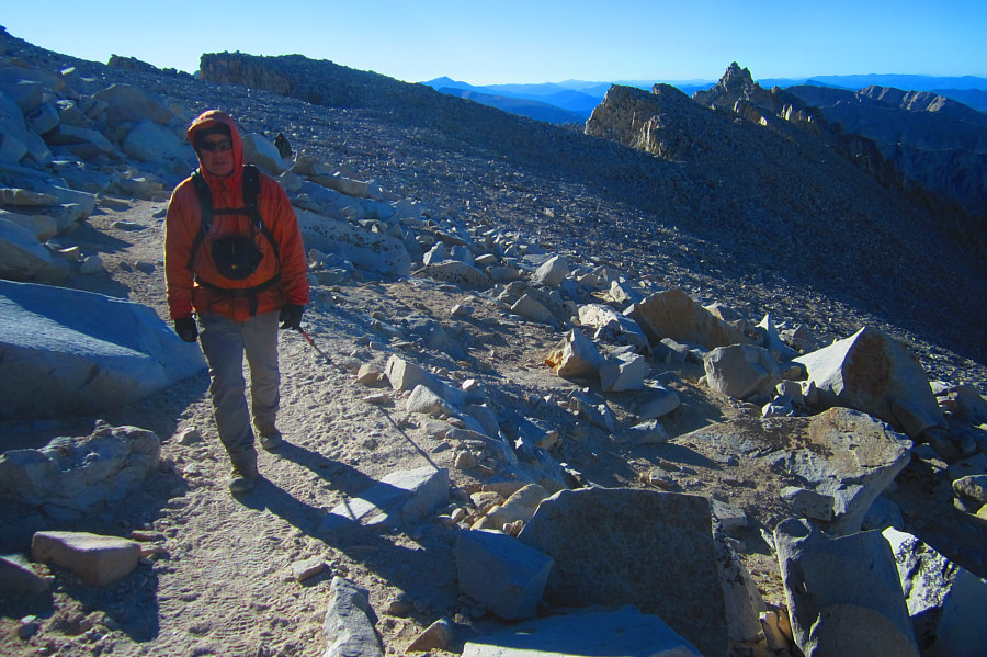 |
Sonny trudges along the easy but
somewhat monotonous trail. Photo courtesy of Zosia Zgolak |
 |
Zosia approaches the Smithsonian Institution Shelter. |
 |
Sonny checks out Mount Whitney's
summit register. Photo courtesy of Zosia Zgolak |
 |
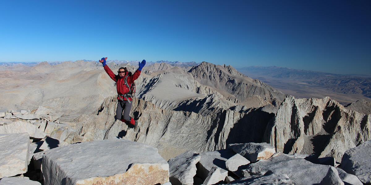
Zosia and Sonny stand on the summit of Mount Whitney (4422 metres). |
 |
To the west is the wild expanse of Sequoia National Park. |
The Sierra Nevada range stretches away to the north behind Zosia.
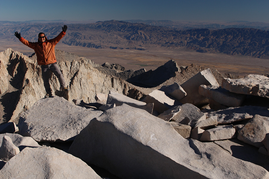 |
Sonny teeters on the edge of a big rock near the summit. |
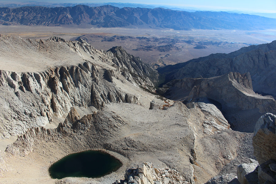 |
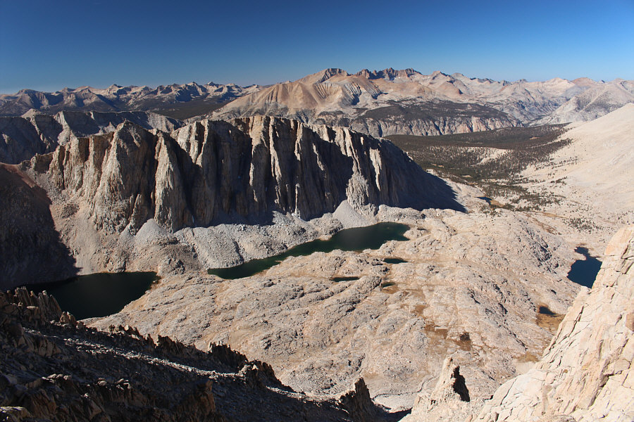
Almost directly below the summit is Iceberg Lake. Whitney Portal, Alabama Hills and Lone Pine are all visible to the east. |
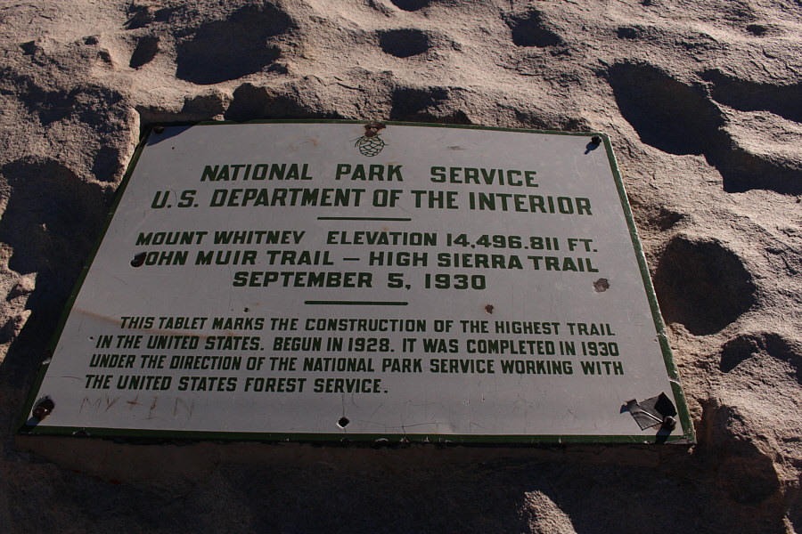 |
This sign is fixed to a rock at the summit and gives an elevation which is slightly lower than the currently accepted figure of 14, 505 feet. |
 |
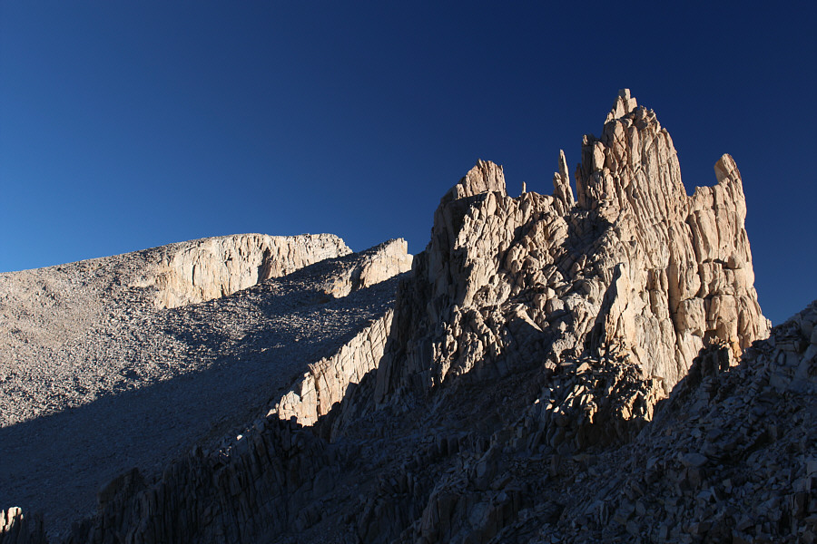
On her return journey, Zosia passes an impressive pinnacle along the crest of the Sierra Nevada range. |
 |
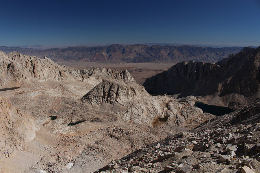
Mount Hitchcock and Hitchcock Lakes sit to the southwest of Mount Whitney. Also partially visible at far right is Guitar Lake. |
 |
Some of the switchbacks are visible at right above Consultation Lake. |
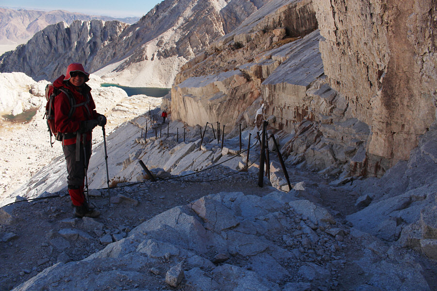 |
Handrails provide some security along this mildly exposed section which can be icy. |
 |
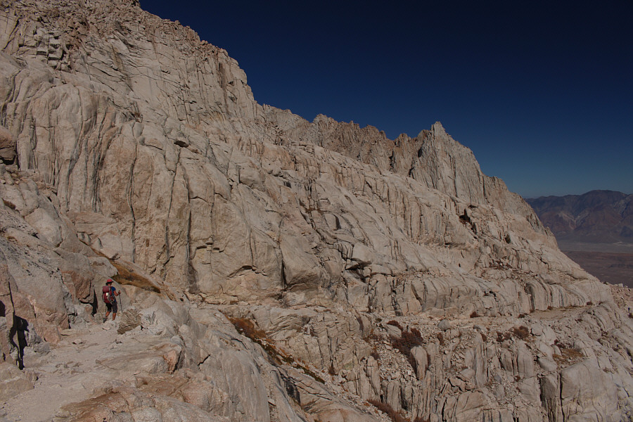
This is looking back up at Mount Muir (right) from near the bottom of the switchbacks. |
 |
The trail passes under some impressive cliffs. |
 |
Sonny pauses high above Mirror Lake. Photo courtesy of Zosia Zgolak |
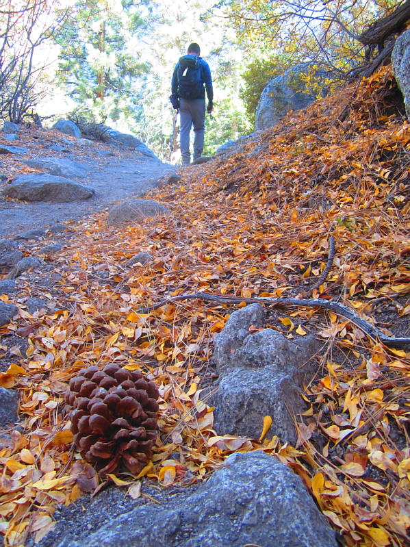 |
It is a long hike back to Whitney
Portal. Photo courtesy of Zosia Zgolak |
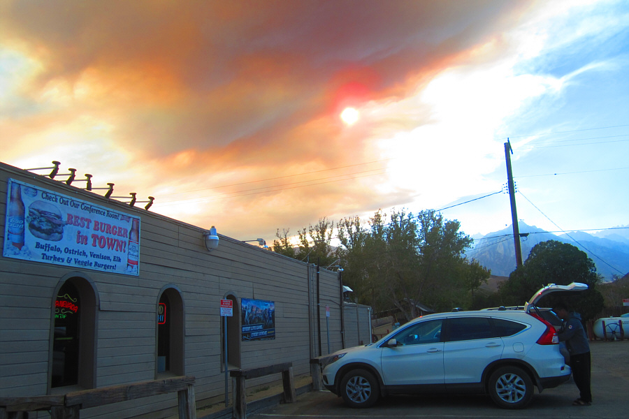 |
Smoke from a fire somewhere obscures
the sun above the Mt Whitney Restaurant in Lone Pine. Photo courtesy of Zosia Zgolak |
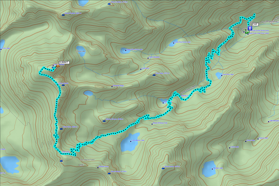 |
Total
Distance: 33.9 kilometres |