
Here is Mount Begbie as seen from Revelstoke.
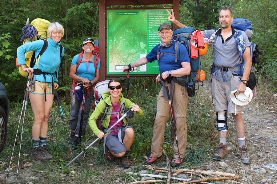 |
All ready to go at the trailhead are (L to R) Marta, Wendy, Zosia, Pierre and Michael. |
 |
Much of the first day is spent hiking up through forest. |
 |
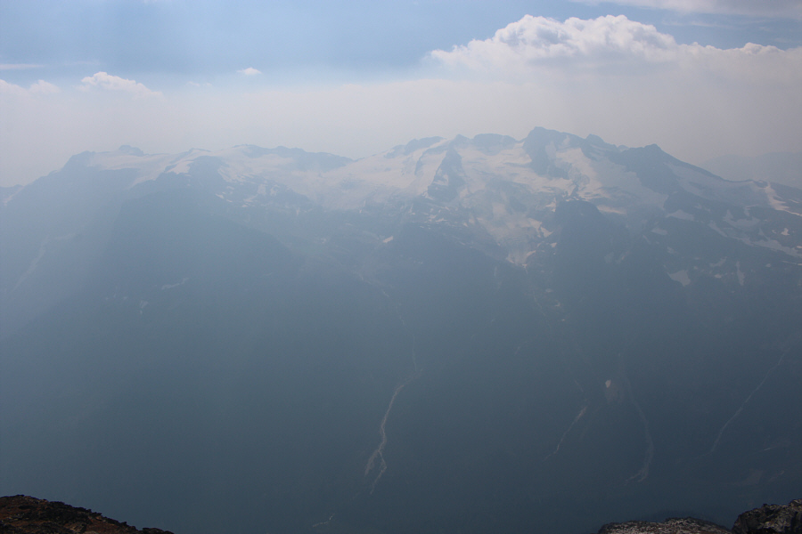
A rare break in the trees allows this unobstructed view of Mount MacPherson. |
 |
These tow-headed babies (western anemone seed heads) look like a field of cotton. |
 |
The group relaxes after arriving at the campground (1992 metres). |
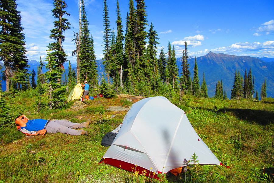 |
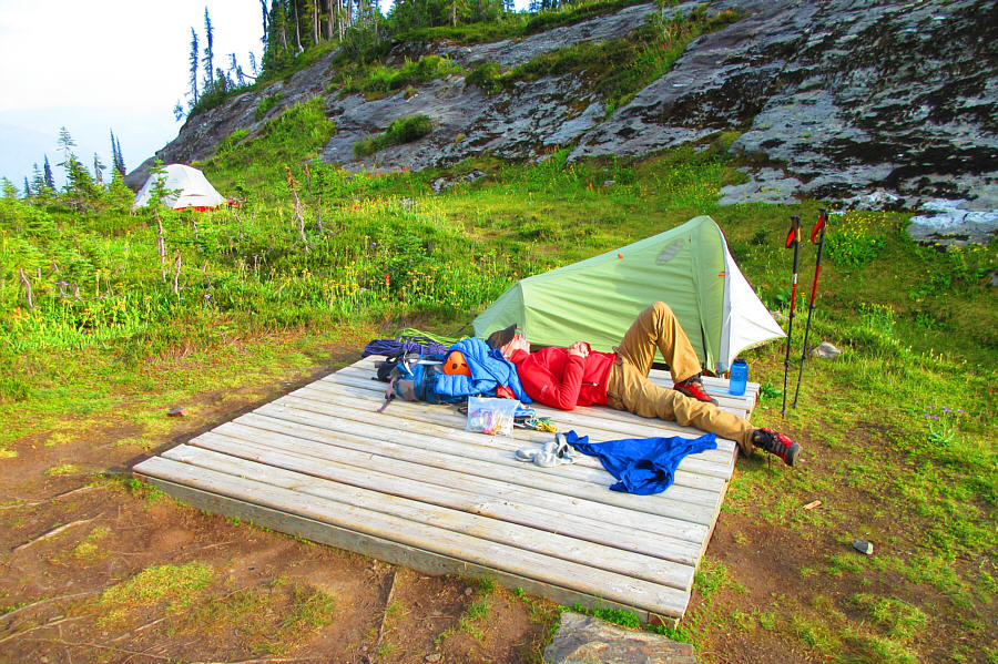
Sonny takes a nap in the sun while
Wendy pitches her tent in the background. Photo courtesy of Zosia Zgolak |
 |
Wildflowers are still in bloom along the creek that runs by the campground. |

Here is a view of Columbia River from a viewpoint above the campground. The town of Revelstoke is at left while the ski runs of Mount Mckenzie are at right.
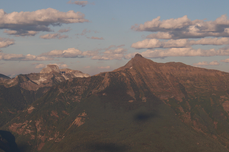 |
Ghost Peak (left) and Mount Cartier are a couple of intriguing mountains southeast of Revelstoke. |
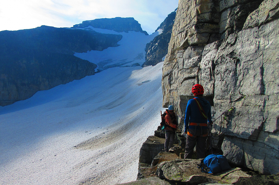
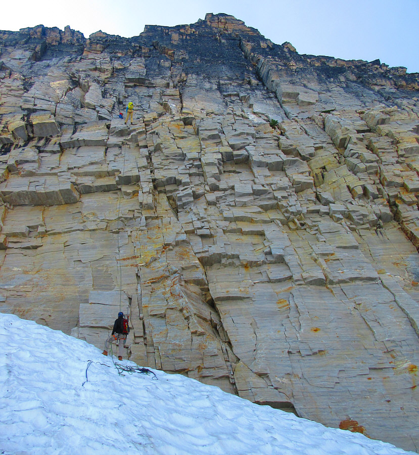
The
initial stretch of about 50 metres along the ledge is quite exposed, and
while some climbers have been known to traverse this section unroped,
most parties choose to rope up and make use of the belay stations here.
In our group, Wendy led the initial traverse with Michael belaying her
from behind. Once she was safely across to the final belay station,
she secured herself there, and the rest of us followed one by one with
Michael being the last to traverse. Beyond the final belay station,
we left behind all our climbing gear and continued along the remainder of
the ledge until it was feasible to scramble up the crest of the north
ridge. Most of the remainder of the ascent is easy to moderate
scrambling over large blocks of rock with plenty of cairns to ease
route-finding. We enjoyed a trouble-free climb to the summit, and
the only disappointing aspect was the build-up of wildfire smoke in the
afternoon which obscured much of the distant views.
After taking an extended break at the top, we retraced our steps back
down the north ridge and returned to the final belay station along the
ledge to retrieve our climbing gear. Wendy then set up a rappel
with two joined ropes, and Michael was the first one to go over the edge
and descend to the glacier. A moat at the bottom of the rappel
proved to be a bit problematic, but Michael, with his long legs, managed
get a foothold on the glacier and avoid dropping down further.
Michael stayed at the bottom for all subsequent rappels to help each of
us swing over to the edge of the moat. This was only my second
rappel I have ever done, and the length of the drop was admittedly a
little intimidating to me. The rappel was also mostly overhanging,
and when I started spinning a bit out of control in midair, it took me a
moment to collect myself before I remembered to keep passing the rope
through my belay device.
Wendy was the last to rappel, and after she and Michael collected the ropes, we all donned our crampons to walk back down the glacier. Descending the toe of the glacier was maybe the most unnerving part of the day as we cautiously front-pointed down a very steep snow slope with only our ice axes to prevent any involuntary slides. Fortunately, everyone made it down safely, and once we were off the glacier, we removed our crampons and easily hiked back across the karst pavement and down to the campground. Although we could have packed up and hiked out that same evening, we elected to relax and stay another night.
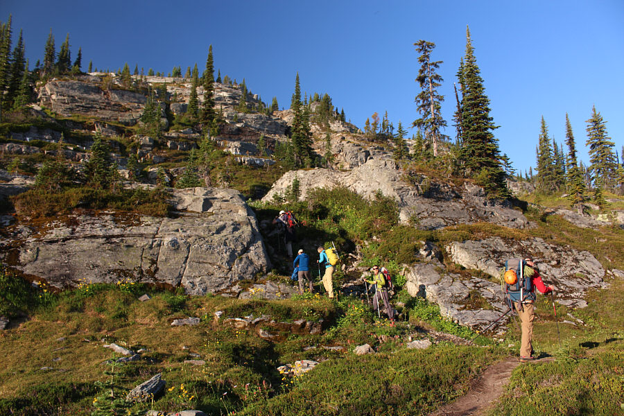 |
The group begins hiking from the campground on the morning of the second day. |
 |
Zosia gets her first clear view of Mount Begbie as she proceeds through the last trees. |
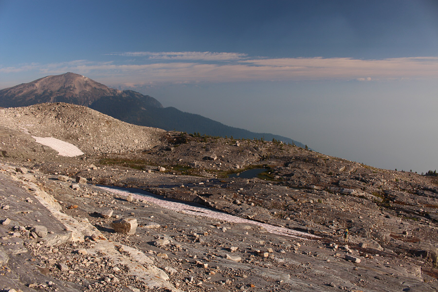 |
Marta is barely visible at bottom right as she hikes up the moonscape beyond the last trees. |

Another party can be seen on the glacier approaching the start of the crux ledge.
 |
The group approaches the toe of the glacier. |
 |
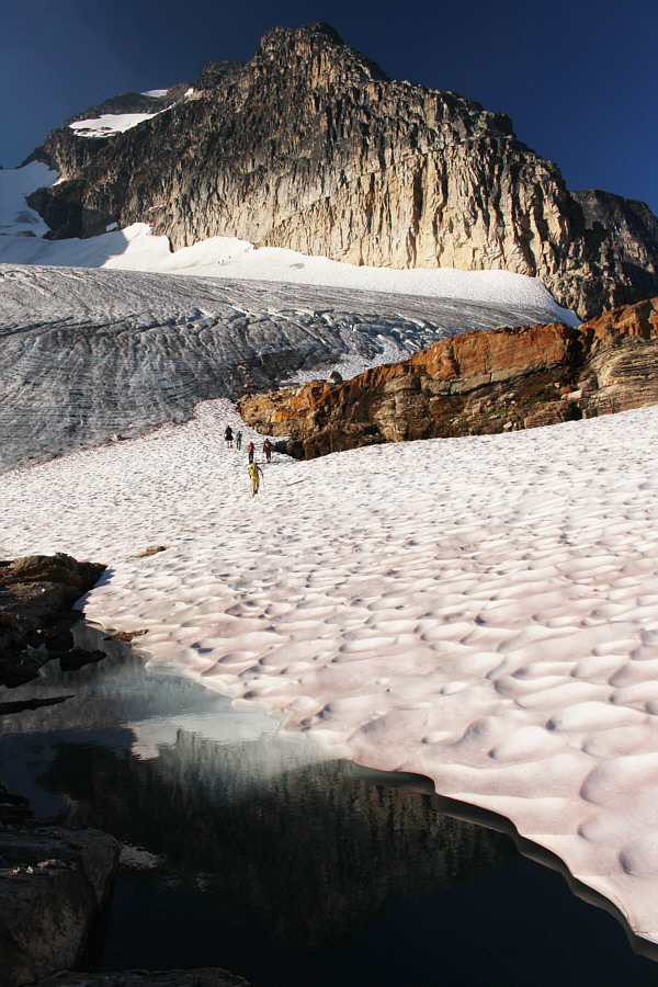
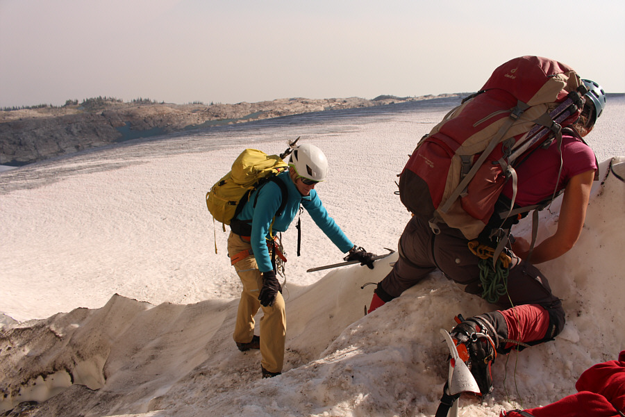
After donning crampons, the group climbs onto the glacier. A couple on the distant snow patch are climbing without crampons. |
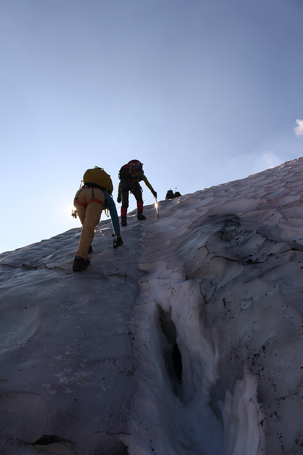 |
The group climbs past a small crevasse. |
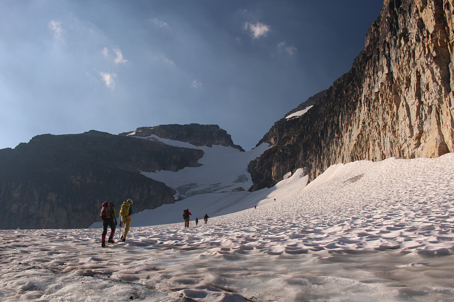 |
The group makes its way across the glacier to the start of the ledge somewhere to the right. |
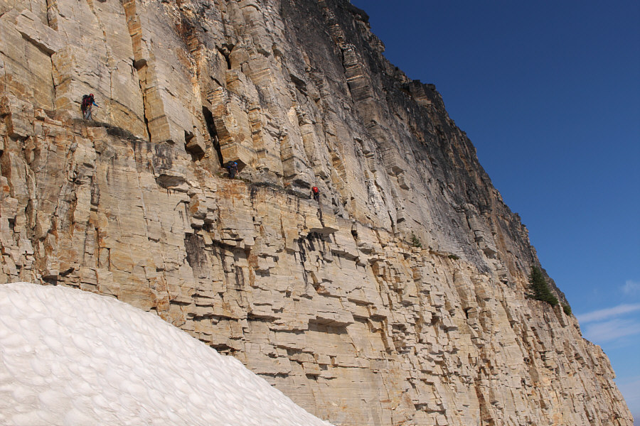 |
A party of three ahead of the group is already traversing along the ledge. |
 |
The group approaches the edge of the glacier to reach the start of the ledge. |
 |
Marta and Zosia climb over the lip of the glacier into a moat. Note the beginnings of a crevasse at bottom left. |
 |
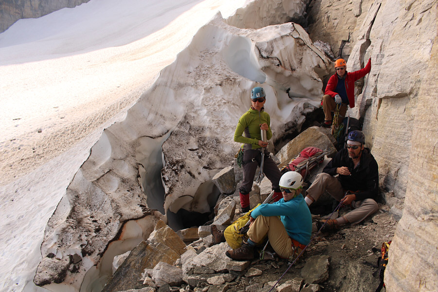
Pierre carefully descends into the moat between the rock face and the glacier. Note the other climbers ahead on the ledge. |
 |
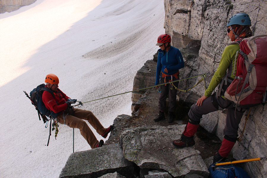
Wendy leads the way on the ledge
traverse. Photo courtesy of Zosia Zgolak |
 |
Michael belays Wendy on her traverse while the other group members wait for their turn. |
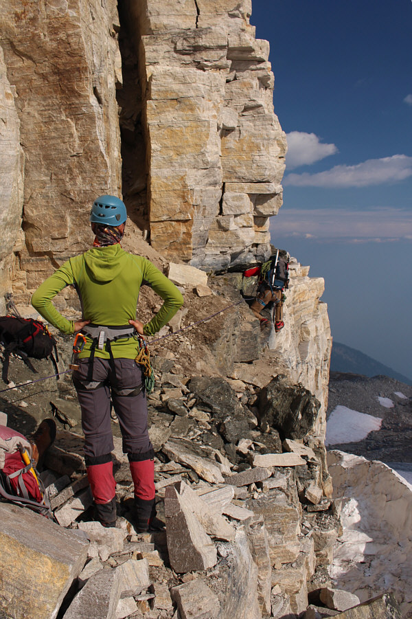 |
Zosia watches Pierre negotiate the most awkward spot along the ledge. |
 |
It is Zosia's turn to traverse the ledge. |
 |
Wendy watches as Sonny arrives at the
end of the technical part of the traverse. Photo courtesy of Zosia Zgolak |
 |
Pierre and Marta wait patiently on the
other side for the rest of the group to complete the traverse. Photo courtesy of Zosia Zgolak |
 |
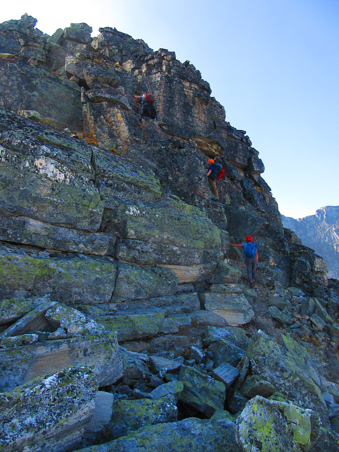
Leaving all the climbing gear behind, the group continues along the rest of the ledge which is now substantially wider. |
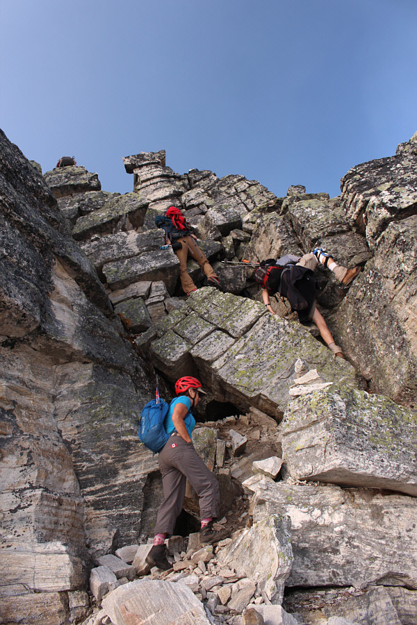 |
The group leaves the ledge and begins scrambling up the crest of the north ridge. |
 |
The route is well-marked and never
more than moderately difficult on the north ridge. Photo courtesy of Zosia Zgolak |
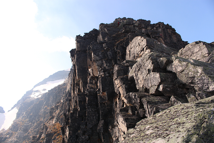 |
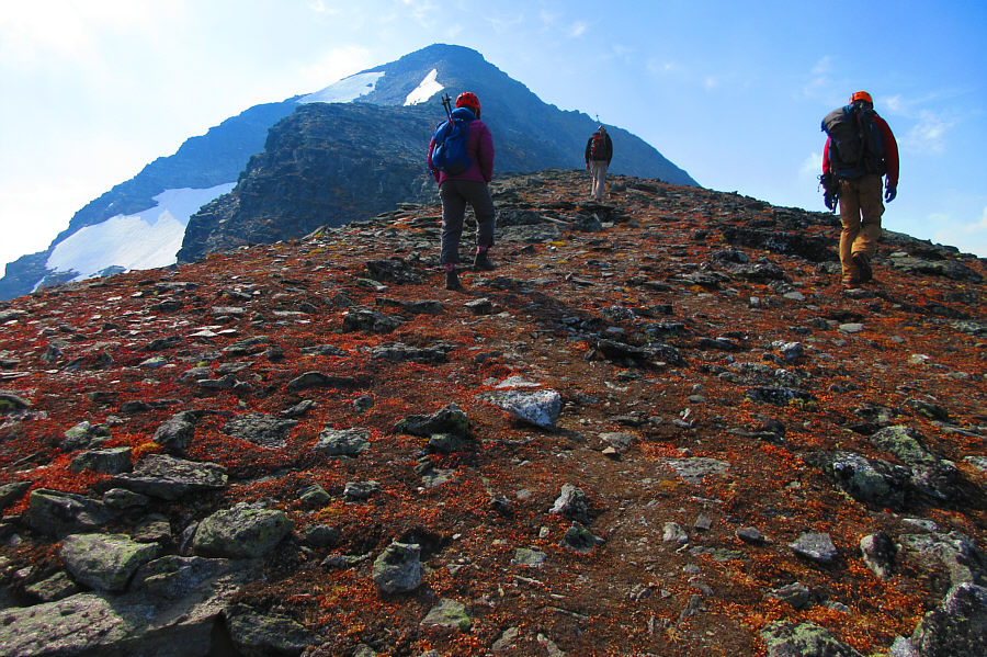
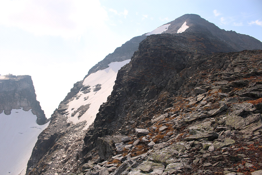
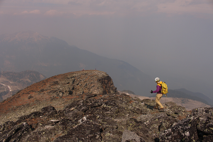
The summit block can be partially seen from this vantage point along the north ridge. |

Scrambling from bottom to top are Marta, Wendy, Zosia, Pierre and Michael.
 |
The terrain begins to flatten out on
the final stretch to the summit. Photo courtesy of Zosia Zgolak |
 |
From here, Marta and her yellow pants are easier to spot than the others further up the ridge. |

From L to R, Sonny, Wendy, Zosia, Marta, Pierre and Michael gather on the summit of Mount Begbie (2722 metres).
 |
In this view to the southwest, Davis Peak is barely visible behind the unnamed pointy peak at left. Revelation Lake can be seen toward the bottom right. |
 |
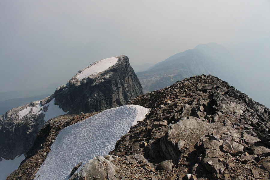
Most notable beyond Mount Begbie's lower west summit are Mount Tilley (pointy peak left of centre) and Mount English (distant left). |
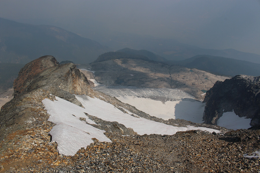 |
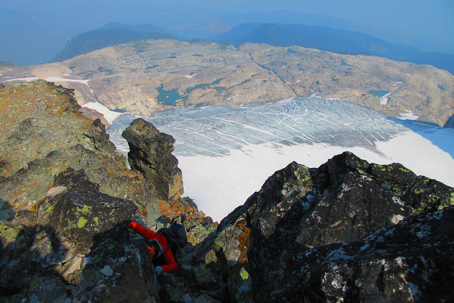
Here is the summit view of Mount Begbie's north ridge and the glacier below. |
 |
Mount Begbie's east summit is adorned with some telecommunications equipment. |
 |
Blanket Glacier is barely visible to the south. |
 |
Marta follows the others down the north ridge. |
 |
Pierre down-climbs one of the steeper
sections of the north ridge. Photo courtesy of Zosia Zgolak |
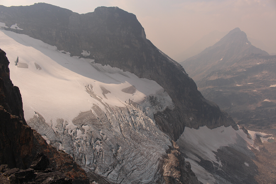 |
This is the hanging glacier below Mount Begbie's west summit. |
 |
Michael begins his rappel off the
ledge. Photo courtesy of Zosia Zgolak |
 |
Wendy and Zosia watch as Pierre lays back over the edge. |
 |
Zosia is rappelling with a Prusik loop as a backup. |
 |
Michael waits below as Marta begins
her rappel. Photo courtesy of Zosia Zgolak |
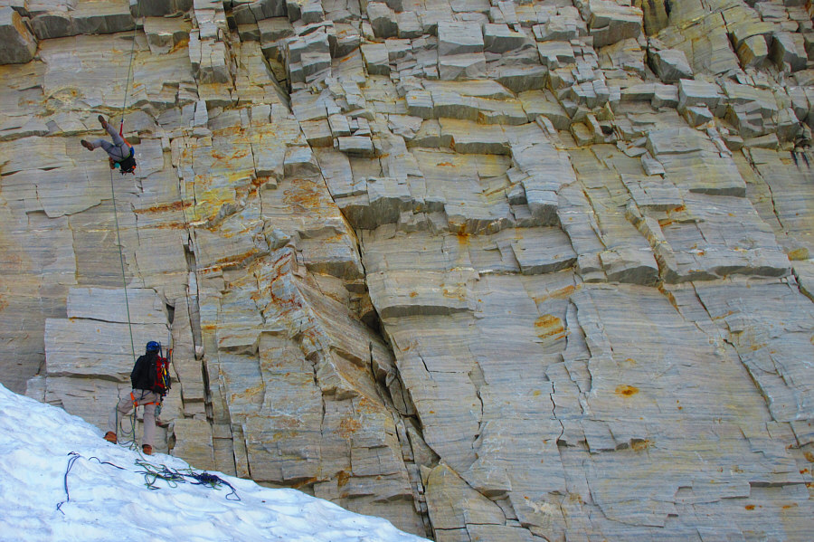 |
Sonny starts spinning in midair during
his rappel. Photo courtesy of Zosia Zgolak |
 |
Sonny finally rights himself and
resumes his descent. Photo courtesy of Zosia Zgolak |
 |
Wendy is the last to rappel down. |
 |
Marta, Zosia and Michael back their way down the steep snow at the toe of the glacier. |
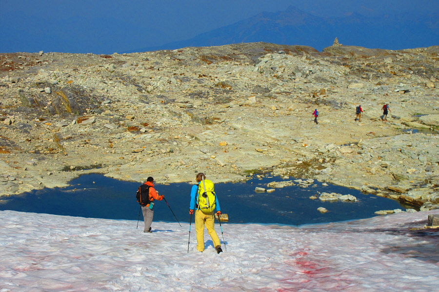 |
The group aims for a large cairn on their way back to the campground. Photo courtesy of Zosia Zgolak |
 |
Pierre takes a well-deserved nap at
the campground. Photo courtesy of Zosia Zgolak |
 |
Revelstoke is once again visible from the campground on the morning of the third (last) day. |
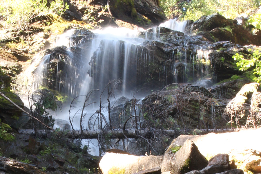 |
A short spur trail leads to this interesting waterfall not far below the campground. |
 |
Total
Distance: 22.1 kilometres Round-Trip Time: 49 hours 33 minutes Net Elevation Gain: 2043 metres |