BOU AVENUE
Mount Cline

Located just east of Saskatchewan Crossing in Alberta's David Thompson Country, Mount Cline is one of the fabled Canadian Rockies mountains whose elevation exceeds 11,000 feet (3352 metres).  The most popular ascent route via the southwest ridge is described in Bill Corbett's The 11,000ers of the Canadian Rockies.  When Aga Sokolowska phoned me on a Thursday evening to ask if I would be interested in joining her and Daniel Dufresne for an ascent of Mount Cline over the weekend, I was at once both excited and hesitant.  The prospect of climbing such a big mountain was obviously thrilling, but having to tackle the infamous crux--two exposed notches along the southwest ridge--gave me pause.  I did not have much experience with technical climbing and rope work, and I was uncertain if Aga and Daniel had picked the right person to accompany them.  Regardless, Aga convinced me that I would suffice for them, and Daniel would even lend me a spare harness with belay device and locking carabiner.  In the afternoon on 7 July 2017, we drove out to Thompson Creek campground to camp for the evening.  Aga paid $27.00 for one night of camping, but the campground host was gracious enough to allow us to leave my car in the day use area for the rest of the weekend.

Early on the morning of 8 July 2017, Daniel, Aga and I left the campground and crossed the highway to the start of a good trail running along the east side of Thompson Creek.  I also had So Nakagawa's GPS tracks to follow in case we went astray.  We hiked up this trail for about 900 metres before crossing to the west side of Thompson Creek.  Despite some washouts along the way, the trail is generally easy to follow, and we made good progress up the creek. About 2.7 kilometres after the first creek crossing, the trail climbs steeply away from the creek and up alongside a gully.  We eventually crossed the gully and climbed up onto a high bench where the angle finally relents a bit.  We settled into some pleasant hiking across open slopes here, but the trail eventually peters out near the top of a small grove of trees where there are nice views of twin waterfalls further up the valley.  Continuing beyond the end of the trail, we traversed across a loose rubble slope aiming for another grove of trees above and to the left of the aforementioned waterfalls.  Beyond this second grove of trees, we enjoyed some more pleasant hiking until we reached a short headwall.  A lingering snow patch here complicated matters somewhat, but we still managed to climb up the headwall without too much trouble.  Shortly after, we reached the lower of the two lakes which would be our bivy site.
Don't go under the bridge; trolls live there! Aga and Daniel are about to cross the highway after leaving Thompson Creek campground.
Still better than bushwhacking! 
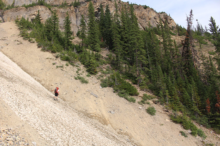
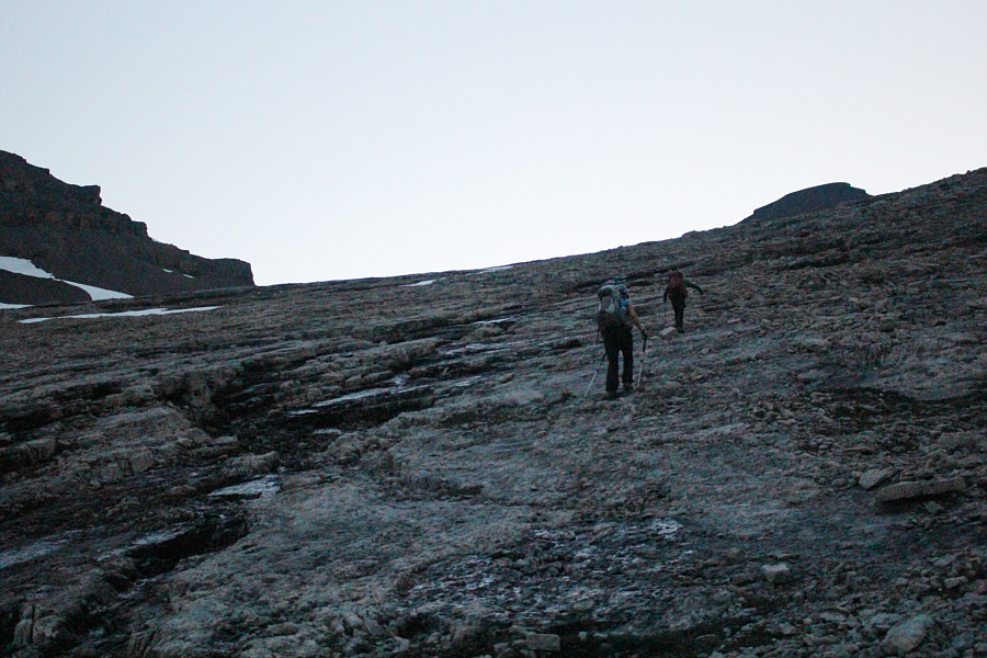
In many places, the approach trail is nothing more than a scratch in the dirt.
Not a good place to slip... Daniel crosses a snow-filled gully far above the creek.
The tedious part of the approach is largely behind us at this point.

Aga hikes along a high bench with views of North Saskatchewan River.

These waterfalls would be a popular hiking destination if this was within a national park. Twin waterfalls cascade over a cliff further up the valley.  The approach route continues across the rubble slope at left and climbs above the trees left of the waterfalls.
Very pleasant hiking up ahead! 
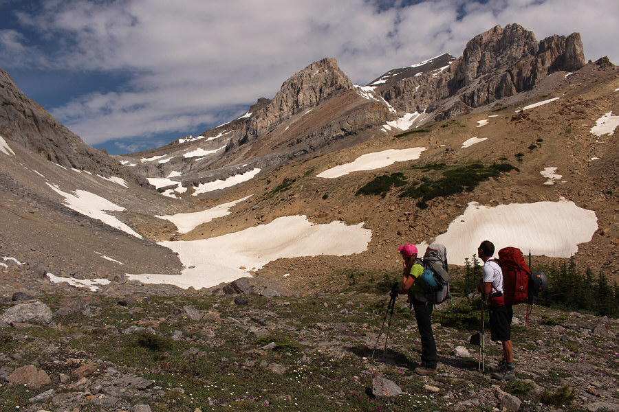
Aga and Daniel survey the remainder of the approach route in the upper valley.
Where the tracks go up the snow is steeper than it looks. 
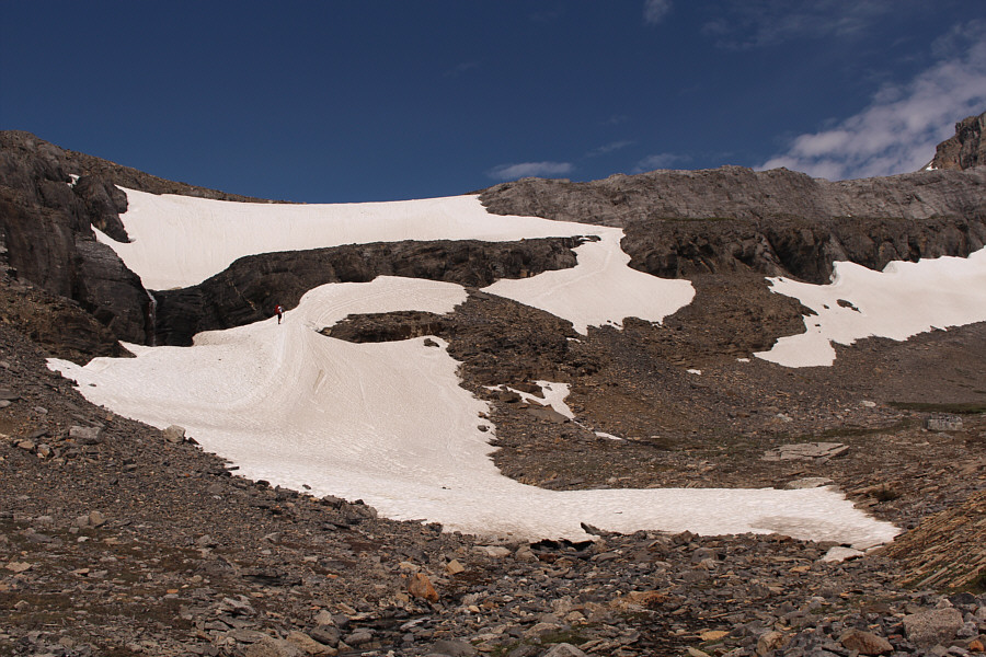
A lingering snow patch at the headwall presents a bit of a challenge.
The shallow gully to the right might be easier to climb. Daniel scrambles up a shallow crack to avoid a steep snow slope out of view to the right.
Daniel set up a quick and dirty belay for Aga here. Aga joins Daniel at the top of the shallow crack on the headwall.
Glad we brought our ice axes! 
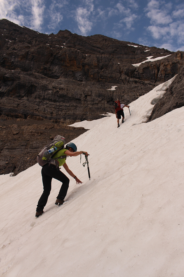
Aga and Daniel ascend a snow patch near the top of the headwall.
It would suck to have to camp here in the rain... 
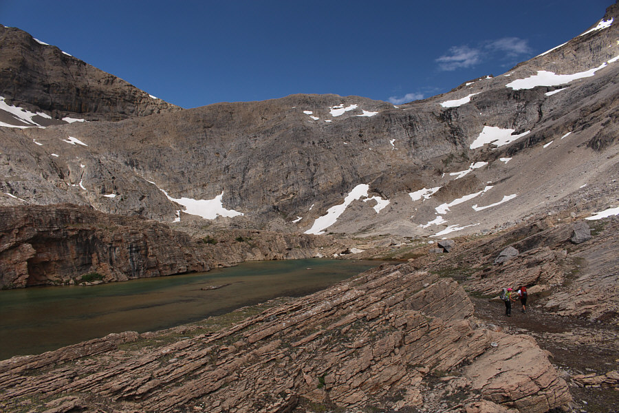
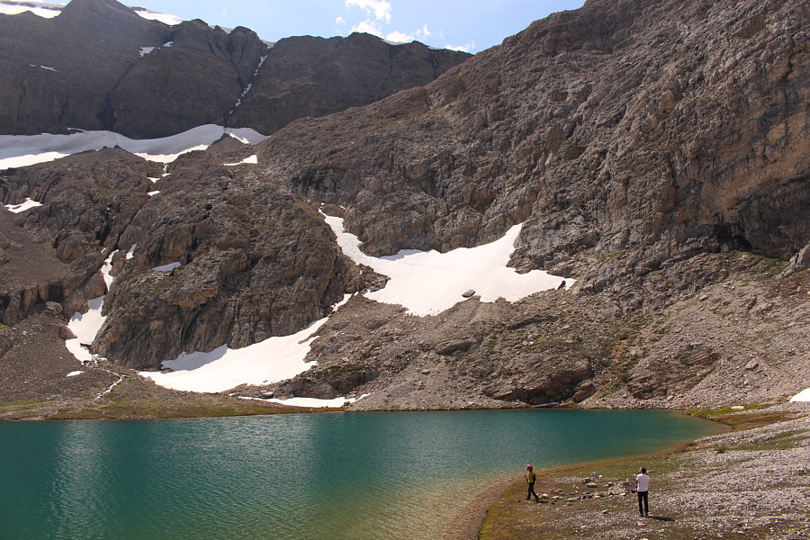
Aga and Daniel arrive at the bivy site.
When we arrived at the bivy site, we had a lot of daylight left, and we briefly considered pushing on to the summit that same day.  A group from Edmonton that was in front of us was doing just that while a group from Calgary just behind us decided to stay put.  Unbeknownst to us, there was yet another group from Calgary that had started even earlier than the Edmonton group and would be doing the whole climb as a very long day trip.  We would chat with them later that afternoon on their way out, and they provided some helpful information regarding the condition of the route.  In the end, we decided to stick with our original plan of starting early the following day in order to reach the summit before descending and hiking out.  As such, we spent a relaxing afternoon eating, snoozing and wandering around the bivy site.  We also spent some time practicing belaying and rappelling off a big boulder.  While I retired to my tent early in the evening, I had a difficult time falling asleep especially since it was still bright out.  As such, I had a rather restless night.
Tip: Don't leave your trekking poles unattended here. Rodents will chew on the straps! Daniel and Aga set up camp beside the lower lake.
Time for a siesta! Sonny has a small garden of flowers beside his bivy tent.
Nicely done, Aga! 
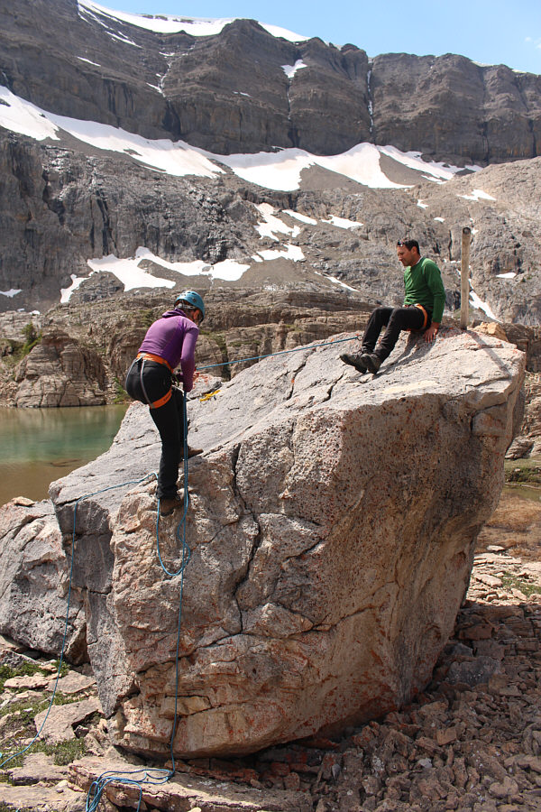
Daniel supervises Aga as she practices rappelling off a big boulder.
Why does Batman and Robin climbing a wall come to mind? 
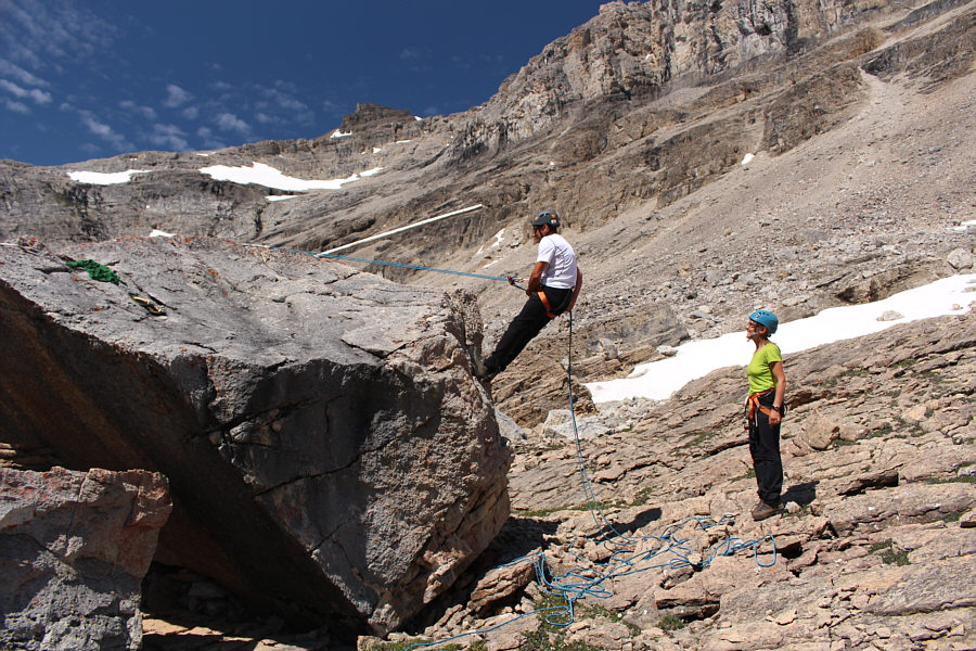
Daniel takes a turn at rappelling off the boulder.
I've done this before, but this is a good refresher for me. 
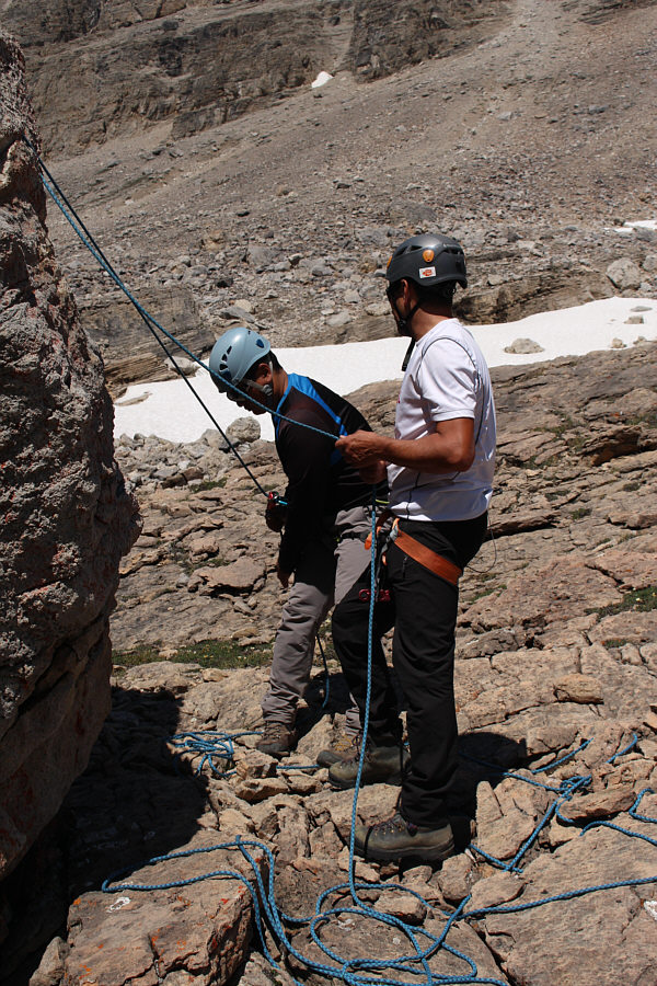
Daniel teaches Sonny how to belay.
Scouting our route for tomorrow...check! Aga and Daniel wander to the upper lake for a closer look at the snow ramp (centre) which is the normal point of access to the next valley above.
Simply beautiful! 
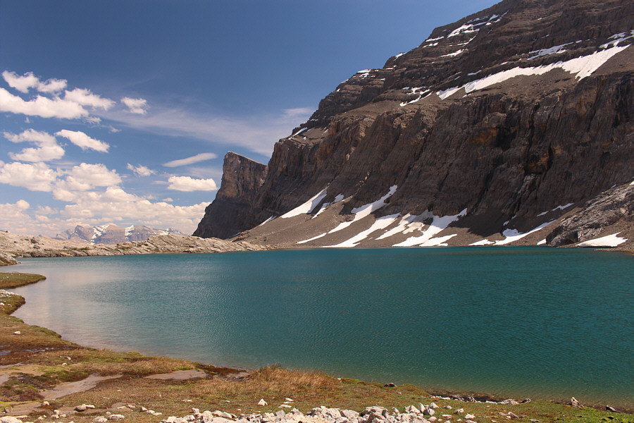
The upper lake is larger and deeper than the lower lake.
When I got up at about 3:00 AM on 8 July 2017, I was ironically just starting to feel sleepy.  I joined Daniel and Aga for a quick breakfast in the dark before we set off for the snow ramp beyond the upper lake.  Taking advantage of the footprints of the climbers from the previous day, we climbed up the snow ramp fairly quickly, and after a short level stretch, we grinded our way up a long but easy slope to a broad col below the southwest outlier of Mount Cline (some references call this outlier, "Mount Owen"--not to be confused with another peak with the same name in Yoho National Park).  The other group from Calgary--a foursome--caught up to us at this point, and they eventually passed us while we traversed across the snowfields below the outlier.
We warmed up really quick going up the ramp. 
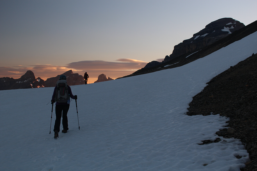
Aga follows Daniel up the snow ramp in the dark.
And it felt even longer coming down! This slope is easy to climb, but it is longer than it looks.
Daniel suggested pushing our bivy site to this spot, but I'm glad we didn't! 
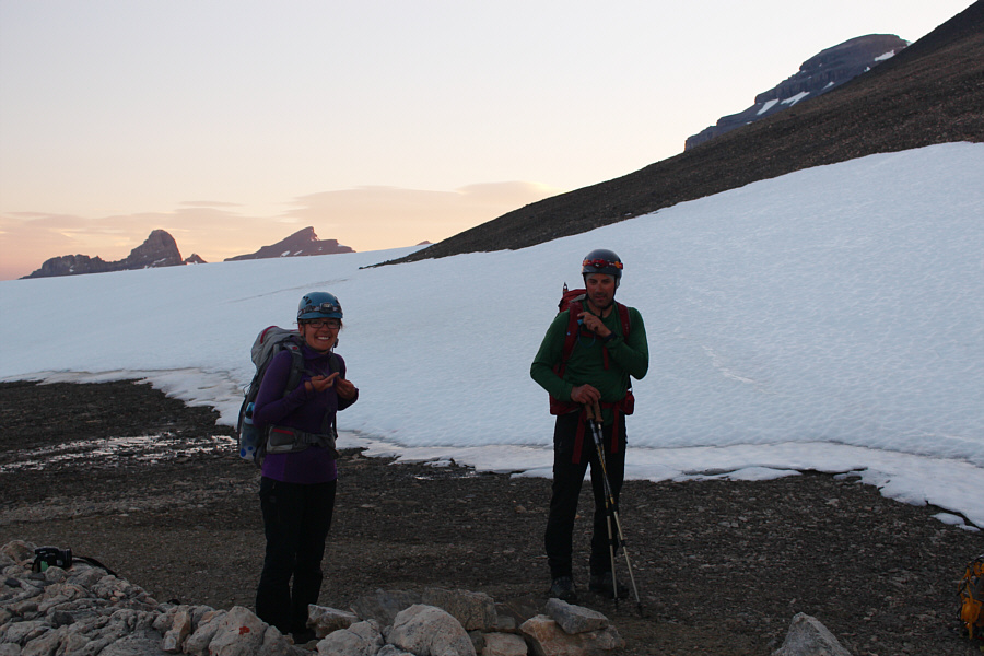
Aga and Daniel pause for a break at the broad col.  The top of Mount Cline is just visible at upper right.

This will be my new FB cover photo!

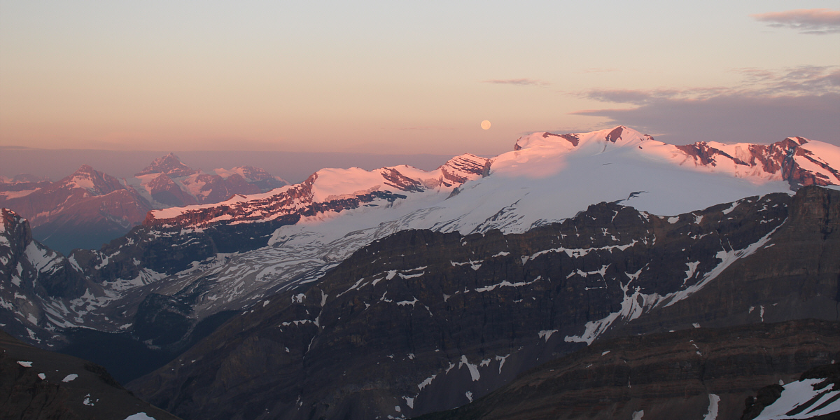
The moon sets behind Mount Wilson as sunlight hits the tops of the peaks.  The high peak at distant left is Mount Forbes.


No crampons needed! 
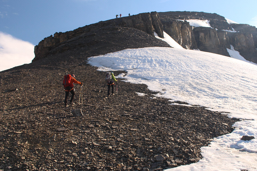
Aga follows Daniel across a snowfield beyond the broad col.
The excitement mounts... 
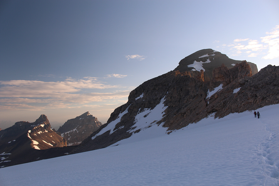
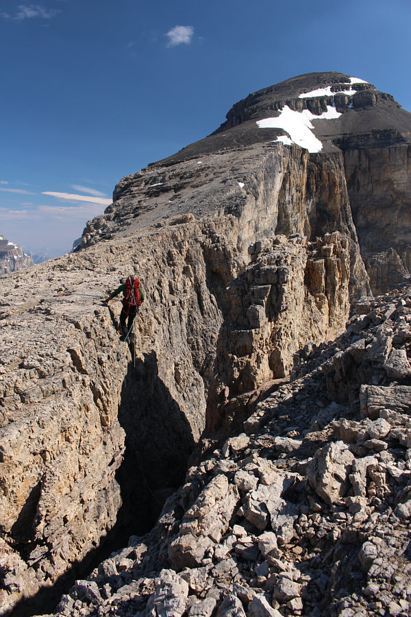
Mount Cline's southwest ridge begins to take shape just beyond the last snowfield.  At left in the distance are the Whitegoat Peaks.
Beyond the last snowfield, we scrambled up and around some pinnacles and rejoined the other group just as they were about to go across the infamous notches.  Daniel discussed belay strategies at length with the other group, and we all agreed to work together to get everyone across safely.  A climber from the other group initially crossed the first notch and was able to set up a second belay from the other side for the rest of us.  One by one, we down-climbed into the first notch and awkwardly maneuvered around an intervening pinnacle before finishing with a steep but straightforward climb above a reassuring chockstone.  Being the last to cross, Daniel rappelled into the notch instead of down-climbing, and he also reeled in and brought over the rope that was used as our initial belay.  For the second notch, we all rappelled off an overhanging cliff face without too much difficulty.  Daniel made sure that the rope was secured at the second notch before we all resumed climbing.  Getting all seven of us across the two notches was certainly time-consuming (about 1 hour 15 minutes), but we all made it without any slips or mishaps which is a fine testament to the safety-consciousness of Daniel and the experienced climbers from the other group.
A little hands-on scrambling here to warm up for the upcoming notches! 
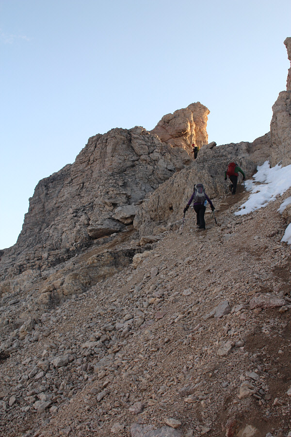
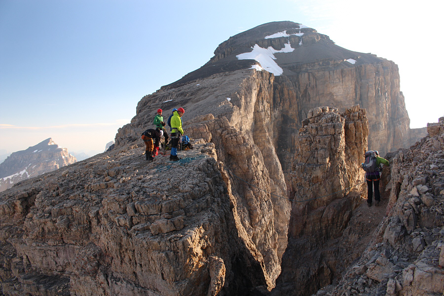
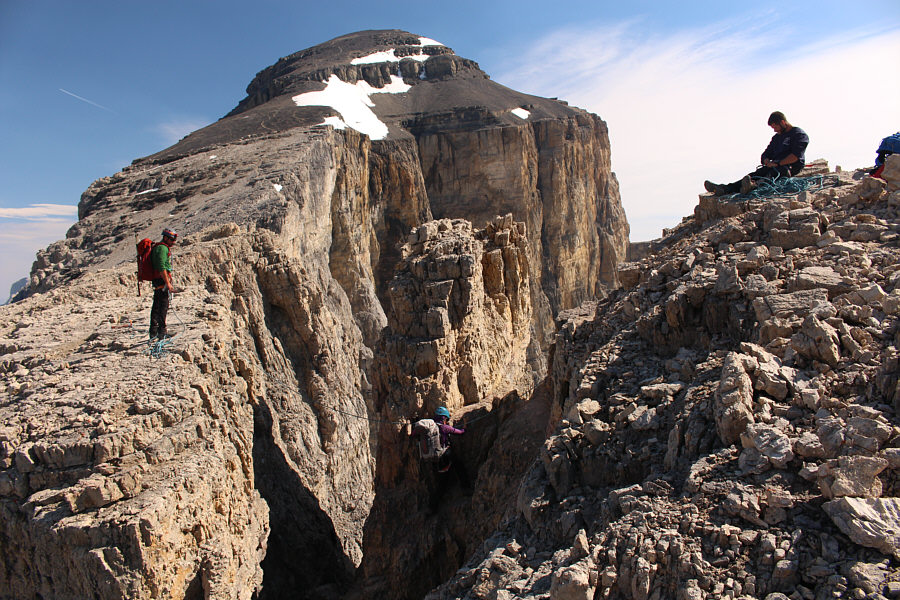
Aga and Daniel scramble up to some pinnacles on the southwest ridge.
This is the fun part! 
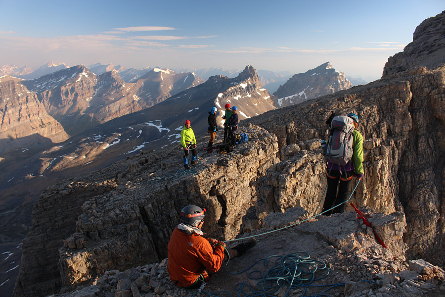
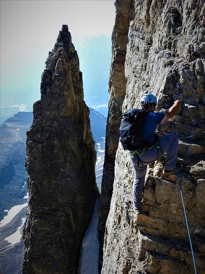
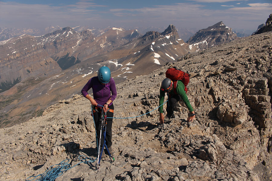
Daniel belays Aga as she prepares to cross the first notch.  The group from Calgary is already on the other side.
Loose and downsloping would aptly describe the initial descent. Aga descends into the first notch.
I think it's easier to get down as low as possible before traversing across to the chockstone. 
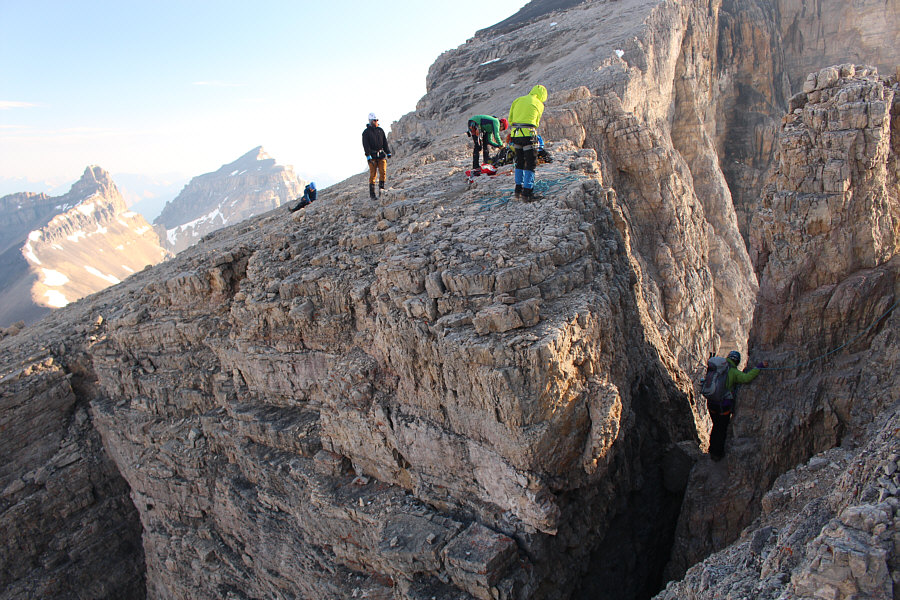
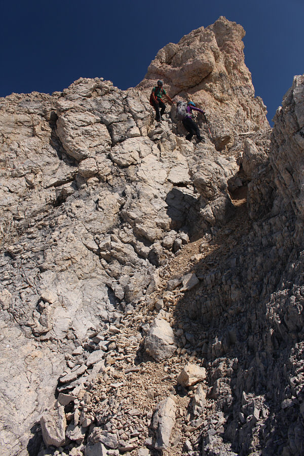
Aga awkwardly gets around the pinnacle to reach the chockstone.
Well done, Aga! 
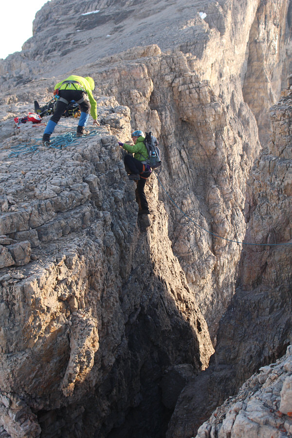
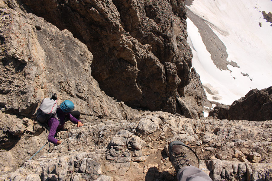
The climbing is relatively easy above the chockstone.
Daniel makes it look easy. The last one to come across, Daniel rappels into the first notch.
This short section is rated 5.4. Daniel climbs out of the first notch.
The overhang makes it a bit trickier to place your feet. 
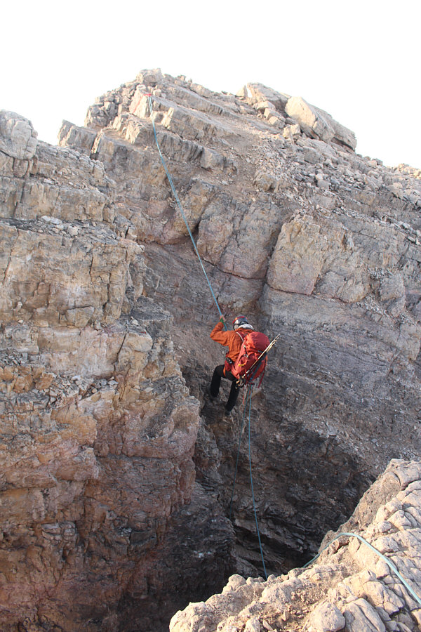
Daniel watches Aga rappel over the second notch.
I've read that some people jump across...hmmm... It is Daniel's turn to rappel over the second notch.
The remainder of the ascent is nothing more than an easy scree slog, and after all the excitement at the notches, reaching the summit felt almost anticlimactic.  Despite some haze from British Columbia forest fires, the summit views were still exceptional, and had there not been a chilly breeze, we may have stayed a bit longer on top.  Although the other group started descending before us, Daniel, Aga and I caught up to them once more just as their last guy was climbing up the far side of the second notch.  We each followed suit by descending a bit into the notch and taking a very big step across an exposed gap.  Climbing up above the gap was not too difficult, but the insane exposure here made me thankful that I was roped up.  The hardest part about getting back across the first notch is the down-climb to the chockstone, and for some, it may be simpler just to rappel here.  Regardless, we all made it across again without mishap, and Daniel, Aga and I thanked the other group for their help and patience before they took off for the rest of their descent.  Our return to the bivy site was mostly uneventful.  We made quick work of the snowfields below the southwest outlier, but the hike down the long slope below the col seemed to take longer than expected.  To descend the steep snow ramp above the lakes, we took out our ice axes, but fortunately, none of us went for an inadvertent slide.
I'm getting sleepy again...yawn. 
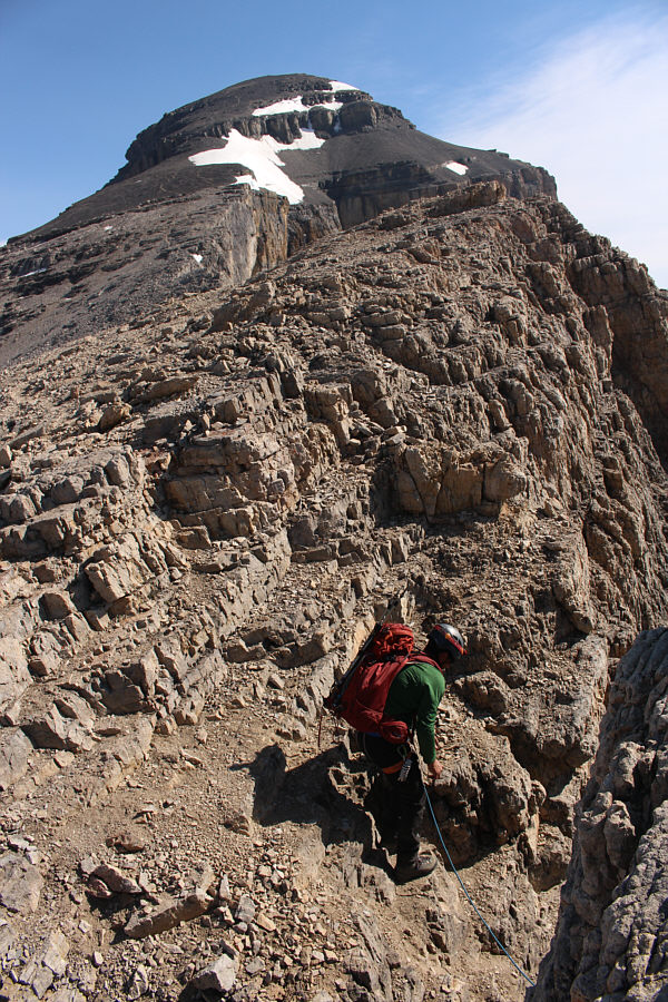
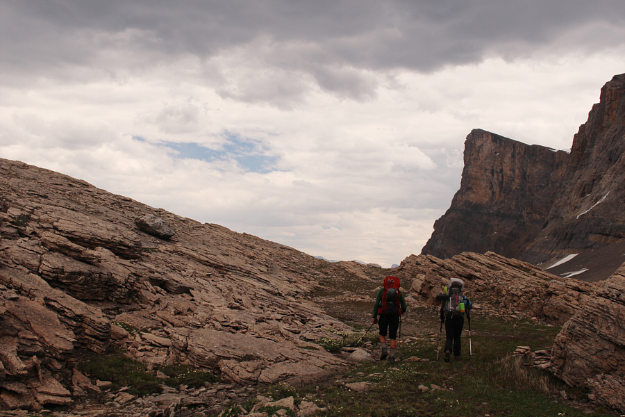
Daniel and Aga follow the other group up a beaten path in the scree slope.

Great success! High five!

Daniel, Aga and Sonny reach the summit of Mount Cline (3374 metres).


Maybe I will climb a few of these in the next few years... 
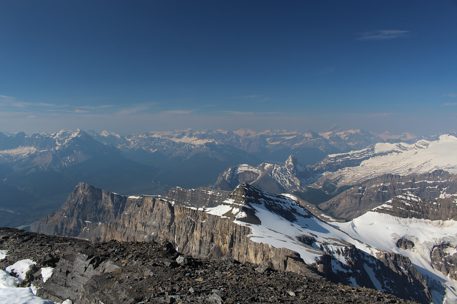
Notable peaks visible to the south include Mount Murchison, White Pyramid, Mount Outram and Mount Forbes.
I would love to try a ski ascent of Mount Wilson someday... Mount Wilson dominates the view to the southwest.  The Lyells can also be spotted on the horizon at right.
I wonder how often that lake in the foreground gets visitors. Mount Amery, Mount Bryce, Mount Saskatchewan and Mount Columbia are among the recognizable peaks to the west.
And a whole lotta unnamed peaks in the distance! North of Mount Cline are the impressive Whitegoat Peaks.
That drop to the left is a doozy! On the way back, Sonny climbs up the second notch.

Photo courtesy of Aga Sokolowska

Dow Williams apparently free-climbed this. Would you?? It is Aga's turn to climb up the second notch.
The hardest part here is the big step across a very exposed gap. It's all psychological! Daniel descends into the second notch.
One more notch to go... Aga belays Daniel as he finishes climbing out of the second notch.
It might have been cool to set up a Tyrolean traverse here à la the movie, "Cliffhanger"! As Aga re-crosses the first notch, she is again belayed by both Daniel (left) and one of the guys from the Calgary foursome.
His third rappel of the day. Daniel rappels into the first notch for a second time.

I kind of regret not tagging the outlier...only a little...

Daniel surveys the tracks in the snowfields below Mount Cline's southwest outlier ("Mount Owen").


Careful with the loose rocks here. Daniel and Aga scramble down from the pinnacles along the southwest ridge.
Au revoir! Here is a last look at the summit block of Mount Cline.
That would be a nasty surprise for a skier! 
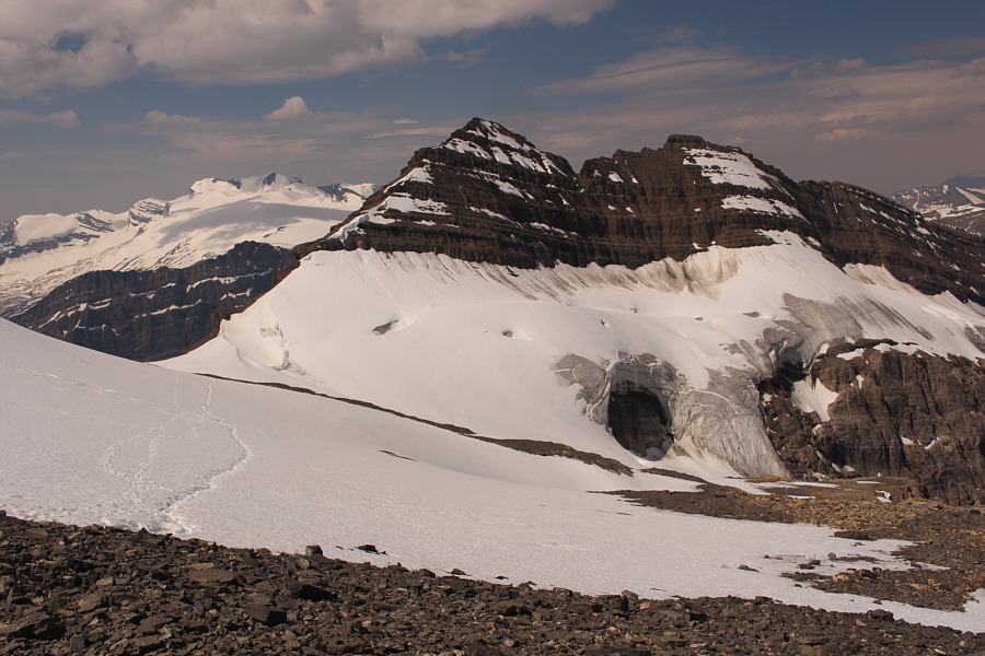
The remnant glacier northwest of the broad col (left) has a big hole in it.

With all the traffic coming through here on a regular basis, this bivy site could use an outhouse.

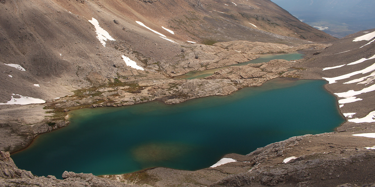
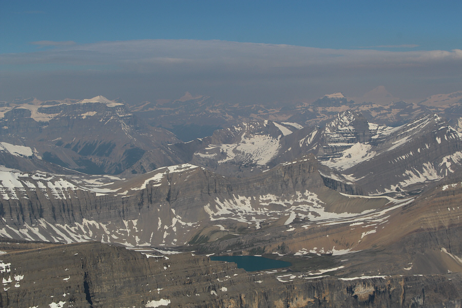
This is an aerial view of the two lakes at the bivy site.


Steeper than it looks! Aga and Daniel carefully descend to the upper lake.
Back at our bivy site, we took an extended break to eat, drink and relax before packing up camp under threatening rain clouds.  Although we felt a few drops of rain as we started hiking again, a full downpour never materialized.  The overcast skies did help to keep the temperature comfortably cool as we retraced our steps out the upper valley, but by the time we dropped back down to Thompson Creek, the hot sun was out again frying our heads.  Once we got close enough to the creek, I took every opportunity to soak my head with cold water during the long march back to Thompson Creek campground.  We missed one critical creek crossing along the way, but fortunately, we did not have far to backtrack when we realized our mistake.   Back at my car, we congratulated one another for a safe and successful trip, and the only real disappointment of the day was driving to Banff town site afterward and finding out that Barpa Bill's was already closed for the day.  Consequently, we had to settle for dinner at Wendy's in Canmore instead.
I will never come back here again! Daniel and Aga leave the bivy site to begin the long hike out.
Probably the highlight of my year so far! Total Distance:  27.1 kilometres
Round-Trip Time:  34 hours 45 minutes
Net Elevation Gain:  1984 metres

GPX Data