BOU AVENUE
Hillcrest Mountain

With a favourable weather forecast in the Crowsnest Pass area of southwestern Alberta on 22 April 2017, Asieh Ghodratabadi, Ali Shariat, Zosia Zgolak and I headed there to scramble up Hillcrest Mountain.  Inspired by Bob Spirko's trip report, we easily navigated to the starting point for this hike using Google Maps and parked in a muddy camping spot just off the main access road.  From there, we followed a logging road westward to the south end of Hillcrest Mountain.  Some sections of the road were still snow-covered, but fortunately, the snow was still supportive on our walk in.  When it seemed reasonable to do so, we left the road and climbed up the south ridge of Hillcrest Mountain.  The initial pull up the ridge is a bit of a steep grunt, but the angle relents above an obvious rock band which requires some easy scrambling to surmount.  The remainder of the hike to the top is gentle enough, but some false summits along the way make it seem much longer than it really is.  Although we briefly entertained thoughts about traversing to Hastings Ridge to the west, the great abundance of snow there convinced us to abandon the attempt and return the way we came.

On our way back, we made a slight deviation from our ascent route to avoid the rock band and take advantage of a big snow slope to ease our descent.  Even as we descended this slope, the snow was softening up in the warm afternoon sun, and we started to punch through the surface more frequently.  Thankfully, we were soon back on solid ground and regained the logging road at the south end of Hillcrest Mountain without too much trouble.  Given the deteriorating snow conditions, it was not surprising to find ourselves post-holing through the snow-covered sections of the road on our way out, but we took heart in knowing that we made the right call in skipping snowy Hastings Ridge on this day.

After our hike, we drove into Bellevue in hopes of getting some ice cream but were dismayed to find all shops closed which seemed strange for a Saturday afternoon.  Undeterred, we then drove all the way to Black Diamond where we were finally able to satisfy our cravings and properly cap off a most enjoyable outing.
Looks pretty straightforward...as long as there's no post-holing in the snow! 
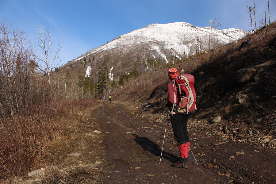
From the logging road, Zosia surveys the ascent route on Hillcrest Mountain's south ridge.
Let the grunting begin! 
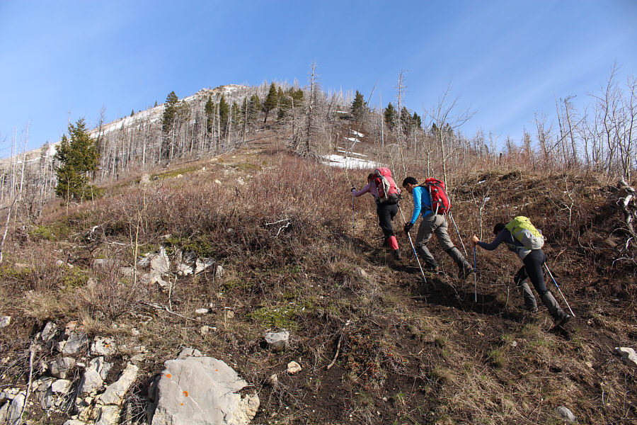
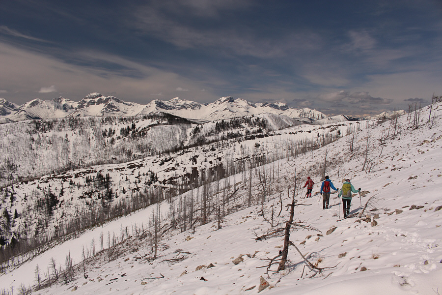
Zosia, Ali and Asieh leave the logging road and begin climbing up the south ridge.
Interestingly, the most recent Google Earth images from 2016 show the ridge being mostly covered with green forest. 
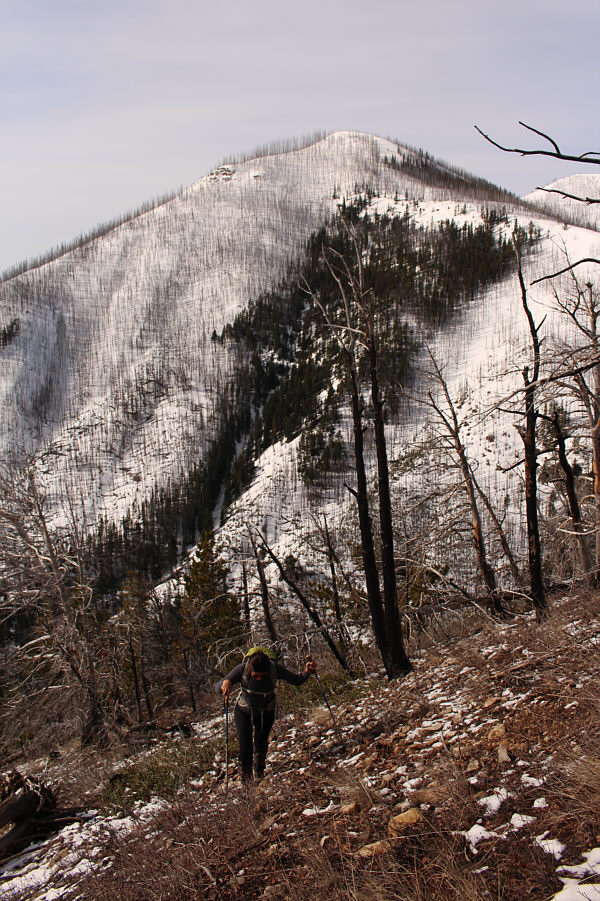
Evidence of a recent forest fire can be seen on the ridge across the valley behind Asieh.
Of course, it can also be easily circumvented, but where's the fun in that?

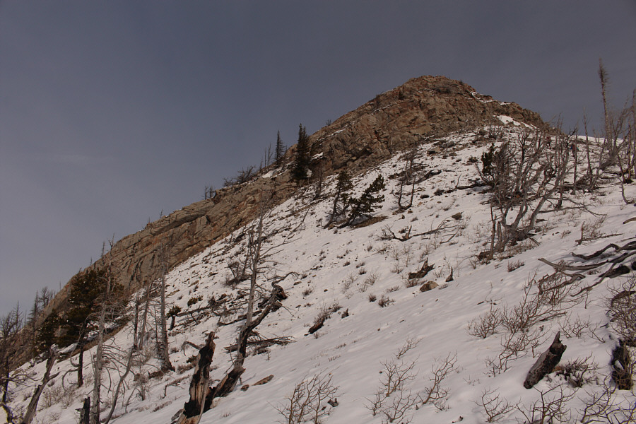
This rock band on the south ridge is the only challenge of any consequence.

It's probably easier just to scramble the direct route like Zosia. Zosia scrambles directly up the rock band while Ali looks for an easier alternative route.
The Great Eye is watching us! There is a ring around the sun on this day.

Photo courtesy of Zosia Zgolak

There's some mild exposure, but the scrambling is quite easy. 
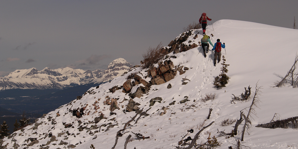
After an aborted attempt to circumvent the rock band, Ali and Asieh simply scramble straight up.
It's pretty much a cakewalk from here! 
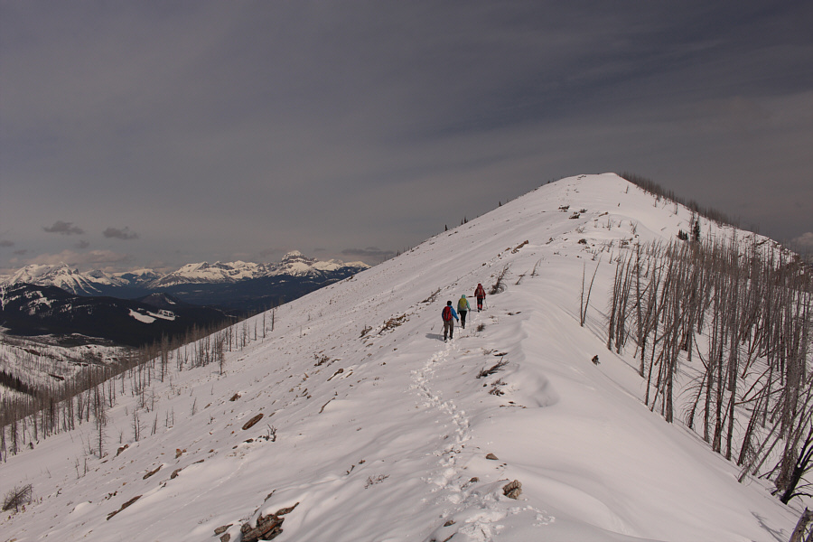
Above the rock band, the group resumes their ascent of the south ridge.  Ahead is a false summit along the ridge.

Be mindful of cornices up here!

The group climbs up a short steep section along the ridge.  Crowsnest Mountain is visible in the distance just left of centre.


Too easy! Sonny, Zosia, Ali and Asieh reach the summit of Hillcrest Mountain (2163 metres).

Mount Darrah is very high on my to-do list!

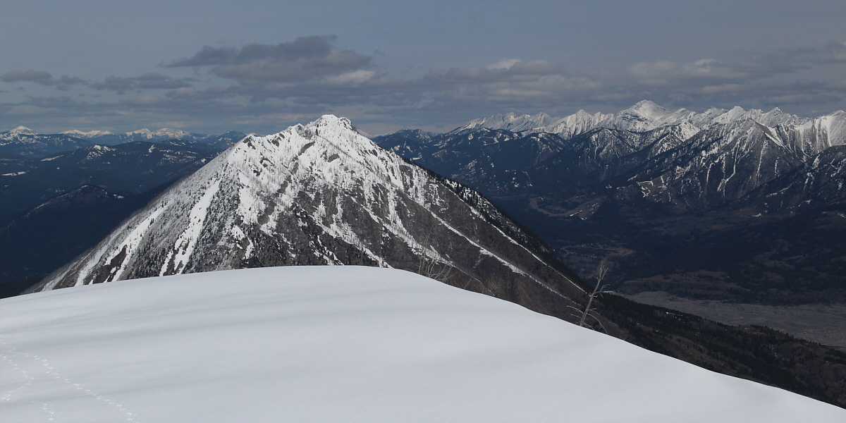
The panoramic view to the southwest includes Hearts Peak (right foreground), Hastings Ridge (next ridge behind Hearts Peak), and Mount Darrah (centre on horizon).


Centre Peak is another one high on my to-do list.

Turtle Mountain dominates the view to the north.  Also visible in the distance at right is Centre Peak.


There are definitely some nice ridgewalks here worth coming back for... 
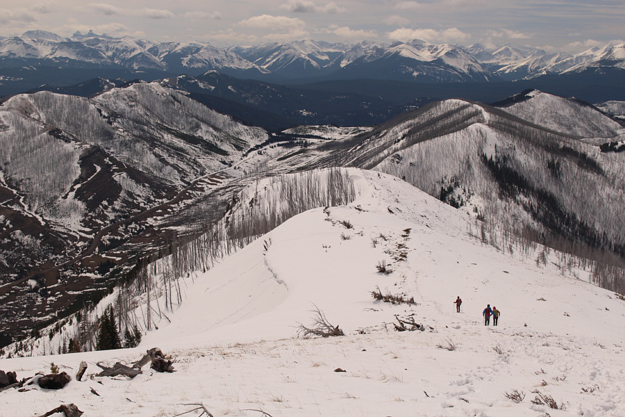
The group descends the south ridge.  Many familiar peaks in Castle Wildland Provincial Park are visible on the horizon.
Looks like winter, feels like summer! The group deviates slightly from their original line of ascent as they head towards the big snow slope at bottom left.
This would have been a great slope to ski down! Sonny glissades a bit awkwardly down the big snow slope.

Photo courtesy of Zosia Zgolak

Also commonly known as prairie crocus even though it is not really a crocus... 
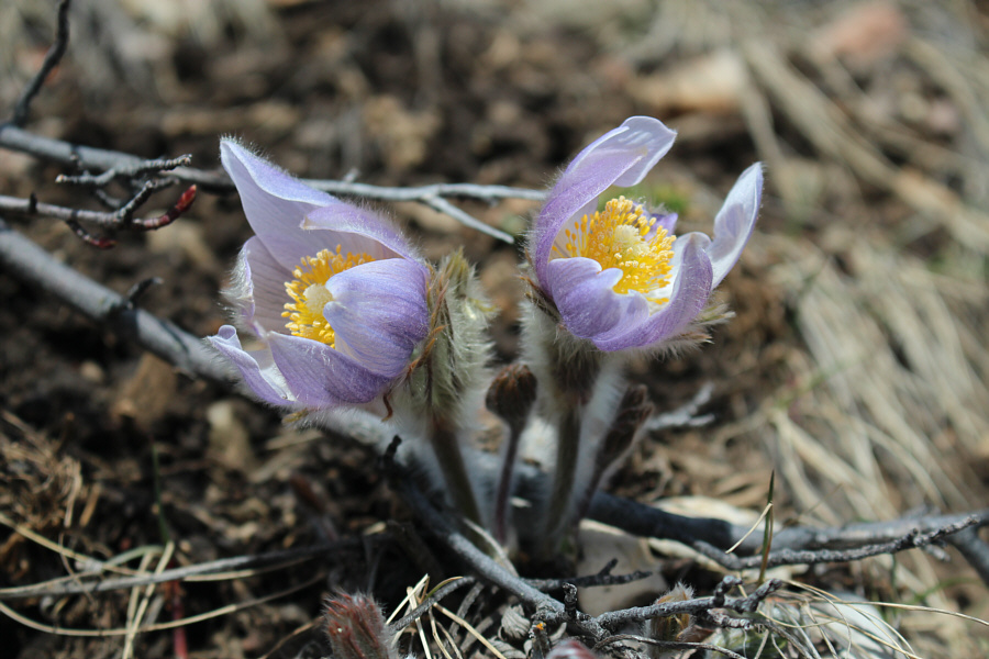
Pasque flowers are a sure sign that spring has arrived.
Still some post-holing to come but not too much! The group hikes out along the same logging road.
A magnificent specimen, is it not? This tick was spotted crawling on top of Asieh's head by the ice cream vendor in Black Diamond.
Mine looks smaller because I've already eaten some of it! 
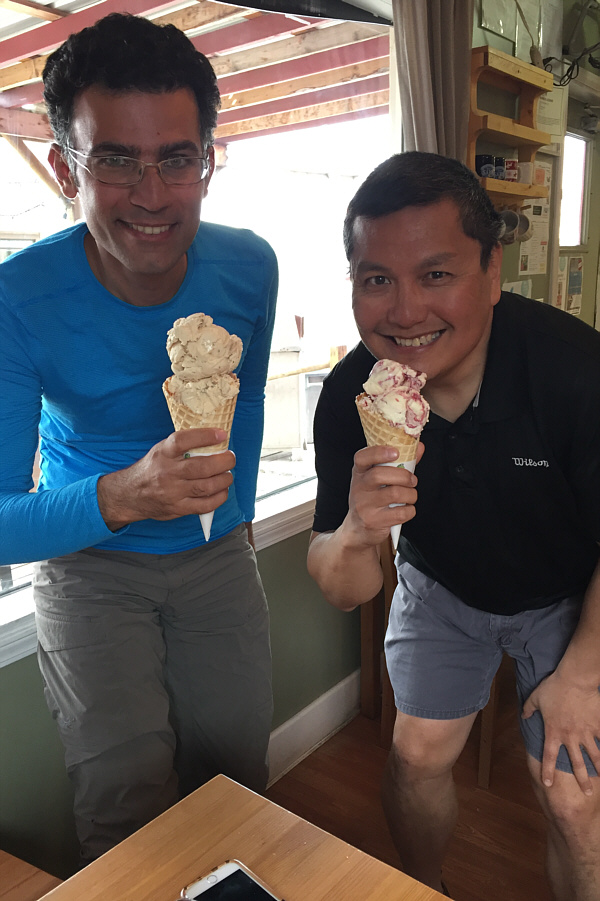
Ali and Sonny show off their waffle cones with double scoops of ice cream.
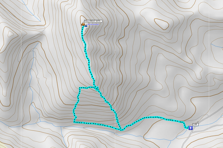
A perfect shoulder-season trip with perfect weather! Total Distance:  7.2 kilometres
Round-Trip Time:  4 hours 58 minutes
Net Elevation Gain:  685 metres

GPX Data