BOU AVENUE
Mount Mann

Zosia Zgolak and I hiked up Mount Mann in the Highwood region of Alberta's Kananaskis Country on 27 August 2017.  The trip is described in Gillean Daffern's Kananaskis Country Trail Guide.  Starting from a pullout near the remains of the Sentinel day use area, we forded the Highwood River and picked up a good trail on the west side of Cataract Creek.  We followed this pleasant trail southward for about 2.8 kilometres to a side creek as mentioned by Daffern.  We left the trail here and bushwhacked up the north side of the side creek to gain the south ridge of Mount Mann.  Heading north, we eventually picked up a good trail which led us most of the way up to the partially forested summit.  Following a recurring theme this summer, wildfire smoke once again cast a haze over the area in the afternoon, but we did not miss much anyway with the normally limited views from the top of Mount Mann.

On our descent, we backtracked a bit along the south ridge before roughly following Bob Spirko's short cut down the steep east face.  Upon regaining the Cataract Creek trail, we simply turned north and hiked back to the Highwood River where we concluded the trip with another splash through the refreshingly cool waters.
Looks like a nice day for a hike elsewhere! Mount Mann is visible behind Zosia as she begins the hike from the highway pullout.
One more river crossing and I will officially be known as Aquaman! 
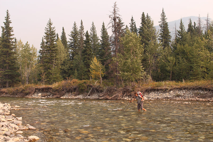
Sonny fords Highwood River.

Photo courtesy of Zosia Zgolak

It's a risky endeavour taking short cuts on this mountain! Numerous cliffs guard the east side of Mount Mann making a direct approach problematic.  Later in the day, Zosia and Sonny would take a short cut and descend the forested slope at left.
Fall colours already in August!! The trail along Cataract Creek is very pleasant to walk.
It's tempting to linger here for the rest of the day! 
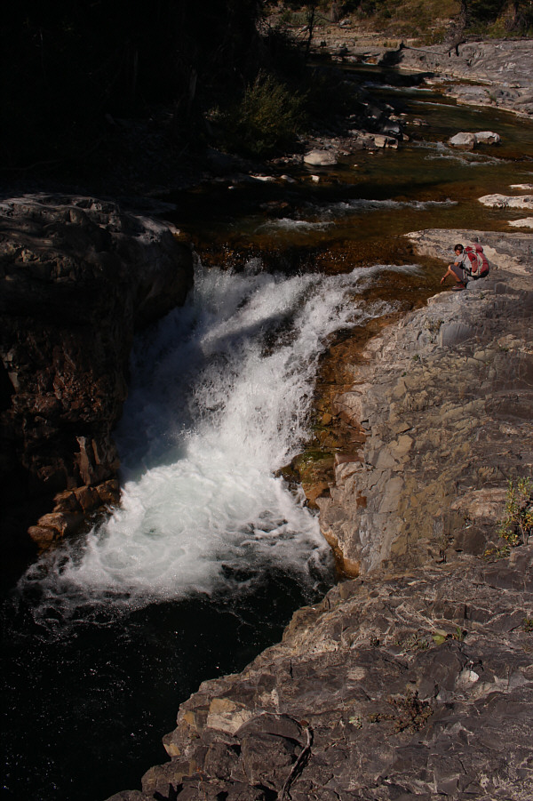
This short waterfall makes for a nice diversion along Cataract Creek.
Brutally hot right now... Zosia climbs steeply up the south end of Mount Mann.
There are better views from the south end of Mount Mann than from its summit! Holy Cross Mountain is visible at left as Zosia proceeds northward along the ridge.
I don't mind the forest when the hot sun is baking my head! The remainder of the route up Mount Mann is mostly in forest, but there is a good trail to follow.
Yoga pose! Zosia and Sonny pose together near the summit of Mount Mann.
I hate tree-covered summits! Sonny stands on the actual summit of Mount Mann (1910 metres).

Photo courtesy of Zosia Zgolak

Will this smoke ever disappear?? Smoke obscures much of the view to the south as Zosia descends Mount Mann.
Very steep but not overly bushy. Zosia takes a short cut down the east side of Mount Mann.
And 4th time this weekend! Zosia crosses Highwood River for the second time on this day.
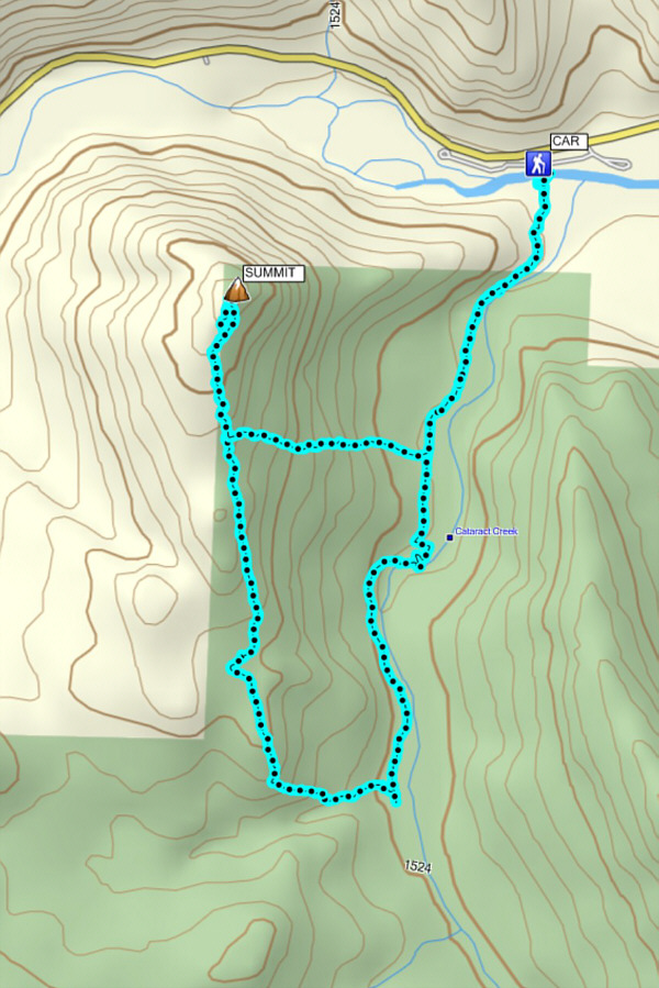
A short trip that most people do in shoulder season, but it's also great if you're short on time and/or energy. Total Distance:  9.8 kilometres
Round-Trip Time:  5 hours 42 minutes
Net Elevation Gain:  473 metres

GPX Data