BOU AVENUE
Ben's Hill
Zosia Zgolak and I made plans to see a Polish movie at the European Film Festival in Calgary late in the afternoon on 10 November 2018, but not wanting to let a nice day go to waste, we chose to ascend Ben’s Hill that morning near Elbow Falls in Alberta’s Kananaskis Country.  Joining us for the short hike, as described by Gillean Daffern, were Andrew Chinnick, Wendy Kadar, Dinah Kruze, Ali Shariat, Bob Spirko, and Wendy’s dog, Ruthie.

Starting from Elbow Falls parking lot, we headed east along Highway 66 for a short distance until we passed an obvious drainage.  Scrambling up the embankment north of the highway, we quickly found a good trail running up the east side of the drainage.  This trail is unofficially known as “Loamzilla” and is mostly used as a downhill run by mountain bikers.  Despite a light dusting of snow, the trail was very easy to follow, and we had no serious issues hiking up the drainage.  A minor cliff band partway up poses no serious difficulties, but the trail can be dangerously slippery here in wet conditions.

About 2.5 kilometres from the highway, an unsigned junction marks the turnoff to the top of Ben’s Hill.  We turned left (west) here and soon reached a large clearing with a mysterious ring of rocks.  The summit is located near the north edge of the clearing, and a geocache with a register is also hidden nearby.

After taking a break at the top, we retraced our steps back down the same trail.  Not paying enough attention, Zosia and I ended up hiking in the wrong direction when we missed our turn at the unsigned junction.  We only noticed our mistake when we came across a trail sign that we did not remember seeing on the way up.  Thankfully, the others were nice enough to wait for us lower down, and we soon rejoined them for the rest of the descent which was mostly uneventful except for a small spill I took at the minor cliff band where I slipped on some mud.  Fortunately, only my ego was bruised.

Be sure to check out Bob’s trip report.
Epic fun, that is! 
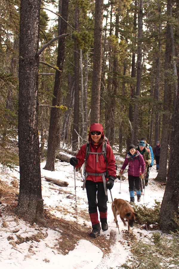
At Elbow Falls parking lot, Ali, Andrew, Wendy (and her dog, Ruthie), Zosia, Dinah and Bob are set for an epic adventure on Ben's Hill.
Probably the closest thing to a crux on this trip! 
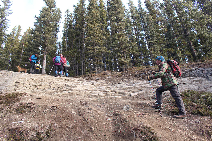
The others wait as Andrew climbs up a section of trail that breaches a minor cliff band.
Whoever said they hardly noticed any elevation gain on this trail is full of shit! Bob climbs up one of the steeper sections of trail.
Pleasant walking here! 
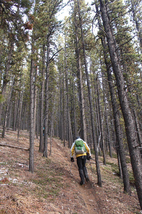
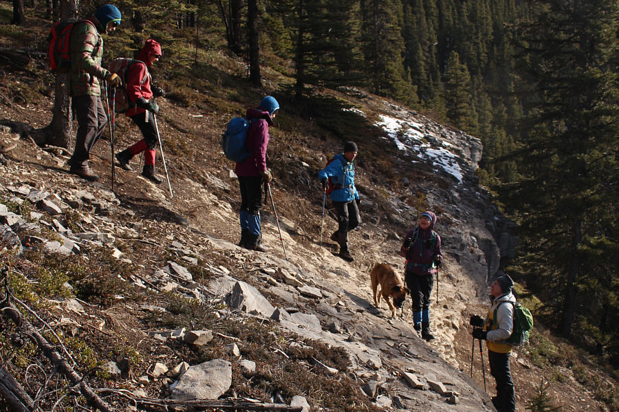
Zosia leads the group along a flatter section in the forest.
Much more solitude here than up there! 
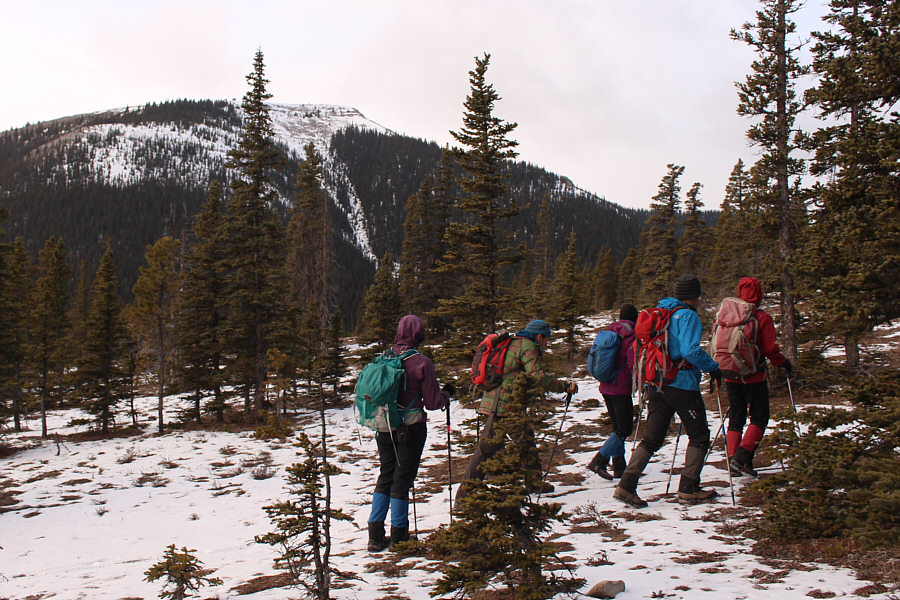
Prairie Mountain comes into view as the group enters a clearing near the top.

Too easy!

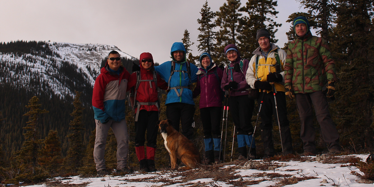
Gathered on the summit of Ben's Hill (~1935 metres) are Sonny, Zosia, Ruthie, Ali, Wendy, Dinah, Bob and Andrew.


A bit creepy à la Blair Witch Project... 
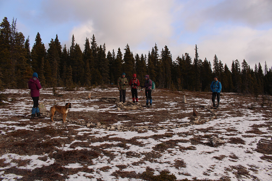
Near the summit is this interesting ring of stones with a fire pit in the middle.
The skull guitar pick is actually animated! 
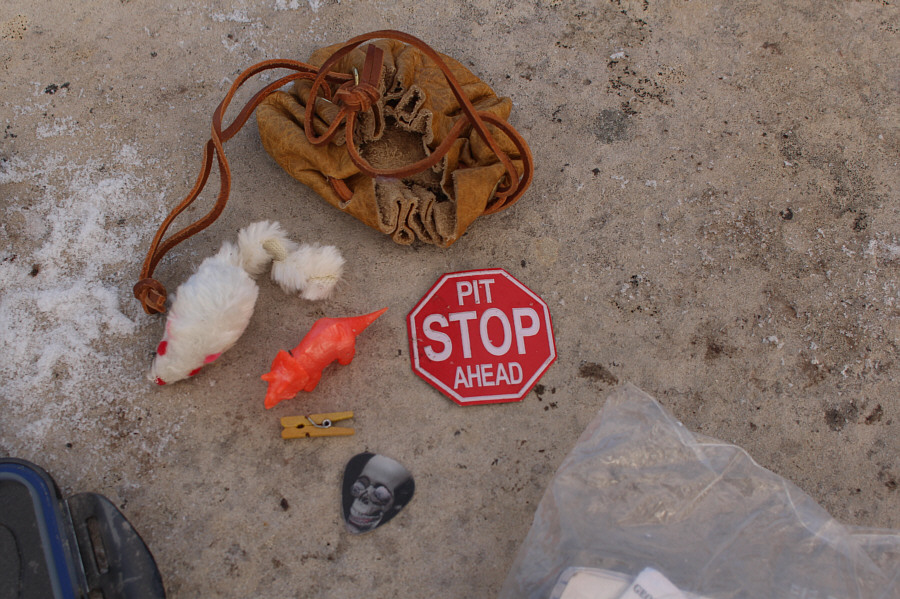
Here are the contents of a nearby hidden geocache which includes a summit register.
Here lies Ben? 
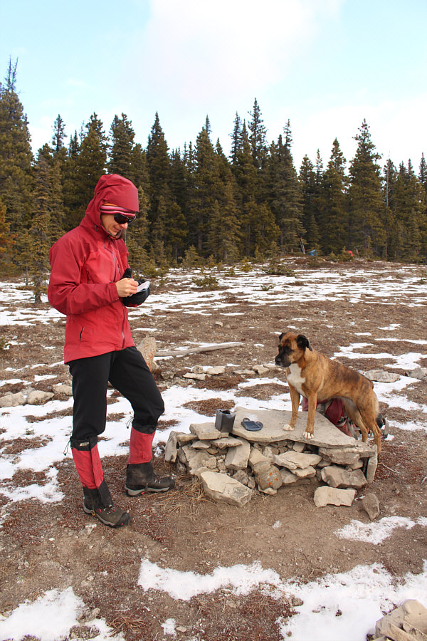
Ruthie stands guard while Zosia signs the summit register.  The stack of rocks might be the grave site of someone's beloved pet.
How did the mountain bikers come up with this stupid name for the trail? 
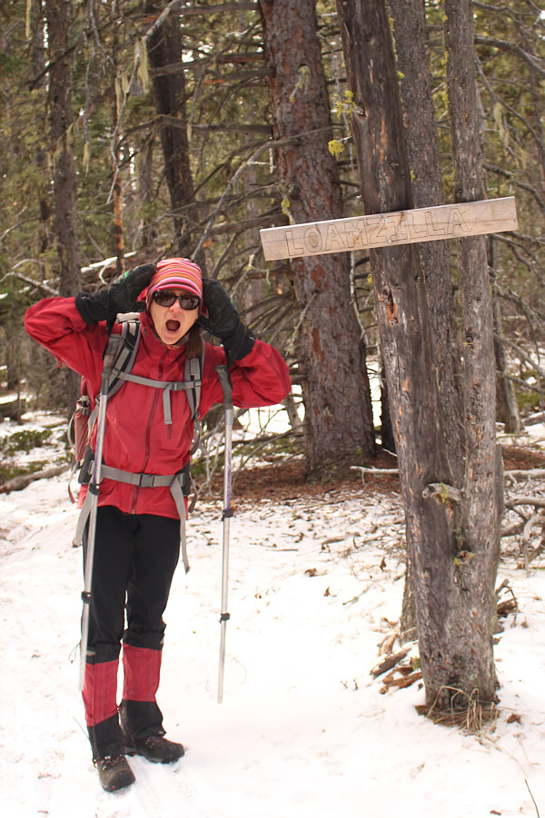
Not seeing this sign on the way up, Zosia suddenly realizes that she took a wrong turn at an important junction on her descent.
Bob says that the mountain bikers must "take some air"! The group tries to figure out how mountain bikers manage to ride down the section of trail that breaches the minor cliff band.
Don't end up as roadkill! 
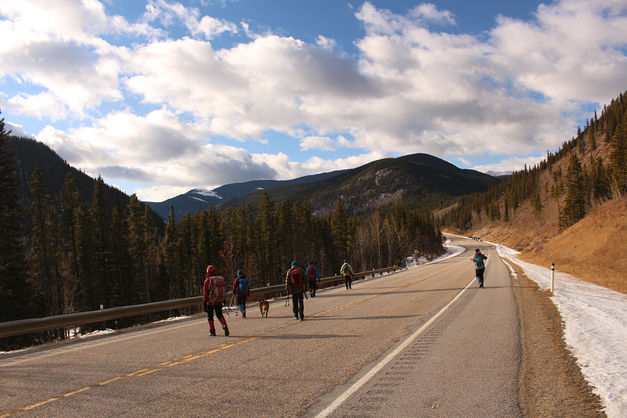
The most dangerous part of the trip is crossing Highway 66 near Elbow Falls parking lot.
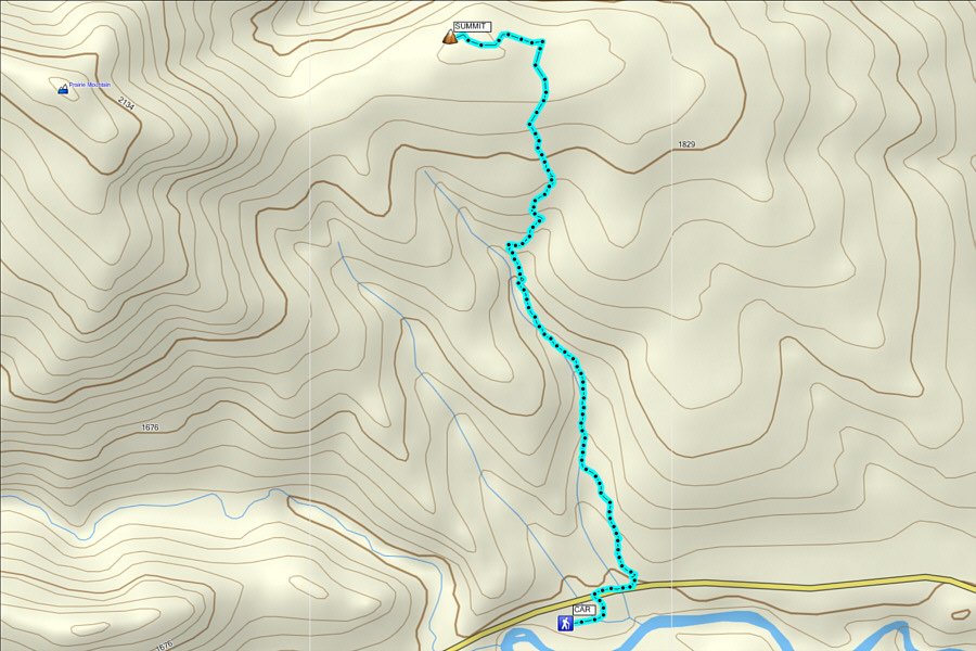
Perfect hike for after work or if you need to get back into town early. Total Distance:  ~6.5 kilometres
Round-Trip Time:  2 hours 49 minutes
Net Elevation Gain:  ~435 metres