BOU AVENUE
Divide Peak

On 8 July 2018, Bob Parr, Marta Wojnarowska and I scrambled up Divide Peak in British Columbia's Yoho National Park.  The ascent route is described in Alan Kane's Scrambles in the Canadian Rockies, but we also relied on Vern Dewit's trip report from almost exactly a year ago.

After parking beside the railroad tracks near the entrance to the Lake O'Hara trailhead, we hiked along the decommissioned Old Highway 1A to the start of the Ross Lake trail.  Upon reaching Ross Lake, we hiked across a boardwalk and headed east along the subsequent trail for about 300 metres or so before plunging into the forest to the south.  A short bushwhack led us to a small clearing at the bottom of an avalanche slope.  While Bob and Marta kept heading straight up the slope through thickening trees, I veered to climber's left to find the gully described by Kane.  Despite some annoying mosquitoes, the gully was very straightforward to climb up.  Marta and Bob eventually joined me in the gully after finding their progress hampered by the trees.  Together, we continued up the remainder of the gully and soon reached the open slopes below the northeast face of Divide Peak.
It says, "Eat at Barpa Bill's!" 
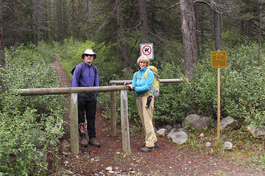
Bob and Marta try to read the fine print on the sign at the start of Old Highway 1A.  Divide Peak is visible directly behind them.
No horses allowed! After a short walk along Old Highway 1A, Bob and Marta reach the trailhead to Ross Lake.
Mosquitoes were a tad annoying here!

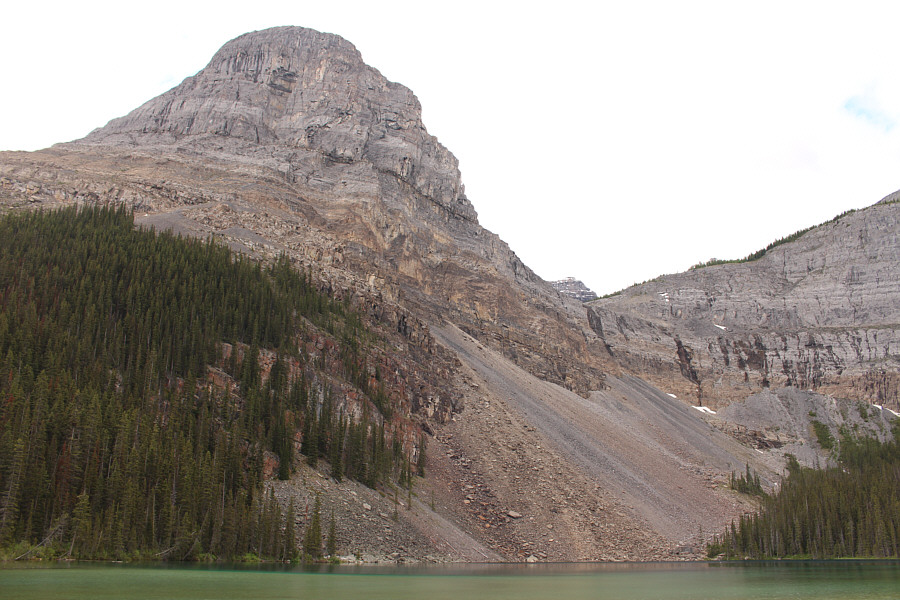
Divide Peak looms above Ross Lake.  Note the headwall at right.

Don't expect much in the way of flagging or a beaten path! 
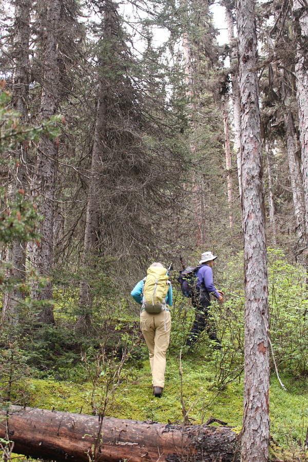
Marta and Bob leave the trail and plunge into the forest.
More annoying mosquitoes here! 
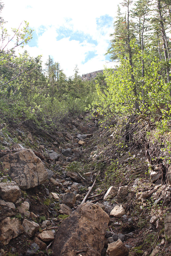
The is the gully mentioned by Alan Kane which simplifies the ascent of an avalanche slope.
Lesson learned: Going up a mosquito-filled gully is still better than thrashing through the trees! 
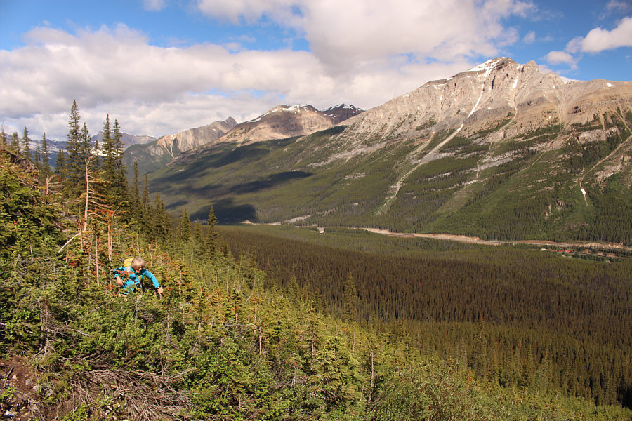
Marta has had enough of thrashing up through thickening trees on an avalanche slope.  At right across the valley is Mount Bosworth.
Under the sea... 
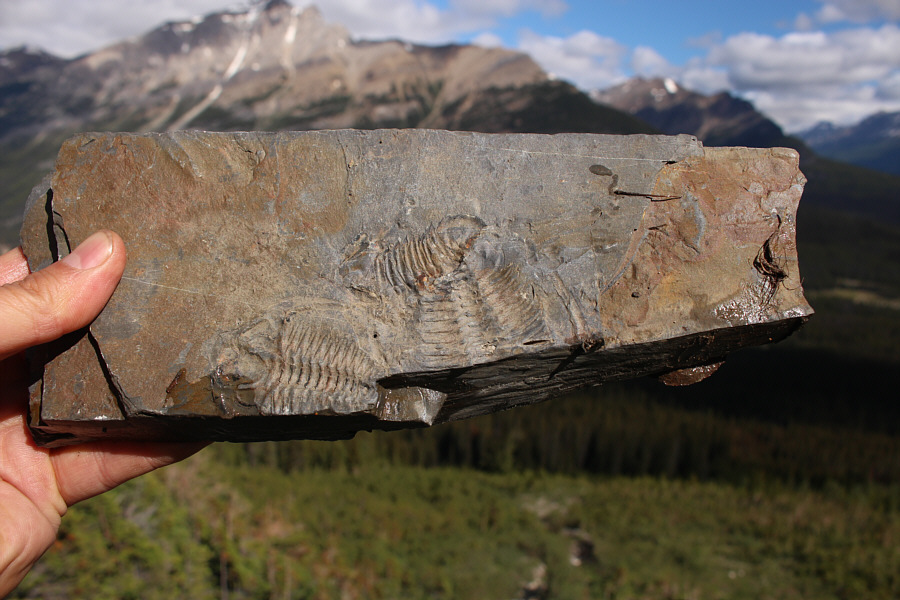
These trilobite fossils were found by Marta.
We're just getting warmed up here!

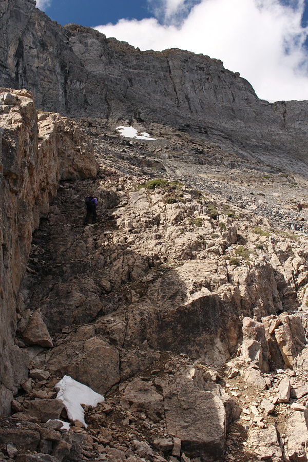
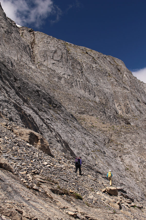
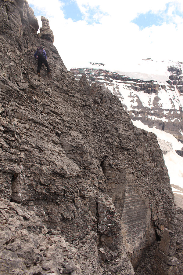
Bob and Marta scramble up some easy cliff bands below the more daunting ones higher up.

From the highway, the crux had looked rather terrifying to me, and now that we were much closer, my opinion of it worryingly had not changed!  Regardless, we maintained our faith in Kane's route description and continued climbing past a lovely stand of larches and onto rubble slopes below the northeast face.  We climbed a little higher before traversing to directly below the crux chute.  Once we had our noses right up against it, the route became readily apparent, and we all tackled the steep scrambling with delight.  As advertised, there is some serious exposure here, but we all agreed that the degree of difficulty was on par with many other comparable Kane "difficult" routes.

How did Kane look up at this and ever think that there was a feasible scramble route here?!

Here is a foreshortened view of Divide Peak's northeast face.  The crux chute is a little right of centre in the photo.


Watch the loose rocks here! 
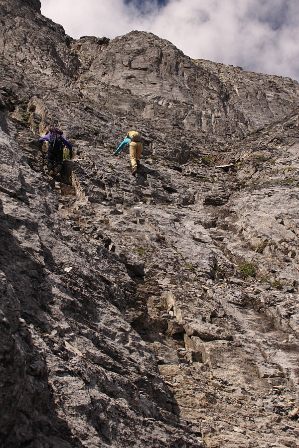
Bob scrambles up some more ledges prior to traversing to climber's right further up.

Apparently, this valley is used as a ski ascent route for Mount Niblock.

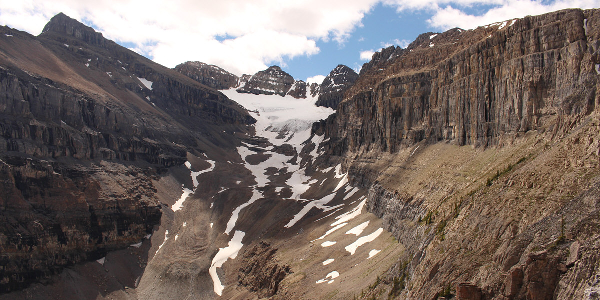
This is looking up the valley southeast of Divide Peak.  Mount Niblock and Mount Whyte are the first two peaks from the left.


I still can't believe there is a scramble route here! Bob and Marta begin traversing across the face to a point directly below the crux chute which is visible at upper left.
We can do this! The crux chute (upper left) starts to look more reasonable as Bob and Marta get closer.
Very delightful scrambling here! Bob and Marta scramble up toward the crux chute above them.
Of course! She's Polish!

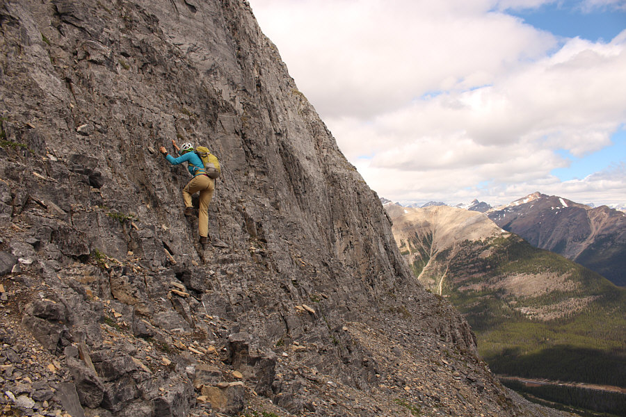
Marta is in her element here.

Check your holds! 
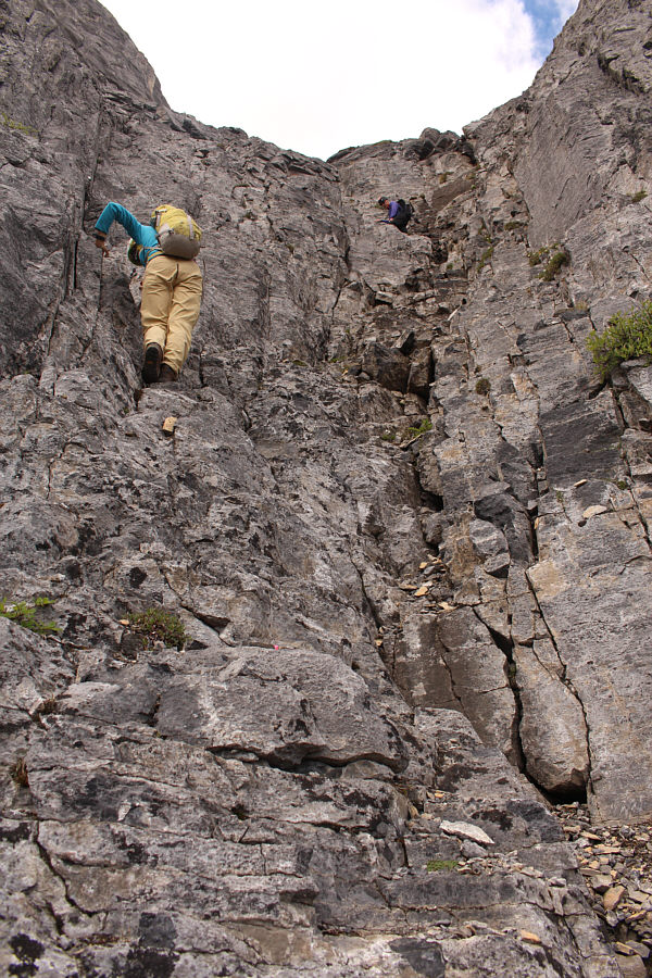
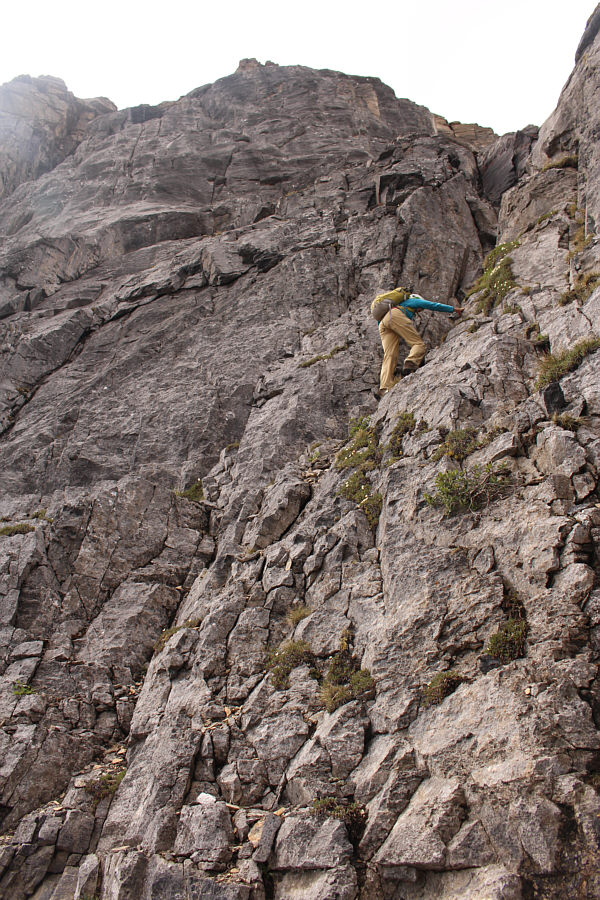
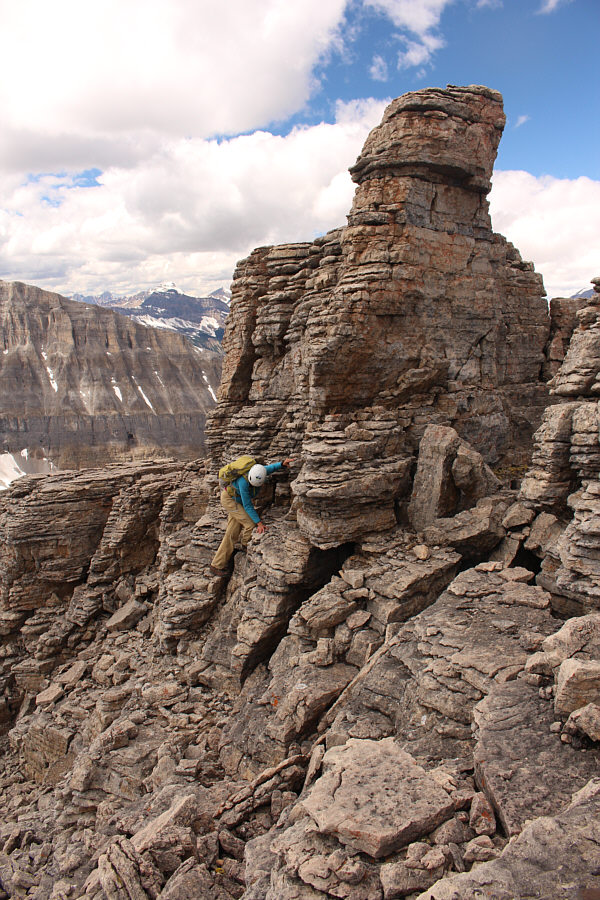
Bob watches from above as Marta carefully climbs up the crux chute.
That wasn't so bad after all! Marta is nearly at the top of the crux chute.
After clearing the crux chute, we walked around a huge lingering snow patch and easily plodded up to the summit cairn where we took a well-deserved break before continuing up the south ridge to a higher point as Kane suggests.  The ridge became more complex the higher we climbed, but I actually found the route-finding challenges here rather fun.  We eventually reached Kane's high point about 75 minutes after leaving Divide Peak's summit.
It's not worth it to go up and over the snow patch. Bob walks around a large lingering snow patch after climbing out of the crux chute.
Sadly, the best scrambling of the day is behind us... 
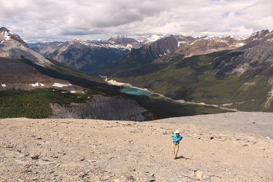
Marta takes the last few steps before the top of Divide Peak.  At centre is Wapta Lake.

I think this is the first "Kane peak" I've done with Marta!

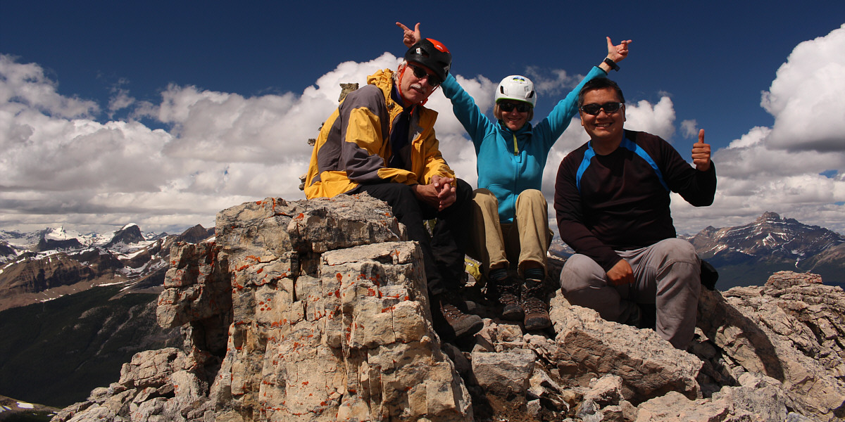
Bob, Marta and Sonny take a well-deserved rest on the summit of Divide Peak (~2489 metres).


Climbing Mount Niblock seems like another lifetime...

This is looking southeast towards Mount Niblock and its north ridge.

Ahh, that was a memorable scramble for me!

Narao Peak dominates the view to the southwest.


Obviously we haven't suffered enough to want to continue climbing! Bob and Marta head south to ascend Kane's high point.
I think Bob even has his hands in his pockets...and is whistling! Reaching Kane's high point is initially just easy off-trail hiking.
A good test of route-finding skills! 
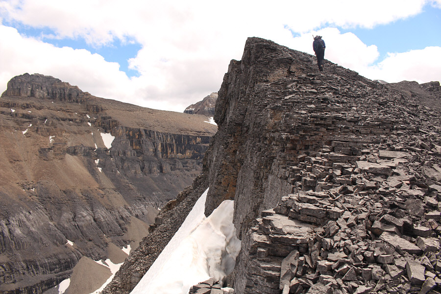
The ridge becomes more complicated higher up.  Note Marta sitting on the pinnacle to the right.
Looks worse than I remember it! 
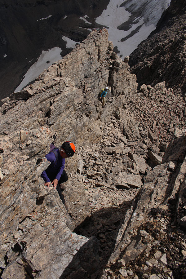
Bob traverses a rather exposed section along the ridge.
We can do this sort of thing all day long!

Bob and Marta drop down below the ridge crest to avoid some difficult terrain.

No problemo! Marta scrambles around a pinnacle blocking the ridge.

Worth counting as a second summit, I think!

Bob, Marta and Sonny rejoice on Kane's high point (2699 metres).


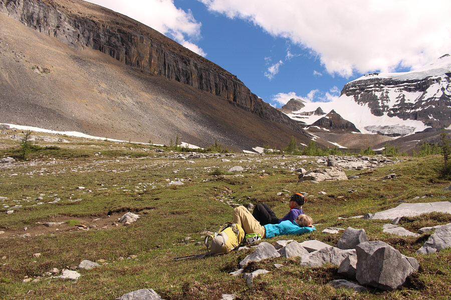
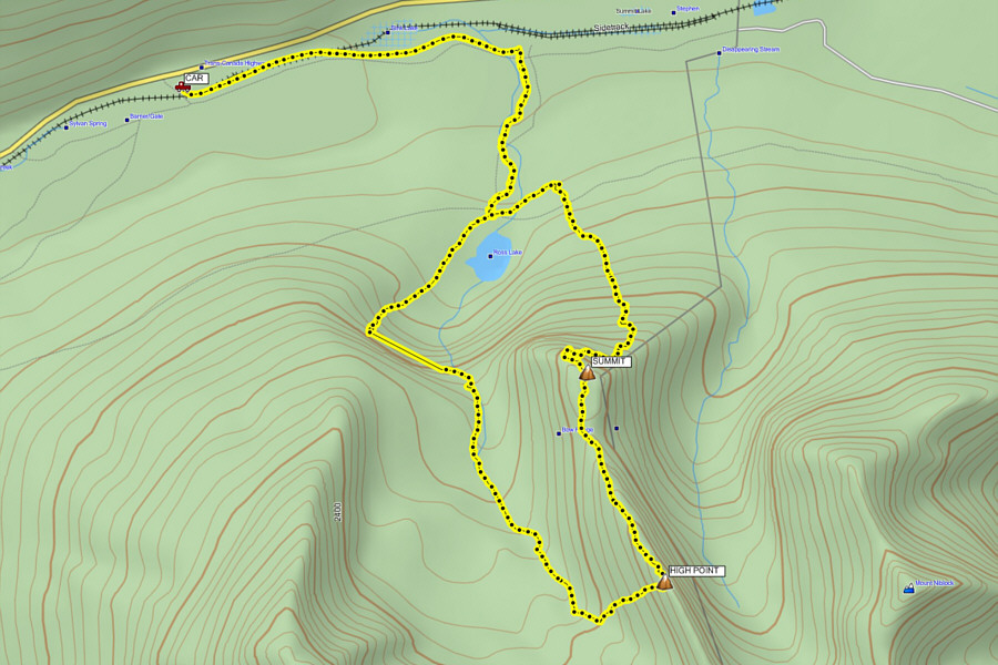
At this point, we discussed our return options and decided to try the alternate descent used by Dewit's party where they dropped into the hanging valley to the west and exited via the headwall above Ross Lake.  Dewit's party had backtracked a bit along the ridge before dropping down, but they had to traverse south to circumvent some big cliff bands blocking their descent into the hanging valley.  Knowing this, we chose to descend directly from Kane's high point.  This entailed a bit of difficult down-climbing just below the high point and some rather unpleasant stumbling down a big talus slope.  This slope is exasperatingly loose, and I found it difficult to maintain my balance and to avoid raining rocks down on my partners.  With a bit of careful route-finding, we made it down safely to some large snow patches which were much easier to descend, and we soon settled into a somewhat lengthy but very pleasant hike out the hanging valley.
It's doable, but there are lotsa loose rocks here! Bob and Marta down-climb some challenging cliff bands on the south side of Kane's high point.
It doesn't look so bad, but this rubble is truly AWFUL! Bob and Marta pick their way down through the rubble below Kane's high point.
Stick to the snow as much as you can--your feet will love you! 
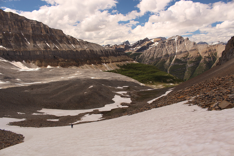
Snow patches help ease the descent into the hanging valley southwest of Divide Peak.
This hanging valley would be immensely popular if there was a good access trail built.

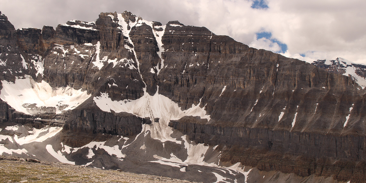
Marta and Bob take a break to admire the significant cliff band guarding the west side of Divide Peak.

As we approached the top of the headwall above Ross Lake, we worked our way to skier's left and were pleased to find a good game trail traversing a high ledge to the west.  We traversed the ledge just as Dewit's party had done, but for some reason or another, we did not follow their route down to the lake.  Instead, we got suckered into the adjacent forest by a promising trail which quickly petered out and left us bushwhacking through some rather dense undergrowth.  As miserable as this descent was--persistent mosquitoes had a lot to do with the misery--I have endured far more heinous and much longer bushwhacks than this, and in the grand scheme of things, it was probably not the worst thing that could have happened to us.
 
In any case, we eventually muddled our way down to a faint path along the lake shore and followed it to our access trail near the boardwalk.  The subsequent hike back to Old Highway 1A and my car was uneventful.
The traverse is easier than it looks, but the descent through the forest...not so much! Marta and Bob follow a game trail which runs across the ledge at centre.  They would eventually drop down the forested slope at bottom right.

A surprisingly gorgeous lake when viewed from above!

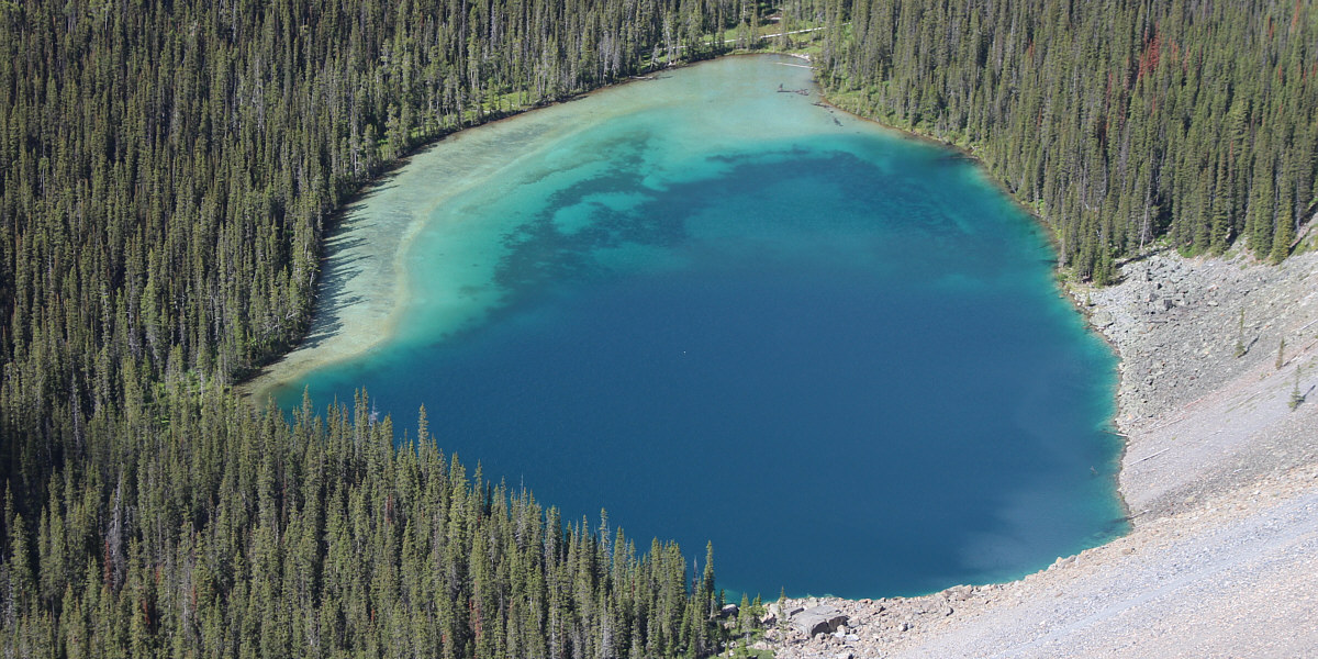
This is an aerial view of Ross Lake from the top of the headwall.


The path doesn't last long... Bob and Marta follow a steep path down through the trees.
Let's just get this over and done with! 
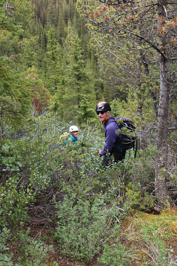
Marta and Bob make a second plunge of the day into forest as they endure some fierce bushwhacking to get down to Ross Lake.
Despite some bushwhacking and mosquitoes, this turned out to be a pretty awesome scramble trip! Total Distance:  15.5 kilometres
Round-Trip Time:  9 hours 55 minutes
Net Elevation Gain:  1090 metres

GPX Data