BOU AVENUE
Graves Lookout
On 1 July 2018, Leslie Pryslak, Zosia Zgolak and I hiked up Graves Lookout in the remote White River region of southeastern British Columbia.  It is a long drive to get to the trailhead, but the roads are in good condition and suitable for 2WD vehicles.

From Highway 93/95, turn east onto White Swan Forest Service Road about 4.6 kilometres south of the bridge over Kootenay River in Canal Flats or about 36.0 kilometres north of the junction with Highway 95A.  Drive east for 32.0 kilometres, and after crossing a bridge over White River, turn right at a T-intersection onto White River Forest Service Road.  Drive east for 12.0 kilometres and cross another bridge over White River.  At a junction about 970 metres further, stay left.  Drive another 460 metres and cross a small creek before keeping right at the next junction.  Drive northeast for 3.3 kilometres to reach the Graves Lookout access road on the right.  Park in a pullout just a little further past the start of the access road which is no longer drivable due to deadfall.

Starting on the access road, we easily hiked the first few kilometres to the actual trailhead which, along with most of the forest in the area, was scorched by a wildfire in 2017.  Thankfully, most of the burnt deadfall up to this point was easy to walk around or over.  Beyond the remnants of the trailhead sign, we started to climb steeply on a well-defined trail, but we eventually ran into a lengthy section of trail that was completely choked by fallen trees that were somehow spared from the wildfire.  Our progress slowed considerably as we climbed over or crawled under many annoying and tedious logs.  At some point, we abandoned the trail temporarily and made better progress by bushwhacking around the fringes of the fallen trees.  We eventually regained the trail above all this mess and were able to resume normal hiking.  The remainder of the ascent was fairly straightforward as we climbed up a broad gully full of burnt tree trunks before finishing on a short semi-open ridge.

Ironically, the fire lookout building was completely destroyed by the wildfire, and all that remains are an antenna and some pieces of the foundation.  We briefly considered extending the hike to a higher point on the ridge to the southeast, but incoming rain clouds prompted us to start descending sooner rather than later.  As it turned out, it rained lightly on and off throughout our descent, but a torrential downpour never materialized.  On the way down, we went off-trail and completely circumvented the section of trail with the fallen trees.  We also missed out on a few switchbacks when we dropped straight down the very steep slope.  We ended up regaining the trail not too far from the trailhead, and from there, we settled into a long but easy hike back down the access road.

After returning to my car, we drove to Lussier Hot Springs on our way back out to the highway.  Unlike my first visit here in 2001 when we had the pools virtually all to ourselves, the hot springs were extremely busy on this day.  Leslie, Zosia and I probably spent more time changing into our swimsuits than soaking in the overcrowded pools.  We promptly left that circus behind and subsequently drove to Cranbrook for dinner before finding a very nice campsite just outside Jaffray to close out a fun-filled Canada Day.
I shall return to visit this lake again...I hope! 
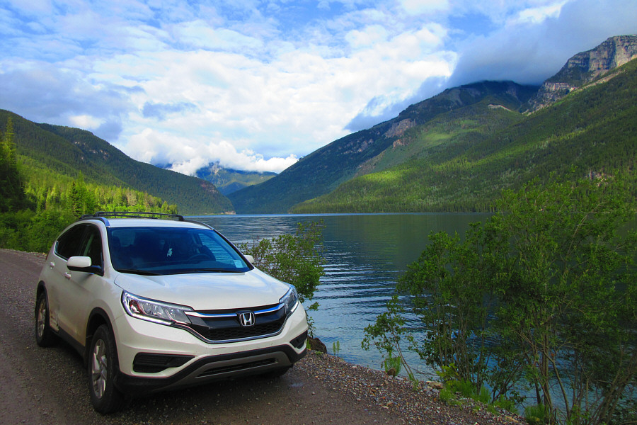
White Swan Lake is well worth a stop during the long drive to access Graves Lookout.

Photo courtesy of Zosia Zgolak

Maybe a mountain bike would help...but only on descent! The access road to Graves Lookout has been decommissioned and is no longer drivable for regular vehicles.
Surprisingly not much deadfall here though. 
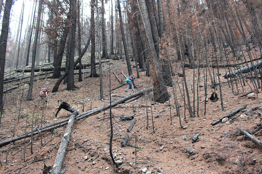
Leslie and Zosia start to see evidence of the wildfire that raged here the previous year.
You could spend all day here eating wild strawberries! Zosia and Leslie stoop to pick and eat wild strawberries.  The White River is visible in the valley below.
So I guess there's no toilet here... Zosia and Leslie examine what is left of the sign at the actual trailhead for Graves Lookout (1800 metres).
And it's a bloody steep climb too! 
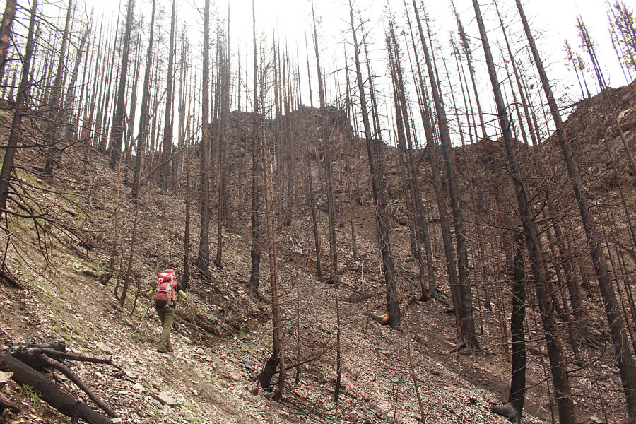
The trail is still easy to follow despite the notable effects of the wildfire.
Someone needs to come here with a chainsaw or two... 
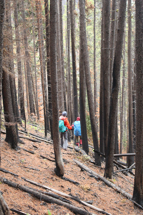
Zosia and Leslie scramble over a lot of fallen trees which have completely obscured the trail.

This sucks.

Leslie and Sonny continue to thrash their way through the annoying deadfall.

Photo courtesy of Zosia Zgolak


Back to just another dull plod...and loving it! After getting past the deadfall, Zosia resumes normal hiking on the trail as it goes up a broad gully.
Entering the "death zone"! 
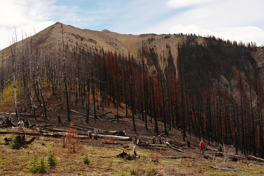
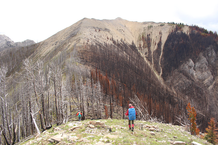
Zosia and Leslie stand out in this stark landscape of scorched earth and blackened trees.
Just a fantastic photo by Zosia! 
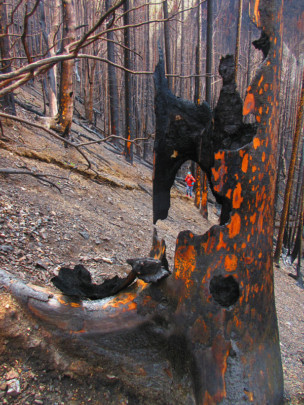
Amidst all the devastation, there is still some beauty to be found.

Photo courtesy of Zosia Zgolak

Some of the trees look like they're still on fire! Leslie emerges from the burnt forest onto a semi-open ridge.
That solar panel still looks good! 
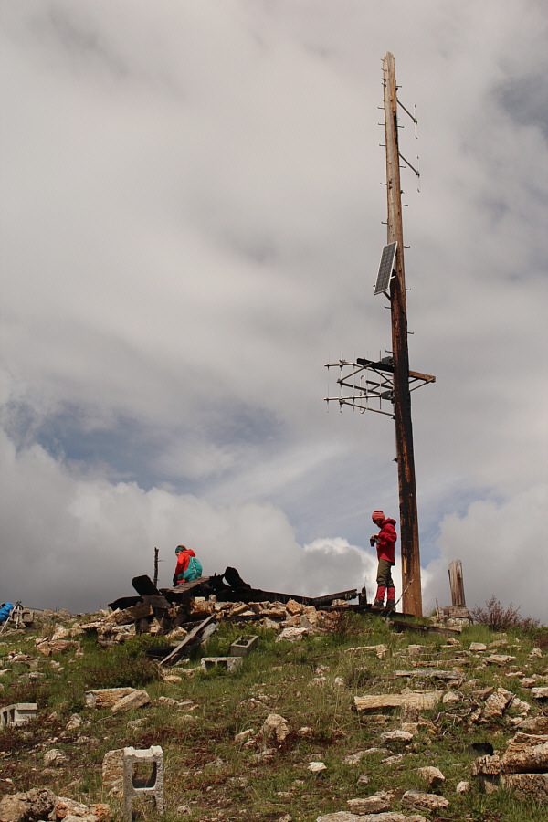
Not much remains of the fire lookout building.

O Canada!

Zosia, Leslie and Sonny celebrate Canada Day on top of Graves Lookout (2272 metres).


At the left edge of the photo, Mount Mike is partly obscured by clouds.

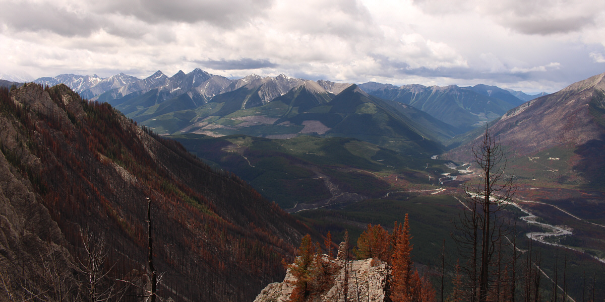
Numerous unnamed peaks of the Quinn Range stretch away to the southwest.  Note the large cairn on the rock outcrop in the foreground.


So many unnamed and maybe unclimbed peaks here... The unnamed ridge to the north separates North White River (left) and White River (right) valleys.
Had the weather been nicer, we would have continued to the higher point on the ridge. Leslie and Zosia start descending ahead of some imminent rain.
Beats bushwhacking, but this was so steep that I wish I had brought my ice axe! Leslie and Zosia drop down a very steep slope in order to avoid the section of trail with all the deadfall.
Good thing we quit while we were ahead; it's raining. 
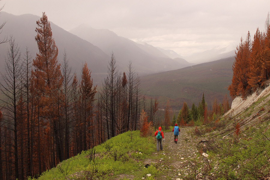
Leslie and Zosia settle into an easy hike back down the access road.
I had no idea there were chicks until I reached out to try and touch her! This spruce grouse hen is actually hiding three chicks underneath her.
This sucks too. 
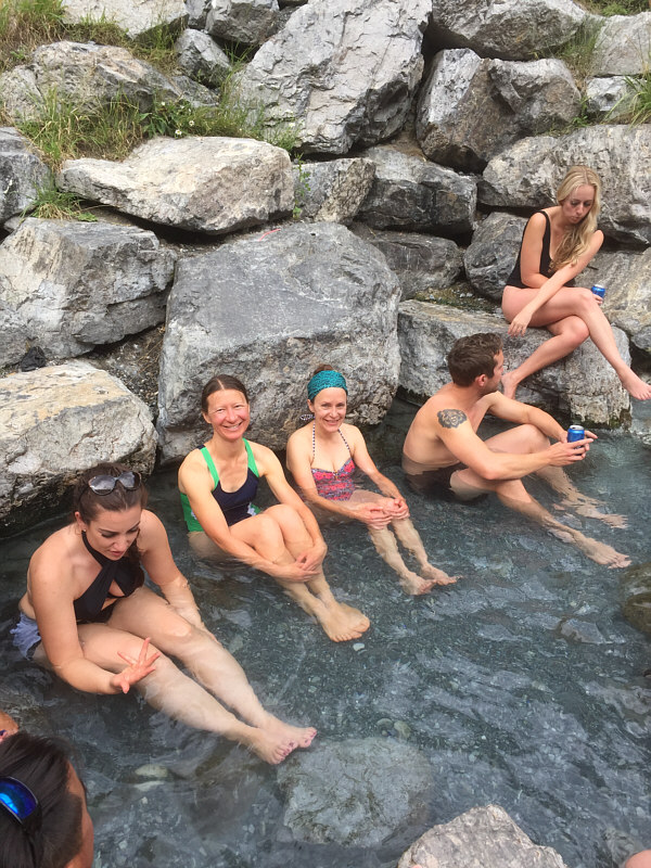
Zosia and Leslie sit in the crowded pool at Lussier Hot Springs.
Unlike the first two campgrounds we stayed at over the long weekend, this one had mosquitoes! Despite this being the Canada Day long weekend, nobody else is camping at Wapiti Lake campground just outside the town of Jaffray.

Photo courtesy of Zosia Zgolak

Not sure if it was worth the long drive... Total Distance:  12.6 kilometres
Round-Trip Time:  6 hours 10 minutes
Net Elevation Gain:  940 metres

GPX Data