BOU AVENUE
Morton Peak (Mara Mountain Lookout)
On 6 October 2018, Zosia Zgolak and I paid a visit to Mara Mountain Lookout which is situated atop unofficially-named Morton Peak, the highest point in the Hunters Range southeast of Sicamous, British Columbia.  Our inspiration for this hike came mostly from an online trip report.

From Trans-Canada Highway in Sicamous, turn south onto MacLean McPherson Road near the A&W and Chevron gas station.  Head eastward and go past Maier Road for 400 metres before turning south into a large gravel parking lot (the rougher road that goes straight merely winds around the eastern edge of the parking lot).  Pick up the Owl Head Forest Service Road at the south end of the parking lot and ignore all side roads while driving for another 17 kilometres to the hikers’ trailhead marked with a “No Motorized Vehicles” sign.  Park on the side of the road where feasible.  Note that the signed snowmobilers’ trailhead is located about 500 metres before (west of) the hikers’ trailhead.  Under dry conditions, Owl Head Forest Service Road is generally suitable for 2WD vehicles, but wet conditions and/or traffic from heavy construction vehicles may render some sections quite muddy and perhaps even undriveable.

From the sign at the trailhead, we immediately plunged into the forest following the somewhat overgrown but distinct trail.  About half a kilometre in, we hopped over Sicamous Creek and briefly visited a rustic cabin that looked structurally sound but had a lot of trash inside.  Both Zosia and I were dismayed by the apparent lack of respect shown by some outdoor enthusiasts for public property in the backcountry.  Leaving the inhospitable cabin behind, we continued to follow the trail southward through unremarkable forest.  Although the trail is flagged and generally easy to follow, it is sadly in need of extensive maintenance.  Many sections of trail are overgrown or choked by deadfall, and numerous log boardwalks that were built some time ago to alleviate impact on marshy areas have largely been trashed supposedly by inconsiderate dirt bikers.
Brrrrr! It's cold out here! 
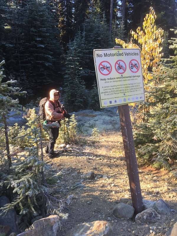
Sonny gets ready to plunge into the forest behind this sign at the trailhead.
There's a lot of trash inside, but with a bit of work, the cabin could be habitable. 
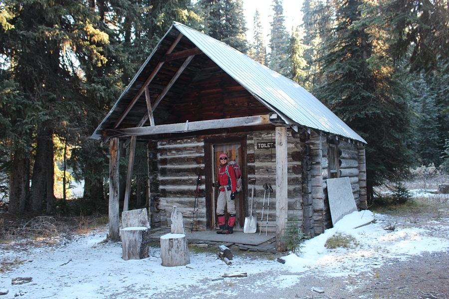
Zosia checks out a rustic cabin about half a kilometre from the trailhead.
A good time to tell stories or dirty jokes! 
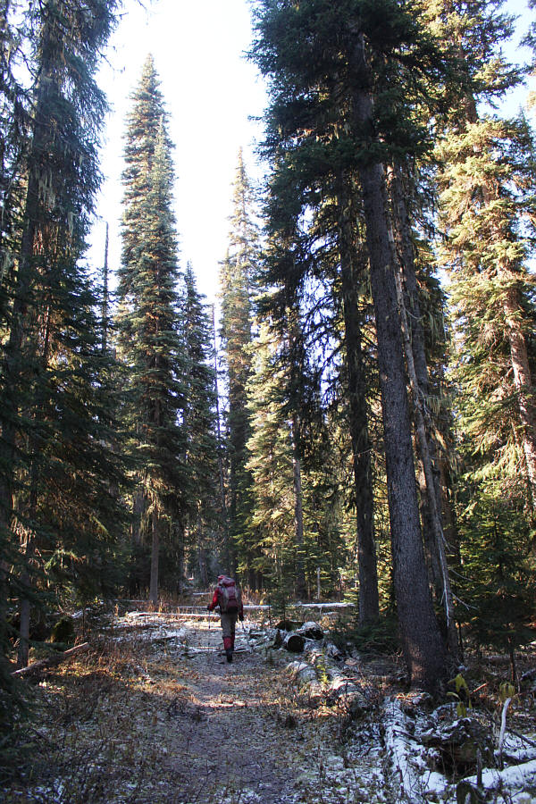
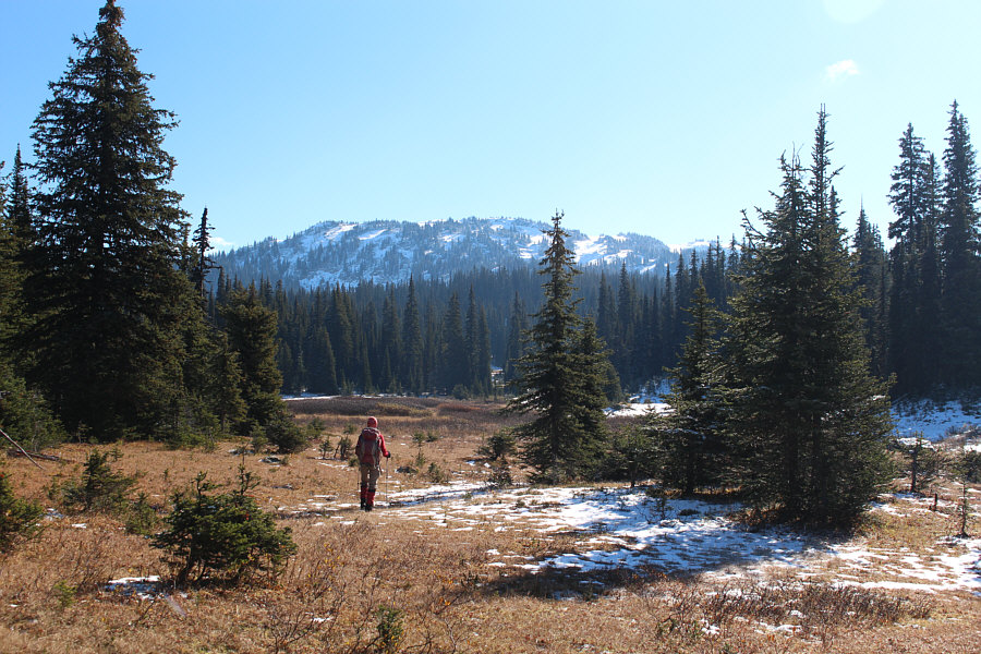
The trail stays mainly in the forest for the first four kilometres.
A chainsaw would be helpful! 
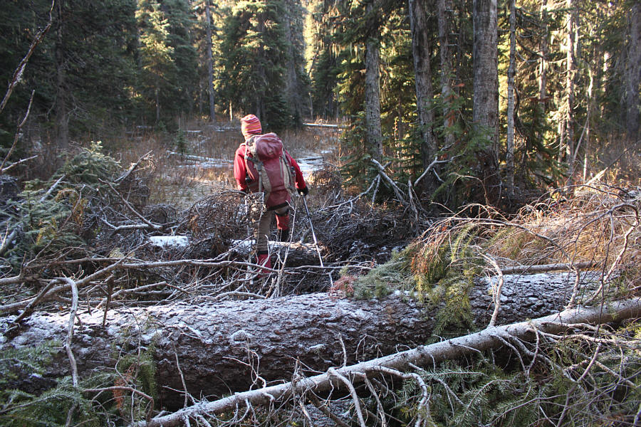
The trail has largely been neglected and is in need of a lot of maintenance.
After walking for about four kilometres through viewless forest, Zosia and I missed a turnoff when we were lured to an open fen with appealing views.  We ended up crossing to the far side of the fen before muddling our way back to the main trail which, at this point, merges with the snowmobilers’ trail.  We soon reached Owlhead Chalet, another backcountry shelter which is free for public use.  Unlike the first cabin though, this one is quite a bit larger and much more well-kept.  While it would have been nice to linger in the shelter, we pressed on southward and began climbing up a minor knob known as Skinny Ridge.  Because of ankle-deep snow cover, we lost the trail here for a short period of time but picked it up again just before a steep section leading to the top of Skinny Ridge.  Following the snow-covered trail, we dropped down slightly before climbing up again and entering a large basin called Super Bowl which sits on the northeast side of Morton Peak.
We actually missed the turnoff on the way in, but it just felt nice to be out of the forest for a change. The trail turns to the right just before this spot, but it is still possible to get back on track by continuing to the far side of the fen ahead.
Yes, hikers should watch their speed here! 
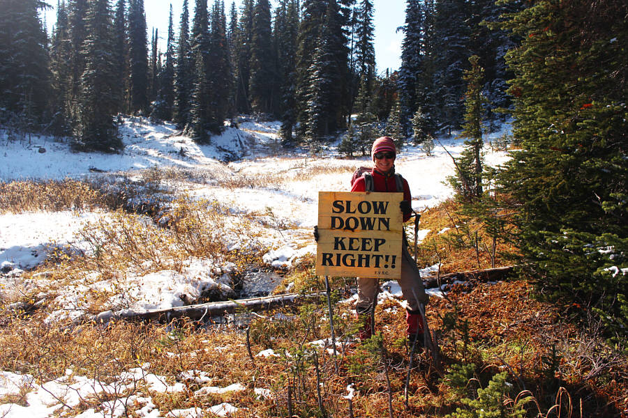
Zosia holds up a fallen sign at the edge of a meadow.
One of the nicest backcountry cabins I've seen! 
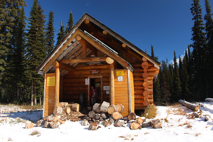
The Owlhead Chalet is located about five kilometres from the trailhead and is free for use by the general public.
There's a king-sized bed up there! 
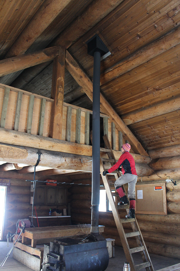
Inside the spacious shelter, Zosia climbs up a ladder to check out the loft.
It's better than looking at tree trunks! 
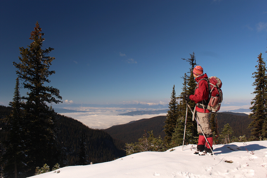
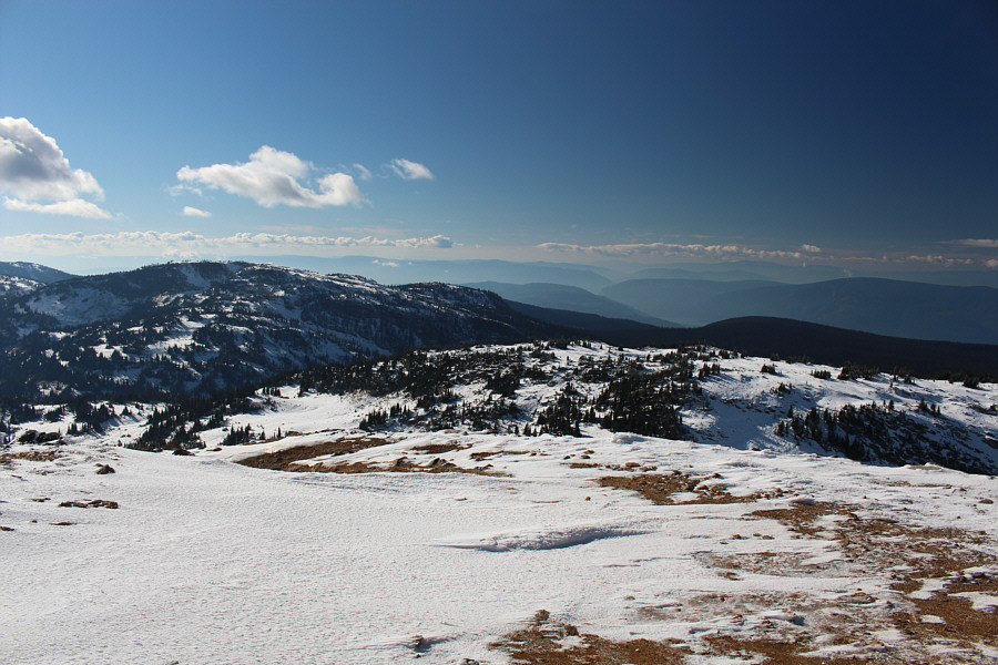
Low clouds to the northwest obscure views of Shuswap Lake from the top of Skinny Ridge.
Still wasn't sure if we would be able to get up there at this point... 
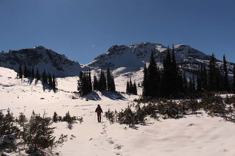
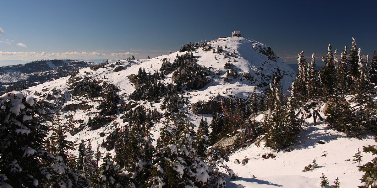
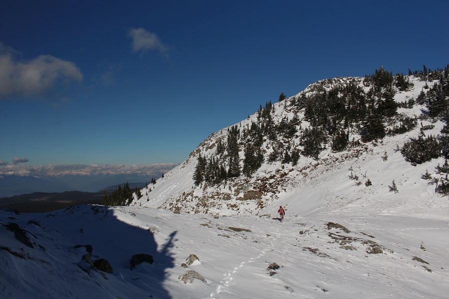
Mara Mountain Lookout and the top of Morton Peak come into sight.
We were kind of on our own here for route-finding... 
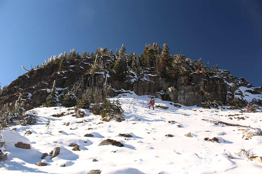
Zosia enters Super Bowl below the northeast side of Morton Peak.  She would eventually head for the col directly ahead and traverse over a subsidiary high point (right of centre) to reach the final summit block (right).  An easier route may be to traverse right and bypass the subsidiary high point.
A bit unsure of where to go next, Zosia and I crossed Super Bowl and climbed up to an obvious col in hopes of following the ridge westward to the top of Morton Peak.  Getting to the col entails crossing a boulder field which was rather tricky because the abundance of snow made for some slippery footing on the ankle-breaking rocks.  Upon reaching the col, we turned right (west), and Zosia led us up through a couple of steep cliff bands which proved to be quite challenging in the snowy conditions.  After climbing over a subsidiary high point, we dropped down slightly to yet another col before climbing up the final summit block on a snow-covered trail.  The restored lookout building is still in decent shape, and we were grateful to be able to take shelter from the wind inside it.
This would be a fine place for a ski tour later in the winter! 
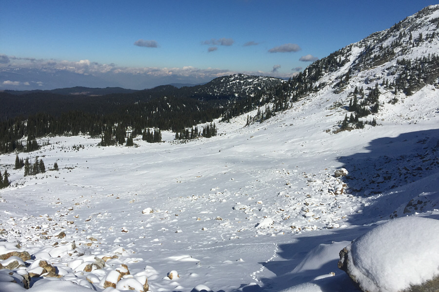
Here is a look back at Sonny's and Zosia's tracks through Super Bowl.
We're on our own here for route-finding... Zosia scrambles up some snowy rocks above the col.
Hard Class 3 scrambling ahead! 
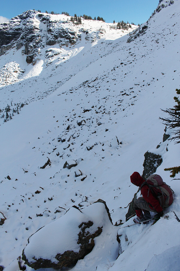
A steep cliff band appears to block further progress up the ridge, but a weakness can be found just a little above and to the right of Zosia.
Zosia's not afraid to get down and dirty! 
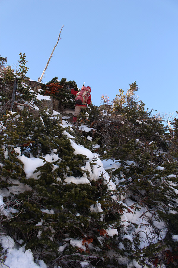
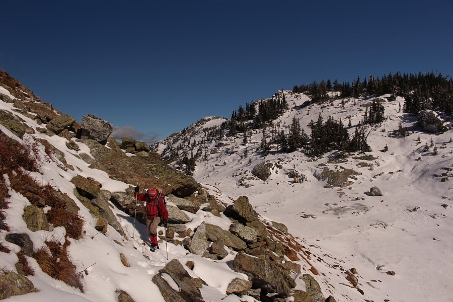
Zosia leads the way up some steep and bushy terrain.
Outstanding scrambling, Zosia! Zosia approaches the top of the subsidiary high point.

Can you spot the hidden outhouse?

The final summit block is just beyond another col in this view from near the subsidiary high point.


Looks like someone tried to blow up the shitter!  

Zosia checks out a well-ventilated outhouse just below the summit.

A well-earned summit (ie. we didn't drive up here with a jeep or snowmobile)! Zosia takes the last few steps before the summit.
This was the less-windy side of the building! Sonny and Zosia stand in front of Mara Mountain Lookout on the summit of Morton Peak (2248 metres).
It's ironic that Mara Mountain Lookout isn't even located on its namesake mountain! The view to the west includes officially-named Mount Mara (left) which is about 50 metres lower than Morton Peak.  A sliver of Shuswap Lake is also visible at distant right.
It's a shame that we didn't have time to take a closer look at this beautiful lake. Morton Lake is partially frozen to the north.
Can you spot the animal tracks that we followed on our descent? Super Bowl sits in the centre of this view to the northeast.
I thought this was an access door for the roof! 
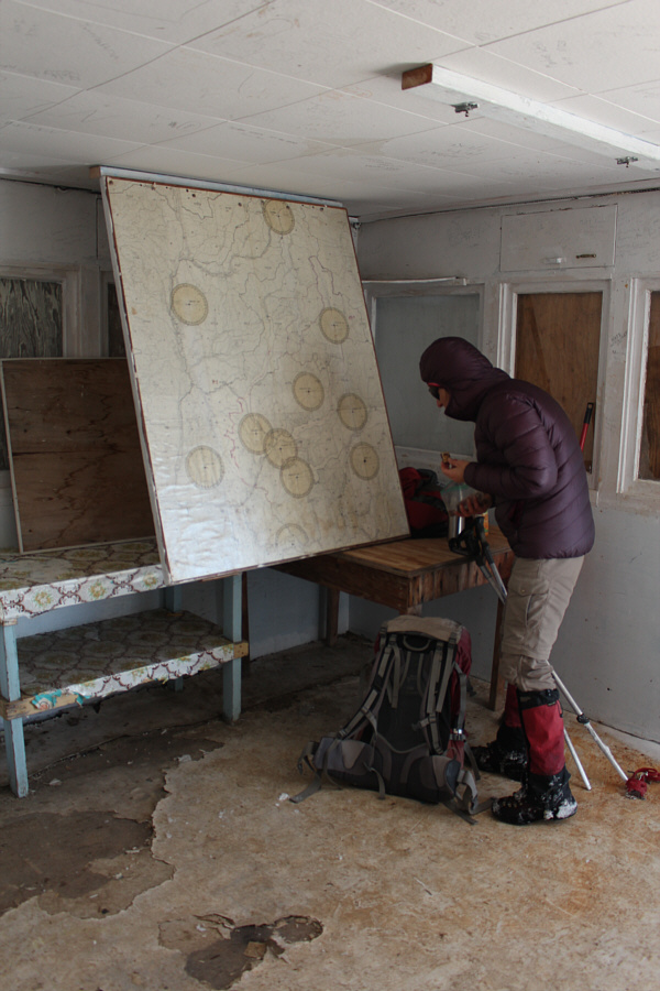
Inside the lookout building is this interesting map which folds down from the ceiling.  The various circles on the map indicate the locations of other fire lookouts in the area.
For our return trip, Zosia and I took a slightly different route back to Super Bowl in order to avoid the challenging cliff bands we scrambled up earlier.  From the col below the summit block, we dropped down the north side and traversed eastward below the subsidiary high point.  Zosia spotted some animal tracks going the same way and speculated that they may have been made by a fox or some other dog-like creature.  We dutifully followed the tracks which uncannily led us through a weakness in a cliff band and all the way back to Super Bowl just as we had intended.  Gracias, pequeño zorro!

From Super Bowl, we retraced our steps back to Owlhead Chalet and continued along the main trail northward to where the snowmobilers’ trail splits off to the west.  We bypassed the open fen where we had lost the trail earlier and had no problems this time sticking to the flagged hiking trail.  The remainder of our hike back to the trailhead was still somewhat tedious because of numerous deadfall, but otherwise, we had no further route-finding issues.
Looking for fox tracks... At the col below the summit block, Zosia prepares to descend and traverse around the left side of the visible ridge.  Her ascent tracks can be seen coming in from the right edge of the photo.
Clever fox! Zosia follows animal tracks down a weakness in a cliff band.  At upper right is the col that she and Sonny climbed up during their ascent.
Not too tough, but the snow does add some spice to the proceedings! Here is a look back up at Sonny descending the same weakness in the cliff band.
Don't be a hiking snob--leave flagging as is! In fact, this trail could use more flagging tape! Sonny settles into a long walk back along the flagged trail.
The trail needs serious work. Maybe better done as a ski trip? Total Distance:  19.3 kilometres
Round-Trip Time:  8 hours 57 minutes
Net Elevation Gain:  626 metres

GPX Data