BOU AVENUE
Sand Bluff
Asieh Ghodratabadi, Ali Shariat, Zosia Zgolak and I planned for a hike up Bob Spirko's "White Ridge" in the Whaleback region of southwest Alberta on 28 April 2018.  As we hopped over a fence to begin the hike as per Spirko's GPS track, a local couple drove up in an ATV and politely informed us that we were trespassing on private property (not their's).  After some discussion, they suggested that we could try hiking in the Porcupine Hills further to the southeast.  Perhaps to appease us, the couple also invited us back to their Bed & Breakfast for some tea, but as tempting as that offer was, we respectfully declined because we did not want to let a beautiful day go to waste.

Back on Highway 22, we headed south to the junction with SR520 and turned east toward the town of Claresholm.  After driving for about 3.3 kilometres, we reached a 4-way junction and turned south onto Skyline Road.  This road basically runs along the crest of the Porcupine Hills, and although there are a few scenic viewpoints along the road, worthwhile hiking objectives seem limited.  Admittedly, we were not even sure where to go as we drove south along Skyline Road for 11.2 kilometres to a T-intersection.  Keeping right, we continued for another 2.2 kilometres to another intersection where the road became too muddy to continue driving.  We were very close to Porcupine Lookout, but despite the presence of a lookout tower, the forested summit held little appeal to us.  Instead, we spotted something called Sand Bluff on my GPS map, and since it was not too far away, we decided to go check it out.  Unbeknownst to us, Dave McMurray had snowshoed up this nondescript hump about a month earlier although he took a much different route up.

From where we parked, we simply dived into the bush and made a beeline for the summit along a mostly forested ridge.  Although the bushwhacking was generally light, we were post-holing right from the beginning along the ridge.  Had I actually researched this objective properly and checked Google Maps, I would have noticed a road starting just a bit further from where we parked.  This road leads all the way to the summit, and we eventually stumbled across it about three-quarters of the way there.  Although we likely still would have had to endure post-holing through deep snow, the road might have saved us the hassle of climbing over numerous barbed wire fences.  Not surprisingly, the actual summit, a large clearing in the middle of a forest, is devoid of views.  By continuing a little further south though, we suddenly found ourselves at the top of some impressive bluffs from which the summit derives its name.  We stopped here for an extended break before retracing our steps without incident back to our car.
Oh well, I wasn't that keen on hiking "White Ridge" anyway... 
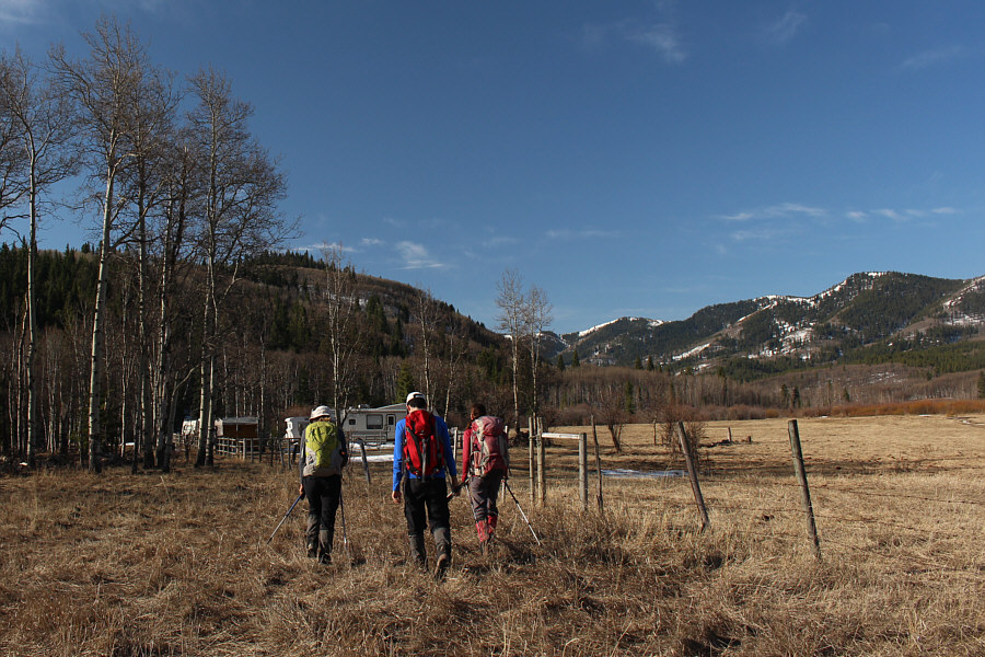
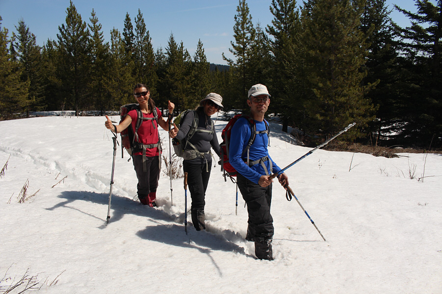
Asieh, Ali and Zosia start hiking toward "White Ridge" just before being stopped by some locals.
There...already much better than "White Ridge"! 
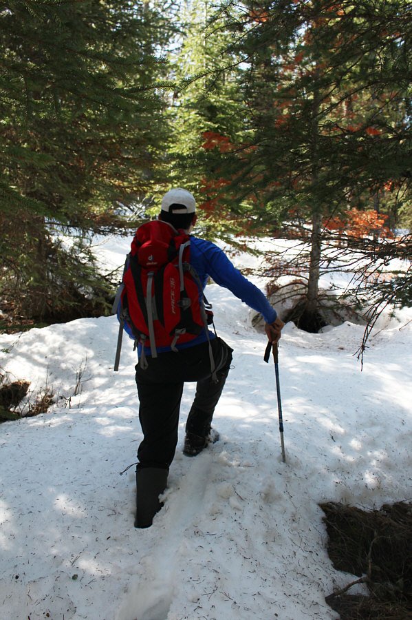
Ali trudges through some deep snow near the start of the hike to Sand Bluff.
Who's idea was it to come here??

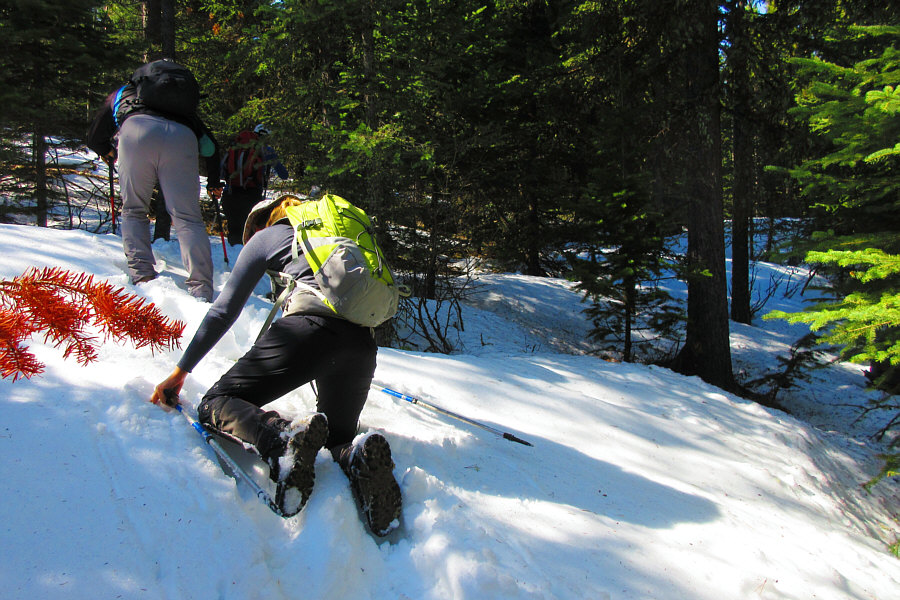
Asieh demonstrates an effective technique for staying on top of the unsupportive snow.

Photo courtesy of Zosia Zgolak

Maybe we're part of the experiment... 
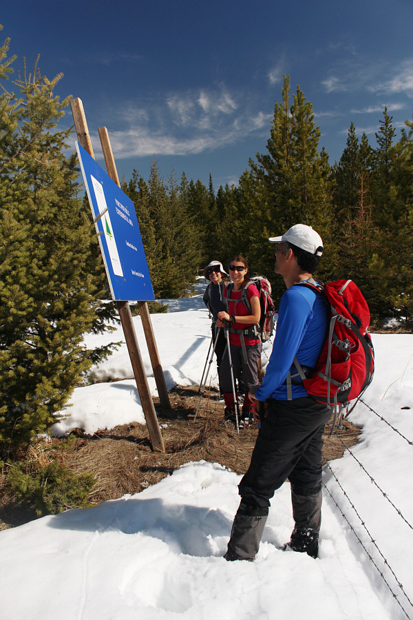
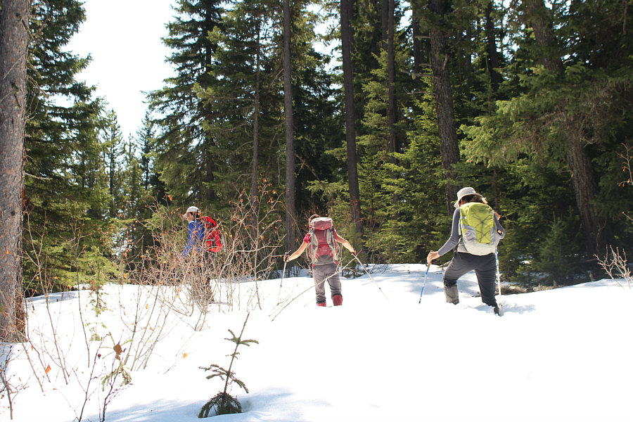
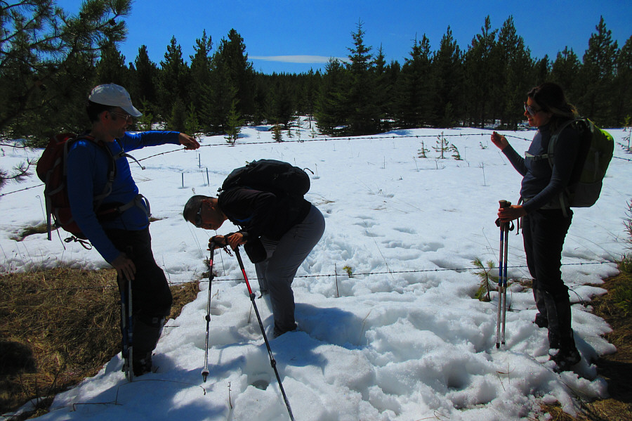
The group stumbles into some sort of forestry experimental area.
There aren't any "No Trespassing" signs here, so I think this is okay... 
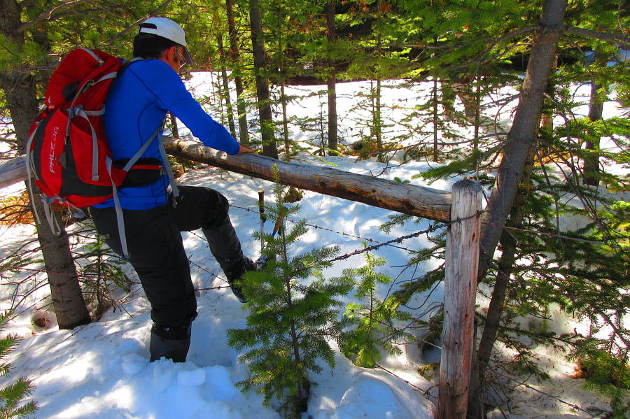
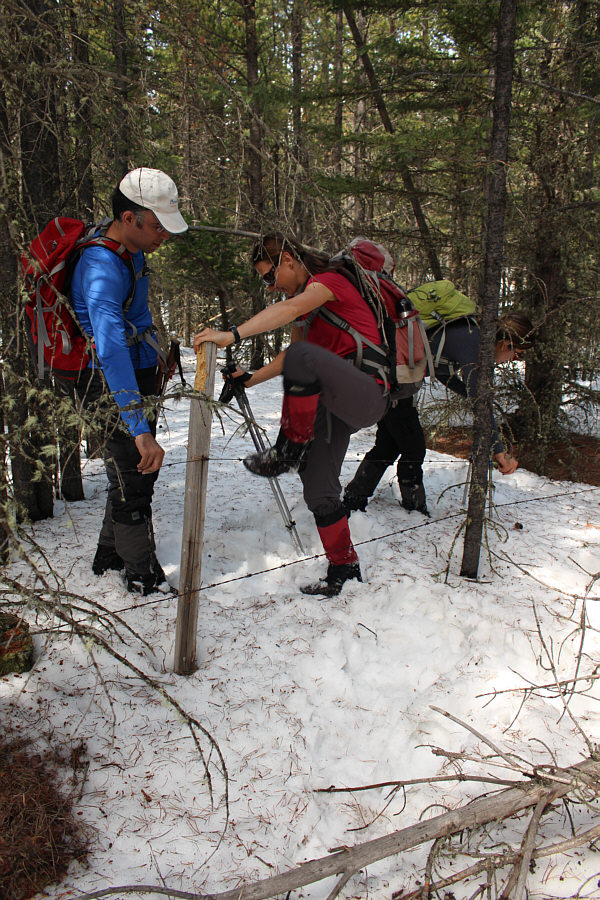
Ali hops over a fence at the edge of the experimental area.

Photo courtesy of Zosia Zgolak

Well, I guess we won't have any problems finding our way back... The group follows a fence line along the ridge crest.
It's a shame we didn't ski this! The group follows a road on the ridge.
Hooray. Zosia, Asieh and Ali reach the unremarkable summit of Sand Bluff (1763 metres).
Now this is more like it! 
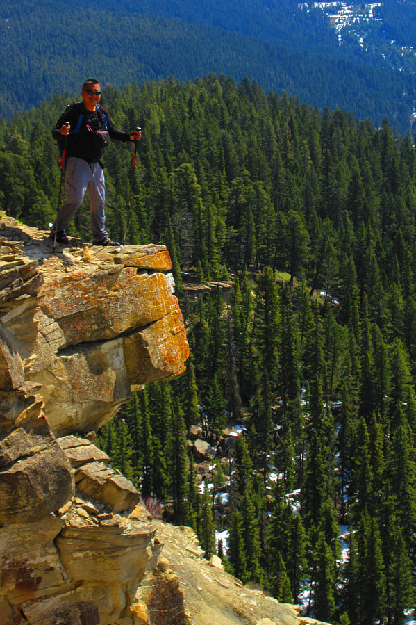
Sonny reaches the top of a bluff a short distance from the summit.

Photo courtesy of Zosia Zgolak

There's even some views of the mountains at far left! 
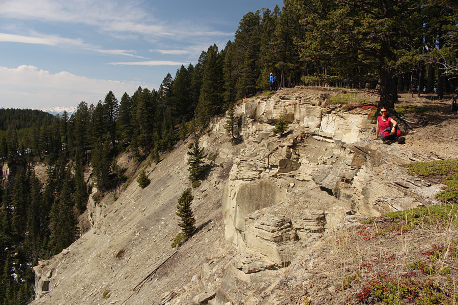
The ridge gets its name from these bluffs southeast of the summit.
Better than the actual summit! Ali, Asieh, Zosia and Sonny pose for a group photo on top of the bluffs.
Hold it steady! Ali and Asieh assist Zosia in getting over a barbed wire fence on the way back.
Teamwork! Ali and Asieh assist Sonny through another barbed wire fence near the experimental area.

Photo courtesy of Zosia Zgolak

How about burning down all the trees near the top of Sand Bluff? 
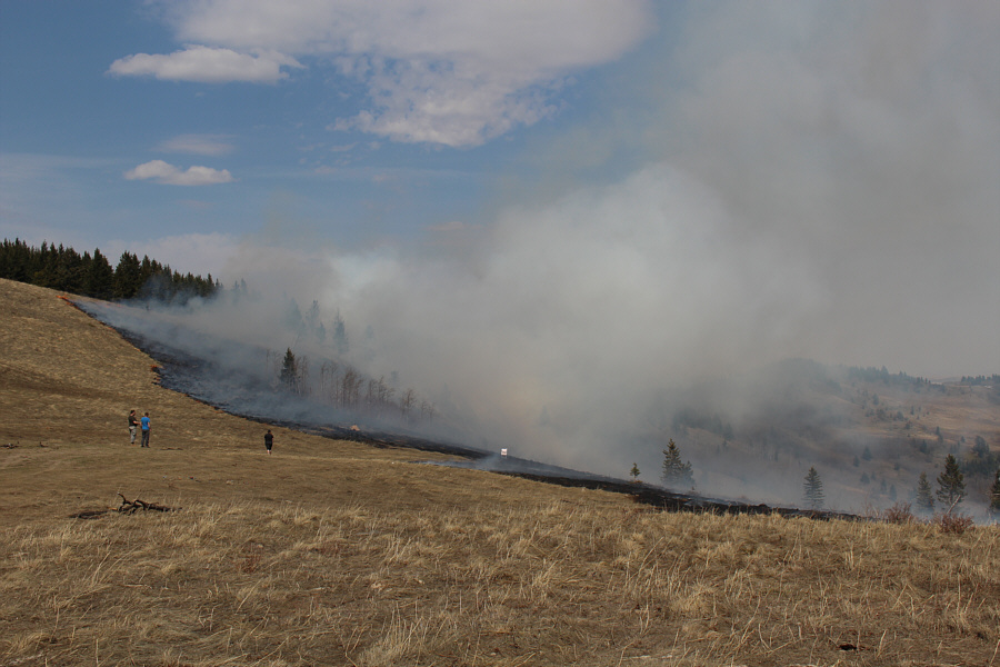
This appears to be a prescribed fire beside Skyline Road during the group's drive out.
Not destined to be a classic...ever. 
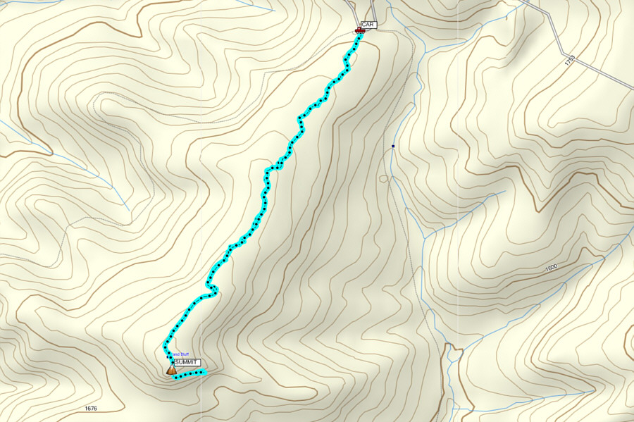
Total Distance: 6.0 kilometres
Round-Trip Time: 3 hours 43 minutes
Net Elevation Gain: 102 metres

GPX Data